![](/images/other/stat-length.png)
- Trails
- On foot
- Germany
- Baden-Württemberg
- Landkreis Freudenstadt
Landkreis Freudenstadt, Baden-Württemberg, On foot: Best trails, routes and walks
Landkreis Freudenstadt: Discover the best trails: 75 on foot and 15 walking. All these trails, routes and outdoor activities are available in our SityTrail applications for smartphones and tablets.
The best trails (89)
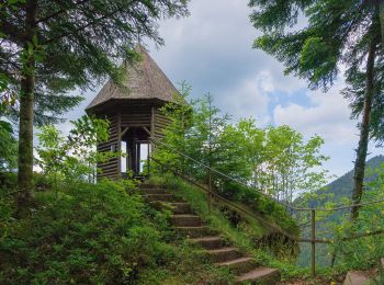
![Trail On foot Bad Rippoldsau-Schapbach - Bad Rippoldsau - Burgbachhöhe (Mittelweg) - Photo](https://media.geolcdn.com/t/350/260/35019236-3d2a-4e92-a8c8-def75f614134.jpeg&format=jpg&maxdim=2)
![On foot On foot](https://static1.geolcdn.com/sitytour/trail-icons/100.png)
Km
On foot
![](/images/other/stat-length.png)
![](https://static1.geolcdn.com/siteimages/upload/files/1508320355ic_sort_den_pos_24dp.png)
![](https://static1.geolcdn.com/siteimages/upload/files/1508320355ic_sort_den_neg_24dp.png)
![](https://static1.geolcdn.com/siteimages/upload/files/16400158638029165_repeat_loop_refresh_sync_direction_icon.png)
• Trail created by Schwarzwaldverein. Symbol: Blaue Raute auf weißem Grund
![Trail On foot Bad Rippoldsau-Schapbach - Klösterle-Schleife - Photo](https://media.geolcdn.com/t/350/260/35019236-3d2a-4e92-a8c8-def75f614134.jpeg&format=jpg&maxdim=2)
![On foot On foot](https://static1.geolcdn.com/sitytour/trail-icons/100.png)
Km
On foot
![](/images/other/stat-length.png)
![](https://static1.geolcdn.com/siteimages/upload/files/1508320355ic_sort_den_pos_24dp.png)
![](https://static1.geolcdn.com/siteimages/upload/files/1508320355ic_sort_den_neg_24dp.png)
![](https://static1.geolcdn.com/siteimages/upload/files/16400158638029165_repeat_loop_refresh_sync_direction_icon.png)
• Trail created by Tourist-Information Bad Rippoldsau-Schapbach. Symbol: Bollenhut
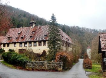
![Trail On foot Eutingen im Gäu - Äußerer Alternativweg - Mühlen am Neckar - Weg-1 - Isenburg - Horb am Neckar - Mühlen am Neckar - Eyach - Photo](https://media.geolcdn.com/t/350/260/68caede5-f27e-4099-aa11-fc6fc1447afc.jpeg&format=jpg&maxdim=2)
![On foot On foot](https://static1.geolcdn.com/sitytour/trail-icons/100.png)
Km
On foot
![](/images/other/stat-length.png)
![](https://static1.geolcdn.com/siteimages/upload/files/1508320355ic_sort_den_pos_24dp.png)
![](https://static1.geolcdn.com/siteimages/upload/files/1508320355ic_sort_den_neg_24dp.png)
![](https://static1.geolcdn.com/siteimages/upload/files/16400158638029165_repeat_loop_refresh_sync_direction_icon.png)
• Trail created by Schwäbischer Albverein - Mühlen am Neckar. Symbol: rotes Kreuz auf weißem Grund
![Trail On foot Horb am Neckar - Äußerer Alternativweg - Horb am Neckar - Weg-1 - Isenburg - Horb am Neckar - Mühlen am Neckar (Hofgut Egelstal) - Photo](https://media.geolcdn.com/t/350/260/68caede5-f27e-4099-aa11-fc6fc1447afc.jpeg&format=jpg&maxdim=2)
![On foot On foot](https://static1.geolcdn.com/sitytour/trail-icons/100.png)
Km
On foot
![](/images/other/stat-length.png)
![](https://static1.geolcdn.com/siteimages/upload/files/1508320355ic_sort_den_pos_24dp.png)
![](https://static1.geolcdn.com/siteimages/upload/files/1508320355ic_sort_den_neg_24dp.png)
![](https://static1.geolcdn.com/siteimages/upload/files/16400158638029165_repeat_loop_refresh_sync_direction_icon.png)
• Trail created by Schwäbischer Albverein - Ortsgruppe Horb am Neckar. Symbol: rotes Kreuz auf weißem Grund
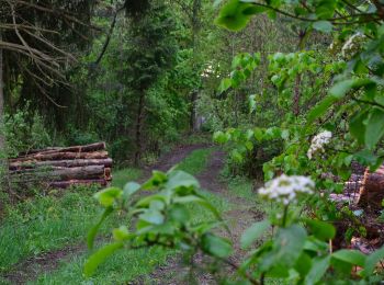
![Trail On foot Horb am Neckar - Äußerer Hauptweg - Mühlen am Neckar - Weg-6 - Mühlen am Neckar - Ahldorf - zu blauer Strich (Eyach - Mühringen) - Photo](https://media.geolcdn.com/t/350/260/b1062971-d396-4cdc-b0c5-50b8ff77dad8.jpeg&format=jpg&maxdim=2)
![On foot On foot](https://static1.geolcdn.com/sitytour/trail-icons/100.png)
Km
On foot
![](/images/other/stat-length.png)
![](https://static1.geolcdn.com/siteimages/upload/files/1508320355ic_sort_den_pos_24dp.png)
![](https://static1.geolcdn.com/siteimages/upload/files/1508320355ic_sort_den_neg_24dp.png)
![](https://static1.geolcdn.com/siteimages/upload/files/16400158638029165_repeat_loop_refresh_sync_direction_icon.png)
• Trail created by Schwäbischer Albverein - Ortsgruppe Horb am Neckar. Symbol: blauer Strich auf weißem Grund
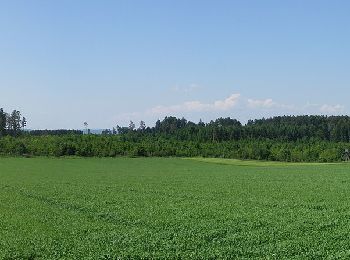
![Trail On foot Empfingen - Äußerer Querweg - Horb am Neckar - Weg-4 - Weiherhof - Dettensee - Photo](https://media.geolcdn.com/t/350/260/96ae4664-162b-423a-8fd8-48aaf1318989.jpeg&format=jpg&maxdim=2)
![On foot On foot](https://static1.geolcdn.com/sitytour/trail-icons/100.png)
Km
On foot
![](/images/other/stat-length.png)
![](https://static1.geolcdn.com/siteimages/upload/files/1508320355ic_sort_den_pos_24dp.png)
![](https://static1.geolcdn.com/siteimages/upload/files/1508320355ic_sort_den_neg_24dp.png)
![](https://static1.geolcdn.com/siteimages/upload/files/16400158638029165_repeat_loop_refresh_sync_direction_icon.png)
• Trail created by Schwäbischer Albverein - Ortsgruppe Horb am Neckar. Symbol: blauer Punkt auf weißem Grund
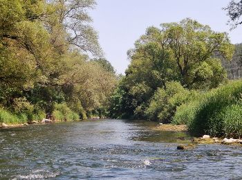
![Trail On foot Horb am Neckar - Äußerer Alternativweg - Horb am Neckar - Weg-3 - Mühringen - Isenburg - Photo](https://media.geolcdn.com/t/350/260/465fc885-a83c-48ec-bf97-5cb7abfcba81.jpeg&format=jpg&maxdim=2)
![On foot On foot](https://static1.geolcdn.com/sitytour/trail-icons/100.png)
Km
On foot
![](/images/other/stat-length.png)
![](https://static1.geolcdn.com/siteimages/upload/files/1508320355ic_sort_den_pos_24dp.png)
![](https://static1.geolcdn.com/siteimages/upload/files/1508320355ic_sort_den_neg_24dp.png)
![](https://static1.geolcdn.com/siteimages/upload/files/16400158638029165_repeat_loop_refresh_sync_direction_icon.png)
• Trail created by Schwäbischer Albverein - Ortsgruppe Horb am Neckar. Symbol: blaues Kreuz auf weißem Grund
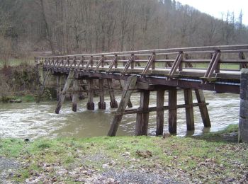
![Trail On foot Horb am Neckar - Äußerer Alternativweg - Dettingen - Weg-1 - Fischingen - Isenburg - Photo](https://media.geolcdn.com/t/350/260/203689a9-6f25-4539-b589-1ddf95a862ec.jpeg&format=jpg&maxdim=2)
![On foot On foot](https://static1.geolcdn.com/sitytour/trail-icons/100.png)
Km
On foot
![](/images/other/stat-length.png)
![](https://static1.geolcdn.com/siteimages/upload/files/1508320355ic_sort_den_pos_24dp.png)
![](https://static1.geolcdn.com/siteimages/upload/files/1508320355ic_sort_den_neg_24dp.png)
![](https://static1.geolcdn.com/siteimages/upload/files/16400158638029165_repeat_loop_refresh_sync_direction_icon.png)
• Trail created by Schwäbischer Albverein - Ortsgruppe Dettingen. Symbol: rotes Kreuz auf weißem Grund
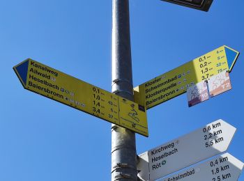
![Trail On foot Baiersbronn - Baiersbronner Himmelsweg: Mönch-Tour - Photo](https://media.geolcdn.com/t/350/260/c4e55c2b-9833-4107-b348-14bbad79ad42.jpeg&format=jpg&maxdim=2)
![On foot On foot](https://static1.geolcdn.com/sitytour/trail-icons/100.png)
Km
On foot
![](/images/other/stat-length.png)
![](https://static1.geolcdn.com/siteimages/upload/files/1508320355ic_sort_den_pos_24dp.png)
![](https://static1.geolcdn.com/siteimages/upload/files/1508320355ic_sort_den_neg_24dp.png)
![](https://static1.geolcdn.com/siteimages/upload/files/16400158638029165_repeat_loop_refresh_sync_direction_icon.png)
• Symbol: Stilisierter grüner Mönch auf weißem Grund
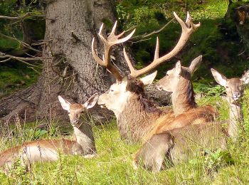
![Trail On foot Baiersbronn - Baiersbronner Himmelsweg: Naturgewalten-Tour - Photo](https://media.geolcdn.com/t/350/260/ae9c224d-33d0-487f-b491-fd051c8c3f7a.jpeg&format=jpg&maxdim=2)
![On foot On foot](https://static1.geolcdn.com/sitytour/trail-icons/100.png)
Km
On foot
![](/images/other/stat-length.png)
![](https://static1.geolcdn.com/siteimages/upload/files/1508320355ic_sort_den_pos_24dp.png)
![](https://static1.geolcdn.com/siteimages/upload/files/1508320355ic_sort_den_neg_24dp.png)
![](https://static1.geolcdn.com/siteimages/upload/files/16400158638029165_repeat_loop_refresh_sync_direction_icon.png)
• Symbol: Stilisierte grüne Brücke mit grünem Wasser auf weißem Grund
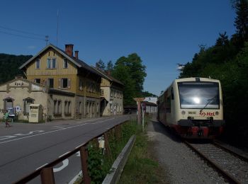
![Trail On foot Eutingen im Gäu - Äußerer Hauptweg - Mühlen am Neckar - Weg-3 - Eyach - Mühringen - Photo](https://media.geolcdn.com/t/350/260/544902e4-ab36-474d-8921-9519147fa5b6.jpeg&format=jpg&maxdim=2)
![On foot On foot](https://static1.geolcdn.com/sitytour/trail-icons/100.png)
Km
On foot
![](/images/other/stat-length.png)
![](https://static1.geolcdn.com/siteimages/upload/files/1508320355ic_sort_den_pos_24dp.png)
![](https://static1.geolcdn.com/siteimages/upload/files/1508320355ic_sort_den_neg_24dp.png)
![](https://static1.geolcdn.com/siteimages/upload/files/16400158638029165_repeat_loop_refresh_sync_direction_icon.png)
• Trail created by Schwäbischer Albverein - Mühlen am Neckar. Symbol: blauer Strich auf weißem Grund
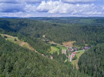
![Trail On foot Seewald - Hochdorf Sägemühle-Winterhalde - Photo](https://media.geolcdn.com/t/350/260/65d5726f-6113-429c-943a-8418fa850a15.jpeg&format=jpg&maxdim=2)
![On foot On foot](https://static1.geolcdn.com/sitytour/trail-icons/100.png)
Km
On foot
![](/images/other/stat-length.png)
![](https://static1.geolcdn.com/siteimages/upload/files/1508320355ic_sort_den_pos_24dp.png)
![](https://static1.geolcdn.com/siteimages/upload/files/1508320355ic_sort_den_neg_24dp.png)
![](https://static1.geolcdn.com/siteimages/upload/files/16400158638029165_repeat_loop_refresh_sync_direction_icon.png)
• Trail created by Schwarzwaldverein. Symbol: yellow diaonod on white
![Trail On foot Baiersbronn - Mitteltal - Dreirevierstein - Photo](https://media.geolcdn.com/t/350/260/9f6ca40c-e42c-4ace-bf8a-e8da2094898c.jpeg&format=jpg&maxdim=2)
![On foot On foot](https://static1.geolcdn.com/sitytour/trail-icons/100.png)
Km
On foot
![](/images/other/stat-length.png)
![](https://static1.geolcdn.com/siteimages/upload/files/1508320355ic_sort_den_pos_24dp.png)
![](https://static1.geolcdn.com/siteimages/upload/files/1508320355ic_sort_den_neg_24dp.png)
![](https://static1.geolcdn.com/siteimages/upload/files/16400158638029165_repeat_loop_refresh_sync_direction_icon.png)
• Trail created by Schwarzwaldverein. Symbol: Blaue Raute auf weißem Grund
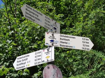
![Trail On foot Baiersbronn - Schöner Platz-Hänger - Photo](https://media.geolcdn.com/t/350/260/5b10d9e5-2618-4744-9ada-f0ae0a8d407b.jpeg&format=jpg&maxdim=2)
![On foot On foot](https://static1.geolcdn.com/sitytour/trail-icons/100.png)
Km
On foot
![](/images/other/stat-length.png)
![](https://static1.geolcdn.com/siteimages/upload/files/1508320355ic_sort_den_pos_24dp.png)
![](https://static1.geolcdn.com/siteimages/upload/files/1508320355ic_sort_den_neg_24dp.png)
![](https://static1.geolcdn.com/siteimages/upload/files/16400158638029165_repeat_loop_refresh_sync_direction_icon.png)
• Trail created by Schwarzwaldverein. Symbol: yellow diamond on white
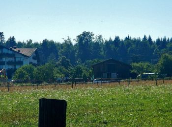
![Trail On foot Pfalzgrafenweiler - Tour 3 Nordic Walking Weiler Wald - Photo](https://media.geolcdn.com/t/350/260/9dd81c5f-8e05-447f-ae52-adf3df020f4f.jpeg&format=jpg&maxdim=2)
![On foot On foot](https://static1.geolcdn.com/sitytour/trail-icons/100.png)
Km
On foot
![](/images/other/stat-length.png)
![](https://static1.geolcdn.com/siteimages/upload/files/1508320355ic_sort_den_pos_24dp.png)
![](https://static1.geolcdn.com/siteimages/upload/files/1508320355ic_sort_den_neg_24dp.png)
![](https://static1.geolcdn.com/siteimages/upload/files/16400158638029165_repeat_loop_refresh_sync_direction_icon.png)
• Trail created by Pfalzgrafenweiler.
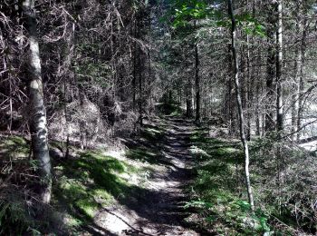
![Trail On foot Pfalzgrafenweiler - Tour 2 Nordic Walking Weiler Wald - Photo](https://media.geolcdn.com/t/350/260/a26263b4-b66c-4a7c-b6a7-1e9d0d5a1ca6.jpeg&format=jpg&maxdim=2)
![On foot On foot](https://static1.geolcdn.com/sitytour/trail-icons/100.png)
Km
On foot
![](/images/other/stat-length.png)
![](https://static1.geolcdn.com/siteimages/upload/files/1508320355ic_sort_den_pos_24dp.png)
![](https://static1.geolcdn.com/siteimages/upload/files/1508320355ic_sort_den_neg_24dp.png)
![](https://static1.geolcdn.com/siteimages/upload/files/16400158638029165_repeat_loop_refresh_sync_direction_icon.png)
• Trail created by Pfalzgrafenweiler.
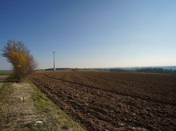
![Trail On foot Schopfloch - Oberiflingen-Dießen - Photo](https://media.geolcdn.com/t/350/260/2f81838a-8d92-42e8-8ad4-8ad33c092112.jpeg&format=jpg&maxdim=2)
![On foot On foot](https://static1.geolcdn.com/sitytour/trail-icons/100.png)
Km
On foot
![](/images/other/stat-length.png)
![](https://static1.geolcdn.com/siteimages/upload/files/1508320355ic_sort_den_pos_24dp.png)
![](https://static1.geolcdn.com/siteimages/upload/files/1508320355ic_sort_den_neg_24dp.png)
![](https://static1.geolcdn.com/siteimages/upload/files/16400158638029165_repeat_loop_refresh_sync_direction_icon.png)
• Trail created by Schwarzwaldverein. Symbol: Gelbe Raute auf weißem Grund
![Trail On foot Pfalzgrafenweiler - Zinsbachmühle-Waldsägemühle - Photo](https://media.geolcdn.com/t/350/260/a26263b4-b66c-4a7c-b6a7-1e9d0d5a1ca6.jpeg&format=jpg&maxdim=2)
![On foot On foot](https://static1.geolcdn.com/sitytour/trail-icons/100.png)
Km
On foot
![](/images/other/stat-length.png)
![](https://static1.geolcdn.com/siteimages/upload/files/1508320355ic_sort_den_pos_24dp.png)
![](https://static1.geolcdn.com/siteimages/upload/files/1508320355ic_sort_den_neg_24dp.png)
![](https://static1.geolcdn.com/siteimages/upload/files/16400158638029165_repeat_loop_refresh_sync_direction_icon.png)
• Trail created by Schwarzwaldverein. Symbol: Gelbe Raute auf weißem Grund
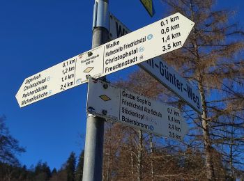
![Trail On foot Baiersbronn - Baiersbronn Gleitschirmlandeplatz-Freudenstadt - Photo](https://media.geolcdn.com/t/350/260/06d504f5-eff2-4e62-8c31-7af1bc24668e.jpeg&format=jpg&maxdim=2)
![On foot On foot](https://static1.geolcdn.com/sitytour/trail-icons/100.png)
Km
On foot
![](/images/other/stat-length.png)
![](https://static1.geolcdn.com/siteimages/upload/files/1508320355ic_sort_den_pos_24dp.png)
![](https://static1.geolcdn.com/siteimages/upload/files/1508320355ic_sort_den_neg_24dp.png)
![](https://static1.geolcdn.com/siteimages/upload/files/16400158638029165_repeat_loop_refresh_sync_direction_icon.png)
• Trail created by Schwarzwaldverein. Symbol: Gelbe Raute auf weißem Grund
![Trail On foot Baiersbronn - Schwarzenberg-Ruhestein - Photo](https://media.geolcdn.com/t/350/260/87283385-277f-49f2-ade4-0bbbcdcb5361.jpeg&format=jpg&maxdim=2)
![On foot On foot](https://static1.geolcdn.com/sitytour/trail-icons/100.png)
Km
On foot
![](/images/other/stat-length.png)
![](https://static1.geolcdn.com/siteimages/upload/files/1508320355ic_sort_den_pos_24dp.png)
![](https://static1.geolcdn.com/siteimages/upload/files/1508320355ic_sort_den_neg_24dp.png)
![](https://static1.geolcdn.com/siteimages/upload/files/16400158638029165_repeat_loop_refresh_sync_direction_icon.png)
• Trail created by Schwarzwaldverein. Symbol: Blaue Raute auf weißem Grund
20 trails displayed on 89
FREE GPS app for hiking