![](/images/other/stat-length.png)
- Trails
- On foot
- Germany
- Bavaria
- Landkreis Freyung-Grafenau
- Neuschönau
Neuschönau, Landkreis Freyung-Grafenau, On foot: Best trails, routes and walks
Neuschönau: Discover the best trails: 9 on foot. All these trails, routes and outdoor activities are available in our SityTrail applications for smartphones and tablets.
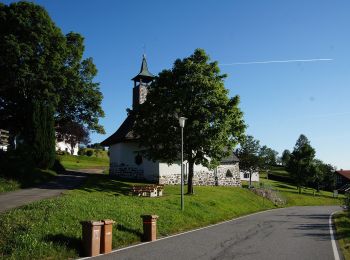
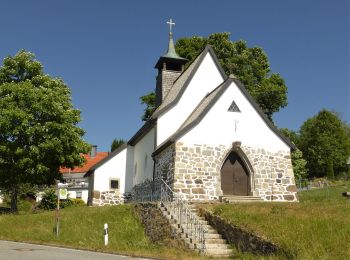
The best trails (9)
![Trail On foot Neuschönau - Dachs - Photo](https://media.geolcdn.com/t/350/260/bd4d4b66-a4a1-483f-a98d-2833317cd1dc.jpeg&format=jpg&maxdim=2)
![On foot On foot](https://static1.geolcdn.com/sitytour/trail-icons/100.png)
Km
On foot
![](/images/other/stat-length.png)
![](https://static1.geolcdn.com/siteimages/upload/files/1508320355ic_sort_den_pos_24dp.png)
![](https://static1.geolcdn.com/siteimages/upload/files/1508320355ic_sort_den_neg_24dp.png)
![](https://static1.geolcdn.com/siteimages/upload/files/16400158638029165_repeat_loop_refresh_sync_direction_icon.png)
• Trail created by Nationalpark Bayerischer Wald. Symbol: Tiersymbol (Dachs) in schwarz auf gelbem quadratischem Grund
![Trail On foot Neuschönau - Haustaube - Photo](https://media.geolcdn.com/t/350/260/78aeb269-300f-4d79-aaf4-32920732cb70.jpeg&format=jpg&maxdim=2)
![On foot On foot](https://static1.geolcdn.com/sitytour/trail-icons/100.png)
Km
On foot
![](/images/other/stat-length.png)
![](https://static1.geolcdn.com/siteimages/upload/files/1508320355ic_sort_den_pos_24dp.png)
![](https://static1.geolcdn.com/siteimages/upload/files/1508320355ic_sort_den_neg_24dp.png)
![](https://static1.geolcdn.com/siteimages/upload/files/16400158638029165_repeat_loop_refresh_sync_direction_icon.png)
• Trail created by Nationalpark Bayerischer Wald. Symbol: Tiersymbol (Haustaube) in schwarz auf gelbem quadratischem G...
![Trail On foot Neuschönau - Laubbaum - Photo](https://media.geolcdn.com/t/350/260/99fba781-b2ad-4f50-a612-eecb0bdb3442.jpeg&format=jpg&maxdim=2)
![On foot On foot](https://static1.geolcdn.com/sitytour/trail-icons/100.png)
Km
On foot
![](/images/other/stat-length.png)
![](https://static1.geolcdn.com/siteimages/upload/files/1508320355ic_sort_den_pos_24dp.png)
![](https://static1.geolcdn.com/siteimages/upload/files/1508320355ic_sort_den_neg_24dp.png)
![](https://static1.geolcdn.com/siteimages/upload/files/16400158638029165_repeat_loop_refresh_sync_direction_icon.png)
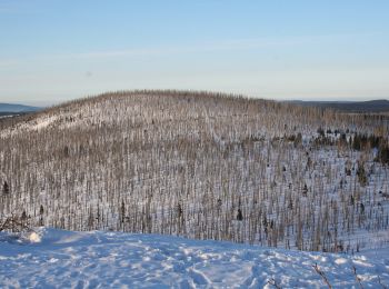
• Trail created by Nationalpark Bayerischer Wald. Symbol: Pflanzensymbol (Laubbaum) in schwarz auf weißem quadratische...
![Trail On foot Neuschönau - Rehbock - Photo](https://media.geolcdn.com/t/350/260/a41e7fd9-4ee4-4705-9a63-55b242f33cfa.jpeg&format=jpg&maxdim=2)
![On foot On foot](https://static1.geolcdn.com/sitytour/trail-icons/100.png)
Km
On foot
![](/images/other/stat-length.png)
![](https://static1.geolcdn.com/siteimages/upload/files/1508320355ic_sort_den_pos_24dp.png)
![](https://static1.geolcdn.com/siteimages/upload/files/1508320355ic_sort_den_neg_24dp.png)
![](https://static1.geolcdn.com/siteimages/upload/files/16400158638029165_repeat_loop_refresh_sync_direction_icon.png)
• Trail created by Nationalpark Bayerischer Wald. Symbol: Tiersymbol (Rehbock) in schwarz auf gelbem quadratischem Grund
![Trail On foot Neuschönau - Luchs - Photo](https://media.geolcdn.com/t/350/260/8c452737-ba5c-48cf-946c-b9516cf7a468.jpeg&format=jpg&maxdim=2)
![On foot On foot](https://static1.geolcdn.com/sitytour/trail-icons/100.png)
Km
On foot
![](/images/other/stat-length.png)
![](https://static1.geolcdn.com/siteimages/upload/files/1508320355ic_sort_den_pos_24dp.png)
![](https://static1.geolcdn.com/siteimages/upload/files/1508320355ic_sort_den_neg_24dp.png)
![](https://static1.geolcdn.com/siteimages/upload/files/16400158638029165_repeat_loop_refresh_sync_direction_icon.png)
• Trail created by Nationalpark Bayerischer Wald. Symbol: Tiersymbol in schwarz auf gelbem quadratischen Grund
![Trail On foot Neuschönau - Habicht - Photo](https://media.geolcdn.com/t/350/260/99fba781-b2ad-4f50-a612-eecb0bdb3442.jpeg&format=jpg&maxdim=2)
![On foot On foot](https://static1.geolcdn.com/sitytour/trail-icons/100.png)
Km
On foot
![](/images/other/stat-length.png)
![](https://static1.geolcdn.com/siteimages/upload/files/1508320355ic_sort_den_pos_24dp.png)
![](https://static1.geolcdn.com/siteimages/upload/files/1508320355ic_sort_den_neg_24dp.png)
![](https://static1.geolcdn.com/siteimages/upload/files/16400158638029165_repeat_loop_refresh_sync_direction_icon.png)
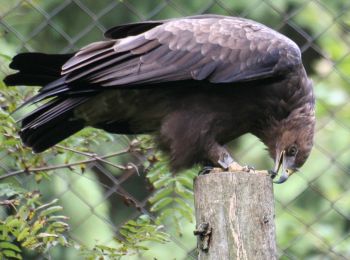
• Trail created by Nationalpark Bayerischer Wald. Symbol: Tiersymbol (Habicht) in schwarz auf gelbem quadratischem Grund
![Trail On foot Neuschönau - Zaunkönig - Photo](https://media.geolcdn.com/t/350/260/15fe21bf-2273-48ed-bfd0-495070f252f0.jpeg&format=jpg&maxdim=2)
![On foot On foot](https://static1.geolcdn.com/sitytour/trail-icons/100.png)
Km
On foot
![](/images/other/stat-length.png)
![](https://static1.geolcdn.com/siteimages/upload/files/1508320355ic_sort_den_pos_24dp.png)
![](https://static1.geolcdn.com/siteimages/upload/files/1508320355ic_sort_den_neg_24dp.png)
![](https://static1.geolcdn.com/siteimages/upload/files/16400158638029165_repeat_loop_refresh_sync_direction_icon.png)
• Trail created by Nationalpark Bayerischer Wald. Symbol: Tiersymbol (Zaunkönig) in schwarz auf gelbem quadratischem G...
![Trail On foot Neuschönau - Gehegerundweg - Photo](https://media.geolcdn.com/t/350/260/e5bc7dd2-73c0-46f6-9590-ed0b397c3f79.jpeg&format=jpg&maxdim=2)
![On foot On foot](https://static1.geolcdn.com/sitytour/trail-icons/100.png)
Km
On foot
![](/images/other/stat-length.png)
![](https://static1.geolcdn.com/siteimages/upload/files/1508320355ic_sort_den_pos_24dp.png)
![](https://static1.geolcdn.com/siteimages/upload/files/1508320355ic_sort_den_neg_24dp.png)
![](https://static1.geolcdn.com/siteimages/upload/files/16400158638029165_repeat_loop_refresh_sync_direction_icon.png)
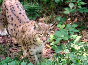
• Trail created by Nationalpark Bayerischer Wald. Symbol: Tiersymbole (Wolf, Luchs und Hirsch) in schwarz auf gelbem q...
![Trail On foot Neuschönau - Rippenfarn - Photo](https://media.geolcdn.com/t/350/260/8c452737-ba5c-48cf-946c-b9516cf7a468.jpeg&format=jpg&maxdim=2)
![On foot On foot](https://static1.geolcdn.com/sitytour/trail-icons/100.png)
Km
On foot
![](/images/other/stat-length.png)
![](https://static1.geolcdn.com/siteimages/upload/files/1508320355ic_sort_den_pos_24dp.png)
![](https://static1.geolcdn.com/siteimages/upload/files/1508320355ic_sort_den_neg_24dp.png)
![](https://static1.geolcdn.com/siteimages/upload/files/16400158638029165_repeat_loop_refresh_sync_direction_icon.png)
• Trail created by Nationalpark Bayerischer Wald. Symbol: Pflanzensymbol (Rippenfarn) in schwarz auf weißem quadratisc...
9 trails displayed on 9
FREE GPS app for hiking