![](/images/other/stat-length.png)
- Trails
- On foot
- Germany
- Bavaria
- Landkreis Hof
- Helmbrechts
Helmbrechts, Landkreis Hof, On foot: Best trails, routes and walks
Helmbrechts: Discover the best trails: 8 on foot. All these trails, routes and outdoor activities are available in our SityTrail applications for smartphones and tablets.
The best trails (8)
![Trail On foot Helmbrechts - Stockhöhen-Weg OS 25 - Photo](https://media.geolcdn.com/t/350/260/879e210e-5f24-4183-a068-356b49ef24f3.jpeg&format=jpg&maxdim=2)
![On foot On foot](https://static1.geolcdn.com/sitytour/trail-icons/100.png)
Km
On foot
![](/images/other/stat-length.png)
![](https://static1.geolcdn.com/siteimages/upload/files/1508320355ic_sort_den_pos_24dp.png)
![](https://static1.geolcdn.com/siteimages/upload/files/1508320355ic_sort_den_neg_24dp.png)
![](https://static1.geolcdn.com/siteimages/upload/files/16400158638029165_repeat_loop_refresh_sync_direction_icon.png)
• Trail created by Frankenwaldverein e.V..
![Trail On foot Helmbrechts - Eng-Weg OS17 - Photo](https://media.geolcdn.com/t/350/260/c5285f4d-b3bb-45aa-9458-af46d38be976.jpeg&format=jpg&maxdim=2)
![On foot On foot](https://static1.geolcdn.com/sitytour/trail-icons/100.png)
Km
On foot
![](/images/other/stat-length.png)
![](https://static1.geolcdn.com/siteimages/upload/files/1508320355ic_sort_den_pos_24dp.png)
![](https://static1.geolcdn.com/siteimages/upload/files/1508320355ic_sort_den_neg_24dp.png)
![](https://static1.geolcdn.com/siteimages/upload/files/16400158638029165_repeat_loop_refresh_sync_direction_icon.png)
• Trail created by Frankenwaldverein e.V.. Symbol: green OS17 on a white background
![Trail On foot Helmbrechts - Krouha-Weg OS 13 - Photo](https://media.geolcdn.com/t/350/260/a3fb62d0-3f9c-4d68-9ba2-36a11843da25.jpeg&format=jpg&maxdim=2)
![On foot On foot](https://static1.geolcdn.com/sitytour/trail-icons/100.png)
Km
On foot
![](/images/other/stat-length.png)
![](https://static1.geolcdn.com/siteimages/upload/files/1508320355ic_sort_den_pos_24dp.png)
![](https://static1.geolcdn.com/siteimages/upload/files/1508320355ic_sort_den_neg_24dp.png)
![](https://static1.geolcdn.com/siteimages/upload/files/16400158638029165_repeat_loop_refresh_sync_direction_icon.png)
• Trail created by Frankenwaldverein e.V.. Symbol: green:white::OS13:green
![Trail On foot Helmbrechts - Helmbrecht-Weg OS 11 - Photo](https://media.geolcdn.com/t/350/260/a3fb62d0-3f9c-4d68-9ba2-36a11843da25.jpeg&format=jpg&maxdim=2)
![On foot On foot](https://static1.geolcdn.com/sitytour/trail-icons/100.png)
Km
On foot
![](/images/other/stat-length.png)
![](https://static1.geolcdn.com/siteimages/upload/files/1508320355ic_sort_den_pos_24dp.png)
![](https://static1.geolcdn.com/siteimages/upload/files/1508320355ic_sort_den_neg_24dp.png)
![](https://static1.geolcdn.com/siteimages/upload/files/16400158638029165_repeat_loop_refresh_sync_direction_icon.png)
• Trail created by Frankenwaldverein e.V.. Symbol: OS11 on a white background
![Trail On foot Helmbrechts - Querkela-Weg OS 12 - Photo](https://media.geolcdn.com/t/350/260/83f86e16-7c7e-4b01-afd1-0ba0cd080cad.jpeg&format=jpg&maxdim=2)
![On foot On foot](https://static1.geolcdn.com/sitytour/trail-icons/100.png)
Km
On foot
![](/images/other/stat-length.png)
![](https://static1.geolcdn.com/siteimages/upload/files/1508320355ic_sort_den_pos_24dp.png)
![](https://static1.geolcdn.com/siteimages/upload/files/1508320355ic_sort_den_neg_24dp.png)
![](https://static1.geolcdn.com/siteimages/upload/files/16400158638029165_repeat_loop_refresh_sync_direction_icon.png)
• Trail created by Frankenwaldverein. Symbol: grünes OS12 auf weißem Grund
![Trail On foot Helmbrechts - Eisvogel-Weg OS 14 - Photo](https://media.geolcdn.com/t/350/260/4b3f8d80-8dad-4aee-bacf-a3adb12183a3.jpeg&format=jpg&maxdim=2)
![On foot On foot](https://static1.geolcdn.com/sitytour/trail-icons/100.png)
Km
On foot
![](/images/other/stat-length.png)
![](https://static1.geolcdn.com/siteimages/upload/files/1508320355ic_sort_den_pos_24dp.png)
![](https://static1.geolcdn.com/siteimages/upload/files/1508320355ic_sort_den_neg_24dp.png)
![](https://static1.geolcdn.com/siteimages/upload/files/16400158638029165_repeat_loop_refresh_sync_direction_icon.png)
• Trail created by Frankenwaldverein. Symbol: grünes OS14 auf weißem Grund
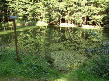
![Trail On foot Helmbrechts - Brücklasteich-Weg OS 15 - Photo](https://media.geolcdn.com/t/350/260/ff67f262-9d33-4fb7-8315-80a544e6406f.jpeg&format=jpg&maxdim=2)
![On foot On foot](https://static1.geolcdn.com/sitytour/trail-icons/100.png)
Km
On foot
![](/images/other/stat-length.png)
![](https://static1.geolcdn.com/siteimages/upload/files/1508320355ic_sort_den_pos_24dp.png)
![](https://static1.geolcdn.com/siteimages/upload/files/1508320355ic_sort_den_neg_24dp.png)
![](https://static1.geolcdn.com/siteimages/upload/files/16400158638029165_repeat_loop_refresh_sync_direction_icon.png)
• Trail created by Frankenwaldverein e.V. Symbol: green OS15 on a white background
![Trail On foot Helmbrechts - Kamm-Weg OS 16 - Photo](https://media.geolcdn.com/t/350/260/ff67f262-9d33-4fb7-8315-80a544e6406f.jpeg&format=jpg&maxdim=2)
![On foot On foot](https://static1.geolcdn.com/sitytour/trail-icons/100.png)
Km
On foot
![](/images/other/stat-length.png)
![](https://static1.geolcdn.com/siteimages/upload/files/1508320355ic_sort_den_pos_24dp.png)
![](https://static1.geolcdn.com/siteimages/upload/files/1508320355ic_sort_den_neg_24dp.png)
![](https://static1.geolcdn.com/siteimages/upload/files/16400158638029165_repeat_loop_refresh_sync_direction_icon.png)
• Trail created by Frankenwaldverein e.V.. Symbol: green OS16 on a whilte background
8 trails displayed on 8
FREE GPS app for hiking