Maxhütte-Haidhof, Landkreis Schwandorf, On foot: Best trails, routes and walks

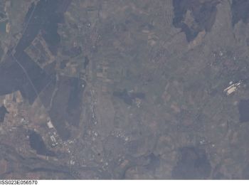
Maxhütte-Haidhof: Discover the best trails: 8 on foot. All these trails, routes and outdoor activities are available in our SityTrail applications for smartphones and tablets.
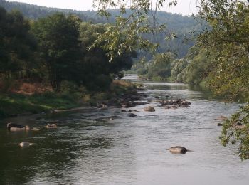
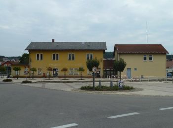
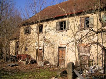

The best trails (8)

Trail On foot Maxhütte-Haidhof - Regentalsteig nach Hirschling (Gelbe 8) - Photo
On foot 8.307
Km
PRO

On foot

Easy
Maxhütte-Haidhof, Bavaria, Landkreis Schwandorf, Germany
8.3 km | 11.6 km-effort
2h 38min
260 m
220 m
No
SityTrail - itinéraires balisés pédestres

• Trail created by Stadt Burglengenfeld, Stadt Teublitz, Stadt Maxhütte-Haidhof.

Trail On foot Maxhütte-Haidhof - Ökumenischer Besinnungsweg Thema
On foot 4.424
Km
PRO

On foot

Easy
Maxhütte-Haidhof, Bavaria, Landkreis Schwandorf, Germany
4.4 km | 5.3 km-effort
1h 11min
60 m
76 m
No
SityTrail - itinéraires balisés pédestres

• Trail created by Stadt Burglengenfeld, Stadt Teublitz, Stadt Maxhütte-Haidhof. Symbol: yellow_round with white 14

Trail On foot Maxhütte-Haidhof - O 78 Leonberg - Ramspau (Rotes Rechteck) - Photo
On foot 5.235
Km
PRO

On foot

Easy
Maxhütte-Haidhof, Bavaria, Landkreis Schwandorf, Germany
5.2 km | 6.7 km-effort
1h 31min
96 m
162 m
No
SityTrail - itinéraires balisés pédestres

• Trail created by Waldverein Regensburg. Symbol: Rotes Rechteck auf weißem Grund

Trail On foot Maxhütte-Haidhof - O 46 Bahnhof Maxhütte-Haidhof - Knotenpunkt Geilenberg (Rotes Rechteck) - Photo
On foot 9.024
Km
PRO

On foot

Easy
Maxhütte-Haidhof, Bavaria, Landkreis Schwandorf, Germany
9 km | 12.8 km-effort
2h 54min
315 m
184 m
No
SityTrail - itinéraires balisés pédestres

• Trail created by Waldverein Regensburg. Symbol: Rotes Rechteck auf weißem Grund

Trail On foot Maxhütte-Haidhof - O 48 Bahnhof Maxhütte-Haidhof - Marienthal (Blaues Rechteck) - Photo
On foot 7.077
Km
PRO

On foot

Easy
Maxhütte-Haidhof, Bavaria, Landkreis Schwandorf, Germany
7.1 km | 9.4 km-effort
2h 8min
165 m
204 m
No
SityTrail - itinéraires balisés pédestres

• Trail created by Waldverein Regensburg. Symbol: Blaues Rechteck auf weißem Grund

Trail On foot Maxhütte-Haidhof - Sagensteig (Rote 7) - Photo
On foot 6.752
Km
PRO

On foot

Easy
Maxhütte-Haidhof, Bavaria, Landkreis Schwandorf, Germany
6.8 km | 9.1 km-effort
2h 3min
177 m
159 m
No
SityTrail - itinéraires balisés pédestres

• Trail created by Stadt Burglengenfeld, Stadt Teublitz, Stadt Maxhütte-Haidhof.

Trail On foot Maxhütte-Haidhof - Sauforstrunde (Lila 9) - Photo
On foot 11.871
Km
PRO

On foot

Easy
Maxhütte-Haidhof, Bavaria, Landkreis Schwandorf, Germany
11.9 km | 13.8 km-effort
3h 7min
142 m
145 m
Yes
SityTrail - itinéraires balisés pédestres

• Trail created by Städte Burglengenfeld/Maxhütte-Haidhof/Teublitz.

Trail On foot Maxhütte-Haidhof - Leonberger Panoramaweg (Graue 11) - Photo
On foot 6.266
Km
PRO

On foot

Easy
Maxhütte-Haidhof, Bavaria, Landkreis Schwandorf, Germany
6.3 km | 8.3 km-effort
1h 53min
155 m
143 m
Yes
SityTrail - itinéraires balisés pédestres

8 trails displayed on 8

FREE GPS app for hiking

Logo SityTrail SityTrail

IGN / Geographical institutes

Download SityTrail from the App Store Download SityTrail from Google Play

Logo SityTrail SityTrail World

The world is yours!

Download SityTrail from the App Store Download SityTrail from Google Play Download SityTrail on Huawei AppGallery

Activities

Close
My subscriptions