![](/images/other/stat-length.png)
- Trails
- On foot
- Germany
- Bavaria
- Landkreis Rosenheim
- Samerberg
Samerberg, Landkreis Rosenheim, On foot: Best trails, routes and walks
Samerberg: Discover the best trails: 28 on foot. All these trails, routes and outdoor activities are available in our SityTrail applications for smartphones and tablets.
The best trails (28)
![Trail On foot Samerberg - SalzAlpenWeg - SalzAlpenZuweg Rohrdorf - Photo](https://media.geolcdn.com/t/350/260/db7f4794-7cab-463b-ad1b-3eff1e8742ec.jpeg&format=jpg&maxdim=2)
![On foot On foot](https://static1.geolcdn.com/sitytour/trail-icons/100.png)
Km
On foot
![](/images/other/stat-length.png)
![](https://static1.geolcdn.com/siteimages/upload/files/1508320355ic_sort_den_pos_24dp.png)
![](https://static1.geolcdn.com/siteimages/upload/files/1508320355ic_sort_den_neg_24dp.png)
![](https://static1.geolcdn.com/siteimages/upload/files/16400158638029165_repeat_loop_refresh_sync_direction_icon.png)
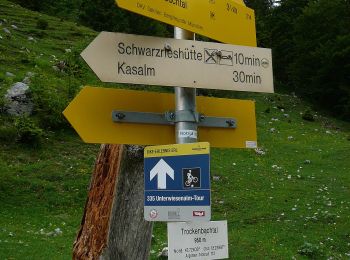
• Symbol: Gelber Hintergrund mit den Silhouetten dreier Gipfel in roter Farbe. Symbole sind an Bäumen gesprüht oder als...
![Trail On foot Samerberg - Wanderweg 51 - Samerberg - Photo](https://media.geolcdn.com/t/350/260/8e570050-b69c-402d-8110-7056f739b2ca.jpeg&format=jpg&maxdim=2)
![On foot On foot](https://static1.geolcdn.com/sitytour/trail-icons/100.png)
Km
On foot
![](/images/other/stat-length.png)
![](https://static1.geolcdn.com/siteimages/upload/files/1508320355ic_sort_den_pos_24dp.png)
![](https://static1.geolcdn.com/siteimages/upload/files/1508320355ic_sort_den_neg_24dp.png)
![](https://static1.geolcdn.com/siteimages/upload/files/16400158638029165_repeat_loop_refresh_sync_direction_icon.png)
• Trail created by Gemeinden Neubeuern, Nußdorf, Samerberg. Symbol: Grüne Schilder mit weißer Zahl
![Trail On foot Samerberg - Wanderweg 67 - Samerberg - Photo](https://media.geolcdn.com/t/350/260/d0847c7b-755c-4245-870a-8a9f42ba7d33.jpeg&format=jpg&maxdim=2)
![On foot On foot](https://static1.geolcdn.com/sitytour/trail-icons/100.png)
Km
On foot
![](/images/other/stat-length.png)
![](https://static1.geolcdn.com/siteimages/upload/files/1508320355ic_sort_den_pos_24dp.png)
![](https://static1.geolcdn.com/siteimages/upload/files/1508320355ic_sort_den_neg_24dp.png)
![](https://static1.geolcdn.com/siteimages/upload/files/16400158638029165_repeat_loop_refresh_sync_direction_icon.png)
• Trail created by Gemeinden Neubeuern, Nußdorf, Samerberg. Symbol: Grüne Schilder mit weißer Zahl
![Trail On foot Samerberg - Wanderweg 57 - Samerberg - Photo](https://media.geolcdn.com/t/350/260/5d7da1db-e559-48bb-bc96-48c1d6a2af35.jpeg&format=jpg&maxdim=2)
![On foot On foot](https://static1.geolcdn.com/sitytour/trail-icons/100.png)
Km
On foot
![](/images/other/stat-length.png)
![](https://static1.geolcdn.com/siteimages/upload/files/1508320355ic_sort_den_pos_24dp.png)
![](https://static1.geolcdn.com/siteimages/upload/files/1508320355ic_sort_den_neg_24dp.png)
![](https://static1.geolcdn.com/siteimages/upload/files/16400158638029165_repeat_loop_refresh_sync_direction_icon.png)
• Trail created by Gemeinden Neubeuern, Nußdorf, Samerberg. Symbol: Grüne Schilder mit weißer Zahl
![Trail On foot Samerberg - Wanderweg 54 - Samerberg - Photo](https://media.geolcdn.com/t/350/260/fc7575ce-b7e0-4759-bfc8-7d94e25cd2d0.jpeg&format=jpg&maxdim=2)
![On foot On foot](https://static1.geolcdn.com/sitytour/trail-icons/100.png)
Km
On foot
![](/images/other/stat-length.png)
![](https://static1.geolcdn.com/siteimages/upload/files/1508320355ic_sort_den_pos_24dp.png)
![](https://static1.geolcdn.com/siteimages/upload/files/1508320355ic_sort_den_neg_24dp.png)
![](https://static1.geolcdn.com/siteimages/upload/files/16400158638029165_repeat_loop_refresh_sync_direction_icon.png)
• Trail created by Gemeinden Neubeuern, Nußdorf, Samerberg. Symbol: Grüne Schilder mit weißer Zahl
![Trail On foot Samerberg - Wanderweg 78 - Samerberg - Photo](https://media.geolcdn.com/t/350/260/6871fcd9-6e31-44a6-80fb-d4d548812be5.jpeg&format=jpg&maxdim=2)
![On foot On foot](https://static1.geolcdn.com/sitytour/trail-icons/100.png)
Km
On foot
![](/images/other/stat-length.png)
![](https://static1.geolcdn.com/siteimages/upload/files/1508320355ic_sort_den_pos_24dp.png)
![](https://static1.geolcdn.com/siteimages/upload/files/1508320355ic_sort_den_neg_24dp.png)
![](https://static1.geolcdn.com/siteimages/upload/files/16400158638029165_repeat_loop_refresh_sync_direction_icon.png)
• Trail created by Gemeinden Neubeuern, Nußdorf, Samerberg. Symbol: Grüne Schilder mit weißer Zahl oder gelbe Blechsch...
![Trail On foot Samerberg - Wanderweg 60 - Samerberg - Photo](https://media.geolcdn.com/t/350/260/c0187670-b7fa-43ec-a4c6-c68c0de5e98b.jpeg&format=jpg&maxdim=2)
![On foot On foot](https://static1.geolcdn.com/sitytour/trail-icons/100.png)
Km
On foot
![](/images/other/stat-length.png)
![](https://static1.geolcdn.com/siteimages/upload/files/1508320355ic_sort_den_pos_24dp.png)
![](https://static1.geolcdn.com/siteimages/upload/files/1508320355ic_sort_den_neg_24dp.png)
![](https://static1.geolcdn.com/siteimages/upload/files/16400158638029165_repeat_loop_refresh_sync_direction_icon.png)
• Trail created by Gemeinden Neubeuern, Nußdorf, Samerberg. Symbol: Grüne Schilder mit weißer Zahl oder gelbe Blechsch...
![Trail On foot Samerberg - Wanderweg 9 - Nußdorf - Photo](https://media.geolcdn.com/t/350/260/5e1c3d1c-01bf-4b0c-b23e-ae95a6e5f146.jpeg&format=jpg&maxdim=2)
![On foot On foot](https://static1.geolcdn.com/sitytour/trail-icons/100.png)
Km
On foot
![](/images/other/stat-length.png)
![](https://static1.geolcdn.com/siteimages/upload/files/1508320355ic_sort_den_pos_24dp.png)
![](https://static1.geolcdn.com/siteimages/upload/files/1508320355ic_sort_den_neg_24dp.png)
![](https://static1.geolcdn.com/siteimages/upload/files/16400158638029165_repeat_loop_refresh_sync_direction_icon.png)
• Trail created by Gemeinden Neubeuern, Nußdorf, Samerberg. Symbol: Grüne Schilder mit weißer Zahl oder gelbe Blechsch...
![Trail On foot Samerberg - Wanderweg 41 - Samerberg - Photo](https://media.geolcdn.com/t/350/260/e4bd8726-65ea-49a1-8503-2e54d65e1897.jpeg&format=jpg&maxdim=2)
![On foot On foot](https://static1.geolcdn.com/sitytour/trail-icons/100.png)
Km
On foot
![](/images/other/stat-length.png)
![](https://static1.geolcdn.com/siteimages/upload/files/1508320355ic_sort_den_pos_24dp.png)
![](https://static1.geolcdn.com/siteimages/upload/files/1508320355ic_sort_den_neg_24dp.png)
![](https://static1.geolcdn.com/siteimages/upload/files/16400158638029165_repeat_loop_refresh_sync_direction_icon.png)
• Trail created by Gemeinden Neubeuern, Nußdorf, Samerberg. Symbol: Grüne Schilder mit weißer Zahl
![Trail On foot Samerberg - Wanderweg 40 - Samerberg - Photo](https://media.geolcdn.com/t/350/260/5186e337-950b-4dbd-8039-3b01edb2b748.jpeg&format=jpg&maxdim=2)
![On foot On foot](https://static1.geolcdn.com/sitytour/trail-icons/100.png)
Km
On foot
![](/images/other/stat-length.png)
![](https://static1.geolcdn.com/siteimages/upload/files/1508320355ic_sort_den_pos_24dp.png)
![](https://static1.geolcdn.com/siteimages/upload/files/1508320355ic_sort_den_neg_24dp.png)
![](https://static1.geolcdn.com/siteimages/upload/files/16400158638029165_repeat_loop_refresh_sync_direction_icon.png)
• Trail created by Gemeinden Neubeuern, Nußdorf, Samerberg. Symbol: Grüne Schilder mit weißer Zahl
![Trail On foot Samerberg - Wanderweg 12 - Nußdorf - Photo](https://media.geolcdn.com/t/350/260/c8b618b3-ec9b-4f33-bd2e-884fd7bf6cd9.jpeg&format=jpg&maxdim=2)
![On foot On foot](https://static1.geolcdn.com/sitytour/trail-icons/100.png)
Km
On foot
![](/images/other/stat-length.png)
![](https://static1.geolcdn.com/siteimages/upload/files/1508320355ic_sort_den_pos_24dp.png)
![](https://static1.geolcdn.com/siteimages/upload/files/1508320355ic_sort_den_neg_24dp.png)
![](https://static1.geolcdn.com/siteimages/upload/files/16400158638029165_repeat_loop_refresh_sync_direction_icon.png)
• Trail created by Gemeinden Neubeuern, Nußdorf, Samerberg. Symbol: Grüne Schilder mit weißer Zahl
![Trail On foot Samerberg - Wanderweg 56 - Samerberg - Photo](https://media.geolcdn.com/t/350/260/8e570050-b69c-402d-8110-7056f739b2ca.jpeg&format=jpg&maxdim=2)
![On foot On foot](https://static1.geolcdn.com/sitytour/trail-icons/100.png)
Km
On foot
![](/images/other/stat-length.png)
![](https://static1.geolcdn.com/siteimages/upload/files/1508320355ic_sort_den_pos_24dp.png)
![](https://static1.geolcdn.com/siteimages/upload/files/1508320355ic_sort_den_neg_24dp.png)
![](https://static1.geolcdn.com/siteimages/upload/files/16400158638029165_repeat_loop_refresh_sync_direction_icon.png)
• Trail created by Gemeinden Neubeuern, Nußdorf, Samerberg. Symbol: Grüne Schilder mit weißer Zahl
![Trail On foot Samerberg - Wanderweg 55 - Samerberg - Photo](https://media.geolcdn.com/t/350/260/5d7da1db-e559-48bb-bc96-48c1d6a2af35.jpeg&format=jpg&maxdim=2)
![On foot On foot](https://static1.geolcdn.com/sitytour/trail-icons/100.png)
Km
On foot
![](/images/other/stat-length.png)
![](https://static1.geolcdn.com/siteimages/upload/files/1508320355ic_sort_den_pos_24dp.png)
![](https://static1.geolcdn.com/siteimages/upload/files/1508320355ic_sort_den_neg_24dp.png)
![](https://static1.geolcdn.com/siteimages/upload/files/16400158638029165_repeat_loop_refresh_sync_direction_icon.png)
• Trail created by Gemeinden Neubeuern, Nußdorf, Samerberg. Symbol: Grüne Schilder mit weißer Zahl
![Trail On foot Samerberg - Wanderweg 45 - Samerberg - Photo](https://media.geolcdn.com/t/350/260/6871fcd9-6e31-44a6-80fb-d4d548812be5.jpeg&format=jpg&maxdim=2)
![On foot On foot](https://static1.geolcdn.com/sitytour/trail-icons/100.png)
Km
On foot
![](/images/other/stat-length.png)
![](https://static1.geolcdn.com/siteimages/upload/files/1508320355ic_sort_den_pos_24dp.png)
![](https://static1.geolcdn.com/siteimages/upload/files/1508320355ic_sort_den_neg_24dp.png)
![](https://static1.geolcdn.com/siteimages/upload/files/16400158638029165_repeat_loop_refresh_sync_direction_icon.png)
• Trail created by Gemeinden Neubeuern, Nußdorf, Samerberg. Symbol: Grüne Schilder mit weißer Zahl oder gelbe Blechsch...
![Trail On foot Samerberg - Wanderweg 74 - Samerberg - Photo](https://media.geolcdn.com/t/350/260/6871fcd9-6e31-44a6-80fb-d4d548812be5.jpeg&format=jpg&maxdim=2)
![On foot On foot](https://static1.geolcdn.com/sitytour/trail-icons/100.png)
Km
On foot
![](/images/other/stat-length.png)
![](https://static1.geolcdn.com/siteimages/upload/files/1508320355ic_sort_den_pos_24dp.png)
![](https://static1.geolcdn.com/siteimages/upload/files/1508320355ic_sort_den_neg_24dp.png)
![](https://static1.geolcdn.com/siteimages/upload/files/16400158638029165_repeat_loop_refresh_sync_direction_icon.png)
• Trail created by Gemeinden Neubeuern, Nußdorf, Samerberg. Symbol: Grüne Schilder mit weißer Zahl oder gelbe Blechsch...
![Trail On foot Samerberg - Wanderweg 72 - Samerberg - Photo](https://media.geolcdn.com/t/350/260/6665d3d1-bcca-42a9-93c1-f71744079529.jpeg&format=jpg&maxdim=2)
![On foot On foot](https://static1.geolcdn.com/sitytour/trail-icons/100.png)
Km
On foot
![](/images/other/stat-length.png)
![](https://static1.geolcdn.com/siteimages/upload/files/1508320355ic_sort_den_pos_24dp.png)
![](https://static1.geolcdn.com/siteimages/upload/files/1508320355ic_sort_den_neg_24dp.png)
![](https://static1.geolcdn.com/siteimages/upload/files/16400158638029165_repeat_loop_refresh_sync_direction_icon.png)
• Trail created by Gemeinden Neubeuern, Nußdorf, Samerberg. Symbol: Grüne Schilder mit weißer Zahl oder gelbe Blechsch...
![Trail On foot Samerberg - Wanderweg 34 - Samerberg - Photo](https://media.geolcdn.com/t/350/260/2831c588-bfe3-4209-ba5a-cbb9079c77b2.jpeg&format=jpg&maxdim=2)
![On foot On foot](https://static1.geolcdn.com/sitytour/trail-icons/100.png)
Km
On foot
![](/images/other/stat-length.png)
![](https://static1.geolcdn.com/siteimages/upload/files/1508320355ic_sort_den_pos_24dp.png)
![](https://static1.geolcdn.com/siteimages/upload/files/1508320355ic_sort_den_neg_24dp.png)
![](https://static1.geolcdn.com/siteimages/upload/files/16400158638029165_repeat_loop_refresh_sync_direction_icon.png)
• Trail created by Gemeinden Neubeuern, Nußdorf, Samerberg. Symbol: Grüne Schilder mit weißer Zahl oder gelbe Blechsch...
![Trail On foot Samerberg - Wanderweg 59 - Samerberg - Photo](https://media.geolcdn.com/t/350/260/6cb2efc7-e0e7-4c69-8308-b17580bef39e.jpeg&format=jpg&maxdim=2)
![On foot On foot](https://static1.geolcdn.com/sitytour/trail-icons/100.png)
Km
On foot
![](/images/other/stat-length.png)
![](https://static1.geolcdn.com/siteimages/upload/files/1508320355ic_sort_den_pos_24dp.png)
![](https://static1.geolcdn.com/siteimages/upload/files/1508320355ic_sort_den_neg_24dp.png)
![](https://static1.geolcdn.com/siteimages/upload/files/16400158638029165_repeat_loop_refresh_sync_direction_icon.png)
• Trail created by Gemeinden Neubeuern, Nußdorf, Samerberg. Symbol: Grüne Schilder mit weißer Zahl oder gelbe Blechsch...
![Trail On foot Samerberg - Wanderweg 43 - Samerberg - Photo](https://media.geolcdn.com/t/350/260/3aded86e-08d8-49f6-b19b-f5fee94cc256.jpeg&format=jpg&maxdim=2)
![On foot On foot](https://static1.geolcdn.com/sitytour/trail-icons/100.png)
Km
On foot
![](/images/other/stat-length.png)
![](https://static1.geolcdn.com/siteimages/upload/files/1508320355ic_sort_den_pos_24dp.png)
![](https://static1.geolcdn.com/siteimages/upload/files/1508320355ic_sort_den_neg_24dp.png)
![](https://static1.geolcdn.com/siteimages/upload/files/16400158638029165_repeat_loop_refresh_sync_direction_icon.png)
• Trail created by Gemeinden Neubeuern, Nußdorf, Samerberg. Symbol: Grüne Schilder mit weißer Zahl
![Trail On foot Samerberg - Wanderweg 61 - Samerberg - Photo](https://media.geolcdn.com/t/350/260/ext.jpg?maxdim=2&url=https%3A%2F%2Fstatic1.geolcdn.com%2Fsiteimages%2Fupload%2Ffiles%2F1545311037marcheuse_200dpi.jpg)
![On foot On foot](https://static1.geolcdn.com/sitytour/trail-icons/100.png)
Km
On foot
![](/images/other/stat-length.png)
![](https://static1.geolcdn.com/siteimages/upload/files/1508320355ic_sort_den_pos_24dp.png)
![](https://static1.geolcdn.com/siteimages/upload/files/1508320355ic_sort_den_neg_24dp.png)
![](https://static1.geolcdn.com/siteimages/upload/files/16400158638029165_repeat_loop_refresh_sync_direction_icon.png)
• Trail created by Gemeinden Neubeuern, Nußdorf, Samerberg. Symbol: Grüne Schilder mit weißer Zahl oder gelbe Blechsch...
20 trails displayed on 28
FREE GPS app for hiking