Litzendorf, Landkreis Bamberg, On foot: Best trails, routes and walks

Litzendorf: Discover the best trails: 16 on foot. All these trails, routes and outdoor activities are available in our SityTrail applications for smartphones and tablets.
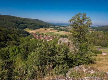

The best trails (16)

Trail On foot Litzendorf - Rund um den Gänsberg - Photo
On foot 3.53
Km
PRO

On foot

Easy
Litzendorf, Bavaria, Landkreis Bamberg, Germany
3.5 km | 6.1 km-effort
1h 22min
191 m
185 m
Yes
SityTrail - itinéraires balisés pédestres

• Symbol: gelber Ring auf weißem Grund
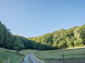
Trail On foot Litzendorf - Rundweg Eulenstein und Jungfernhöhle - Photo
On foot 3.114
Km
PRO

On foot

Easy
Litzendorf, Bavaria, Landkreis Bamberg, Germany
3.1 km | 5.3 km-effort
1h 12min
161 m
167 m
Yes
SityTrail - itinéraires balisés pédestres

• Symbol: roter Ring auf weißem Grund
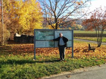
Trail On foot Litzendorf - Rund um den Ellerberg - Photo
On foot 8.496
Km
PRO

On foot

Easy
Litzendorf, Bavaria, Landkreis Bamberg, Germany
8.5 km | 11.7 km-effort
2h 38min
239 m
232 m
Yes
SityTrail - itinéraires balisés pédestres

• Symbol: schwarzer Ring auf weißem Grund
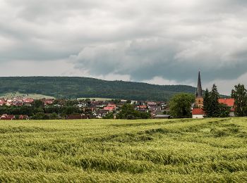
Trail On foot Litzendorf - Rundweg Tiefenellern - Herzogenreuth - Stockenberg - Photo
On foot 5.689
Km
PRO

On foot

Easy
Litzendorf, Bavaria, Landkreis Bamberg, Germany
5.7 km | 8.4 km-effort
1h 53min
199 m
203 m
Yes
SityTrail - itinéraires balisés pédestres

• Symbol: blauer Ring auf weißem Grund

Trail On foot Litzendorf - Kleine Tal-Rundwanderung - Photo
On foot 8.369
Km
PRO

On foot

Easy
Litzendorf, Bavaria, Landkreis Bamberg, Germany
8.4 km | 10 km-effort
2h 16min
122 m
122 m
Yes
SityTrail - itinéraires balisés pédestres

• Trail created by Gemeinde Litzendorf. Symbol: Gelbe Raute auf weißem Hintergrund

Trail On foot Litzendorf - Seehoftour - Photo
On foot 11.02
Km
PRO

On foot

Easy
Litzendorf, Bavaria, Landkreis Bamberg, Germany
11 km | 12.8 km-effort
2h 53min
130 m
129 m
Yes
SityTrail - itinéraires balisés pédestres

• Trail created by Gemeinde Litzendorf. Verlauf in Memmelsdorf und Schammelsdorf überprüfen (Bauarbeiten) Symbol: Sch...

Trail On foot Litzendorf - Ellertalwanderung - Photo
On foot 5.647
Km
PRO

On foot

Easy
Litzendorf, Bavaria, Landkreis Bamberg, Germany
5.6 km | 6.8 km-effort
1h 32min
105 m
19 m
No
SityTrail - itinéraires balisés pédestres

• Trail created by Gemeinde Litzendorf. Symbol: Blauer Schrägstrich auf weißem Hintergrund

Trail On foot Litzendorf - Wanderweg Hügelgräber - Sängerehrenmal - Photo
On foot 9.561
Km
PRO

On foot

Easy
Litzendorf, Bavaria, Landkreis Bamberg, Germany
9.6 km | 11.9 km-effort
2h 42min
175 m
174 m
Yes
SityTrail - itinéraires balisés pédestres

• Trail created by Gemeinde Litzendorf. Symbol: Rote Raute auf weißem Hintergrund

Trail On foot Litzendorf - Ellertal Nord - Stammberg - Rundweg - Photo
On foot 13.926
Km
PRO

On foot

Easy
Litzendorf, Bavaria, Landkreis Bamberg, Germany
13.9 km | 19.2 km-effort
4h 21min
397 m
395 m
Yes
SityTrail - itinéraires balisés pédestres

• Symbol: blaue Raute auf weißem Grund

Trail On foot Litzendorf - Rundweg von Schammelsdorf zum Gügel - Photo
On foot 15.017
Km
PRO

On foot

Medium
Litzendorf, Bavaria, Landkreis Bamberg, Germany
15 km | 21 km-effort
4h 40min
419 m
418 m
Yes
SityTrail - itinéraires balisés pédestres

• Symbol: Rote Raute auf weißem Hintergrund

Trail On foot Litzendorf - Kunst- und Besinnungsweg - Fränkische Toskana - Photo
On foot 3.818
Km
PRO

On foot

Easy
Litzendorf, Bavaria, Landkreis Bamberg, Germany
3.8 km | 5 km-effort
1h 7min
85 m
85 m
Yes
SityTrail - itinéraires balisés pédestres

• Trail created by Gemeinde Litzendorf. Symbol: Weißer Punkt auf dunklem Hintergrund

Trail On foot Litzendorf - Mittlere Geisbergtour - Photo
On foot 11.085
Km
PRO

On foot

Easy
Litzendorf, Bavaria, Landkreis Bamberg, Germany
11.1 km | 15.5 km-effort
3h 30min
328 m
327 m
Yes
SityTrail - itinéraires balisés pédestres

• Trail created by Gemeinde Litzendorf. Symbol: Roter Ring auf weißem Hintergrund

Trail On foot Litzendorf - Melkendorfer Rundwanderweg - Photo
On foot 12.407
Km
PRO

On foot

Easy
Litzendorf, Bavaria, Landkreis Bamberg, Germany
12.4 km | 16.9 km-effort
3h 50min
335 m
333 m
Yes
SityTrail - itinéraires balisés pédestres

• Trail created by Gemeinde Litzendorf. Symbol: Gelber Ring auf weißem Hintergrund

Trail On foot Litzendorf - Große Geisbergtour - Photo
On foot 13.697
Km
PRO

On foot

Easy
Litzendorf, Bavaria, Landkreis Bamberg, Germany
13.7 km | 18.6 km-effort
4h 13min
366 m
364 m
Yes
SityTrail - itinéraires balisés pédestres

• Trail created by Gemeinde Litzendorf. Symbol: Blauer Ring auf weißem Hintergrund

Trail On foot Litzendorf - Kleine Geisbergrunde - Photo
On foot 6.204
Km
PRO

On foot

Easy
Litzendorf, Bavaria, Landkreis Bamberg, Germany
6.2 km | 8.7 km-effort
1h 58min
185 m
183 m
Yes
SityTrail - itinéraires balisés pédestres

• Trail created by Gemeinde Litzendorf. Symbol: Grüner Ring auf weißem Hintergrund

Trail On foot Litzendorf - Große Stammbergtour - Photo
On foot 8.759
Km
PRO

On foot

Easy
Litzendorf, Bavaria, Landkreis Bamberg, Germany
8.8 km | 11.6 km-effort
2h 38min
214 m
207 m
Yes
SityTrail - itinéraires balisés pédestres

• Symbol: grüne Raute auf weißem Grund

16 trails displayed on 16

FREE GPS app for hiking

Logo SityTrail SityTrail

IGN / Geographical institutes

Download SityTrail from the App Store Download SityTrail from Google Play

Logo SityTrail SityTrail World

The world is yours!

Download SityTrail from the App Store Download SityTrail from Google Play Download SityTrail on Huawei AppGallery

Activities

Close
My subscriptions