![](/images/other/stat-length.png)
- Trails
- On foot
- Germany
- Saxony
- Mittelsachsen
- Oederan
Oederan, Mittelsachsen, On foot: Best trails, routes and walks
Oederan: Discover the best trails: 6 on foot. All these trails, routes and outdoor activities are available in our SityTrail applications for smartphones and tablets.
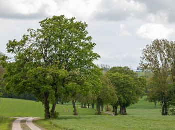
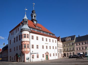
The best trails (6)
![Trail On foot Oederan - Glockenpfad zur Kirche Frankenstein - Photo](https://media.geolcdn.com/t/350/260/58e1935f-e048-471d-85eb-8067b42078cc.jpeg&format=jpg&maxdim=2)
![On foot On foot](https://static1.geolcdn.com/sitytour/trail-icons/100.png)
Km
On foot
![](/images/other/stat-length.png)
![](https://static1.geolcdn.com/siteimages/upload/files/1508320355ic_sort_den_pos_24dp.png)
![](https://static1.geolcdn.com/siteimages/upload/files/1508320355ic_sort_den_neg_24dp.png)
![](https://static1.geolcdn.com/siteimages/upload/files/16400158638029165_repeat_loop_refresh_sync_direction_icon.png)
• Trail created by ev.-Luth Kirchgemeinde Frankenstein.
![Trail On foot Oederan - Ortswanderweg Oederan - Börnichen - Schönerstadt (Rundweg) - Photo](https://media.geolcdn.com/t/350/260/22e674bd-fd5a-4c1c-9ec6-e926cb3102c8.jpeg&format=jpg&maxdim=2)
![On foot On foot](https://static1.geolcdn.com/sitytour/trail-icons/100.png)
Km
On foot
![](/images/other/stat-length.png)
![](https://static1.geolcdn.com/siteimages/upload/files/1508320355ic_sort_den_pos_24dp.png)
![](https://static1.geolcdn.com/siteimages/upload/files/1508320355ic_sort_den_neg_24dp.png)
![](https://static1.geolcdn.com/siteimages/upload/files/16400158638029165_repeat_loop_refresh_sync_direction_icon.png)
• Trail created by Stadt Oederan. Symbol: grüner Strich, weißer Grund
![Trail On foot Oederan - Gahlenzer Rundweg - Photo](https://media.geolcdn.com/t/350/260/ext.jpg?maxdim=2&url=https%3A%2F%2Fstatic1.geolcdn.com%2Fsiteimages%2Fupload%2Ffiles%2F1545311037marcheuse_200dpi.jpg)
![On foot On foot](https://static1.geolcdn.com/sitytour/trail-icons/100.png)
Km
On foot
![](/images/other/stat-length.png)
![](https://static1.geolcdn.com/siteimages/upload/files/1508320355ic_sort_den_pos_24dp.png)
![](https://static1.geolcdn.com/siteimages/upload/files/1508320355ic_sort_den_neg_24dp.png)
![](https://static1.geolcdn.com/siteimages/upload/files/16400158638029165_repeat_loop_refresh_sync_direction_icon.png)
• Symbol: green bar on white ground
![Trail On foot Oederan - Wanderweg Oederan - Grünberg - Augustusburg - Photo](https://media.geolcdn.com/t/350/260/ext.jpg?maxdim=2&url=https%3A%2F%2Fstatic1.geolcdn.com%2Fsiteimages%2Fupload%2Ffiles%2F1545311037marcheuse_200dpi.jpg)
![On foot On foot](https://static1.geolcdn.com/sitytour/trail-icons/100.png)
Km
On foot
![](/images/other/stat-length.png)
![](https://static1.geolcdn.com/siteimages/upload/files/1508320355ic_sort_den_pos_24dp.png)
![](https://static1.geolcdn.com/siteimages/upload/files/1508320355ic_sort_den_neg_24dp.png)
![](https://static1.geolcdn.com/siteimages/upload/files/16400158638029165_repeat_loop_refresh_sync_direction_icon.png)
• Symbol: yellow bar on white ground
![Trail On foot Oederan - Ortswanderweg Oederan - Memmendorf - Photo](https://media.geolcdn.com/t/350/260/ext.jpg?maxdim=2&url=https%3A%2F%2Fstatic1.geolcdn.com%2Fsiteimages%2Fupload%2Ffiles%2F1545311037marcheuse_200dpi.jpg)
![On foot On foot](https://static1.geolcdn.com/sitytour/trail-icons/100.png)
Km
On foot
![](/images/other/stat-length.png)
![](https://static1.geolcdn.com/siteimages/upload/files/1508320355ic_sort_den_pos_24dp.png)
![](https://static1.geolcdn.com/siteimages/upload/files/1508320355ic_sort_den_neg_24dp.png)
![](https://static1.geolcdn.com/siteimages/upload/files/16400158638029165_repeat_loop_refresh_sync_direction_icon.png)
• Symbol: yellow bar on white ground
![Trail On foot Oederan - DE-Naturlehrpfad Borntalweg - Photo](https://media.geolcdn.com/t/350/260/ext.jpg?maxdim=2&url=https%3A%2F%2Fstatic1.geolcdn.com%2Fsiteimages%2Fupload%2Ffiles%2F1545311037marcheuse_200dpi.jpg)
![On foot On foot](https://static1.geolcdn.com/sitytour/trail-icons/100.png)
Km
On foot
![](/images/other/stat-length.png)
![](https://static1.geolcdn.com/siteimages/upload/files/1508320355ic_sort_den_pos_24dp.png)
![](https://static1.geolcdn.com/siteimages/upload/files/1508320355ic_sort_den_neg_24dp.png)
![](https://static1.geolcdn.com/siteimages/upload/files/16400158638029165_repeat_loop_refresh_sync_direction_icon.png)
• Naturlehrpfad Borntalweg Symbol: green backslash on white ground
6 trails displayed on 6
FREE GPS app for hiking