


14.5 km | 16.4 km-effort
Montreux: Discover the best trails: 3 on foot, 13 walking and 5 running. All these trails, routes and outdoor activities are available in our SityTrail applications for smartphones and tablets.

Walking


On foot
• Trail created by Narcisses Riviera. Website: http://www.narcisses.ch/narcisse_parcours_avants.php
Walking
Walking
Walking

On foot
• Derrière la gare de Montreux, sur la « Rue de la Gare » se trouvent les panneaux pédestres indiquant les « Gorges du ...
On foot
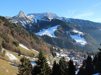
• Parcours : du parking de Haut de Caux (1155 m.), prendre la route goudronnée des Raveyres. Après un peu plus d’un kil...
On foot
• Parcours : du parking de Haut de Caux (1155 m.), prendre la route goudronnée des Raveyres. Après un peu plus d’un kil...

Running
• De la gare des Avants (960 m.), revenir sur la route de Chamby sur 200 mètres et guetter à droite un escalier qui se ...
Walking
Walking
• Sentier dès narcisses
Running
• Magnifique mais éprouvant descente interminable
Running
Running
Walking
•
Walking
•
Walking
Walking
Walking
Walking
20 trails displayed on 20
FREE GPS app for hiking
 SityTrail
IGN / Geographical institutes
SityTrail World
The world is yours!