Randa, Visp, On foot: Best trails, routes and walks

Randa: Discover the best trails: 7 walking. All these trails, routes and outdoor activities are available in our SityTrail applications for smartphones and tablets.
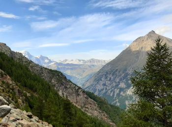

The best trails (7)

Trail Walking Randa - La Haute Route : J11 - Photo
Walking 18.818
Km

Walking

Difficult
Randa, Valais/Wallis, Visp, Switzerland
18.8 km | 34 km-effort
5h 7min
964 m
1622 m
No
Greg813

Trail Walking Randa - CHX ZRMT Étape 10 de Rwanda à Zermatt  - Photo
Walking 18.521
Km

Walking

Medium
Randa, Valais/Wallis, Visp, Switzerland
18.5 km | 37 km-effort
6h 9min
1408 m
1229 m
No
jeff2

• La plus journée pour la météo et la plus belle arrivée sur Zermatt

Trail Walking Randa - st_ny0915 - Photo
Walking 15.11
Km
GUIDE+

Walking

Very easy
Randa, Valais/Wallis, Visp, Switzerland
15.1 km | 31 km-effort
5h 9min
1212 m
1198 m
No
My Switzerland

Trail Walking Randa - randa  - Photo
Walking 7.872
Km

Walking

Difficult
Randa, Valais/Wallis, Visp, Switzerland
7.9 km | 19.2 km-effort
5h 46min
863 m
810 m
No
stouf07

Trail Walking Randa - Randa - Pont suspendu Charles Kuonen - Photo
Walking 8.391
Km

Walking

Difficult
Randa, Valais/Wallis, Visp, Switzerland
8.4 km | 19.2 km-effort
5h 21min
807 m
807 m
Yes
mich06

Trail Walking Randa - Zermatt - stelisee sans télécabines - Photo
Walking 27.546
Km

Walking

Very difficult
Randa, Valais/Wallis, Visp, Switzerland
28 km | 46 km-effort
10h 31min
1409 m
1412 m
Yes
Bruno566

Trail Walking Randa - Pont Suspendu Randa - Photo
Walking 9.069
Km

Walking

Very difficult
Randa, Valais/Wallis, Visp, Switzerland
9.1 km | 23 km-effort
5h 8min
1039 m
955 m
No
Muriel74

7 trails displayed on 7

FREE GPS app for hiking

Logo SityTrail SityTrail

IGN / Geographical institutes

Download SityTrail from the App Store Download SityTrail from Google Play

Logo SityTrail SityTrail World

The world is yours!

Download SityTrail from the App Store Download SityTrail from Google Play Download SityTrail on Huawei AppGallery

Activities

Close
My subscriptions