![](/images/other/stat-length.png)
- Trails
- On foot
- Switzerland
- Schwyz
- Schwyz
- Unteriberg
Unteriberg, Schwyz, On foot: Best trails, routes and walks
Unteriberg: Discover the best trails: 4 on foot. All these trails, routes and outdoor activities are available in our SityTrail applications for smartphones and tablets.
The best trails (4)
![Trail On foot Unteriberg - Ochsenboden-Diethelm - Photo](https://media.geolcdn.com/t/350/260/ext.jpg?maxdim=2&url=https%3A%2F%2Fmedia.geolcdn.com%2Ff%2Fbb501f78-c887-4a7b-b877-a7094c16c552.jpeg)
![On foot On foot](https://static1.geolcdn.com/sitytour/trail-icons/100.png)
Km
On foot
![](/images/other/stat-length.png)
![](https://static1.geolcdn.com/siteimages/upload/files/1508320355ic_sort_den_pos_24dp.png)
![](https://static1.geolcdn.com/siteimages/upload/files/1508320355ic_sort_den_neg_24dp.png)
![](https://static1.geolcdn.com/siteimages/upload/files/16400158638029165_repeat_loop_refresh_sync_direction_icon.png)
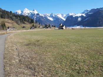
• Ochsenboden-Diethelm Symbol: rot weiss rot
![Trail On foot Unteriberg - Studen - Unteriberg-Stöcken - Photo](https://media.geolcdn.com/t/350/260/ext.jpg?maxdim=2&url=https%3A%2F%2Fmedia.geolcdn.com%2Ff%2F4fcdaac4-531b-4467-9540-917d13ca9efa.jpeg)
![On foot On foot](https://static1.geolcdn.com/sitytour/trail-icons/100.png)
Km
On foot
![](/images/other/stat-length.png)
![](https://static1.geolcdn.com/siteimages/upload/files/1508320355ic_sort_den_pos_24dp.png)
![](https://static1.geolcdn.com/siteimages/upload/files/1508320355ic_sort_den_neg_24dp.png)
![](https://static1.geolcdn.com/siteimages/upload/files/16400158638029165_repeat_loop_refresh_sync_direction_icon.png)
• Trail created by Umweltdepartement Kt Schwyz. Studen - Unteriberg-Stöcken Symbol: gelber Diamant
![Trail On foot Unteriberg - Unteriberg-Stöcken - Minsterbrücke - Photo](https://media.geolcdn.com/t/350/260/ext.jpg?maxdim=2&url=https%3A%2F%2Fmedia.geolcdn.com%2Ff%2Fd48d8403-4738-4ce8-998d-ff6d79dc5598.jpeg)
![On foot On foot](https://static1.geolcdn.com/sitytour/trail-icons/100.png)
Km
On foot
![](/images/other/stat-length.png)
![](https://static1.geolcdn.com/siteimages/upload/files/1508320355ic_sort_den_pos_24dp.png)
![](https://static1.geolcdn.com/siteimages/upload/files/1508320355ic_sort_den_neg_24dp.png)
![](https://static1.geolcdn.com/siteimages/upload/files/16400158638029165_repeat_loop_refresh_sync_direction_icon.png)
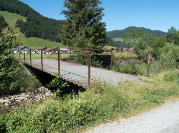
• Trail created by Umweltdepartement Kt Schwyz. Unteriberg-Stöcken - Minsterbrücke Symbol: gelber Diamant
![Trail On foot Unteriberg - Haldeli - Wisstannen-Weid - Photo](https://media.geolcdn.com/t/350/260/ext.jpg?maxdim=2&url=https%3A%2F%2Fmedia.geolcdn.com%2Ff%2F4fcdaac4-531b-4467-9540-917d13ca9efa.jpeg)
![On foot On foot](https://static1.geolcdn.com/sitytour/trail-icons/100.png)
Km
On foot
![](/images/other/stat-length.png)
![](https://static1.geolcdn.com/siteimages/upload/files/1508320355ic_sort_den_pos_24dp.png)
![](https://static1.geolcdn.com/siteimages/upload/files/1508320355ic_sort_den_neg_24dp.png)
![](https://static1.geolcdn.com/siteimages/upload/files/16400158638029165_repeat_loop_refresh_sync_direction_icon.png)
• Trail created by Umweltdepartement Kt Schwyz. Haldeli - Wisstannen-Weid Symbol: gelber Diamant
4 trails displayed on 4
FREE GPS app for hiking