![](/images/other/stat-length.png)
- Trails
- On foot
- Switzerland
- Aargau
- Bezirk Laufenburg
Bezirk Laufenburg, Aargau, On foot: Best trails, routes and walks
Bezirk Laufenburg: Discover the best trails: 23 on foot and 1 walking. All these trails, routes and outdoor activities are available in our SityTrail applications for smartphones and tablets.
The best trails (24)
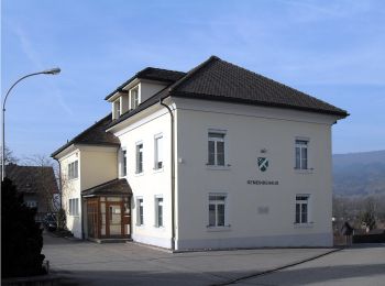
![Trail On foot Laufenburg - Laufenburg - Sisseln - Photo](https://media.geolcdn.com/t/350/260/f6f962f9-4f62-4c94-9e33-68190dd25ed5.jpeg&format=jpg&maxdim=2)
![On foot On foot](https://static1.geolcdn.com/sitytour/trail-icons/100.png)
Km
On foot
![](/images/other/stat-length.png)
![](https://static1.geolcdn.com/siteimages/upload/files/1508320355ic_sort_den_pos_24dp.png)
![](https://static1.geolcdn.com/siteimages/upload/files/1508320355ic_sort_den_neg_24dp.png)
![](https://static1.geolcdn.com/siteimages/upload/files/16400158638029165_repeat_loop_refresh_sync_direction_icon.png)
• Laufenburg - Sisseln Symbol: gelber Diamant (waagrecht)
![Trail On foot Sisseln - Eiken - Sisseln - Photo](https://media.geolcdn.com/t/350/260/f6f962f9-4f62-4c94-9e33-68190dd25ed5.jpeg&format=jpg&maxdim=2)
![On foot On foot](https://static1.geolcdn.com/sitytour/trail-icons/100.png)
Km
On foot
![](/images/other/stat-length.png)
![](https://static1.geolcdn.com/siteimages/upload/files/1508320355ic_sort_den_pos_24dp.png)
![](https://static1.geolcdn.com/siteimages/upload/files/1508320355ic_sort_den_neg_24dp.png)
![](https://static1.geolcdn.com/siteimages/upload/files/16400158638029165_repeat_loop_refresh_sync_direction_icon.png)
• Eiken - Sisseln Symbol: gelber Diamant (waagrecht)
![Trail On foot Frick - Frick - Oeschgen - Photo](https://media.geolcdn.com/t/350/260/dev_4459ec54-e78f-499d-a597-ee88cf25b2c2.jpeg&format=jpg&maxdim=2)
![On foot On foot](https://static1.geolcdn.com/sitytour/trail-icons/100.png)
Km
On foot
![](/images/other/stat-length.png)
![](https://static1.geolcdn.com/siteimages/upload/files/1508320355ic_sort_den_pos_24dp.png)
![](https://static1.geolcdn.com/siteimages/upload/files/1508320355ic_sort_den_neg_24dp.png)
![](https://static1.geolcdn.com/siteimages/upload/files/16400158638029165_repeat_loop_refresh_sync_direction_icon.png)
• Frick - Oeschgen Symbol: gelber Diamant (waagrecht)
![Trail On foot Frick - Frick - Junkholz - Photo](https://media.geolcdn.com/t/350/260/dev_4459ec54-e78f-499d-a597-ee88cf25b2c2.jpeg&format=jpg&maxdim=2)
![On foot On foot](https://static1.geolcdn.com/sitytour/trail-icons/100.png)
Km
On foot
![](/images/other/stat-length.png)
![](https://static1.geolcdn.com/siteimages/upload/files/1508320355ic_sort_den_pos_24dp.png)
![](https://static1.geolcdn.com/siteimages/upload/files/1508320355ic_sort_den_neg_24dp.png)
![](https://static1.geolcdn.com/siteimages/upload/files/16400158638029165_repeat_loop_refresh_sync_direction_icon.png)
• Frick - Junkholz Symbol: gelbe Raute
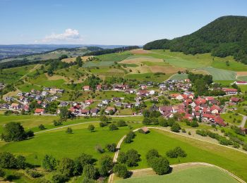
![Trail On foot Kaisten - Ittenthal - Frick - Photo](https://media.geolcdn.com/t/350/260/dev_29b0417c-ec28-4965-b980-955f927d61da.jpeg&format=jpg&maxdim=2)
![On foot On foot](https://static1.geolcdn.com/sitytour/trail-icons/100.png)
Km
On foot
![](/images/other/stat-length.png)
![](https://static1.geolcdn.com/siteimages/upload/files/1508320355ic_sort_den_pos_24dp.png)
![](https://static1.geolcdn.com/siteimages/upload/files/1508320355ic_sort_den_neg_24dp.png)
![](https://static1.geolcdn.com/siteimages/upload/files/16400158638029165_repeat_loop_refresh_sync_direction_icon.png)
• Ittenthal - Frick Symbol: gelber Diamant (waagrecht)
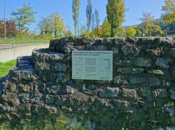
![Trail On foot Laufenburg - Etzgen Postauto - Rheinsulz - Photo](https://media.geolcdn.com/t/350/260/dev_777bcf25-f345-460a-9a90-6ce6e19b0209.jpeg&format=jpg&maxdim=2)
![On foot On foot](https://static1.geolcdn.com/sitytour/trail-icons/100.png)
Km
On foot
![](/images/other/stat-length.png)
![](https://static1.geolcdn.com/siteimages/upload/files/1508320355ic_sort_den_pos_24dp.png)
![](https://static1.geolcdn.com/siteimages/upload/files/1508320355ic_sort_den_neg_24dp.png)
![](https://static1.geolcdn.com/siteimages/upload/files/16400158638029165_repeat_loop_refresh_sync_direction_icon.png)
• Etzgen Postauto - Rheinsulz Symbol: gelber Diamant (waagrecht)
![Trail On foot Frick - Frick - Ruine Tierstein - Photo](https://media.geolcdn.com/t/350/260/dev_4459ec54-e78f-499d-a597-ee88cf25b2c2.jpeg&format=jpg&maxdim=2)
![On foot On foot](https://static1.geolcdn.com/sitytour/trail-icons/100.png)
Km
On foot
![](/images/other/stat-length.png)
![](https://static1.geolcdn.com/siteimages/upload/files/1508320355ic_sort_den_pos_24dp.png)
![](https://static1.geolcdn.com/siteimages/upload/files/1508320355ic_sort_den_neg_24dp.png)
![](https://static1.geolcdn.com/siteimages/upload/files/16400158638029165_repeat_loop_refresh_sync_direction_icon.png)
• Frick - Ruine Tierstein Symbol: gelber Diamant
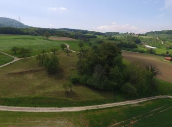
![Trail On foot Herznach - fixme - fixme - Photo](https://media.geolcdn.com/t/350/260/ccbe76e3-4b0b-4cf8-921b-1aa93c0437b1.jpeg&format=jpg&maxdim=2)
![On foot On foot](https://static1.geolcdn.com/sitytour/trail-icons/100.png)
Km
On foot
![](/images/other/stat-length.png)
![](https://static1.geolcdn.com/siteimages/upload/files/1508320355ic_sort_den_pos_24dp.png)
![](https://static1.geolcdn.com/siteimages/upload/files/1508320355ic_sort_den_neg_24dp.png)
![](https://static1.geolcdn.com/siteimages/upload/files/16400158638029165_repeat_loop_refresh_sync_direction_icon.png)
• fixme - fixme Symbol: gelbe Raute
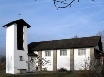
![Trail On foot Schwaderloch - Schwaderloch - Etzgen Dorf - Photo](https://media.geolcdn.com/t/350/260/dev_eda1989f-c220-4865-a017-4b4188445023.jpeg&format=jpg&maxdim=2)
![On foot On foot](https://static1.geolcdn.com/sitytour/trail-icons/100.png)
Km
On foot
![](/images/other/stat-length.png)
![](https://static1.geolcdn.com/siteimages/upload/files/1508320355ic_sort_den_pos_24dp.png)
![](https://static1.geolcdn.com/siteimages/upload/files/1508320355ic_sort_den_neg_24dp.png)
![](https://static1.geolcdn.com/siteimages/upload/files/16400158638029165_repeat_loop_refresh_sync_direction_icon.png)
• Schwaderloch - Etzgen Dorf Symbol: gelber Diamant (waagrecht)
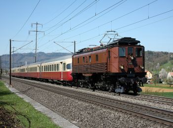
![Trail On foot Hornussen - Wettacher - Frick - Photo](https://media.geolcdn.com/t/350/260/dev_d1b41557-a977-4528-8d42-3a5f7e898bfd.jpeg&format=jpg&maxdim=2)
![On foot On foot](https://static1.geolcdn.com/sitytour/trail-icons/100.png)
Km
On foot
![](/images/other/stat-length.png)
![](https://static1.geolcdn.com/siteimages/upload/files/1508320355ic_sort_den_pos_24dp.png)
![](https://static1.geolcdn.com/siteimages/upload/files/1508320355ic_sort_den_neg_24dp.png)
![](https://static1.geolcdn.com/siteimages/upload/files/16400158638029165_repeat_loop_refresh_sync_direction_icon.png)
• Wettacher - Frick Symbol: gelber Diamant (waagrecht)
![Trail On foot Kaisten - Schinberg Abz. - Ittenthal - Photo](https://media.geolcdn.com/t/350/260/dev_29b0417c-ec28-4965-b980-955f927d61da.jpeg&format=jpg&maxdim=2)
![On foot On foot](https://static1.geolcdn.com/sitytour/trail-icons/100.png)
Km
On foot
![](/images/other/stat-length.png)
![](https://static1.geolcdn.com/siteimages/upload/files/1508320355ic_sort_den_pos_24dp.png)
![](https://static1.geolcdn.com/siteimages/upload/files/1508320355ic_sort_den_neg_24dp.png)
![](https://static1.geolcdn.com/siteimages/upload/files/16400158638029165_repeat_loop_refresh_sync_direction_icon.png)
• Schinberg Abz. - Ittenthal Symbol: gelber Diamant (waagrecht)
![Trail On foot Mettauertal - Etzgen Dorf - Rheinsulz - Photo](https://media.geolcdn.com/t/350/260/dev_777bcf25-f345-460a-9a90-6ce6e19b0209.jpeg&format=jpg&maxdim=2)
![On foot On foot](https://static1.geolcdn.com/sitytour/trail-icons/100.png)
Km
On foot
![](/images/other/stat-length.png)
![](https://static1.geolcdn.com/siteimages/upload/files/1508320355ic_sort_den_pos_24dp.png)
![](https://static1.geolcdn.com/siteimages/upload/files/1508320355ic_sort_den_neg_24dp.png)
![](https://static1.geolcdn.com/siteimages/upload/files/16400158638029165_repeat_loop_refresh_sync_direction_icon.png)
• Etzgen Dorf - Rheinsulz Symbol: gelber Diamant (waagrecht)
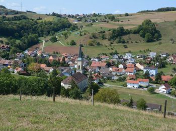
![Trail On foot Mettauertal - Mettau Postauto - Sulz - Photo](https://media.geolcdn.com/t/350/260/dev_8789f791-6716-44ce-baa5-b55cf2426f6f.jpeg&format=jpg&maxdim=2)
![On foot On foot](https://static1.geolcdn.com/sitytour/trail-icons/100.png)
Km
On foot
![](/images/other/stat-length.png)
![](https://static1.geolcdn.com/siteimages/upload/files/1508320355ic_sort_den_pos_24dp.png)
![](https://static1.geolcdn.com/siteimages/upload/files/1508320355ic_sort_den_neg_24dp.png)
![](https://static1.geolcdn.com/siteimages/upload/files/16400158638029165_repeat_loop_refresh_sync_direction_icon.png)
• Mettau Postauto - Sulz Symbol: gelber Diamant (waagrecht)
![Trail On foot Laufenburg - Rund um Sulz - Photo](https://media.geolcdn.com/t/350/260/dev_777bcf25-f345-460a-9a90-6ce6e19b0209.jpeg&format=jpg&maxdim=2)
![On foot On foot](https://static1.geolcdn.com/sitytour/trail-icons/100.png)
Km
On foot
![](/images/other/stat-length.png)
![](https://static1.geolcdn.com/siteimages/upload/files/1508320355ic_sort_den_pos_24dp.png)
![](https://static1.geolcdn.com/siteimages/upload/files/1508320355ic_sort_den_neg_24dp.png)
![](https://static1.geolcdn.com/siteimages/upload/files/16400158638029165_repeat_loop_refresh_sync_direction_icon.png)
• Trail created by www.gewerbe-sulz.ch. Rund um Sulz Symbol: roter Wegweiser
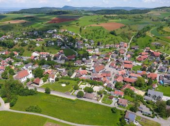
![Trail On foot Oberhof - Zwei Dörfer-Rundweg - Photo](https://media.geolcdn.com/t/350/260/9bcf9ac6-b1d9-4caf-b16f-7f9888483edd.jpeg&format=jpg&maxdim=2)
![On foot On foot](https://static1.geolcdn.com/sitytour/trail-icons/100.png)
Km
On foot
![](/images/other/stat-length.png)
![](https://static1.geolcdn.com/siteimages/upload/files/1508320355ic_sort_den_pos_24dp.png)
![](https://static1.geolcdn.com/siteimages/upload/files/1508320355ic_sort_den_neg_24dp.png)
![](https://static1.geolcdn.com/siteimages/upload/files/16400158638029165_repeat_loop_refresh_sync_direction_icon.png)
• Zwei Dörfer-Rundweg Symbol: weisser Diamant
![Trail On foot Wölflinswil - Eisenweg - Photo](https://media.geolcdn.com/t/350/260/9bcf9ac6-b1d9-4caf-b16f-7f9888483edd.jpeg&format=jpg&maxdim=2)
![On foot On foot](https://static1.geolcdn.com/sitytour/trail-icons/100.png)
Km
On foot
![](/images/other/stat-length.png)
![](https://static1.geolcdn.com/siteimages/upload/files/1508320355ic_sort_den_pos_24dp.png)
![](https://static1.geolcdn.com/siteimages/upload/files/1508320355ic_sort_den_neg_24dp.png)
![](https://static1.geolcdn.com/siteimages/upload/files/16400158638029165_repeat_loop_refresh_sync_direction_icon.png)
• Eisenweg Symbol: brauner Wegweiser
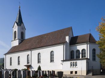
![Trail On foot Wittnau - Wittnau - Buschberg - Photo](https://media.geolcdn.com/t/350/260/5b085102-6be2-4304-9f45-bdc9d5b9ab9c.jpeg&format=jpg&maxdim=2)
![On foot On foot](https://static1.geolcdn.com/sitytour/trail-icons/100.png)
Km
On foot
![](/images/other/stat-length.png)
![](https://static1.geolcdn.com/siteimages/upload/files/1508320355ic_sort_den_pos_24dp.png)
![](https://static1.geolcdn.com/siteimages/upload/files/1508320355ic_sort_den_neg_24dp.png)
![](https://static1.geolcdn.com/siteimages/upload/files/16400158638029165_repeat_loop_refresh_sync_direction_icon.png)
• Wittnau - Buschberg Symbol: gelber Diamant (waagrecht)
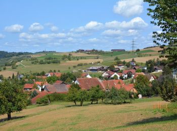
![Trail On foot Gansingen - Laubberg - Wil - Photo](https://media.geolcdn.com/t/350/260/dev_3788db29-f688-4a91-b4ed-58efe677389c.jpeg&format=jpg&maxdim=2)
![On foot On foot](https://static1.geolcdn.com/sitytour/trail-icons/100.png)
Km
On foot
![](/images/other/stat-length.png)
![](https://static1.geolcdn.com/siteimages/upload/files/1508320355ic_sort_den_pos_24dp.png)
![](https://static1.geolcdn.com/siteimages/upload/files/1508320355ic_sort_den_neg_24dp.png)
![](https://static1.geolcdn.com/siteimages/upload/files/16400158638029165_repeat_loop_refresh_sync_direction_icon.png)
• Laubberg - Wil Symbol: gelber Diamant (waagrecht)
![Trail On foot Mettauertal - Bossenhus - Leibstadt Postauto - Photo](https://media.geolcdn.com/t/350/260/dev_ccca126e-eace-483e-b235-f16e532152ca.jpeg&format=jpg&maxdim=2)
![On foot On foot](https://static1.geolcdn.com/sitytour/trail-icons/100.png)
Km
On foot
![](/images/other/stat-length.png)
![](https://static1.geolcdn.com/siteimages/upload/files/1508320355ic_sort_den_pos_24dp.png)
![](https://static1.geolcdn.com/siteimages/upload/files/1508320355ic_sort_den_neg_24dp.png)
![](https://static1.geolcdn.com/siteimages/upload/files/16400158638029165_repeat_loop_refresh_sync_direction_icon.png)
• Bossenhus - Leibstadt Postauto Symbol: gelber Diamant (waagrecht)
![Trail On foot Oeschgen - Warthöf - Oeschgen - Photo](https://media.geolcdn.com/t/350/260/ext.jpg?maxdim=2&url=https%3A%2F%2Fstatic1.geolcdn.com%2Fsiteimages%2Fupload%2Ffiles%2F1545311037marcheuse_200dpi.jpg)
![On foot On foot](https://static1.geolcdn.com/sitytour/trail-icons/100.png)
Km
On foot
![](/images/other/stat-length.png)
![](https://static1.geolcdn.com/siteimages/upload/files/1508320355ic_sort_den_pos_24dp.png)
![](https://static1.geolcdn.com/siteimages/upload/files/1508320355ic_sort_den_neg_24dp.png)
![](https://static1.geolcdn.com/siteimages/upload/files/16400158638029165_repeat_loop_refresh_sync_direction_icon.png)
• Warthöf - Oeschgen Symbol: gelber Diamant (waagrecht)
20 trails displayed on 24
FREE GPS app for hiking