![](/images/other/stat-length.png)
- Trails
- On foot
- Austria
- Tyrol
- Bezirk Kufstein
- Gemeinde Scheffau am Wilden Kaiser
Gemeinde Scheffau am Wilden Kaiser, Bezirk Kufstein, On foot: Best trails, routes and walks
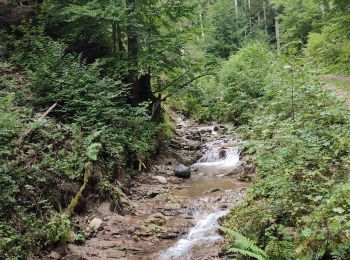
Gemeinde Scheffau am Wilden Kaiser: Discover the best trails: 4 on foot and 1 walking. All these trails, routes and outdoor activities are available in our SityTrail applications for smartphones and tablets.
The best trails (5)
![Trail On foot Gemeinde Scheffau am Wilden Kaiser - Auwaldrunde - Photo](https://media.geolcdn.com/t/350/260/3a82ec08-361f-407c-b990-092670ab9561.jpeg&format=jpg&maxdim=2)
![On foot On foot](https://static1.geolcdn.com/sitytour/trail-icons/100.png)
Km
On foot
![](/images/other/stat-length.png)
![](https://static1.geolcdn.com/siteimages/upload/files/1508320355ic_sort_den_pos_24dp.png)
![](https://static1.geolcdn.com/siteimages/upload/files/1508320355ic_sort_den_neg_24dp.png)
![](https://static1.geolcdn.com/siteimages/upload/files/16400158638029165_repeat_loop_refresh_sync_direction_icon.png)
• Trail created by Lauf- und Nordic Walking Region Wilder Kaiser. Route 2020 vor Ort Übersichtskarte und nur noch vere...
![Trail On foot Gemeinde Scheffau am Wilden Kaiser - Blaikenrunde - Photo](https://media.geolcdn.com/t/350/260/f62c0da4-e38c-4f86-bb60-08e7cedb9a5c.jpeg&format=jpg&maxdim=2)
![On foot On foot](https://static1.geolcdn.com/sitytour/trail-icons/100.png)
Km
On foot
![](/images/other/stat-length.png)
![](https://static1.geolcdn.com/siteimages/upload/files/1508320355ic_sort_den_pos_24dp.png)
![](https://static1.geolcdn.com/siteimages/upload/files/1508320355ic_sort_den_neg_24dp.png)
![](https://static1.geolcdn.com/siteimages/upload/files/16400158638029165_repeat_loop_refresh_sync_direction_icon.png)
• Trail created by Lauf- und Nordic Walking Region Wilder Kaiser. Route 2020 vor Ort Übersichtskarte und nur noch vere...
![Trail On foot Gemeinde Scheffau am Wilden Kaiser - Hintersteinersee Runde - Photo](https://media.geolcdn.com/t/350/260/7ce82edb-c501-4d03-be1c-122723060ba0.jpeg&format=jpg&maxdim=2)
![On foot On foot](https://static1.geolcdn.com/sitytour/trail-icons/100.png)
Km
On foot
![](/images/other/stat-length.png)
![](https://static1.geolcdn.com/siteimages/upload/files/1508320355ic_sort_den_pos_24dp.png)
![](https://static1.geolcdn.com/siteimages/upload/files/1508320355ic_sort_den_neg_24dp.png)
![](https://static1.geolcdn.com/siteimages/upload/files/16400158638029165_repeat_loop_refresh_sync_direction_icon.png)
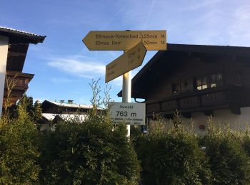
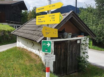
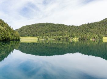
• Symbol: Weiße Schilder mit rotem Richtungspfeil und gelbem Streifen mit dem Namen "Hintersteinersee Runde"
![Trail On foot Gemeinde Scheffau am Wilden Kaiser - Wanderweg 57 - Wilder Kaiser - Photo](https://media.geolcdn.com/t/350/260/5a7c03dd-c48c-4c83-ac24-883b19017390.jpeg&format=jpg&maxdim=2)
![On foot On foot](https://static1.geolcdn.com/sitytour/trail-icons/100.png)
Km
On foot
![](/images/other/stat-length.png)
![](https://static1.geolcdn.com/siteimages/upload/files/1508320355ic_sort_den_pos_24dp.png)
![](https://static1.geolcdn.com/siteimages/upload/files/1508320355ic_sort_den_neg_24dp.png)
![](https://static1.geolcdn.com/siteimages/upload/files/16400158638029165_repeat_loop_refresh_sync_direction_icon.png)
![Trail Walking Gemeinde Scheffau am Wilden Kaiser - Hintersteinersee - Photo](https://media.geolcdn.com/t/350/260/31c678ec-d47e-4a4e-9908-bd239baff29d.jpg&format=jpg&maxdim=2)
![Walking Walking](https://static1.geolcdn.com/sitytour/trail-icons/101.png)
Km
Walking
![](/images/other/stat-length.png)
![](https://static1.geolcdn.com/siteimages/upload/files/1508320355ic_sort_den_pos_24dp.png)
![](https://static1.geolcdn.com/siteimages/upload/files/1508320355ic_sort_den_neg_24dp.png)
![](https://static1.geolcdn.com/siteimages/upload/files/16400158638029165_repeat_loop_refresh_sync_direction_icon.png)
5 trails displayed on 5
FREE GPS app for hiking