![](/images/other/stat-length.png)
- Trails
- On foot
- Austria
- Burgenland
- Bezirk Oberwart
- Gemeinde Wiesfleck
Gemeinde Wiesfleck, Bezirk Oberwart, On foot: Best trails, routes and walks
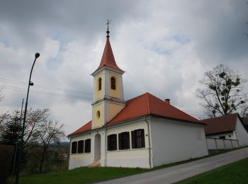
Gemeinde Wiesfleck: Discover the best trails: 4 on foot. All these trails, routes and outdoor activities are available in our SityTrail applications for smartphones and tablets.
The best trails (4)
![Trail On foot Gemeinde Wiesfleck - Wanderstrecke gelbe Markierung - Photo](https://media.geolcdn.com/t/350/260/d03447aa-6c26-4860-a889-6ecd9799b847.jpeg&format=jpg&maxdim=2)
![On foot On foot](https://static1.geolcdn.com/sitytour/trail-icons/100.png)
Km
On foot
![](/images/other/stat-length.png)
![](https://static1.geolcdn.com/siteimages/upload/files/1508320355ic_sort_den_pos_24dp.png)
![](https://static1.geolcdn.com/siteimages/upload/files/1508320355ic_sort_den_neg_24dp.png)
![](https://static1.geolcdn.com/siteimages/upload/files/16400158638029165_repeat_loop_refresh_sync_direction_icon.png)
• wird nicht mehr gewartet; ehemals betreut vom Verschönerungsverein Schreibersdorf Symbol: gelb-weiß
![Trail On foot Gemeinde Wiesfleck - Rundwanderweg Gemeinde Wiesfleck - Photo](https://media.geolcdn.com/t/350/260/6a421525-3b9a-419d-8625-452e98d723a0.jpeg&format=jpg&maxdim=2)
![On foot On foot](https://static1.geolcdn.com/sitytour/trail-icons/100.png)
Km
On foot
![](/images/other/stat-length.png)
![](https://static1.geolcdn.com/siteimages/upload/files/1508320355ic_sort_den_pos_24dp.png)
![](https://static1.geolcdn.com/siteimages/upload/files/1508320355ic_sort_den_neg_24dp.png)
![](https://static1.geolcdn.com/siteimages/upload/files/16400158638029165_repeat_loop_refresh_sync_direction_icon.png)
• Symbol: gelbe Pfeile mit Buchstaben R W
![Trail On foot Gemeinde Wiesfleck - Wanderstrecke blaue Markierung - Photo](https://media.geolcdn.com/t/350/260/d03447aa-6c26-4860-a889-6ecd9799b847.jpeg&format=jpg&maxdim=2)
![On foot On foot](https://static1.geolcdn.com/sitytour/trail-icons/100.png)
Km
On foot
![](/images/other/stat-length.png)
![](https://static1.geolcdn.com/siteimages/upload/files/1508320355ic_sort_den_pos_24dp.png)
![](https://static1.geolcdn.com/siteimages/upload/files/1508320355ic_sort_den_neg_24dp.png)
![](https://static1.geolcdn.com/siteimages/upload/files/16400158638029165_repeat_loop_refresh_sync_direction_icon.png)
• wird nicht mehr gewartet; ehemals betreut vom Verschönerungsverein Schreibersdorf Symbol: blau-weiß
![Trail On foot Gemeinde Wiesfleck - Rundwanderweg Schreibersdorf - Römergräber - Photo](https://media.geolcdn.com/t/350/260/ext.jpg?maxdim=2&url=https%3A%2F%2Fstatic1.geolcdn.com%2Fsiteimages%2Fupload%2Ffiles%2F1545311037marcheuse_200dpi.jpg)
![On foot On foot](https://static1.geolcdn.com/sitytour/trail-icons/100.png)
Km
On foot
![](/images/other/stat-length.png)
![](https://static1.geolcdn.com/siteimages/upload/files/1508320355ic_sort_den_pos_24dp.png)
![](https://static1.geolcdn.com/siteimages/upload/files/1508320355ic_sort_den_neg_24dp.png)
![](https://static1.geolcdn.com/siteimages/upload/files/16400158638029165_repeat_loop_refresh_sync_direction_icon.png)
• wird nicht mehr gewartet Symbol: weiß-grün
4 trails displayed on 4
FREE GPS app for hiking