![](/images/other/stat-length.png)
- Trails
- On foot
- Austria
- Styria
- Bezirk Deutschlandsberg
- Bad Schwanberg
Bad Schwanberg, Bezirk Deutschlandsberg, On foot: Best trails, routes and walks
Bad Schwanberg: Discover the best trails: 3 on foot. All these trails, routes and outdoor activities are available in our SityTrail applications for smartphones and tablets.
The best trails (3)
![Trail On foot Bad Schwanberg - Glashütten - Weinebene - Photo](https://media.geolcdn.com/t/350/260/e7baa868-05b3-4cce-8621-83f6ad67156c.jpeg&format=jpg&maxdim=2)
![On foot On foot](https://static1.geolcdn.com/sitytour/trail-icons/100.png)
Km
On foot
![](/images/other/stat-length.png)
![](https://static1.geolcdn.com/siteimages/upload/files/1508320355ic_sort_den_pos_24dp.png)
![](https://static1.geolcdn.com/siteimages/upload/files/1508320355ic_sort_den_neg_24dp.png)
![](https://static1.geolcdn.com/siteimages/upload/files/16400158638029165_repeat_loop_refresh_sync_direction_icon.png)
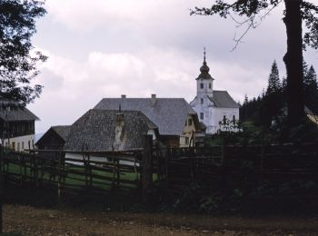
• Trail created by öAV Deutschlandsberg. Glashütten - Glashüttenkogel - Weinebene - Glashütten
![Trail On foot Bad Schwanberg - Grünangerhütte - Rundweg - Photo](https://media.geolcdn.com/t/350/260/fae8064c-a92d-46dd-a900-da5e461e0625.jpeg&format=jpg&maxdim=2)
![On foot On foot](https://static1.geolcdn.com/sitytour/trail-icons/100.png)
Km
On foot
![](/images/other/stat-length.png)
![](https://static1.geolcdn.com/siteimages/upload/files/1508320355ic_sort_den_pos_24dp.png)
![](https://static1.geolcdn.com/siteimages/upload/files/1508320355ic_sort_den_neg_24dp.png)
![](https://static1.geolcdn.com/siteimages/upload/files/16400158638029165_repeat_loop_refresh_sync_direction_icon.png)
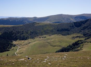
• Trail created by ÖAV Deutschlandsberg. Symbol: Rot-weiss-rot mit schwarzer Zahl 20 im weissen Streifen
![Trail On foot Bad Schwanberg - Wanderweg 34 - Photo](https://media.geolcdn.com/t/350/260/d8d32e7a-9add-467e-b294-28468356c44c.jpeg&format=jpg&maxdim=2)
![On foot On foot](https://static1.geolcdn.com/sitytour/trail-icons/100.png)
Km
On foot
![](/images/other/stat-length.png)
![](https://static1.geolcdn.com/siteimages/upload/files/1508320355ic_sort_den_pos_24dp.png)
![](https://static1.geolcdn.com/siteimages/upload/files/1508320355ic_sort_den_neg_24dp.png)
![](https://static1.geolcdn.com/siteimages/upload/files/16400158638029165_repeat_loop_refresh_sync_direction_icon.png)
• Trail created by ?. http://wiki.openstreetmap.org/index.php?title=WikiProject_Austria/Wanderwege Symbol: Rot-Weiss-...
3 trails displayed on 3
FREE GPS app for hiking