![](/images/other/stat-length.png)
Bezirk Graz-Umgebung, Styria, On foot: Best trails, routes and walks
Bezirk Graz-Umgebung: Discover the best trails: 100 on foot. All these trails, routes and outdoor activities are available in our SityTrail applications for smartphones and tablets.
The best trails (100)
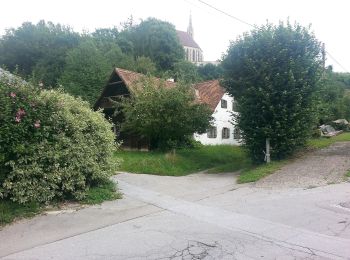
![Trail On foot Dobl-Zwaring - Kneippwanderweg 3 - Photo](https://media.geolcdn.com/t/350/260/c723462d-f74e-4c27-a311-09ccce09a531.jpeg&format=jpg&maxdim=2)
![On foot On foot](https://static1.geolcdn.com/sitytour/trail-icons/100.png)
Km
On foot
![](/images/other/stat-length.png)
![](https://static1.geolcdn.com/siteimages/upload/files/1508320355ic_sort_den_pos_24dp.png)
![](https://static1.geolcdn.com/siteimages/upload/files/1508320355ic_sort_den_neg_24dp.png)
![](https://static1.geolcdn.com/siteimages/upload/files/16400158638029165_repeat_loop_refresh_sync_direction_icon.png)
• http://wiki.openstreetmap.org/wiki/WikiProject_Austria/Wanderwege Symbol: rot-weiss-rot 3
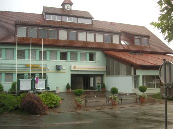
![Trail On foot Hitzendorf - Auf den Spuren von Österr-Weiß - Photo](https://media.geolcdn.com/t/350/260/a0e35225-25c1-4707-9eac-cdb4afc8dded.jpeg&format=jpg&maxdim=2)
![On foot On foot](https://static1.geolcdn.com/sitytour/trail-icons/100.png)
Km
On foot
![](/images/other/stat-length.png)
![](https://static1.geolcdn.com/siteimages/upload/files/1508320355ic_sort_den_pos_24dp.png)
![](https://static1.geolcdn.com/siteimages/upload/files/1508320355ic_sort_den_neg_24dp.png)
![](https://static1.geolcdn.com/siteimages/upload/files/16400158638029165_repeat_loop_refresh_sync_direction_icon.png)
• Symbol: gelbe Wegweiser schwarzer Schrift
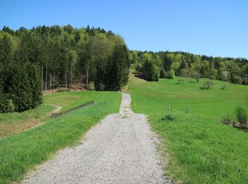
![Trail On foot Seiersberg-Pirka - Erzherzog Johann Marsch - Photo](https://media.geolcdn.com/t/350/260/b5082dba-0998-49ac-9424-be1264138178.jpeg&format=jpg&maxdim=2)
![On foot On foot](https://static1.geolcdn.com/sitytour/trail-icons/100.png)
Km
On foot
![](/images/other/stat-length.png)
![](https://static1.geolcdn.com/siteimages/upload/files/1508320355ic_sort_den_pos_24dp.png)
![](https://static1.geolcdn.com/siteimages/upload/files/1508320355ic_sort_den_neg_24dp.png)
![](https://static1.geolcdn.com/siteimages/upload/files/16400158638029165_repeat_loop_refresh_sync_direction_icon.png)
• Trail created by Heeressportverein Graz. Symbol: blau-weiß
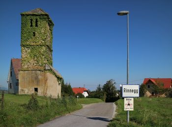
![Trail On foot St. Radegund - Ster- und Mühlgraben - Photo](https://media.geolcdn.com/t/350/260/7a33bd2d-ec74-4c87-bd70-8bec9ef4280c.jpeg&format=jpg&maxdim=2)
![On foot On foot](https://static1.geolcdn.com/sitytour/trail-icons/100.png)
Km
On foot
![](/images/other/stat-length.png)
![](https://static1.geolcdn.com/siteimages/upload/files/1508320355ic_sort_den_pos_24dp.png)
![](https://static1.geolcdn.com/siteimages/upload/files/1508320355ic_sort_den_neg_24dp.png)
![](https://static1.geolcdn.com/siteimages/upload/files/16400158638029165_repeat_loop_refresh_sync_direction_icon.png)
• Trail created by Tourismusverband St. Radegund. nicht markiert
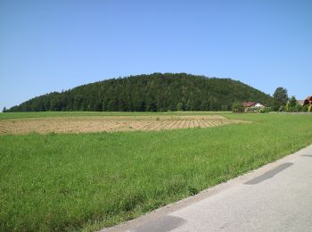
![Trail On foot Semriach - R10 Boden-Rechbergkogel-Greithweg - Photo](https://media.geolcdn.com/t/350/260/dd516bf9-a83f-46d6-ba85-5f6b59546e4f.jpeg&format=jpg&maxdim=2)
![On foot On foot](https://static1.geolcdn.com/sitytour/trail-icons/100.png)
Km
On foot
![](/images/other/stat-length.png)
![](https://static1.geolcdn.com/siteimages/upload/files/1508320355ic_sort_den_pos_24dp.png)
![](https://static1.geolcdn.com/siteimages/upload/files/1508320355ic_sort_den_neg_24dp.png)
![](https://static1.geolcdn.com/siteimages/upload/files/16400158638029165_repeat_loop_refresh_sync_direction_icon.png)
• Symbol: Schilder
![Trail On foot St. Radegund - Hubertusrunde - Photo](https://media.geolcdn.com/t/350/260/463637a7-775e-41c9-a40c-5b8940fa2c16.jpeg&format=jpg&maxdim=2)
![On foot On foot](https://static1.geolcdn.com/sitytour/trail-icons/100.png)
Km
On foot
![](/images/other/stat-length.png)
![](https://static1.geolcdn.com/siteimages/upload/files/1508320355ic_sort_den_pos_24dp.png)
![](https://static1.geolcdn.com/siteimages/upload/files/1508320355ic_sort_den_neg_24dp.png)
![](https://static1.geolcdn.com/siteimages/upload/files/16400158638029165_repeat_loop_refresh_sync_direction_icon.png)
• Trail created by ?. http://wiki.openstreetmap.org/wiki/WikiProject_Austria/Wanderwege Symbol: Weisses Quadrat mit g...
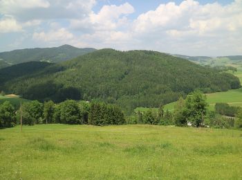
![Trail On foot Semriach - R9 Eichberg-Lurgrotte-Rundweg - Photo](https://media.geolcdn.com/t/350/260/e36297de-df9b-424c-9a65-143f9939b4f9.jpeg&format=jpg&maxdim=2)
![On foot On foot](https://static1.geolcdn.com/sitytour/trail-icons/100.png)
Km
On foot
![](/images/other/stat-length.png)
![](https://static1.geolcdn.com/siteimages/upload/files/1508320355ic_sort_den_pos_24dp.png)
![](https://static1.geolcdn.com/siteimages/upload/files/1508320355ic_sort_den_neg_24dp.png)
![](https://static1.geolcdn.com/siteimages/upload/files/16400158638029165_repeat_loop_refresh_sync_direction_icon.png)
• Symbol: Schilder
![Trail On foot Semriach - R7 Tannebenwald-Rundweg - Photo](https://media.geolcdn.com/t/350/260/e6d63f61-fdfa-4536-a7ef-f8e3a2e19f2e.jpeg&format=jpg&maxdim=2)
![On foot On foot](https://static1.geolcdn.com/sitytour/trail-icons/100.png)
Km
On foot
![](/images/other/stat-length.png)
![](https://static1.geolcdn.com/siteimages/upload/files/1508320355ic_sort_den_pos_24dp.png)
![](https://static1.geolcdn.com/siteimages/upload/files/1508320355ic_sort_den_neg_24dp.png)
![](https://static1.geolcdn.com/siteimages/upload/files/16400158638029165_repeat_loop_refresh_sync_direction_icon.png)
• Symbol: Schilder
![Trail On foot Semriach - R11 Lehrwanderweg - Photo](https://media.geolcdn.com/t/350/260/fda0f671-847a-4dfc-93d6-af54d1cdf474.jpeg&format=jpg&maxdim=2)
![On foot On foot](https://static1.geolcdn.com/sitytour/trail-icons/100.png)
Km
On foot
![](/images/other/stat-length.png)
![](https://static1.geolcdn.com/siteimages/upload/files/1508320355ic_sort_den_pos_24dp.png)
![](https://static1.geolcdn.com/siteimages/upload/files/1508320355ic_sort_den_neg_24dp.png)
![](https://static1.geolcdn.com/siteimages/upload/files/16400158638029165_repeat_loop_refresh_sync_direction_icon.png)
• Symbol: Schilder: R11, Markierung grün-weiss-grün 1
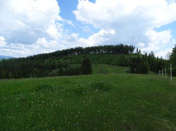
![Trail On foot Stiwoll - Wanderweg 1 - Photo](https://media.geolcdn.com/t/350/260/e4d403b8-5bf0-42d3-8dba-0c60bcabfa3c.jpeg&format=jpg&maxdim=2)
![On foot On foot](https://static1.geolcdn.com/sitytour/trail-icons/100.png)
Km
On foot
![](/images/other/stat-length.png)
![](https://static1.geolcdn.com/siteimages/upload/files/1508320355ic_sort_den_pos_24dp.png)
![](https://static1.geolcdn.com/siteimages/upload/files/1508320355ic_sort_den_neg_24dp.png)
![](https://static1.geolcdn.com/siteimages/upload/files/16400158638029165_repeat_loop_refresh_sync_direction_icon.png)
• Trail created by Gemeinde Stiwoll. Symbol: gelbe Schilder mit schwarzer 1
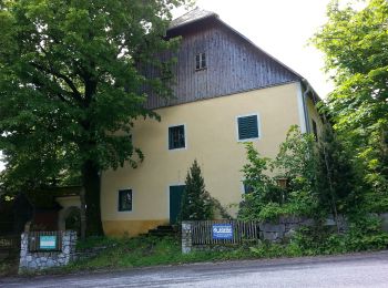
![Trail On foot Stiwoll - Wanderweg 13a - Photo](https://media.geolcdn.com/t/350/260/b8af7cfc-f07d-4b58-af01-795c9309e6c6.jpeg&format=jpg&maxdim=2)
![On foot On foot](https://static1.geolcdn.com/sitytour/trail-icons/100.png)
Km
On foot
![](/images/other/stat-length.png)
![](https://static1.geolcdn.com/siteimages/upload/files/1508320355ic_sort_den_pos_24dp.png)
![](https://static1.geolcdn.com/siteimages/upload/files/1508320355ic_sort_den_neg_24dp.png)
![](https://static1.geolcdn.com/siteimages/upload/files/16400158638029165_repeat_loop_refresh_sync_direction_icon.png)
• Symbol: rot-weiss-rot 13a
![Trail On foot Gratwein-Straßengel - Wanderweg 16, Greitherweg - Photo](https://media.geolcdn.com/t/350/260/03ecfe23-aa70-4fce-80ef-8d67606e9e15.jpeg&format=jpg&maxdim=2)
![On foot On foot](https://static1.geolcdn.com/sitytour/trail-icons/100.png)
Km
On foot
![](/images/other/stat-length.png)
![](https://static1.geolcdn.com/siteimages/upload/files/1508320355ic_sort_den_pos_24dp.png)
![](https://static1.geolcdn.com/siteimages/upload/files/1508320355ic_sort_den_neg_24dp.png)
![](https://static1.geolcdn.com/siteimages/upload/files/16400158638029165_repeat_loop_refresh_sync_direction_icon.png)
• Symbol: rot-weiss-rot 16
![Trail On foot Gratwein-Straßengel - Wanderweg 14 - Photo](https://media.geolcdn.com/t/350/260/145e2a83-b263-4a09-9666-7dd5a74a4f9e.jpeg&format=jpg&maxdim=2)
![On foot On foot](https://static1.geolcdn.com/sitytour/trail-icons/100.png)
Km
On foot
![](/images/other/stat-length.png)
![](https://static1.geolcdn.com/siteimages/upload/files/1508320355ic_sort_den_pos_24dp.png)
![](https://static1.geolcdn.com/siteimages/upload/files/1508320355ic_sort_den_neg_24dp.png)
![](https://static1.geolcdn.com/siteimages/upload/files/16400158638029165_repeat_loop_refresh_sync_direction_icon.png)
• Trail created by ÖAV Gratkorn-Gratwein. Symbol: rot-weiss-rot 14
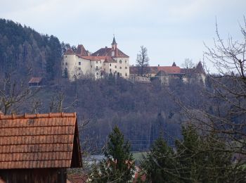
![Trail On foot Gratwein-Straßengel - Wanderweg 12 - Photo](https://media.geolcdn.com/t/350/260/ee0342fc-462c-4384-a09d-1fbd30e783d9.jpeg&format=jpg&maxdim=2)
![On foot On foot](https://static1.geolcdn.com/sitytour/trail-icons/100.png)
Km
On foot
![](/images/other/stat-length.png)
![](https://static1.geolcdn.com/siteimages/upload/files/1508320355ic_sort_den_pos_24dp.png)
![](https://static1.geolcdn.com/siteimages/upload/files/1508320355ic_sort_den_neg_24dp.png)
![](https://static1.geolcdn.com/siteimages/upload/files/16400158638029165_repeat_loop_refresh_sync_direction_icon.png)
• Trail created by ÖAV Gratkorn-Gratwein. Symbol: rot-weiss-rot 12
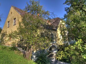
![Trail On foot Kumberg - Wanderweg 5 - Photo](https://media.geolcdn.com/t/350/260/b406ba29-6782-4197-8023-7d44bef6647e.jpeg&format=jpg&maxdim=2)
![On foot On foot](https://static1.geolcdn.com/sitytour/trail-icons/100.png)
Km
On foot
![](/images/other/stat-length.png)
![](https://static1.geolcdn.com/siteimages/upload/files/1508320355ic_sort_den_pos_24dp.png)
![](https://static1.geolcdn.com/siteimages/upload/files/1508320355ic_sort_den_neg_24dp.png)
![](https://static1.geolcdn.com/siteimages/upload/files/16400158638029165_repeat_loop_refresh_sync_direction_icon.png)
• Trail created by Gemeinde Kumberg. Symbol: rot-weiss-rot 5
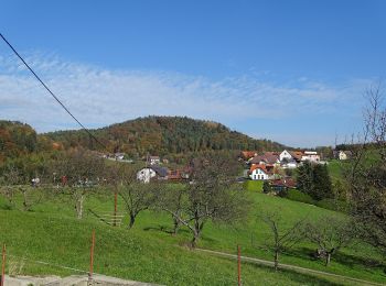
![Trail On foot Sankt Oswald bei Plankenwarth - Wanderweg 34 - Photo](https://media.geolcdn.com/t/350/260/fee6b74c-350d-407e-bbc6-7871ef2279fc.jpeg&format=jpg&maxdim=2)
![On foot On foot](https://static1.geolcdn.com/sitytour/trail-icons/100.png)
Km
On foot
![](/images/other/stat-length.png)
![](https://static1.geolcdn.com/siteimages/upload/files/1508320355ic_sort_den_pos_24dp.png)
![](https://static1.geolcdn.com/siteimages/upload/files/1508320355ic_sort_den_neg_24dp.png)
![](https://static1.geolcdn.com/siteimages/upload/files/16400158638029165_repeat_loop_refresh_sync_direction_icon.png)
• Trail created by ÖTK Sektion Graz. Symbol: rot-weiss-rot 34
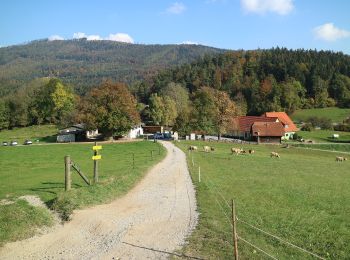
![Trail On foot Gratkorn - Wanderweg 8 - Photo](https://media.geolcdn.com/t/350/260/3fdd285e-c383-480b-8fe8-d3a5ceffc73c.jpeg&format=jpg&maxdim=2)
![On foot On foot](https://static1.geolcdn.com/sitytour/trail-icons/100.png)
Km
On foot
![](/images/other/stat-length.png)
![](https://static1.geolcdn.com/siteimages/upload/files/1508320355ic_sort_den_pos_24dp.png)
![](https://static1.geolcdn.com/siteimages/upload/files/1508320355ic_sort_den_neg_24dp.png)
![](https://static1.geolcdn.com/siteimages/upload/files/16400158638029165_repeat_loop_refresh_sync_direction_icon.png)
• Trail created by ÖAV Graz. http://wiki.openstreetmap.org/wiki/WikiProject_Austria/Wanderwege Symbol: rot-weiss-rot 8
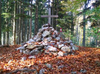
![Trail On foot Semriach - Wanderweg 7 - Photo](https://media.geolcdn.com/t/350/260/7ff544d1-675f-4e76-b66c-c137438eef10.jpeg&format=jpg&maxdim=2)
![On foot On foot](https://static1.geolcdn.com/sitytour/trail-icons/100.png)
Km
On foot
![](/images/other/stat-length.png)
![](https://static1.geolcdn.com/siteimages/upload/files/1508320355ic_sort_den_pos_24dp.png)
![](https://static1.geolcdn.com/siteimages/upload/files/1508320355ic_sort_den_neg_24dp.png)
![](https://static1.geolcdn.com/siteimages/upload/files/16400158638029165_repeat_loop_refresh_sync_direction_icon.png)
• Trail created by ÖAV Graz. http://wiki.openstreetmap.org/wiki/WikiProject_Austria/Wanderwege Symbol: rot-weiss-rot 7
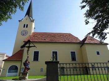
![Trail On foot Gratkorn - Wanderweg 8a - Photo](https://media.geolcdn.com/t/350/260/c5e5c5d2-8e9e-4658-9c2b-b929bcd7dffa.jpeg&format=jpg&maxdim=2)
![On foot On foot](https://static1.geolcdn.com/sitytour/trail-icons/100.png)
Km
On foot
![](/images/other/stat-length.png)
![](https://static1.geolcdn.com/siteimages/upload/files/1508320355ic_sort_den_pos_24dp.png)
![](https://static1.geolcdn.com/siteimages/upload/files/1508320355ic_sort_den_neg_24dp.png)
![](https://static1.geolcdn.com/siteimages/upload/files/16400158638029165_repeat_loop_refresh_sync_direction_icon.png)
• Trail created by ÖAV Graz. http://wiki.openstreetmap.org/wiki/WikiProject_Austria/Wanderwege Symbol: rot-weiss-rot 8a
![Trail On foot Kumberg - Wanderweg 4 - Photo](https://media.geolcdn.com/t/350/260/60756a39-61dd-48e0-a7f6-58f7a0ca53af.jpeg&format=jpg&maxdim=2)
![On foot On foot](https://static1.geolcdn.com/sitytour/trail-icons/100.png)
Km
On foot
![](/images/other/stat-length.png)
![](https://static1.geolcdn.com/siteimages/upload/files/1508320355ic_sort_den_pos_24dp.png)
![](https://static1.geolcdn.com/siteimages/upload/files/1508320355ic_sort_den_neg_24dp.png)
![](https://static1.geolcdn.com/siteimages/upload/files/16400158638029165_repeat_loop_refresh_sync_direction_icon.png)
• Trail created by Gemeinde Kumberg. Symbol: rot-weiss-rot 4
20 trails displayed on 100
FREE GPS app for hiking
Activities
Nearby regions
- Deutschfeistritz
- Dobl-Zwaring
- Eggersdorf bei Graz
- Fernitz-Mellach
- Frohnleiten
- Gratkorn
- Gratwein-Straßengel
- Haselsdorf-Tobelbad
- Hausmannstätten
- Hitzendorf
- Kumberg
- Laßnitzhöhe
- Lieboch
- Peggau
- Raaba-Grambach
- Sankt Bartholomä
- Sankt Oswald bei Plankenwarth
- Seiersberg-Pirka
- Semriach
- St. Radegund
- Stattegg
- Stiwoll
- Thal
- Weinitzen