![](/images/other/stat-length.png)
- Trails
- On foot
- Austria
- Lower Austria
- Bezirk Zwettl
Bezirk Zwettl, Lower Austria, On foot: Best trails, routes and walks
Bezirk Zwettl: Discover the best trails: 110 on foot. All these trails, routes and outdoor activities are available in our SityTrail applications for smartphones and tablets.
The best trails (110)
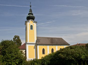
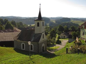
![Trail On foot Gemeinde Zwettl-Niederösterreich - Zwettl - Stift Zwettl 8 - Photo](https://media.geolcdn.com/t/350/260/370145a8-de5f-46a5-b7c8-9cbf61386797.jpeg&format=jpg&maxdim=2)
![On foot On foot](https://static1.geolcdn.com/sitytour/trail-icons/100.png)
Km
On foot
![](/images/other/stat-length.png)
![](https://static1.geolcdn.com/siteimages/upload/files/1508320355ic_sort_den_pos_24dp.png)
![](https://static1.geolcdn.com/siteimages/upload/files/1508320355ic_sort_den_neg_24dp.png)
![](https://static1.geolcdn.com/siteimages/upload/files/16400158638029165_repeat_loop_refresh_sync_direction_icon.png)
• Symbol: rot-weiß-rot 8
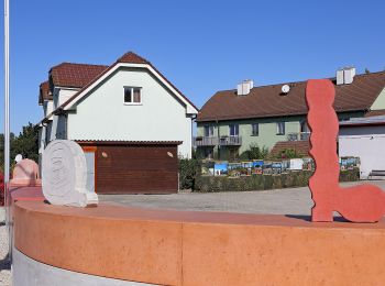
![Trail On foot Göpfritz an der Wild - Kräuterweg 43 - Photo](https://media.geolcdn.com/t/350/260/8c218c0d-d51f-4186-a6e8-11eb7b8a42b8.jpeg&format=jpg&maxdim=2)
![On foot On foot](https://static1.geolcdn.com/sitytour/trail-icons/100.png)
Km
On foot
![](/images/other/stat-length.png)
![](https://static1.geolcdn.com/siteimages/upload/files/1508320355ic_sort_den_pos_24dp.png)
![](https://static1.geolcdn.com/siteimages/upload/files/1508320355ic_sort_den_neg_24dp.png)
![](https://static1.geolcdn.com/siteimages/upload/files/16400158638029165_repeat_loop_refresh_sync_direction_icon.png)
• Symbol: 43 auf gelbem Grund
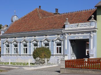
![Trail On foot Göpfritz an der Wild - Bergteichweg 41 - Photo](https://media.geolcdn.com/t/350/260/4898cee2-4b24-4a58-9b9c-3a771e499082.jpeg&format=jpg&maxdim=2)
![On foot On foot](https://static1.geolcdn.com/sitytour/trail-icons/100.png)
Km
On foot
![](/images/other/stat-length.png)
![](https://static1.geolcdn.com/siteimages/upload/files/1508320355ic_sort_den_pos_24dp.png)
![](https://static1.geolcdn.com/siteimages/upload/files/1508320355ic_sort_den_neg_24dp.png)
![](https://static1.geolcdn.com/siteimages/upload/files/16400158638029165_repeat_loop_refresh_sync_direction_icon.png)
• Symbol: 41 auf gelbem Grund
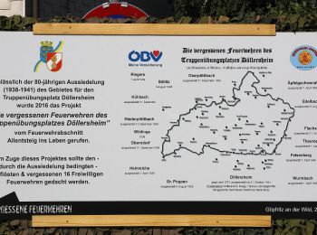
![Trail On foot Göpfritz an der Wild - Dreipfarren - Wanderweg 40 - Photo](https://media.geolcdn.com/t/350/260/86d4a6e4-eca1-4073-bcb4-637b4f197c2b.jpeg&format=jpg&maxdim=2)
![On foot On foot](https://static1.geolcdn.com/sitytour/trail-icons/100.png)
Km
On foot
![](/images/other/stat-length.png)
![](https://static1.geolcdn.com/siteimages/upload/files/1508320355ic_sort_den_pos_24dp.png)
![](https://static1.geolcdn.com/siteimages/upload/files/1508320355ic_sort_den_neg_24dp.png)
![](https://static1.geolcdn.com/siteimages/upload/files/16400158638029165_repeat_loop_refresh_sync_direction_icon.png)
• Symbol: 40 auf gelbem Grund
![Trail On foot Göpfritz an der Wild - Georgenberg - Watzelmühlen-Weg 42 - Photo](https://media.geolcdn.com/t/350/260/9476b6e7-dd09-4a81-b295-4c53e6c55199.jpeg&format=jpg&maxdim=2)
![On foot On foot](https://static1.geolcdn.com/sitytour/trail-icons/100.png)
Km
On foot
![](/images/other/stat-length.png)
![](https://static1.geolcdn.com/siteimages/upload/files/1508320355ic_sort_den_pos_24dp.png)
![](https://static1.geolcdn.com/siteimages/upload/files/1508320355ic_sort_den_neg_24dp.png)
![](https://static1.geolcdn.com/siteimages/upload/files/16400158638029165_repeat_loop_refresh_sync_direction_icon.png)
• Symbol: 42 au gelbem Grund
![Trail On foot Gemeinde Pölla - Schauensteinweg 52 - Photo](https://media.geolcdn.com/t/350/260/1b509059-6f51-493b-8ef1-594d95b35c28.jpeg&format=jpg&maxdim=2)
![On foot On foot](https://static1.geolcdn.com/sitytour/trail-icons/100.png)
Km
On foot
![](/images/other/stat-length.png)
![](https://static1.geolcdn.com/siteimages/upload/files/1508320355ic_sort_den_pos_24dp.png)
![](https://static1.geolcdn.com/siteimages/upload/files/1508320355ic_sort_den_neg_24dp.png)
![](https://static1.geolcdn.com/siteimages/upload/files/16400158638029165_repeat_loop_refresh_sync_direction_icon.png)
• Symbol: 52 auf gelbem Grund
![Trail On foot Allentsteig - Natur 33 - Photo](https://media.geolcdn.com/t/350/260/c1c00b55-4454-4bed-9af6-2461481ef678.jpeg&format=jpg&maxdim=2)
![On foot On foot](https://static1.geolcdn.com/sitytour/trail-icons/100.png)
Km
On foot
![](/images/other/stat-length.png)
![](https://static1.geolcdn.com/siteimages/upload/files/1508320355ic_sort_den_pos_24dp.png)
![](https://static1.geolcdn.com/siteimages/upload/files/1508320355ic_sort_den_neg_24dp.png)
![](https://static1.geolcdn.com/siteimages/upload/files/16400158638029165_repeat_loop_refresh_sync_direction_icon.png)
• Symbol: 33 auf gelbem Grund
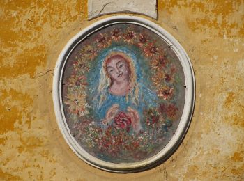
![Trail On foot Schwarzenau - Felix - Pilgerweg - Photo](https://media.geolcdn.com/t/350/260/f9c16609-eafa-45e2-ada6-8261d4a2b240.jpeg&format=jpg&maxdim=2)
![On foot On foot](https://static1.geolcdn.com/sitytour/trail-icons/100.png)
Km
On foot
![](/images/other/stat-length.png)
![](https://static1.geolcdn.com/siteimages/upload/files/1508320355ic_sort_den_pos_24dp.png)
![](https://static1.geolcdn.com/siteimages/upload/files/1508320355ic_sort_den_neg_24dp.png)
![](https://static1.geolcdn.com/siteimages/upload/files/16400158638029165_repeat_loop_refresh_sync_direction_icon.png)
• Symbol: 10 auf gelbem Grund
![Trail On foot Allentsteig - Bundesheer - Photo](https://media.geolcdn.com/t/350/260/53deee7e-57c6-4d02-a483-e46bd2e8146a.jpeg&format=jpg&maxdim=2)
![On foot On foot](https://static1.geolcdn.com/sitytour/trail-icons/100.png)
Km
On foot
![](/images/other/stat-length.png)
![](https://static1.geolcdn.com/siteimages/upload/files/1508320355ic_sort_den_pos_24dp.png)
![](https://static1.geolcdn.com/siteimages/upload/files/1508320355ic_sort_den_neg_24dp.png)
![](https://static1.geolcdn.com/siteimages/upload/files/16400158638029165_repeat_loop_refresh_sync_direction_icon.png)
• Symbol: 32 auf gelbem Grund
![Trail On foot Allentsteig - Eichen und Eulen 30 - Photo](https://media.geolcdn.com/t/350/260/30ec026a-5073-4092-8174-1a4d12505f9d.jpeg&format=jpg&maxdim=2)
![On foot On foot](https://static1.geolcdn.com/sitytour/trail-icons/100.png)
Km
On foot
![](/images/other/stat-length.png)
![](https://static1.geolcdn.com/siteimages/upload/files/1508320355ic_sort_den_pos_24dp.png)
![](https://static1.geolcdn.com/siteimages/upload/files/1508320355ic_sort_den_neg_24dp.png)
![](https://static1.geolcdn.com/siteimages/upload/files/16400158638029165_repeat_loop_refresh_sync_direction_icon.png)
• Symbol: 30 auf gelbem Grund
![Trail On foot Schwarzenau - Von den Fuchshöhlen bis zur Wolfsgrube - Photo](https://media.geolcdn.com/t/350/260/a0e30655-4c4a-4ab0-8107-5e232157c7f1.jpeg&format=jpg&maxdim=2)
![On foot On foot](https://static1.geolcdn.com/sitytour/trail-icons/100.png)
Km
On foot
![](/images/other/stat-length.png)
![](https://static1.geolcdn.com/siteimages/upload/files/1508320355ic_sort_den_pos_24dp.png)
![](https://static1.geolcdn.com/siteimages/upload/files/1508320355ic_sort_den_neg_24dp.png)
![](https://static1.geolcdn.com/siteimages/upload/files/16400158638029165_repeat_loop_refresh_sync_direction_icon.png)
• Symbol: 13 auf gelbem Grund
![Trail On foot Schwarzenau - Alter Schwede 12 - Photo](https://media.geolcdn.com/t/350/260/b84a1f8f-26e1-483e-8273-7157d4c9aeb6.jpeg&format=jpg&maxdim=2)
![On foot On foot](https://static1.geolcdn.com/sitytour/trail-icons/100.png)
Km
On foot
![](/images/other/stat-length.png)
![](https://static1.geolcdn.com/siteimages/upload/files/1508320355ic_sort_den_pos_24dp.png)
![](https://static1.geolcdn.com/siteimages/upload/files/1508320355ic_sort_den_neg_24dp.png)
![](https://static1.geolcdn.com/siteimages/upload/files/16400158638029165_repeat_loop_refresh_sync_direction_icon.png)
• Symbol: 12 uf gelbem Grund
![Trail On foot Gemeinde Arbesbach - Beeren/Bärenweg 81 - Photo](https://media.geolcdn.com/t/350/260/93d09b9f-abbf-4cd0-9ba7-9ee55a4f7989.jpeg&format=jpg&maxdim=2)
![On foot On foot](https://static1.geolcdn.com/sitytour/trail-icons/100.png)
Km
On foot
![](/images/other/stat-length.png)
![](https://static1.geolcdn.com/siteimages/upload/files/1508320355ic_sort_den_pos_24dp.png)
![](https://static1.geolcdn.com/siteimages/upload/files/1508320355ic_sort_den_neg_24dp.png)
![](https://static1.geolcdn.com/siteimages/upload/files/16400158638029165_repeat_loop_refresh_sync_direction_icon.png)
• Symbol: 81 auf gelbem Grund
![Trail On foot Gemeinde Schönbach - Lohnbachfallweg 92 - Photo](https://media.geolcdn.com/t/350/260/f4e7fa50-0657-4198-85c6-40a784d60496.jpeg&format=jpg&maxdim=2)
![On foot On foot](https://static1.geolcdn.com/sitytour/trail-icons/100.png)
Km
On foot
![](/images/other/stat-length.png)
![](https://static1.geolcdn.com/siteimages/upload/files/1508320355ic_sort_den_pos_24dp.png)
![](https://static1.geolcdn.com/siteimages/upload/files/1508320355ic_sort_den_neg_24dp.png)
![](https://static1.geolcdn.com/siteimages/upload/files/16400158638029165_repeat_loop_refresh_sync_direction_icon.png)
• Trail created by Waldviertel Tourismus. Symbol: 92 auf gelbem Grund
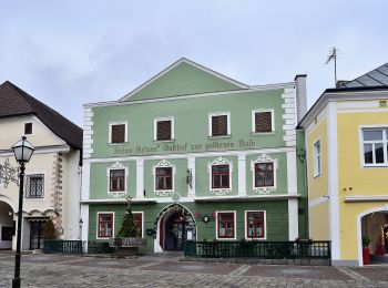
![Trail On foot Gemeinde Zwettl-Niederösterreich - Zwei Flüsse Rundwanderweg 58 - Photo](https://media.geolcdn.com/t/350/260/7eca8a98-457d-42eb-953e-f91796b9ba38.jpeg&format=jpg&maxdim=2)
![On foot On foot](https://static1.geolcdn.com/sitytour/trail-icons/100.png)
Km
On foot
![](/images/other/stat-length.png)
![](https://static1.geolcdn.com/siteimages/upload/files/1508320355ic_sort_den_pos_24dp.png)
![](https://static1.geolcdn.com/siteimages/upload/files/1508320355ic_sort_den_neg_24dp.png)
![](https://static1.geolcdn.com/siteimages/upload/files/16400158638029165_repeat_loop_refresh_sync_direction_icon.png)
• Symbol: 58 auf gelbem Grund
![Trail On foot Echsenbach - Heimkehren im Glauben - Photo](https://media.geolcdn.com/t/350/260/23c121ae-d847-4554-8e5a-cb896ca34a1a.jpeg&format=jpg&maxdim=2)
![On foot On foot](https://static1.geolcdn.com/sitytour/trail-icons/100.png)
Km
On foot
![](/images/other/stat-length.png)
![](https://static1.geolcdn.com/siteimages/upload/files/1508320355ic_sort_den_pos_24dp.png)
![](https://static1.geolcdn.com/siteimages/upload/files/1508320355ic_sort_den_neg_24dp.png)
![](https://static1.geolcdn.com/siteimages/upload/files/16400158638029165_repeat_loop_refresh_sync_direction_icon.png)
• Symbol: 20 auf gelbem Grund
![Trail On foot Gemeinde Schweiggers - Stoana-Thaya-Weg 45 - Photo](https://media.geolcdn.com/t/350/260/08c03faf-9eba-4b5d-993d-1418217018e8.jpeg&format=jpg&maxdim=2)
![On foot On foot](https://static1.geolcdn.com/sitytour/trail-icons/100.png)
Km
On foot
![](/images/other/stat-length.png)
![](https://static1.geolcdn.com/siteimages/upload/files/1508320355ic_sort_den_pos_24dp.png)
![](https://static1.geolcdn.com/siteimages/upload/files/1508320355ic_sort_den_neg_24dp.png)
![](https://static1.geolcdn.com/siteimages/upload/files/16400158638029165_repeat_loop_refresh_sync_direction_icon.png)
• Symbol: schwarze Schrift auf gelbem Grund
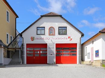
![Trail On foot Gemeinde Schweiggers - Familien Weg, Route 1 - Photo](https://media.geolcdn.com/t/350/260/f4a97f5b-2bf3-4eee-9cf9-757a90d6dc7e.jpeg&format=jpg&maxdim=2)
![On foot On foot](https://static1.geolcdn.com/sitytour/trail-icons/100.png)
Km
On foot
![](/images/other/stat-length.png)
![](https://static1.geolcdn.com/siteimages/upload/files/1508320355ic_sort_den_pos_24dp.png)
![](https://static1.geolcdn.com/siteimages/upload/files/1508320355ic_sort_den_neg_24dp.png)
![](https://static1.geolcdn.com/siteimages/upload/files/16400158638029165_repeat_loop_refresh_sync_direction_icon.png)
• Symbol: gelb/Route 1
![Trail On foot Gemeinde Schweiggers - Wasser Weg 44 - Photo](https://media.geolcdn.com/t/350/260/cad0c66f-4cd3-48fa-9e33-17be3010ab1e.jpeg&format=jpg&maxdim=2)
![On foot On foot](https://static1.geolcdn.com/sitytour/trail-icons/100.png)
Km
On foot
![](/images/other/stat-length.png)
![](https://static1.geolcdn.com/siteimages/upload/files/1508320355ic_sort_den_pos_24dp.png)
![](https://static1.geolcdn.com/siteimages/upload/files/1508320355ic_sort_den_neg_24dp.png)
![](https://static1.geolcdn.com/siteimages/upload/files/16400158638029165_repeat_loop_refresh_sync_direction_icon.png)
• Symbol: gelb/rot-weiß-rot
![Trail On foot Gemeinde Groß Gerungs - Kierlingstein 32 - Photo](https://media.geolcdn.com/t/350/260/1646451f-1c27-4054-9bac-ca7adbaa212f.jpeg&format=jpg&maxdim=2)
![On foot On foot](https://static1.geolcdn.com/sitytour/trail-icons/100.png)
Km
On foot
![](/images/other/stat-length.png)
![](https://static1.geolcdn.com/siteimages/upload/files/1508320355ic_sort_den_pos_24dp.png)
![](https://static1.geolcdn.com/siteimages/upload/files/1508320355ic_sort_den_neg_24dp.png)
![](https://static1.geolcdn.com/siteimages/upload/files/16400158638029165_repeat_loop_refresh_sync_direction_icon.png)
• Symbol: 32 auf gelbem Grund
20 trails displayed on 110
FREE GPS app for hiking
Activities
Nearby regions
- Allentsteig
- Altmelon
- Bärnkopf
- Echsenbach
- Gemeinde Arbesbach
- Gemeinde Grafenschlag
- Gemeinde Groß Gerungs
- Gemeinde Großgöttfritz
- Gemeinde Ottenschlag
- Gemeinde Pölla
- Gemeinde Rappottenstein
- Gemeinde Sallingberg
- Gemeinde Schönbach
- Gemeinde Schweiggers
- Gemeinde Waldhausen
- Gemeinde Zwettl-Niederösterreich
- Göpfritz an der Wild
- Gutenbrunn
- Langschlag
- Schwarzenau