![](/images/other/stat-length.png)
- Trails
- On foot
- Austria
- Lower Austria
- Bezirk Neunkirchen
- Gemeinde Scheiblingkirchen-Thernberg
Gemeinde Scheiblingkirchen-Thernberg, Bezirk Neunkirchen, On foot: Best trails, routes and walks
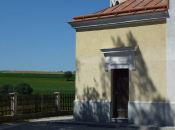
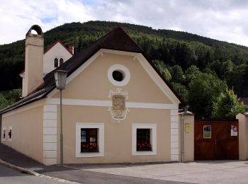
Gemeinde Scheiblingkirchen-Thernberg: Discover the best trails: 6 on foot. All these trails, routes and outdoor activities are available in our SityTrail applications for smartphones and tablets.
The best trails (6)
![Trail On foot Gemeinde Scheiblingkirchen-Thernberg - Scheiblingkirchen: Erzherzog Johann](https://media.geolcdn.com/t/350/260/bec888b9-de6c-4918-847c-285910c1a278.jpeg&format=jpg&maxdim=2)
![On foot On foot](https://static1.geolcdn.com/sitytour/trail-icons/100.png)
Km
On foot
![](/images/other/stat-length.png)
![](https://static1.geolcdn.com/siteimages/upload/files/1508320355ic_sort_den_pos_24dp.png)
![](https://static1.geolcdn.com/siteimages/upload/files/1508320355ic_sort_den_neg_24dp.png)
![](https://static1.geolcdn.com/siteimages/upload/files/16400158638029165_repeat_loop_refresh_sync_direction_icon.png)
• Trail created by Marktgemeinde Scheiblingkirchen-Thernberg. Symbol: 3 auf gelbem Grund
![Trail On foot Gemeinde Scheiblingkirchen-Thernberg - Scheiblingkirchen: Erzherzog Johann](https://media.geolcdn.com/t/350/260/f939fe67-3338-43f6-8c86-172ae1075ac9.jpeg&format=jpg&maxdim=2)
![On foot On foot](https://static1.geolcdn.com/sitytour/trail-icons/100.png)
Km
On foot
![](/images/other/stat-length.png)
![](https://static1.geolcdn.com/siteimages/upload/files/1508320355ic_sort_den_pos_24dp.png)
![](https://static1.geolcdn.com/siteimages/upload/files/1508320355ic_sort_den_neg_24dp.png)
![](https://static1.geolcdn.com/siteimages/upload/files/16400158638029165_repeat_loop_refresh_sync_direction_icon.png)
• Trail created by Marktgemeinde Scheiblingkirchen-Thernberg. Symbol: 4 auf grünem Grund
![Trail On foot Gemeinde Scheiblingkirchen-Thernberg - Scheiblingkirchen: Erzherzog Johann](https://media.geolcdn.com/t/350/260/785cf6ab-62a5-42cc-bc88-c8111ee05a27.jpeg&format=jpg&maxdim=2)
![On foot On foot](https://static1.geolcdn.com/sitytour/trail-icons/100.png)
Km
On foot
![](/images/other/stat-length.png)
![](https://static1.geolcdn.com/siteimages/upload/files/1508320355ic_sort_den_pos_24dp.png)
![](https://static1.geolcdn.com/siteimages/upload/files/1508320355ic_sort_den_neg_24dp.png)
![](https://static1.geolcdn.com/siteimages/upload/files/16400158638029165_repeat_loop_refresh_sync_direction_icon.png)
• Trail created by Marktgemeinde Scheiblingkirchen-Thernberg. Symbol: 1 auf blauem Grund
![Trail On foot Gemeinde Scheiblingkirchen-Thernberg - Scheiblingskirchen - Kaltenberg - Photo](https://media.geolcdn.com/t/350/260/355ec2ac-e5d1-4a7a-a36b-1505ebd370e8.jpeg&format=jpg&maxdim=2)
![On foot On foot](https://static1.geolcdn.com/sitytour/trail-icons/100.png)
Km
On foot
![](/images/other/stat-length.png)
![](https://static1.geolcdn.com/siteimages/upload/files/1508320355ic_sort_den_pos_24dp.png)
![](https://static1.geolcdn.com/siteimages/upload/files/1508320355ic_sort_den_neg_24dp.png)
![](https://static1.geolcdn.com/siteimages/upload/files/16400158638029165_repeat_loop_refresh_sync_direction_icon.png)
• Trail created by Österreichischer Touristenklub. Symbol: blauer, waagrechter Balken
![Trail On foot Gemeinde Scheiblingkirchen-Thernberg - Scheiblingkirchen: Erzherzog Johann-Rundwanderweg - Photo](https://media.geolcdn.com/t/350/260/0120a664-6e09-45cf-98fc-ce0f1e5029d5.jpeg&format=jpg&maxdim=2)
![On foot On foot](https://static1.geolcdn.com/sitytour/trail-icons/100.png)
Km
On foot
![](/images/other/stat-length.png)
![](https://static1.geolcdn.com/siteimages/upload/files/1508320355ic_sort_den_pos_24dp.png)
![](https://static1.geolcdn.com/siteimages/upload/files/1508320355ic_sort_den_neg_24dp.png)
![](https://static1.geolcdn.com/siteimages/upload/files/16400158638029165_repeat_loop_refresh_sync_direction_icon.png)
• Trail created by Marktgemeinde Scheiblingkirchen-Thernberg. Symbol: 2 auf rotem Grund
![Trail On foot Gemeinde Scheiblingkirchen-Thernberg - Erzherzog Johann Rundwanderweg - Photo](https://media.geolcdn.com/t/350/260/53f0ee04-d9b2-4725-ac65-1f4976a90116.jpeg&format=jpg&maxdim=2)
![On foot On foot](https://static1.geolcdn.com/sitytour/trail-icons/100.png)
Km
On foot
![](/images/other/stat-length.png)
![](https://static1.geolcdn.com/siteimages/upload/files/1508320355ic_sort_den_pos_24dp.png)
![](https://static1.geolcdn.com/siteimages/upload/files/1508320355ic_sort_den_neg_24dp.png)
![](https://static1.geolcdn.com/siteimages/upload/files/16400158638029165_repeat_loop_refresh_sync_direction_icon.png)
6 trails displayed on 6
FREE GPS app for hiking