![](/images/other/stat-length.png)
- Trails
- On foot
- Austria
- Lower Austria
- Bezirk Mödling
- Gemeinde Guntramsdorf
Gemeinde Guntramsdorf, Bezirk Mödling, On foot: Best trails, routes and walks
Gemeinde Guntramsdorf: Discover the best trails: 5 on foot. All these trails, routes and outdoor activities are available in our SityTrail applications for smartphones and tablets.
The best trails (5)
![Trail On foot Gemeinde Guntramsdorf - Runnersfun Runde (Guntramsdorf) - Photo](https://media.geolcdn.com/t/350/260/c113addb-d86d-427f-99ef-f58f748261ea.jpeg&format=jpg&maxdim=2)
![On foot On foot](https://static1.geolcdn.com/sitytour/trail-icons/100.png)
Km
On foot
![](/images/other/stat-length.png)
![](https://static1.geolcdn.com/siteimages/upload/files/1508320355ic_sort_den_pos_24dp.png)
![](https://static1.geolcdn.com/siteimages/upload/files/1508320355ic_sort_den_neg_24dp.png)
![](https://static1.geolcdn.com/siteimages/upload/files/16400158638029165_repeat_loop_refresh_sync_direction_icon.png)
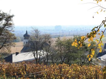
• Trail created by Runnersfun. Symbol: dunkelroter Pfeil, G1 Website: https://www.guntramsdorf.at/ONLWYSIWYG/IMG/ls_...
![Trail On foot Gemeinde Guntramsdorf - Rauch Immobilien Runde (Guntramsdorf) - Photo](https://media.geolcdn.com/t/350/260/c17bce65-4238-4873-be8c-f9ffa6c61775.jpeg&format=jpg&maxdim=2)
![On foot On foot](https://static1.geolcdn.com/sitytour/trail-icons/100.png)
Km
On foot
![](/images/other/stat-length.png)
![](https://static1.geolcdn.com/siteimages/upload/files/1508320355ic_sort_den_pos_24dp.png)
![](https://static1.geolcdn.com/siteimages/upload/files/1508320355ic_sort_den_neg_24dp.png)
![](https://static1.geolcdn.com/siteimages/upload/files/16400158638029165_repeat_loop_refresh_sync_direction_icon.png)
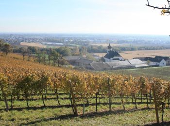
• Trail created by Runnersfun. Symbol: gelber Pfeil, G2
![Trail On foot Gemeinde Guntramsdorf - Pro Consult Runde (Guntramsdorf) - Photo](https://media.geolcdn.com/t/350/260/ba491c30-be4d-4817-865a-8d5a8181be08.jpeg&format=jpg&maxdim=2)
![On foot On foot](https://static1.geolcdn.com/sitytour/trail-icons/100.png)
Km
On foot
![](/images/other/stat-length.png)
![](https://static1.geolcdn.com/siteimages/upload/files/1508320355ic_sort_den_pos_24dp.png)
![](https://static1.geolcdn.com/siteimages/upload/files/1508320355ic_sort_den_neg_24dp.png)
![](https://static1.geolcdn.com/siteimages/upload/files/16400158638029165_repeat_loop_refresh_sync_direction_icon.png)
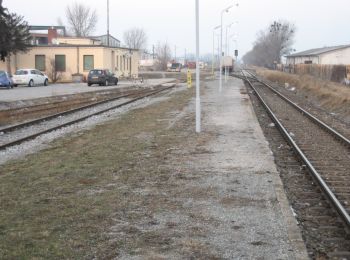
• Trail created by Runnersfun. Symbol: hellblauer Pfeil, G4
![Trail On foot Gemeinde Guntramsdorf - Salomon Runde (Guntramsdorf) - Photo](https://media.geolcdn.com/t/350/260/44a0ea6a-4b86-44dc-a215-9983737c4de6.jpeg&format=jpg&maxdim=2)
![On foot On foot](https://static1.geolcdn.com/sitytour/trail-icons/100.png)
Km
On foot
![](/images/other/stat-length.png)
![](https://static1.geolcdn.com/siteimages/upload/files/1508320355ic_sort_den_pos_24dp.png)
![](https://static1.geolcdn.com/siteimages/upload/files/1508320355ic_sort_den_neg_24dp.png)
![](https://static1.geolcdn.com/siteimages/upload/files/16400158638029165_repeat_loop_refresh_sync_direction_icon.png)
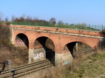
• Trail created by Runnersfun. Symbol: roter Pfeil, G5
![Trail On foot Gemeinde Guntramsdorf - Playfit Runde (Guntramsdorf) - Photo](https://media.geolcdn.com/t/350/260/af484f36-614a-488d-a9d1-c534ffed1c94.jpeg&format=jpg&maxdim=2)
![On foot On foot](https://static1.geolcdn.com/sitytour/trail-icons/100.png)
Km
On foot
![](/images/other/stat-length.png)
![](https://static1.geolcdn.com/siteimages/upload/files/1508320355ic_sort_den_pos_24dp.png)
![](https://static1.geolcdn.com/siteimages/upload/files/1508320355ic_sort_den_neg_24dp.png)
![](https://static1.geolcdn.com/siteimages/upload/files/16400158638029165_repeat_loop_refresh_sync_direction_icon.png)
• Trail created by Runnersfun. Symbol: roter Pfeil, G3
5 trails displayed on 5
FREE GPS app for hiking