![](/images/other/stat-length.png)
- Trails
- On foot
- Austria
- Salzburg
- Bezirk Tamsweg
- Sankt Michael im Lungau
Sankt Michael im Lungau, Bezirk Tamsweg, On foot: Best trails, routes and walks
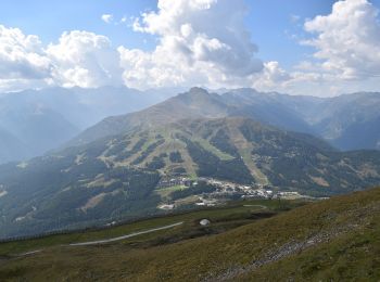
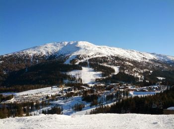
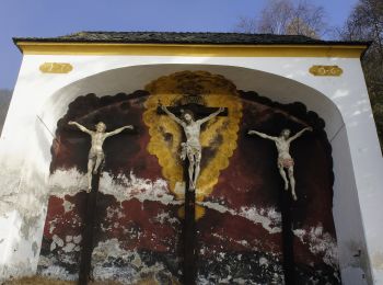
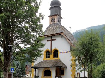
Sankt Michael im Lungau: Discover the best trails: 11 on foot. All these trails, routes and outdoor activities are available in our SityTrail applications for smartphones and tablets.
The best trails (11)
![Trail On foot Sankt Michael im Lungau - Wanderweg 90, Saumoos - Rundwanderweg - Photo](https://media.geolcdn.com/t/350/260/0ae10204-ec5c-4221-bfef-5aa343a5d6e0.jpeg&format=jpg&maxdim=2)
![On foot On foot](https://static1.geolcdn.com/sitytour/trail-icons/100.png)
Km
On foot
![](/images/other/stat-length.png)
![](https://static1.geolcdn.com/siteimages/upload/files/1508320355ic_sort_den_pos_24dp.png)
![](https://static1.geolcdn.com/siteimages/upload/files/1508320355ic_sort_den_neg_24dp.png)
![](https://static1.geolcdn.com/siteimages/upload/files/16400158638029165_repeat_loop_refresh_sync_direction_icon.png)
• Trail created by TVB St. Michael im Lungau. Symbol: rot-weiß-rot 91
![Trail On foot Sankt Michael im Lungau - Wanderweg 94, Speyereck - Bergwanderung - Photo](https://media.geolcdn.com/t/350/260/977b81a0-530e-47e3-b2e5-576f46ae6f99.jpeg&format=jpg&maxdim=2)
![On foot On foot](https://static1.geolcdn.com/sitytour/trail-icons/100.png)
Km
On foot
![](/images/other/stat-length.png)
![](https://static1.geolcdn.com/siteimages/upload/files/1508320355ic_sort_den_pos_24dp.png)
![](https://static1.geolcdn.com/siteimages/upload/files/1508320355ic_sort_den_neg_24dp.png)
![](https://static1.geolcdn.com/siteimages/upload/files/16400158638029165_repeat_loop_refresh_sync_direction_icon.png)
• Trail created by TVB St. Michael im Lungau. Symbol: rot-weiß-rot 91
![Trail On foot Sankt Michael im Lungau - Wanderweg 93, Grubental - Rundwanderweg - Photo](https://media.geolcdn.com/t/350/260/9119b55d-52c5-4440-8883-e0e71640e841.jpeg&format=jpg&maxdim=2)
![On foot On foot](https://static1.geolcdn.com/sitytour/trail-icons/100.png)
Km
On foot
![](/images/other/stat-length.png)
![](https://static1.geolcdn.com/siteimages/upload/files/1508320355ic_sort_den_pos_24dp.png)
![](https://static1.geolcdn.com/siteimages/upload/files/1508320355ic_sort_den_neg_24dp.png)
![](https://static1.geolcdn.com/siteimages/upload/files/16400158638029165_repeat_loop_refresh_sync_direction_icon.png)
• Trail created by TVB St. Michael im Lungau. Symbol: rot-weiß-rot 91
![Trail On foot Sankt Michael im Lungau - Wanderweg 56, Martiniberg Rundwanderweg - Photo](https://media.geolcdn.com/t/350/260/4123e658-b57d-4ae7-928d-bd43da8a7ded.jpeg&format=jpg&maxdim=2)
![On foot On foot](https://static1.geolcdn.com/sitytour/trail-icons/100.png)
Km
On foot
![](/images/other/stat-length.png)
![](https://static1.geolcdn.com/siteimages/upload/files/1508320355ic_sort_den_pos_24dp.png)
![](https://static1.geolcdn.com/siteimages/upload/files/1508320355ic_sort_den_neg_24dp.png)
![](https://static1.geolcdn.com/siteimages/upload/files/16400158638029165_repeat_loop_refresh_sync_direction_icon.png)
• Trail created by TVB St. Michael im Lungau. Symbol: rot-weiß-rot 91
![Trail On foot Sankt Michael im Lungau - Wanderweg 98, Aineck Rundwanderweg - Photo](https://media.geolcdn.com/t/350/260/98cf76b6-458f-4b64-94e0-0f78b06abc14.jpeg&format=jpg&maxdim=2)
![On foot On foot](https://static1.geolcdn.com/sitytour/trail-icons/100.png)
Km
On foot
![](/images/other/stat-length.png)
![](https://static1.geolcdn.com/siteimages/upload/files/1508320355ic_sort_den_pos_24dp.png)
![](https://static1.geolcdn.com/siteimages/upload/files/1508320355ic_sort_den_neg_24dp.png)
![](https://static1.geolcdn.com/siteimages/upload/files/16400158638029165_repeat_loop_refresh_sync_direction_icon.png)
• Trail created by TVB St. Michael im Lungau. Symbol: rot-weiß-rot 91
![Trail On foot Sankt Michael im Lungau - Wanderweg 99, St. Michael-Katschberg Rundwanderweg - Photo](https://media.geolcdn.com/t/350/260/b440003b-5bc7-4f0a-81b7-5bfc99d09f8b.jpeg&format=jpg&maxdim=2)
![On foot On foot](https://static1.geolcdn.com/sitytour/trail-icons/100.png)
Km
On foot
![](/images/other/stat-length.png)
![](https://static1.geolcdn.com/siteimages/upload/files/1508320355ic_sort_den_pos_24dp.png)
![](https://static1.geolcdn.com/siteimages/upload/files/1508320355ic_sort_den_neg_24dp.png)
![](https://static1.geolcdn.com/siteimages/upload/files/16400158638029165_repeat_loop_refresh_sync_direction_icon.png)
• Trail created by TVB St. Michael im Lungau. Symbol: rot-weiß-rot 91
![Trail On foot Sankt Michael im Lungau - Wanderweg 91, Hollerberger Rundwanderweg - Photo](https://media.geolcdn.com/t/350/260/9bbb3358-4203-47f7-a27c-7c662cabe28f.jpeg&format=jpg&maxdim=2)
![On foot On foot](https://static1.geolcdn.com/sitytour/trail-icons/100.png)
Km
On foot
![](/images/other/stat-length.png)
![](https://static1.geolcdn.com/siteimages/upload/files/1508320355ic_sort_den_pos_24dp.png)
![](https://static1.geolcdn.com/siteimages/upload/files/1508320355ic_sort_den_neg_24dp.png)
![](https://static1.geolcdn.com/siteimages/upload/files/16400158638029165_repeat_loop_refresh_sync_direction_icon.png)
• Trail created by TVB St. Michael im Lungau. Symbol: rot-weiß-rot 91
![Trail On foot Sankt Michael im Lungau - Wanderweg 95, Glashüttenrundweg - Photo](https://media.geolcdn.com/t/350/260/5e84d42f-0104-4aa5-802a-823ba4b52cdf.jpeg&format=jpg&maxdim=2)
![On foot On foot](https://static1.geolcdn.com/sitytour/trail-icons/100.png)
Km
On foot
![](/images/other/stat-length.png)
![](https://static1.geolcdn.com/siteimages/upload/files/1508320355ic_sort_den_pos_24dp.png)
![](https://static1.geolcdn.com/siteimages/upload/files/1508320355ic_sort_den_neg_24dp.png)
![](https://static1.geolcdn.com/siteimages/upload/files/16400158638029165_repeat_loop_refresh_sync_direction_icon.png)
• Trail created by TVB St. Michael im Lungau. Symbol: rot-weiß-rot 95
![Trail On foot Sankt Michael im Lungau - Wanderweg 96, Oberweißburger Rundweg - Photo](https://media.geolcdn.com/t/350/260/0f056bc1-639c-4902-a567-d56905ab170d.jpeg&format=jpg&maxdim=2)
![On foot On foot](https://static1.geolcdn.com/sitytour/trail-icons/100.png)
Km
On foot
![](/images/other/stat-length.png)
![](https://static1.geolcdn.com/siteimages/upload/files/1508320355ic_sort_den_pos_24dp.png)
![](https://static1.geolcdn.com/siteimages/upload/files/1508320355ic_sort_den_neg_24dp.png)
![](https://static1.geolcdn.com/siteimages/upload/files/16400158638029165_repeat_loop_refresh_sync_direction_icon.png)
• Trail created by TVB St. Michael im Lungau. Symbol: rot-weiß-rot 96
![Trail On foot Sankt Michael im Lungau - Wanderweg 92, Mühlsteig Rundwanderweg - Photo](https://media.geolcdn.com/t/350/260/5e84d42f-0104-4aa5-802a-823ba4b52cdf.jpeg&format=jpg&maxdim=2)
![On foot On foot](https://static1.geolcdn.com/sitytour/trail-icons/100.png)
Km
On foot
![](/images/other/stat-length.png)
![](https://static1.geolcdn.com/siteimages/upload/files/1508320355ic_sort_den_pos_24dp.png)
![](https://static1.geolcdn.com/siteimages/upload/files/1508320355ic_sort_den_neg_24dp.png)
![](https://static1.geolcdn.com/siteimages/upload/files/16400158638029165_repeat_loop_refresh_sync_direction_icon.png)
• Trail created by TVB St. Michael im Lungau. Symbol: rot-weiß-rot 92
![Trail On foot Sankt Michael im Lungau - Wanderweg 55, Oberweißburg-Fell Rundweg - Photo](https://media.geolcdn.com/t/350/260/03f01dcc-2e5a-4112-9d5e-b24d065e3f9b.jpeg&format=jpg&maxdim=2)
![On foot On foot](https://static1.geolcdn.com/sitytour/trail-icons/100.png)
Km
On foot
![](/images/other/stat-length.png)
![](https://static1.geolcdn.com/siteimages/upload/files/1508320355ic_sort_den_pos_24dp.png)
![](https://static1.geolcdn.com/siteimages/upload/files/1508320355ic_sort_den_neg_24dp.png)
![](https://static1.geolcdn.com/siteimages/upload/files/16400158638029165_repeat_loop_refresh_sync_direction_icon.png)
• Trail created by TVB St. Michael im Lungau. Symbol: rot-weiß-rot 55
11 trails displayed on 11
FREE GPS app for hiking