Ile-de-France, France, Air: Best trails, routes and walks

2528 comments

Ile-de-France: Discover the best trails: 11 plane and 1 hot-air balloon. All these trails, routes and outdoor activities are available in our SityTrail applications for smartphones and tablets.


The best trails (12)
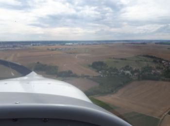
Trail Plane Neauphle-le-Vieux - Chavenay Etretat  - Photo
Plane 358.627
Km

Plane

Very easy
Neauphle-le-Vieux, Ile-de-France, Yvelines, France
359 km | 441 km-effort
2h 3min
6210 m
6156 m
No
mallovon

Trail Plane Tremblay-en-France - Athènes  - Photo
Plane 2314.301
Km

Plane

Very easy
Tremblay-en-France, Ile-de-France, Seine-Saint-Denis, France
2314 km | 0 m-effort
3h 46min
0 m
0 m
No
jcm17

Trail Plane Paray-Vieille-Poste - Grande  - Photo
Plane 2886.366
Km

Plane

Very easy
Paray-Vieille-Poste, Ile-de-France, Essonne, France
2886 km | 0 m-effort
3h 40min
0 m
0 m
No
Didier81

Trail Plane Mauregard - Paris Prague  - Photo
Plane 942.994
Km

Plane

Very easy
Mauregard, Ile-de-France, Seine-et-Marne, France
943 km | 1251 km-effort
1h 27min
23160 m
22910 m
No
jcm17

Trail Plane Sarcelles - cdg milano - Photo
Plane 785.886
Km

Plane

Very easy
Sarcelles, Ile-de-France, Val-d'Oise, France
786 km | 1276 km-effort
59min
36794 m
36771 m
No
jcm17

Trail Hot-air balloon Chérence - Montgolfière  - Photo
Hot-air balloon 7.04
Km

Hot-air balloon

Very easy
Chérence, Ile-de-France, Val-d'Oise, France
7 km | 9.8 km-effort
50min
191 m
268 m
No
pmg.griot

Trail Plane Paray-Vieille-Poste - Paris Lanzarote - Photo
Plane 2519.515
Km

Plane

Very easy
Paray-Vieille-Poste, Ile-de-France, Essonne, France
2520 km | 0 m-effort
2h 54min
0 m
0 m
No
jcm17

Trail Plane Wissous - Nice - Photo
Plane 821.73
Km

Plane

Very easy
Wissous, Ile-de-France, Essonne, France
822 km | 1161 km-effort
1h 10min
25415 m
25492 m
No
jcm17

Trail Plane Herblay-sur-Seine - 2019-10-20 retour Rhodes - Photo
Plane 30.779
Km

Plane

Very easy
Herblay-sur-Seine, Ile-de-France, Val-d'Oise, France
31 km | 36 km-effort
10min
436 m
405 m
No
Bernardb44

Trail Plane Boissy-l'Aillerie - 3tdp et local Serans  - Photo
Plane 134.569
Km

Plane

Very easy
Boissy-l'Aillerie, Ile-de-France, Val-d'Oise, France
135 km | 163 km-effort
1h 8min
2111 m
2109 m
Yes
Aragier

Trail Plane Boissy-l'Aillerie - Françoise  - Photo
Plane 202.088
Km

Plane

Very easy
Boissy-l'Aillerie, Ile-de-France, Val-d'Oise, France
202 km | 248 km-effort
1h 52min
3432 m
3431 m
Yes
Aragier

Trail Plane Boissy-l'Aillerie - Pierrefonds - Photo
Plane 203.164
Km

Plane

Very easy
Boissy-l'Aillerie, Ile-de-France, Val-d'Oise, France
203 km | 241 km-effort
1h 56min
2832 m
2829 m
Yes
Aragier

12 trails displayed on 12

FREE GPS app for hiking

Logo SityTrail SityTrail

IGN / Geographical institutes

Download SityTrail from the App Store Download SityTrail from Google Play

Logo SityTrail SityTrail World

The world is yours!

Download SityTrail from the App Store Download SityTrail from Google Play Download SityTrail on Huawei AppGallery

Activities

Nearby regions

Close
My subscriptions