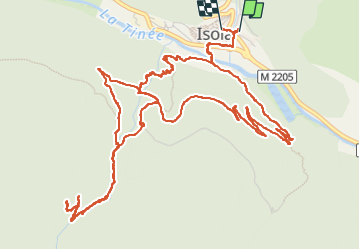
![](/images/other/stat-length.png)
![Tour Wandern Isola - Fontaine St Laurent par Collet de Léchio et Cascade de Louch Isola Village - Photo](https://media.geolcdn.com/t/1900/400/db3d6713-0c9e-4c65-af5d-a138b43add5e.jpg&format=pjpeg&maxdim=2)
Fontaine St Laurent par Collet de Léchio et Cascade de Louch Isola Village
GrouGary
Benutzer
![Länge](/images/other/stat-length.png)
![Maximale Höhe](https://static1.geolcdn.com/siteimages/upload/files/1508320355ic_sort_altitude_max_24dp.png)
![Positive Höhendifferenz](https://static1.geolcdn.com/siteimages/upload/files/1508320355ic_sort_den_pos_24dp.png)
![Km-Effort](/images/other/stat-length.png)
![Min. Höhe](https://static1.geolcdn.com/siteimages/upload/files/1508320355ic_sort_altitude_min_24dp.png)
![Negative Höhendifferenz](https://static1.geolcdn.com/siteimages/upload/files/1508320355ic_sort_den_neg_24dp.png)
![Boucle](https://static1.geolcdn.com/siteimages/upload/files/16400158638029165_repeat_loop_refresh_sync_direction_icon.png)
![Wandern](https://static1.geolcdn.com/sitytour/trail-icons/101.png)
4h44
Schwierigkeit : Einfach
![Scannen Sie diesen QR-Code, um die Tour in der SityTrail-Anwendung zu öffnen](https://capi.geolives.com/qq0zvz2zws4bq2lad0pu/sitytour/trails/4099143/qr.png?size=200)
Kostenlosegpshiking-Anwendung
Über SityTrail
Tour Wandern von 9,5 km verfügbar auf Provence-Alpes-Côte d'Azur, Seealpen, Isola. Diese Tour wird von GrouGary vorgeschlagen.
Beschreibung
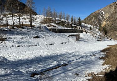
L'essentiel des dénivelés se fait dans la première partie, immédiatement après la traversée de la Tinée ;
Montée un peu sévère pour passer le long de la cascade de Louch mais qui mérite le détour après les fortes pluies de printemps.
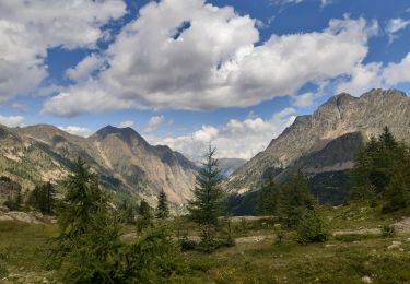
Le reste de la rando se fait essentiellement en sentiers très praticables jusqu'aux bergeries au-dessus du Vallon de Louch ;
Au-delà, la sente pour le Collet de Léchio puis la Fontaine St Laurent est peu visible, les traces de balisages jaunes très effacées. La rando reste cependant ouverte, sans couvert forestier ni densité de végétation, ce qui la rend probablement possible, sans difficulté, jusqu'à la Fontaine St Laurent (pour une autre fois...)
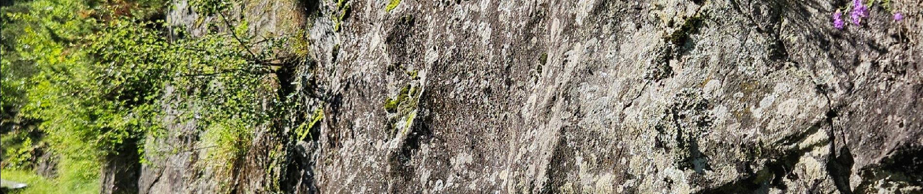
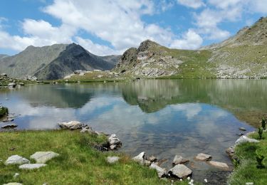
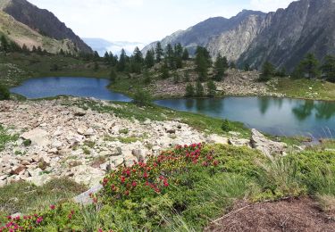
Ort
Kommentare
Touren in der Umgebung
![Tour Wandern Isola - Châtaigneraie ISOLA - Photo](https://media.geolcdn.com/t/375/260/ext.jpg?maxdim=2&url=https%3A%2F%2Fservices.sitytrail.com%2FGeolivesWS%2FDownloadMedia.ashx%3FTrailID%3D470503%26Media%3D20150910120215.jpg)
![Wandern Wandern](https://static1.geolcdn.com/sitytour/trail-icons/101.png)
Wandern
![](/images/other/stat-length.png)
![](https://static1.geolcdn.com/siteimages/upload/files/16400158638029165_repeat_loop_refresh_sync_direction_icon.png)
![Tour Wandern Vinadio - Tour du Lausfer 25.8.24 - Photo](https://media.geolcdn.com/t/375/260/72863bea-5e16-4036-8653-9180a45481ca.jpg&format=jpg&maxdim=2)
![Wandern Wandern](https://static1.geolcdn.com/sitytour/trail-icons/101.png)
Wandern
![](/images/other/stat-length.png)
![](https://static1.geolcdn.com/siteimages/upload/files/16400158638029165_repeat_loop_refresh_sync_direction_icon.png)
![Tour Wandern Isola - Lacs du Lausfer / pas de Ste Anne - Photo](https://media.geolcdn.com/t/375/260/c67485b0-6dd2-402f-93b8-4ef26648110e.jpg&format=jpg&maxdim=2)
![Wandern Wandern](https://static1.geolcdn.com/sitytour/trail-icons/101.png)
Wandern
![](/images/other/stat-length.png)
![](https://static1.geolcdn.com/siteimages/upload/files/16400158638029165_repeat_loop_refresh_sync_direction_icon.png)
![Tour Wandern Isola - Cimes et lacs de Lausfer - Photo](https://media.geolcdn.com/t/375/260/8458cb4f-7948-4b07-b934-4be31ee8dbe8.jpg&format=jpg&maxdim=2)
![Wandern Wandern](https://static1.geolcdn.com/sitytour/trail-icons/101.png)
Wandern
![](/images/other/stat-length.png)
![](https://static1.geolcdn.com/siteimages/upload/files/16400158638029165_repeat_loop_refresh_sync_direction_icon.png)
![Tour Wandern Vinadio - St Anna di Vinadio - Photo](https://media.geolcdn.com/t/375/260/7e16e9c5-3bc6-4d82-9bad-802e8da6a660.jpg&format=jpg&maxdim=2)
![Wandern Wandern](https://static1.geolcdn.com/sitytour/trail-icons/101.png)
Wandern
![](/images/other/stat-length.png)
![](https://static1.geolcdn.com/siteimages/upload/files/16400158638029165_repeat_loop_refresh_sync_direction_icon.png)
![Tour Wandern Isola - Pas de St Anne - Photo](https://media.geolcdn.com/t/375/260/e079154f-1020-47df-973a-da51f7316992.jpg&format=jpg&maxdim=2)
![Wandern Wandern](https://static1.geolcdn.com/sitytour/trail-icons/101.png)
Wandern
![](/images/other/stat-length.png)
![](https://static1.geolcdn.com/siteimages/upload/files/16400158638029165_repeat_loop_refresh_sync_direction_icon.png)
![Tour Zu Fuß Isola - Boucle de Louch - Photo](https://media.geolcdn.com/t/375/260/3b66ff9e-06f4-4751-843b-3367523d8fc7.jpeg&format=jpg&maxdim=2)
![Zu Fuß Zu Fuß](https://static1.geolcdn.com/sitytour/trail-icons/100.png)
Zu Fuß
![](/images/other/stat-length.png)
![](https://static1.geolcdn.com/siteimages/upload/files/16400158638029165_repeat_loop_refresh_sync_direction_icon.png)
![Tour Wandern Isola - Col de la Guercha - Photo](https://media.geolcdn.com/t/375/260/8bbb67ab-24b8-4128-a1e0-12ad3d57f0e4.jpg&format=jpg&maxdim=2)
![Wandern Wandern](https://static1.geolcdn.com/sitytour/trail-icons/101.png)
Wandern
![](/images/other/stat-length.png)
![](https://static1.geolcdn.com/siteimages/upload/files/16400158638029165_repeat_loop_refresh_sync_direction_icon.png)
![Tour Wandern Vinadio - giro di lagi (les lacs de Lausfer) - Photo](https://media.geolcdn.com/t/375/260/6bd004cb-7dff-492b-8832-c67ceaeaec92.jpg&format=jpg&maxdim=2)
![Wandern Wandern](https://static1.geolcdn.com/sitytour/trail-icons/101.png)
Wandern
![](/images/other/stat-length.png)
![](https://static1.geolcdn.com/siteimages/upload/files/16400158638029165_repeat_loop_refresh_sync_direction_icon.png)