![](/images/other/stat-length.png)
![Tour Wandern Saint-Michel-de-Chaillol - Pic du Tourond - Photo](https://media.geolcdn.com/t/1900/400/01ce6341-dc1d-4078-9a13-caf8c777653c.jpg&format=pjpeg&maxdim=2)
Pic du Tourond
Marco05
Benutzer GUIDE
![Länge](/images/other/stat-length.png)
![Maximale Höhe](https://static1.geolcdn.com/siteimages/upload/files/1508320355ic_sort_altitude_max_24dp.png)
![Positive Höhendifferenz](https://static1.geolcdn.com/siteimages/upload/files/1508320355ic_sort_den_pos_24dp.png)
![Km-Effort](/images/other/stat-length.png)
![Min. Höhe](https://static1.geolcdn.com/siteimages/upload/files/1508320355ic_sort_altitude_min_24dp.png)
![Negative Höhendifferenz](https://static1.geolcdn.com/siteimages/upload/files/1508320355ic_sort_den_neg_24dp.png)
![Boucle](https://static1.geolcdn.com/siteimages/upload/files/16400158638029165_repeat_loop_refresh_sync_direction_icon.png)
![Wandern](https://static1.geolcdn.com/sitytour/trail-icons/101.png)
6h14
Schwierigkeit : Sehr schwierig
![Scannen Sie diesen QR-Code, um die Tour in der SityTrail-Anwendung zu öffnen](https://capi.geolives.com/qq0zvz2zws4bq2lad0pu/sitytour/trails/3188254/qr.png?size=200)
Kostenlosegpshiking-Anwendung
Über SityTrail
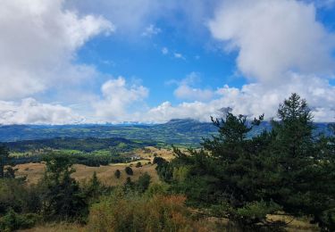
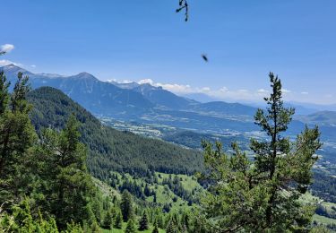
Tour Wandern von 13,7 km verfügbar auf Provence-Alpes-Côte d'Azur, Hochalpen, Saint-Michel-de-Chaillol. Diese Tour wird von Marco05 vorgeschlagen.
Beschreibung
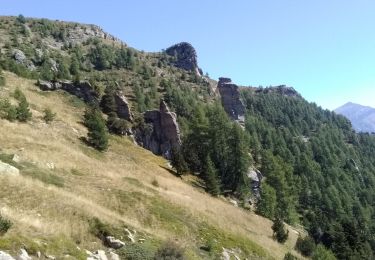
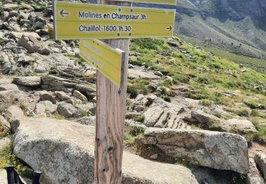
Départ de la station Chaillol 1600.
En prenant le piste on peut se stationner sur une grande place herbeuse vers 1700m.
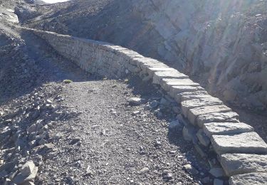
Prendre la direction du col de la Pisse. Mais avant ce col prendre le chemin de droite vers le col de la Vénasque.
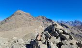
Arrivé à ce col descendre le sentier qui conduit au refuge du Tourond. Au 2ème virage à droite, il y a un petit cairn sur la gauche.
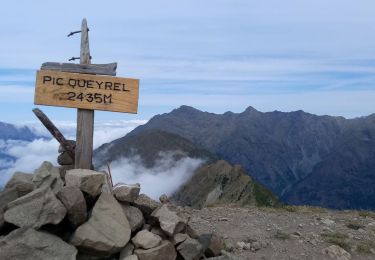
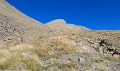
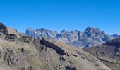
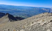
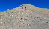
A partir de là, suivre à vue vers le sommet en se tenant toujours vers la gauche de la pente. Il y a encore quelques cairns.
Les 200 derniers mètres de dénivelé sont très pentus aux environs de 40 degrés.
Ce qui en fait une montée très difficile, réservée aux randonneurs expérimentés et en pleine forme.
Ort
Kommentare
Touren in der Umgebung
![Tour Wandern Saint-Jean-Saint-Nicolas - Circuit de Costebelle - Photo](https://media.geolcdn.com/t/375/260/ext.jpg?maxdim=2&url=https%3A%2F%2Fservices.sitytrail.com%2FGeolivesWS%2FDownloadMedia.ashx%3FTrailID%3D269960%26Media%3Dfix__20140424150455.jpg)
![Wandern Wandern](https://static1.geolcdn.com/sitytour/trail-icons/101.png)
Wandern
![](/images/other/stat-length.png)
![](https://static1.geolcdn.com/siteimages/upload/files/16400158638029165_repeat_loop_refresh_sync_direction_icon.png)
![Tour Wandern Saint-Bonnet-en-Champsaur - Les infournas - Lac des Barbeyroux 22/09/23 - Photo](https://media.geolcdn.com/t/375/260/0538c280-feb5-4d65-96e8-19b0b69c47f0.jpg&format=jpg&maxdim=2)
![Wandern Wandern](https://static1.geolcdn.com/sitytour/trail-icons/101.png)
Wandern
![](/images/other/stat-length.png)
![](https://static1.geolcdn.com/siteimages/upload/files/16400158638029165_repeat_loop_refresh_sync_direction_icon.png)
![Tour Wandern Saint-Michel-de-Chaillol - Col de l'Escalier - Photo](https://media.geolcdn.com/t/375/260/ab16f81e-2013-445c-8eb3-48638c0edd61.jpg&format=jpg&maxdim=2)
![Wandern Wandern](https://static1.geolcdn.com/sitytour/trail-icons/101.png)
Wandern
![](/images/other/stat-length.png)
![](https://static1.geolcdn.com/siteimages/upload/files/16400158638029165_repeat_loop_refresh_sync_direction_icon.png)
![Tour Wandern Saint-Michel-de-Chaillol - Pic Queyrel - Photo](https://media.geolcdn.com/t/375/260/3587472a-93b3-4434-9291-823cc836fe6a.jpg&format=jpg&maxdim=2)
![Wandern Wandern](https://static1.geolcdn.com/sitytour/trail-icons/101.png)
Wandern
![](/images/other/stat-length.png)
![](https://static1.geolcdn.com/siteimages/upload/files/16400158638029165_repeat_loop_refresh_sync_direction_icon.png)
![Tour Wandern Saint-Michel-de-Chaillol - Lac de Malcros - Photo](https://media.geolcdn.com/t/375/260/6a7a1b5d-0b23-46a5-9179-bf8c821d0afb.jpg&format=jpg&maxdim=2)
![Wandern Wandern](https://static1.geolcdn.com/sitytour/trail-icons/101.png)
Wandern
![](/images/other/stat-length.png)
![](https://static1.geolcdn.com/siteimages/upload/files/16400158638029165_repeat_loop_refresh_sync_direction_icon.png)
![Tour Wandern Saint-Michel-de-Chaillol - pic de queyrel - Photo](https://media.geolcdn.com/t/375/260/16bf5dfe-1e8f-41f7-8280-542f457efdf9.jpg&format=jpg&maxdim=2)
![Wandern Wandern](https://static1.geolcdn.com/sitytour/trail-icons/101.png)
Wandern
![](/images/other/stat-length.png)
![](https://static1.geolcdn.com/siteimages/upload/files/16400158638029165_repeat_loop_refresh_sync_direction_icon.png)
![Tour Wandern Saint-Michel-de-Chaillol - Tête ouest de Mal Cros 11/08/18 - Photo](https://media.geolcdn.com/t/375/260/8702d498-6db2-40a6-b115-ed3ce3d7c0b6.jpg&format=jpg&maxdim=2)
![Wandern Wandern](https://static1.geolcdn.com/sitytour/trail-icons/101.png)
Wandern
![](/images/other/stat-length.png)
![](https://static1.geolcdn.com/siteimages/upload/files/16400158638029165_repeat_loop_refresh_sync_direction_icon.png)
![Tour Wandern Saint-Jean-Saint-Nicolas - Pont Ricous Pelissier Coste Belle Pont du Fossé - Photo](https://media.geolcdn.com/t/375/260/ext.jpg?maxdim=2&url=https%3A%2F%2Fstatic1.geolcdn.com%2Fsiteimages%2Fupload%2Ffiles%2F1553511878bg_sport_marche.png)
![Wandern Wandern](https://static1.geolcdn.com/sitytour/trail-icons/101.png)
Wandern
![](/images/other/stat-length.png)
![](https://static1.geolcdn.com/siteimages/upload/files/16400158638029165_repeat_loop_refresh_sync_direction_icon.png)
![Tour Wandern Saint-Michel-de-Chaillol - col de la pisse - Photo](https://media.geolcdn.com/t/375/260/8e690fd3-f0ad-4120-9a92-3c8fe4646f31.jpg&format=jpg&maxdim=2)
![Wandern Wandern](https://static1.geolcdn.com/sitytour/trail-icons/101.png)
Wandern
![](/images/other/stat-length.png)
![](https://static1.geolcdn.com/siteimages/upload/files/16400158638029165_repeat_loop_refresh_sync_direction_icon.png)