


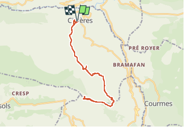

13,5 km | 18,6 km-effort

Benutzer


Kostenlosegpshiking-Anwendung
 SityTrail
IGN / Geografische Institute
SityTrail World
Die Welt öffnet sich für Sie
Tour Wandern von 17,9 km verfügbar auf Provence-Alpes-Côte d'Azur, Seealpen, Cipières. Diese Tour wird von GrouGary vorgeschlagen.
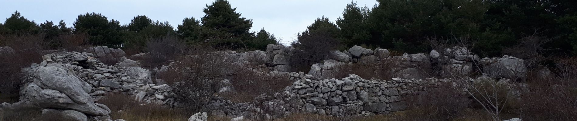
Longue randonnée/Balade sans grosses montées ou difficultés. En terrain découvert et caillouteux ou boisé. Nombreuses traces d'activités pastorales humaines (bories, murets...) ;


Wandern

Wandern

Zu Fuß

Zu Fuß

Zu Fuß

Zu Fuß

Zu Fuß

Zu Fuß
Zu Fuß