


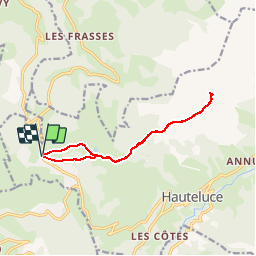

18,1 km | 28 km-effort


Benutzer


Kostenlosegpshiking-Anwendung
 SityTrail
IGN / Geografische Institute
SityTrail World
Die Welt öffnet sich für Sie
Tour Schneeschuhwandern von 11,8 km verfügbar auf Auvergne-Rhone-Alpen, Savoyen, Hauteluce. Diese Tour wird von GGsavoie vorgeschlagen.
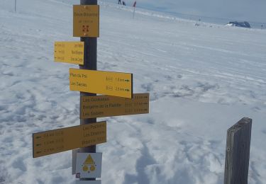
Départ des Saisies en direction du col de la Légette puis montée en direction du Mont Clocher. Tour interrompu par le brouillard, retour au point e départ

Wandern

Fahrrad

Wandern

Mountainbike

Wandern
Wandern

Wandern

Wandern
Schneeschuhwandern