![](/images/other/stat-length.png)
![Tour Wandern Montségur - Pic de Saint Barthélemy - Pic de Soularac - Photo](https://media.geolcdn.com/t/1900/400/ext.pjpeg?maxdim=2&url=https%3A%2F%2Fservices.sitytrail.com%2FGeolivesWS%2FDownloadMedia.ashx%3FTrailID%3D105315%26Media%3D9006_2.jpg)
Pic de Saint Barthélemy - Pic de Soularac
tracegps
Benutzer
![Länge](/images/other/stat-length.png)
![Maximale Höhe](https://static1.geolcdn.com/siteimages/upload/files/1508320355ic_sort_altitude_max_24dp.png)
![Positive Höhendifferenz](https://static1.geolcdn.com/siteimages/upload/files/1508320355ic_sort_den_pos_24dp.png)
![Km-Effort](/images/other/stat-length.png)
![Min. Höhe](https://static1.geolcdn.com/siteimages/upload/files/1508320355ic_sort_altitude_min_24dp.png)
![Negative Höhendifferenz](https://static1.geolcdn.com/siteimages/upload/files/1508320355ic_sort_den_neg_24dp.png)
![Boucle](https://static1.geolcdn.com/siteimages/upload/files/16400158638029165_repeat_loop_refresh_sync_direction_icon.png)
![Wandern](https://static1.geolcdn.com/sitytour/trail-icons/101.png)
6h00
Schwierigkeit : Schwierig
![Scannen Sie diesen QR-Code, um die Tour in der SityTrail-Anwendung zu öffnen](https://capi.geolives.com/qq0zvz2zws4bq2lad0pu/sitytour/trails/105315/qr.png?size=200)
Kostenlosegpshiking-Anwendung
Über SityTrail
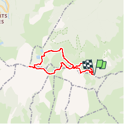
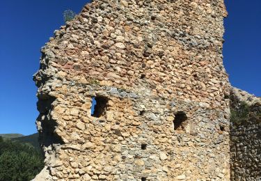
Tour Wandern von 12,7 km verfügbar auf Okzitanien, Ariège, Montségur. Diese Tour wird von tracegps vorgeschlagen.
Beschreibung
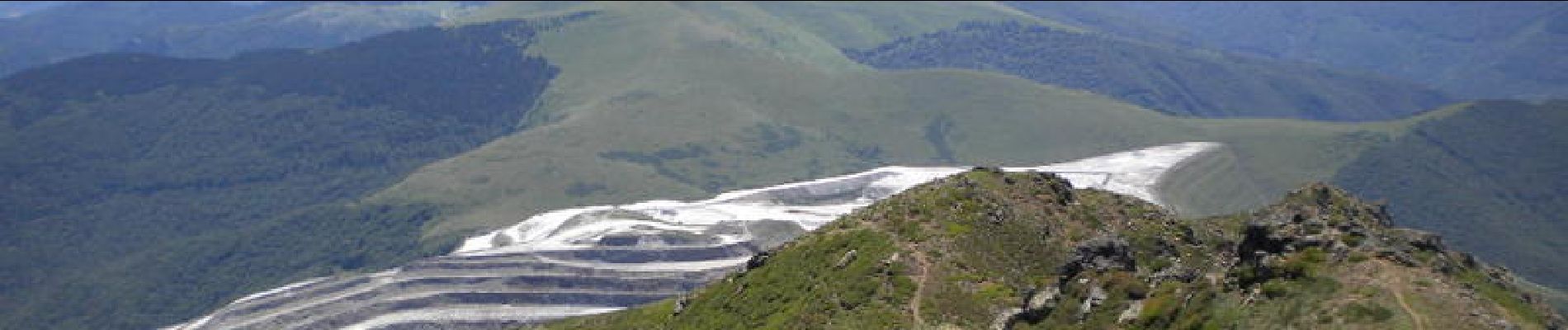
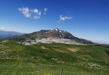
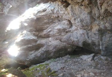
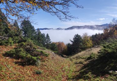
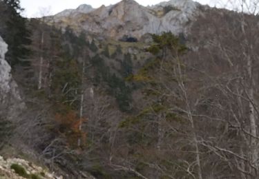
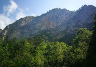
Prendre la piste forestière de Comus aux gorges de la Frau. A l'entrée de la gorge prendre la piste carrossable à gauche sur 2km. Terminus. Suivez les indications GPS au départ: piste peu marquée côté Nord, passage d'une fenêtre avec câble (sans danger ni vertige), grimpe sérieuse le long des étangs de la Truite, du Diable et Supérieur. Passage d'un névé en début de saison. Passage aérien sans difficulté au Pic Soularac mais rester très attentif, ce pic n'est pas facile.
Ort
Kommentare
Touren in der Umgebung
![Tour Wandern Prades - Pic Fourcat Prades - Photo](https://media.geolcdn.com/t/375/260/7328a631-1f70-4385-b122-8064227fbc3d.jpg&format=jpg&maxdim=2)
![Wandern Wandern](https://static1.geolcdn.com/sitytour/trail-icons/101.png)
Wandern
![](/images/other/stat-length.png)
![](https://static1.geolcdn.com/siteimages/upload/files/16400158638029165_repeat_loop_refresh_sync_direction_icon.png)
![Tour Wandern Montségur - la Frau - Photo](https://media.geolcdn.com/t/375/260/ext.jpg?maxdim=2&url=https%3A%2F%2Fservices.sitytrail.com%2FGeolivesWS%2FDownloadMedia.ashx%3FTrailID%3D1026292%26Media%3Dfix__20180821154103.jpg)
![Wandern Wandern](https://static1.geolcdn.com/sitytour/trail-icons/101.png)
![Tour Wandern Prades - Prades col de la Gardie - Photo](https://media.geolcdn.com/t/375/260/b3245a59-b7a3-4db2-b8b4-77161bab9754.jpg&format=jpg&maxdim=2)
![Wandern Wandern](https://static1.geolcdn.com/sitytour/trail-icons/101.png)
Wandern
![](/images/other/stat-length.png)
![](https://static1.geolcdn.com/siteimages/upload/files/16400158638029165_repeat_loop_refresh_sync_direction_icon.png)
![Tour Wandern Prades - Prades 2024 - Photo](https://media.geolcdn.com/t/375/260/64bfe982-cc32-4069-8363-5e5f0733d611.jpg&format=jpg&maxdim=2)
![Wandern Wandern](https://static1.geolcdn.com/sitytour/trail-icons/101.png)
![Tour Wandern Prades - Mont Fourcat - Photo](https://media.geolcdn.com/t/375/260/ext.jpg?maxdim=2&url=https%3A%2F%2Fstatic1.geolcdn.com%2Fsiteimages%2Fupload%2Ffiles%2F1553511878bg_sport_marche.png)
![Wandern Wandern](https://static1.geolcdn.com/sitytour/trail-icons/101.png)
Wandern
![](/images/other/stat-length.png)
![](https://static1.geolcdn.com/siteimages/upload/files/16400158638029165_repeat_loop_refresh_sync_direction_icon.png)
![Tour Andere Aktivitäten Montségur - roc punchut grotte des foyers - Photo](https://media.geolcdn.com/t/375/260/a4b55b03-ce46-46d1-8d53-1f5741836163.jpg&format=jpg&maxdim=2)
![Andere Aktivitäten Andere Aktivitäten](https://static1.geolcdn.com/sitytour/trail-icons/900.png)
Andere Aktivitäten
![](/images/other/stat-length.png)
![](https://static1.geolcdn.com/siteimages/upload/files/16400158638029165_repeat_loop_refresh_sync_direction_icon.png)
![Tour Wandern Prades - Prades 09 - Photo](https://media.geolcdn.com/t/375/260/27857fa2-dc99-4d32-836d-6c12c4a51c7a.jpg&format=jpg&maxdim=2)
![Wandern Wandern](https://static1.geolcdn.com/sitytour/trail-icons/101.png)
Wandern
![](/images/other/stat-length.png)
![](https://static1.geolcdn.com/siteimages/upload/files/16400158638029165_repeat_loop_refresh_sync_direction_icon.png)
![Tour Wandern Prades - Prades Montaillou - Photo](https://media.geolcdn.com/t/375/260/26d4d780-593e-493d-a2f0-7ccce6afccce.jpg&format=jpg&maxdim=2)
![Wandern Wandern](https://static1.geolcdn.com/sitytour/trail-icons/101.png)
![Tour Wandern Fougax-et-Barrineuf - gorge de la Frau - Photo](https://media.geolcdn.com/t/375/260/ee53b454-d59c-4857-b04f-88058a76ae49.jpg&format=jpg&maxdim=2)
![Wandern Wandern](https://static1.geolcdn.com/sitytour/trail-icons/101.png)
Wandern
![](/images/other/stat-length.png)
![](https://static1.geolcdn.com/siteimages/upload/files/16400158638029165_repeat_loop_refresh_sync_direction_icon.png)
wahou la rando. 4h de montée pour 3h de descente.30mn de repas. descente dcenfer