


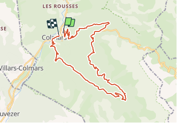


18,8 km | 29 km-effort


Benutzer


Kostenlosegpshiking-Anwendung
 SityTrail
IGN / Geografische Institute
SityTrail World
Die Welt öffnet sich für Sie
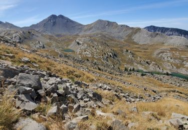
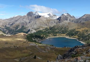
Tour Mountainbike von 22 km verfügbar auf Provence-Alpes-Côte d'Azur, Alpes-de-Haute-Provence, Colmars. Diese Tour wird von tracegps vorgeschlagen.
Pas de difficultes majeures. Montée par la route et fin de la montée en single. La descente n'a quasi aucune difficulte et reste plutot rapide.

Wandern

Wandern
Wandern
Wandern
Wandern
Wandern
Wandern
Wandern
Wandern