![](/images/other/stat-length.png)
- Touren
- Zu Fuß
- Germany
- Niedersachsen
- Landkreis Goslar
Landkreis Goslar, Niedersachsen, Zu Fuß: Die besten Touren, Trails, Trecks und Wanderungen
Landkreis Goslar : Entdecken Sie die besten Touren : 35 zu fuß, 1 wandern und 1 pfad. Alle diese Touren, Trails, Routen und Outdoor-Aktivitäten sind in unseren SityTrail-Apps für Smartphones und Tablets verfügbar.
Die besten Spuren (37)
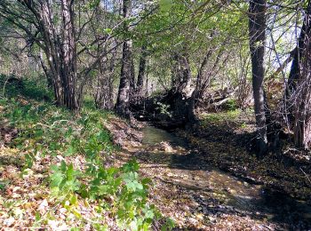
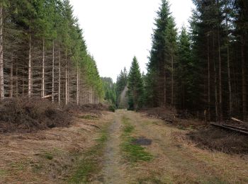
![Tour Zu Fuß Goslar - Harly Rundwanderweg 1 - Photo](https://media.geolcdn.com/t/350/260/021c8b09-c12a-48aa-a9f4-916877c70a12.jpeg&format=jpg&maxdim=2)
![Zu Fuß Zu Fuß](https://static1.geolcdn.com/sitytour/trail-icons/100.png)
Km
Zu Fuß
![](/images/other/stat-length.png)
![](https://static1.geolcdn.com/siteimages/upload/files/1508320355ic_sort_den_pos_24dp.png)
![](https://static1.geolcdn.com/siteimages/upload/files/1508320355ic_sort_den_neg_24dp.png)
![](https://static1.geolcdn.com/siteimages/upload/files/16400158638029165_repeat_loop_refresh_sync_direction_icon.png)
• Symbol: weiße 1 auf Baum gemalt
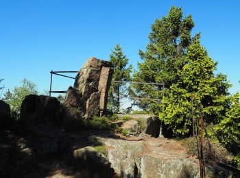
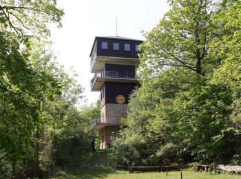
![Tour Zu Fuß Goslar - Harly Rundwanderweg 3 - Photo](https://media.geolcdn.com/t/350/260/2ba72d2a-799a-4259-a779-84743af688fd.jpeg&format=jpg&maxdim=2)
![Zu Fuß Zu Fuß](https://static1.geolcdn.com/sitytour/trail-icons/100.png)
Km
Zu Fuß
![](/images/other/stat-length.png)
![](https://static1.geolcdn.com/siteimages/upload/files/1508320355ic_sort_den_pos_24dp.png)
![](https://static1.geolcdn.com/siteimages/upload/files/1508320355ic_sort_den_neg_24dp.png)
![](https://static1.geolcdn.com/siteimages/upload/files/16400158638029165_repeat_loop_refresh_sync_direction_icon.png)
• Symbol: rote 3 auf Baum gemalt
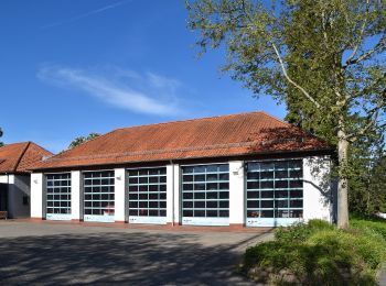
![Tour Zu Fuß Bad Harzburg - Luchstour - Photo](https://media.geolcdn.com/t/350/260/5a4c5f26-93db-40c8-be08-cbef573cd379.jpeg&format=jpg&maxdim=2)
![Zu Fuß Zu Fuß](https://static1.geolcdn.com/sitytour/trail-icons/100.png)
Km
Zu Fuß
![](/images/other/stat-length.png)
![](https://static1.geolcdn.com/siteimages/upload/files/1508320355ic_sort_den_pos_24dp.png)
![](https://static1.geolcdn.com/siteimages/upload/files/1508320355ic_sort_den_neg_24dp.png)
![](https://static1.geolcdn.com/siteimages/upload/files/16400158638029165_repeat_loop_refresh_sync_direction_icon.png)
• Symbol: Luchskopf Website: https://www.bad-harzburg.de/wanderland/wandern-aktiv/luchstour.html
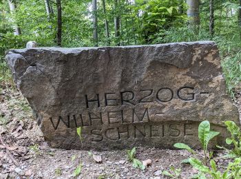
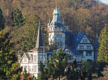
![Tour Zu Fuß Harz (LK Goslar) - Rundwanderweg 1 - Photo](https://media.geolcdn.com/t/350/260/6a73bd32-225f-4ca9-8742-55e55946a9e3.jpeg&format=jpg&maxdim=2)
![Zu Fuß Zu Fuß](https://static1.geolcdn.com/sitytour/trail-icons/100.png)
Km
Zu Fuß
![](/images/other/stat-length.png)
![](https://static1.geolcdn.com/siteimages/upload/files/1508320355ic_sort_den_pos_24dp.png)
![](https://static1.geolcdn.com/siteimages/upload/files/1508320355ic_sort_den_neg_24dp.png)
![](https://static1.geolcdn.com/siteimages/upload/files/16400158638029165_repeat_loop_refresh_sync_direction_icon.png)
• Symbol: roter Kreis mit Dreieck Nr. 1
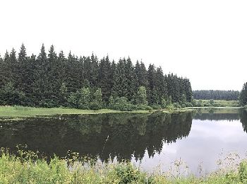
![Tour Zu Fuß Clausthal-Zellerfeld - Prinzen / Flambacher Teiche - Photo](https://media.geolcdn.com/t/350/260/9544bb55-423a-4dcd-a560-c97b3ab924ca.jpeg&format=jpg&maxdim=2)
![Zu Fuß Zu Fuß](https://static1.geolcdn.com/sitytour/trail-icons/100.png)
Km
Zu Fuß
![](/images/other/stat-length.png)
![](https://static1.geolcdn.com/siteimages/upload/files/1508320355ic_sort_den_pos_24dp.png)
![](https://static1.geolcdn.com/siteimages/upload/files/1508320355ic_sort_den_neg_24dp.png)
![](https://static1.geolcdn.com/siteimages/upload/files/16400158638029165_repeat_loop_refresh_sync_direction_icon.png)
• Trail created by Harzklub. Symbol: Wasserrad auf blauem Grund
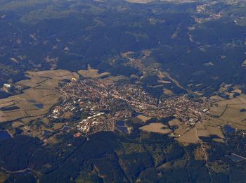
![Tour Zu Fuß Clausthal-Zellerfeld - Clausthaler Teiche - Photo](https://media.geolcdn.com/t/350/260/9a2df3cb-02c5-40ea-9acf-0413a0a73c36.jpeg&format=jpg&maxdim=2)
![Zu Fuß Zu Fuß](https://static1.geolcdn.com/sitytour/trail-icons/100.png)
Km
Zu Fuß
![](/images/other/stat-length.png)
![](https://static1.geolcdn.com/siteimages/upload/files/1508320355ic_sort_den_pos_24dp.png)
![](https://static1.geolcdn.com/siteimages/upload/files/1508320355ic_sort_den_neg_24dp.png)
![](https://static1.geolcdn.com/siteimages/upload/files/16400158638029165_repeat_loop_refresh_sync_direction_icon.png)
• Trail created by Harzklub. Symbol: Wasserrad auf blauem Grund
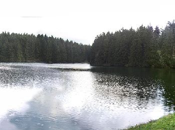
![Tour Zu Fuß Clausthal-Zellerfeld - HK 4: Neckelnberg, Seesen - Bad Grund - Wildemann - Langelsheim - Photo](https://media.geolcdn.com/t/350/260/c054374a-437a-4e3b-a74f-17eca2481959.jpeg&format=jpg&maxdim=2)
![Zu Fuß Zu Fuß](https://static1.geolcdn.com/sitytour/trail-icons/100.png)
Km
Zu Fuß
![](/images/other/stat-length.png)
![](https://static1.geolcdn.com/siteimages/upload/files/1508320355ic_sort_den_pos_24dp.png)
![](https://static1.geolcdn.com/siteimages/upload/files/1508320355ic_sort_den_neg_24dp.png)
![](https://static1.geolcdn.com/siteimages/upload/files/16400158638029165_repeat_loop_refresh_sync_direction_icon.png)
• Trail created by Harzklub.
![Tour Zu Fuß Clausthal-Zellerfeld - HK 8: Osterode - Clausthal-Zellerfeld - Goslar - Photo](https://media.geolcdn.com/t/350/260/a1f07da8-33b6-492c-9051-bb7199e48b68.jpeg&format=jpg&maxdim=2)
![Zu Fuß Zu Fuß](https://static1.geolcdn.com/sitytour/trail-icons/100.png)
Km
Zu Fuß
![](/images/other/stat-length.png)
![](https://static1.geolcdn.com/siteimages/upload/files/1508320355ic_sort_den_pos_24dp.png)
![](https://static1.geolcdn.com/siteimages/upload/files/1508320355ic_sort_den_neg_24dp.png)
![](https://static1.geolcdn.com/siteimages/upload/files/16400158638029165_repeat_loop_refresh_sync_direction_icon.png)
• Trail created by Harzklub.
![Tour Zu Fuß Harz (LK Goslar) - HK 7: Bad Grund - Okertal - Bad Harzburg - Photo](https://media.geolcdn.com/t/350/260/5ec67649-2277-4b30-b807-d8796dff005f.jpeg&format=jpg&maxdim=2)
![Zu Fuß Zu Fuß](https://static1.geolcdn.com/sitytour/trail-icons/100.png)
Km
Zu Fuß
![](/images/other/stat-length.png)
![](https://static1.geolcdn.com/siteimages/upload/files/1508320355ic_sort_den_pos_24dp.png)
![](https://static1.geolcdn.com/siteimages/upload/files/1508320355ic_sort_den_neg_24dp.png)
![](https://static1.geolcdn.com/siteimages/upload/files/16400158638029165_repeat_loop_refresh_sync_direction_icon.png)
• Trail created by Harzklub.
![Tour Zu Fuß Harz (LK Goslar) - HK 6: Osterode - Söse - Okertal - Goslar - Photo](https://media.geolcdn.com/t/350/260/fd555058-07f4-472f-8540-e2770d48c187.jpeg&format=jpg&maxdim=2)
![Zu Fuß Zu Fuß](https://static1.geolcdn.com/sitytour/trail-icons/100.png)
Km
Zu Fuß
![](/images/other/stat-length.png)
![](https://static1.geolcdn.com/siteimages/upload/files/1508320355ic_sort_den_pos_24dp.png)
![](https://static1.geolcdn.com/siteimages/upload/files/1508320355ic_sort_den_neg_24dp.png)
![](https://static1.geolcdn.com/siteimages/upload/files/16400158638029165_repeat_loop_refresh_sync_direction_icon.png)
• Trail created by Harzklub.
![Tour Zu Fuß Harz (LK Goslar) - HK 5: Münchehof, Bhf. - Altenau - Dammhaus - Photo](https://media.geolcdn.com/t/350/260/fe496d3c-d12f-4168-9cfa-c279aa907142.jpeg&format=jpg&maxdim=2)
![Zu Fuß Zu Fuß](https://static1.geolcdn.com/sitytour/trail-icons/100.png)
Km
Zu Fuß
![](/images/other/stat-length.png)
![](https://static1.geolcdn.com/siteimages/upload/files/1508320355ic_sort_den_pos_24dp.png)
![](https://static1.geolcdn.com/siteimages/upload/files/1508320355ic_sort_den_neg_24dp.png)
![](https://static1.geolcdn.com/siteimages/upload/files/16400158638029165_repeat_loop_refresh_sync_direction_icon.png)
• Trail created by Harzklub.
![Tour Zu Fuß Goslar - HK 2: Münchehof, Bhf. - Bad Grund - Clausthal-Zellerfeld - Langelsheim - Photo](https://media.geolcdn.com/t/350/260/8326c40a-24ed-489b-8c86-25ab75659a36.jpeg&format=jpg&maxdim=2)
![Zu Fuß Zu Fuß](https://static1.geolcdn.com/sitytour/trail-icons/100.png)
Km
Zu Fuß
![](/images/other/stat-length.png)
![](https://static1.geolcdn.com/siteimages/upload/files/1508320355ic_sort_den_pos_24dp.png)
![](https://static1.geolcdn.com/siteimages/upload/files/1508320355ic_sort_den_neg_24dp.png)
![](https://static1.geolcdn.com/siteimages/upload/files/16400158638029165_repeat_loop_refresh_sync_direction_icon.png)
• Trail created by Harzklub.
![Tour Zu Fuß Harz (LK Goslar) - HK 1: Seesen, Bahnhof - Hahnenklee - Goslar - Seesen - Photo](https://media.geolcdn.com/t/350/260/e179b839-6575-453c-a153-a5786da426a9.jpeg&format=jpg&maxdim=2)
![Zu Fuß Zu Fuß](https://static1.geolcdn.com/sitytour/trail-icons/100.png)
Km
Zu Fuß
![](/images/other/stat-length.png)
![](https://static1.geolcdn.com/siteimages/upload/files/1508320355ic_sort_den_pos_24dp.png)
![](https://static1.geolcdn.com/siteimages/upload/files/1508320355ic_sort_den_neg_24dp.png)
![](https://static1.geolcdn.com/siteimages/upload/files/16400158638029165_repeat_loop_refresh_sync_direction_icon.png)
• Trail created by Harzklub.
![Tour Zu Fuß Harz (LK Goslar) - Naturmythenpfad - Photo](https://media.geolcdn.com/t/350/260/a380fc51-3557-418f-9d8d-90f8e72a1ef8.jpeg&format=jpg&maxdim=2)
![Zu Fuß Zu Fuß](https://static1.geolcdn.com/sitytour/trail-icons/100.png)
Km
Zu Fuß
![](/images/other/stat-length.png)
![](https://static1.geolcdn.com/siteimages/upload/files/1508320355ic_sort_den_pos_24dp.png)
![](https://static1.geolcdn.com/siteimages/upload/files/1508320355ic_sort_den_neg_24dp.png)
![](https://static1.geolcdn.com/siteimages/upload/files/16400158638029165_repeat_loop_refresh_sync_direction_icon.png)
• Ergründen Sie die mythischen Verbindungen zwischen Mensch und Natur Website: https://www.nationalpark-harz.de/de/na...
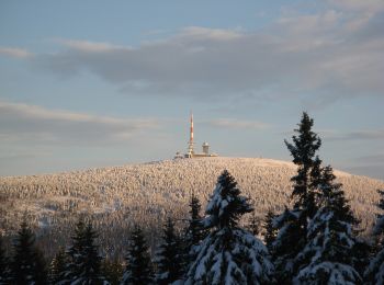
![Tour Zu Fuß Clausthal-Zellerfeld - Rund um das Große Torfhausmoor - Photo](https://media.geolcdn.com/t/350/260/2f3d7e96-7e4b-4b83-b692-89c4b1b12b00.jpeg&format=jpg&maxdim=2)
![Zu Fuß Zu Fuß](https://static1.geolcdn.com/sitytour/trail-icons/100.png)
Km
Zu Fuß
![](/images/other/stat-length.png)
![](https://static1.geolcdn.com/siteimages/upload/files/1508320355ic_sort_den_pos_24dp.png)
![](https://static1.geolcdn.com/siteimages/upload/files/1508320355ic_sort_den_neg_24dp.png)
![](https://static1.geolcdn.com/siteimages/upload/files/16400158638029165_repeat_loop_refresh_sync_direction_icon.png)
• Trail created by Nationalpark Harz.
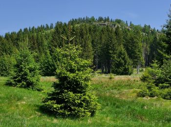
![Tour Zu Fuß Bad Harzburg - Teufelsstieg - Photo](https://media.geolcdn.com/t/350/260/392db4e3-d9a3-49b5-acbc-33086b46f6bd.jpeg&format=jpg&maxdim=2)
![Zu Fuß Zu Fuß](https://static1.geolcdn.com/sitytour/trail-icons/100.png)
Km
Zu Fuß
![](/images/other/stat-length.png)
![](https://static1.geolcdn.com/siteimages/upload/files/1508320355ic_sort_den_pos_24dp.png)
![](https://static1.geolcdn.com/siteimages/upload/files/1508320355ic_sort_den_neg_24dp.png)
![](https://static1.geolcdn.com/siteimages/upload/files/16400158638029165_repeat_loop_refresh_sync_direction_icon.png)
• Symbol: Weißer Teufel auf grünem Grund Website: https://www.bad-harzburg.de/wanderland/wandern-aktiv/teufelsstieg.html
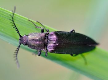
![Tour Zu Fuß Clausthal-Zellerfeld - Buntenbocker Teiche - Photo](https://media.geolcdn.com/t/350/260/551e9bda-a9e2-46cb-bf69-04f9050399a9.jpeg&format=jpg&maxdim=2)
![Zu Fuß Zu Fuß](https://static1.geolcdn.com/sitytour/trail-icons/100.png)
Km
Zu Fuß
![](/images/other/stat-length.png)
![](https://static1.geolcdn.com/siteimages/upload/files/1508320355ic_sort_den_pos_24dp.png)
![](https://static1.geolcdn.com/siteimages/upload/files/1508320355ic_sort_den_neg_24dp.png)
![](https://static1.geolcdn.com/siteimages/upload/files/16400158638029165_repeat_loop_refresh_sync_direction_icon.png)
• Trail created by Harzklub. Symbol: Wasserrad auf bleuem Grund
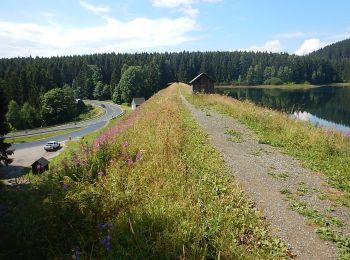
![Tour Zu Fuß Clausthal-Zellerfeld - Zellerfelder Kunstgraben - Photo](https://media.geolcdn.com/t/350/260/11ac4336-7d85-462f-9662-03ec1fe4f77c.jpeg&format=jpg&maxdim=2)
![Zu Fuß Zu Fuß](https://static1.geolcdn.com/sitytour/trail-icons/100.png)
Km
Zu Fuß
![](/images/other/stat-length.png)
![](https://static1.geolcdn.com/siteimages/upload/files/1508320355ic_sort_den_pos_24dp.png)
![](https://static1.geolcdn.com/siteimages/upload/files/1508320355ic_sort_den_neg_24dp.png)
![](https://static1.geolcdn.com/siteimages/upload/files/16400158638029165_repeat_loop_refresh_sync_direction_icon.png)
• Trail created by Harzklub. Symbol: Weißes Wasserrad auf blauem Grund
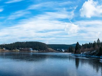
![Tour Zu Fuß Harz (LK Goslar) - Eckertalsperren-Rundweg - Photo](https://media.geolcdn.com/t/350/260/5c9ed9cb-b69d-4e8f-93d8-96beb9994ac2.jpeg&format=jpg&maxdim=2)
![Zu Fuß Zu Fuß](https://static1.geolcdn.com/sitytour/trail-icons/100.png)
Km
Zu Fuß
![](/images/other/stat-length.png)
![](https://static1.geolcdn.com/siteimages/upload/files/1508320355ic_sort_den_pos_24dp.png)
![](https://static1.geolcdn.com/siteimages/upload/files/1508320355ic_sort_den_neg_24dp.png)
![](https://static1.geolcdn.com/siteimages/upload/files/16400158638029165_repeat_loop_refresh_sync_direction_icon.png)
• Symbol: Blaue stilisierte Welle auf weißem Grund
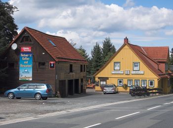
![Tour Zu Fuß Harz (LK Goslar) - Alter Dammgraben - Photo](https://media.geolcdn.com/t/350/260/3e6d776d-371f-4984-b235-54cfc1f0db3a.jpeg&format=jpg&maxdim=2)
![Zu Fuß Zu Fuß](https://static1.geolcdn.com/sitytour/trail-icons/100.png)
Km
Zu Fuß
![](/images/other/stat-length.png)
![](https://static1.geolcdn.com/siteimages/upload/files/1508320355ic_sort_den_pos_24dp.png)
![](https://static1.geolcdn.com/siteimages/upload/files/1508320355ic_sort_den_neg_24dp.png)
![](https://static1.geolcdn.com/siteimages/upload/files/16400158638029165_repeat_loop_refresh_sync_direction_icon.png)
• Trail created by Harzklub. Symbol: Wasserrad auf blauem Grund
20 Angezeigte Touren bei 37
Kostenlosegpshiking-Anwendung