![](/images/other/stat-length.png)
Rheinland-Pfalz, Germany, Zu Fuß: Die besten Touren, Trails, Trecks und Wanderungen
Rheinland-Pfalz : Entdecken Sie die besten Touren : 1123 zu fuß, 178 wandern, 3 nordic walking, 2 laufen und 1 pfad. Alle diese Touren, Trails, Routen und Outdoor-Aktivitäten sind in unseren SityTrail-Apps für Smartphones und Tablets verfügbar.
Die besten Spuren (1306)
![Tour Wandern Mörsdorf - pont suspendu de Geierlay - Photo](https://media.geolcdn.com/t/350/260/864ecd12-4eaf-47c6-a99d-cc6e483e3fd9.jpg&format=jpg&maxdim=2)
![Wandern Wandern](https://static1.geolcdn.com/sitytour/trail-icons/101.png)
Km
Wandern
![](/images/other/stat-length.png)
![](https://static1.geolcdn.com/siteimages/upload/files/1508320355ic_sort_den_pos_24dp.png)
![](https://static1.geolcdn.com/siteimages/upload/files/1508320355ic_sort_den_neg_24dp.png)
![](https://static1.geolcdn.com/siteimages/upload/files/16400158638029165_repeat_loop_refresh_sync_direction_icon.png)
![Tour Wandern Dahn - Dahner Felsenpfad - Photo](https://media.geolcdn.com/t/350/260/ext.jpg?maxdim=2&url=https%3A%2F%2Fservices.sitytrail.com%2FGeolivesWS%2FDownloadMedia.ashx%3FTrailID%3D732172%26Media%3Dfix__20170409162639.jpg)
![Wandern Wandern](https://static1.geolcdn.com/sitytour/trail-icons/101.png)
Km
Wandern
![](/images/other/stat-length.png)
![](https://static1.geolcdn.com/siteimages/upload/files/1508320355ic_sort_den_pos_24dp.png)
![](https://static1.geolcdn.com/siteimages/upload/files/1508320355ic_sort_den_neg_24dp.png)
![](https://static1.geolcdn.com/siteimages/upload/files/16400158638029165_repeat_loop_refresh_sync_direction_icon.png)
• Faite le 09/04/2017 avec notre fils Théo de 12 ans et nos amis Eléonore, Jennifer, Bernard et Rémy. Durée indiquée po...
![Tour Wandern Ernzen - DeLux Wanderpark Felsenweg1, Weilerbach-Houllay - Photo](https://media.geolcdn.com/t/350/260/ext.jpg?maxdim=2&url=https%3A%2F%2Fstatic1.geolcdn.com%2Fsiteimages%2Fupload%2Ffiles%2F1553511878bg_sport_marche.png)
![Wandern Wandern](https://static1.geolcdn.com/sitytour/trail-icons/101.png)
Km
Wandern
![](/images/other/stat-length.png)
![](https://static1.geolcdn.com/siteimages/upload/files/1508320355ic_sort_den_pos_24dp.png)
![](https://static1.geolcdn.com/siteimages/upload/files/1508320355ic_sort_den_neg_24dp.png)
![](https://static1.geolcdn.com/siteimages/upload/files/16400158638029165_repeat_loop_refresh_sync_direction_icon.png)
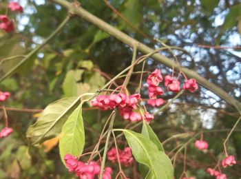
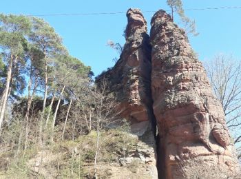
• Kulturelle Schätze Bizzare Felslandschaften, blütenreiche Wiesen und farnreiche Wälder kennzeichnen diese Route. Ab...
![Tour Wandern Nickenich - Promenade autour du Laacher See - Photo](https://media.geolcdn.com/t/350/260/e1b35707-7df5-445a-9d32-a9ce8c3d3690.jpg&format=jpg&maxdim=2)
![Wandern Wandern](https://static1.geolcdn.com/sitytour/trail-icons/101.png)
Km
Wandern
![](/images/other/stat-length.png)
![](https://static1.geolcdn.com/siteimages/upload/files/1508320355ic_sort_den_pos_24dp.png)
![](https://static1.geolcdn.com/siteimages/upload/files/1508320355ic_sort_den_neg_24dp.png)
![](https://static1.geolcdn.com/siteimages/upload/files/16400158638029165_repeat_loop_refresh_sync_direction_icon.png)
![Tour Wandern Mörsdorf - Promenade vers le pont de Geierlay - Photo](https://media.geolcdn.com/t/350/260/0d007229-5338-45e8-9509-5159d63bf2a7.jpg&format=jpg&maxdim=2)
![Wandern Wandern](https://static1.geolcdn.com/sitytour/trail-icons/101.png)
Km
Wandern
![](/images/other/stat-length.png)
![](https://static1.geolcdn.com/siteimages/upload/files/1508320355ic_sort_den_pos_24dp.png)
![](https://static1.geolcdn.com/siteimages/upload/files/1508320355ic_sort_den_neg_24dp.png)
![](https://static1.geolcdn.com/siteimages/upload/files/16400158638029165_repeat_loop_refresh_sync_direction_icon.png)
![Tour Zu Fuß Lahnstein - Rundwanderweg A - Photo](https://media.geolcdn.com/t/350/260/b3ba714d-2c3e-4a80-887e-6fcddb8584ce.jpeg&format=jpg&maxdim=2)
![Zu Fuß Zu Fuß](https://static1.geolcdn.com/sitytour/trail-icons/100.png)
Km
Zu Fuß
![](/images/other/stat-length.png)
![](https://static1.geolcdn.com/siteimages/upload/files/1508320355ic_sort_den_pos_24dp.png)
![](https://static1.geolcdn.com/siteimages/upload/files/1508320355ic_sort_den_neg_24dp.png)
![](https://static1.geolcdn.com/siteimages/upload/files/16400158638029165_repeat_loop_refresh_sync_direction_icon.png)
• Trail created by Forstamt Lahnstein - Forstrevier Lahnstein. Symbol: gelbes "A" auf weißem Grund
![Tour Zu Fuß Lahnstein - Rundwanderweg B - Photo](https://media.geolcdn.com/t/350/260/35ccf662-4335-4af1-a7ec-7cb0f2ffa796.jpeg&format=jpg&maxdim=2)
![Zu Fuß Zu Fuß](https://static1.geolcdn.com/sitytour/trail-icons/100.png)
Km
Zu Fuß
![](/images/other/stat-length.png)
![](https://static1.geolcdn.com/siteimages/upload/files/1508320355ic_sort_den_pos_24dp.png)
![](https://static1.geolcdn.com/siteimages/upload/files/1508320355ic_sort_den_neg_24dp.png)
![](https://static1.geolcdn.com/siteimages/upload/files/16400158638029165_repeat_loop_refresh_sync_direction_icon.png)
• Trail created by Forstamt Lahnstein - Forstrevier Spiessborn. Symbol: rotes "B" auf weißem Grund
![Tour Zu Fuß Löf - Traumpfädchen Löfer Rabenlaypfad - Photo](https://media.geolcdn.com/t/350/260/c9aedc4e-53d0-4f82-897b-9a251aee4734.jpeg&format=jpg&maxdim=2)
![Zu Fuß Zu Fuß](https://static1.geolcdn.com/sitytour/trail-icons/100.png)
Km
Zu Fuß
![](/images/other/stat-length.png)
![](https://static1.geolcdn.com/siteimages/upload/files/1508320355ic_sort_den_pos_24dp.png)
![](https://static1.geolcdn.com/siteimages/upload/files/1508320355ic_sort_den_neg_24dp.png)
![](https://static1.geolcdn.com/siteimages/upload/files/16400158638029165_repeat_loop_refresh_sync_direction_icon.png)
• Trail created by Projektbüro Traumpfade der Rhein-Mosel-Eifel-Touristik. Symbol: weißer Hintergrung mit wißem Weg in...
![Tour Zu Fuß Wallenborn - HeimatSpur Wallenborner Weg - Photo](https://media.geolcdn.com/t/350/260/08414572-6267-479b-9e5f-5501dfbc3e83.jpeg&format=jpg&maxdim=2)
![Zu Fuß Zu Fuß](https://static1.geolcdn.com/sitytour/trail-icons/100.png)
Km
Zu Fuß
![](/images/other/stat-length.png)
![](https://static1.geolcdn.com/siteimages/upload/files/1508320355ic_sort_den_pos_24dp.png)
![](https://static1.geolcdn.com/siteimages/upload/files/1508320355ic_sort_den_neg_24dp.png)
![](https://static1.geolcdn.com/siteimages/upload/files/16400158638029165_repeat_loop_refresh_sync_direction_icon.png)
• Trail created by Eifel Tourismus.
![Tour Zu Fuß Daun - HeimatSpur Großer Dauner - Photo](https://media.geolcdn.com/t/350/260/c7f2fcb7-dac5-4db8-bc46-541d9f834168.jpeg&format=jpg&maxdim=2)
![Zu Fuß Zu Fuß](https://static1.geolcdn.com/sitytour/trail-icons/100.png)
Km
Zu Fuß
![](/images/other/stat-length.png)
![](https://static1.geolcdn.com/siteimages/upload/files/1508320355ic_sort_den_pos_24dp.png)
![](https://static1.geolcdn.com/siteimages/upload/files/1508320355ic_sort_den_neg_24dp.png)
![](https://static1.geolcdn.com/siteimages/upload/files/16400158638029165_repeat_loop_refresh_sync_direction_icon.png)
• Trail created by Eifel Tourismus.
![Tour Zu Fuß Üdersdorf - HeimatSpur Wasser- und Felsenweg - Photo](https://media.geolcdn.com/t/350/260/2a06d58d-a40a-4c3b-9920-9399a98721d8.jpeg&format=jpg&maxdim=2)
![Zu Fuß Zu Fuß](https://static1.geolcdn.com/sitytour/trail-icons/100.png)
Km
Zu Fuß
![](/images/other/stat-length.png)
![](https://static1.geolcdn.com/siteimages/upload/files/1508320355ic_sort_den_pos_24dp.png)
![](https://static1.geolcdn.com/siteimages/upload/files/1508320355ic_sort_den_neg_24dp.png)
![](https://static1.geolcdn.com/siteimages/upload/files/16400158638029165_repeat_loop_refresh_sync_direction_icon.png)
• Trail created by Eifel Tourismus.
![Tour Zu Fuß Burgen - Forellenweg - Photo](https://media.geolcdn.com/t/350/260/ced9dd62-857a-4a6e-9a35-70bc102c6483.jpeg&format=jpg&maxdim=2)
![Zu Fuß Zu Fuß](https://static1.geolcdn.com/sitytour/trail-icons/100.png)
Km
Zu Fuß
![](/images/other/stat-length.png)
![](https://static1.geolcdn.com/siteimages/upload/files/1508320355ic_sort_den_pos_24dp.png)
![](https://static1.geolcdn.com/siteimages/upload/files/1508320355ic_sort_den_neg_24dp.png)
![](https://static1.geolcdn.com/siteimages/upload/files/16400158638029165_repeat_loop_refresh_sync_direction_icon.png)
• Symbol: Forelle auf weissem Grund
![Tour Zu Fuß Niederstadtfeld - HeimatSpur 1000-jähriger Weg - Photo](https://media.geolcdn.com/t/350/260/61236137-3a2a-4eba-a67c-81ce289debec.jpeg&format=jpg&maxdim=2)
![Zu Fuß Zu Fuß](https://static1.geolcdn.com/sitytour/trail-icons/100.png)
Km
Zu Fuß
![](/images/other/stat-length.png)
![](https://static1.geolcdn.com/siteimages/upload/files/1508320355ic_sort_den_pos_24dp.png)
![](https://static1.geolcdn.com/siteimages/upload/files/1508320355ic_sort_den_neg_24dp.png)
![](https://static1.geolcdn.com/siteimages/upload/files/16400158638029165_repeat_loop_refresh_sync_direction_icon.png)
• Trail created by Eifel Tourismus.
![Tour Zu Fuß Steineberg - HeimatSpur Keltenrundweg - Photo](https://media.geolcdn.com/t/350/260/4b1692aa-f11b-4d67-8202-607607da5a44.jpeg&format=jpg&maxdim=2)
![Zu Fuß Zu Fuß](https://static1.geolcdn.com/sitytour/trail-icons/100.png)
Km
Zu Fuß
![](/images/other/stat-length.png)
![](https://static1.geolcdn.com/siteimages/upload/files/1508320355ic_sort_den_pos_24dp.png)
![](https://static1.geolcdn.com/siteimages/upload/files/1508320355ic_sort_den_neg_24dp.png)
![](https://static1.geolcdn.com/siteimages/upload/files/16400158638029165_repeat_loop_refresh_sync_direction_icon.png)
• Trail created by Eifel Tourismus. Symbol: grünes rechteck mit KE in weißer Schrift
![Tour Zu Fuß Strohn - Rundweg Strohner Schweiz - Photo](https://media.geolcdn.com/t/350/260/0d85f9aa-8c27-4f78-b3f2-bfe04930aefe.jpeg&format=jpg&maxdim=2)
![Zu Fuß Zu Fuß](https://static1.geolcdn.com/sitytour/trail-icons/100.png)
Km
Zu Fuß
![](/images/other/stat-length.png)
![](https://static1.geolcdn.com/siteimages/upload/files/1508320355ic_sort_den_pos_24dp.png)
![](https://static1.geolcdn.com/siteimages/upload/files/1508320355ic_sort_den_neg_24dp.png)
![](https://static1.geolcdn.com/siteimages/upload/files/16400158638029165_repeat_loop_refresh_sync_direction_icon.png)
• Trail created by Eifelverein.
![Tour Zu Fuß Strohn - HeimatSpur Lavaweg Strohn - Photo](https://media.geolcdn.com/t/350/260/f09be04d-a256-4442-9159-f0968e97baeb.jpeg&format=jpg&maxdim=2)
![Zu Fuß Zu Fuß](https://static1.geolcdn.com/sitytour/trail-icons/100.png)
Km
Zu Fuß
![](/images/other/stat-length.png)
![](https://static1.geolcdn.com/siteimages/upload/files/1508320355ic_sort_den_pos_24dp.png)
![](https://static1.geolcdn.com/siteimages/upload/files/1508320355ic_sort_den_neg_24dp.png)
![](https://static1.geolcdn.com/siteimages/upload/files/16400158638029165_repeat_loop_refresh_sync_direction_icon.png)
• Trail created by Eifel Tourismus.
![Tour Zu Fuß Puderbach - [B3] Burgweg 3 - Photo](https://media.geolcdn.com/t/350/260/bd3a678d-fa90-49ee-85ba-df82f5331819.jpeg&format=jpg&maxdim=2)
![Zu Fuß Zu Fuß](https://static1.geolcdn.com/sitytour/trail-icons/100.png)
Km
Zu Fuß
![](/images/other/stat-length.png)
![](https://static1.geolcdn.com/siteimages/upload/files/1508320355ic_sort_den_pos_24dp.png)
![](https://static1.geolcdn.com/siteimages/upload/files/1508320355ic_sort_den_neg_24dp.png)
![](https://static1.geolcdn.com/siteimages/upload/files/16400158638029165_repeat_loop_refresh_sync_direction_icon.png)
• Trail created by Verbandsgemeinde Puderbach. Symbol: Symbol "Burg" und Text "3" auf weißem Grund Website: https://...
![Tour Zu Fuß Puderbach - [B2] Burgweg 2 - Photo](https://media.geolcdn.com/t/350/260/bd3a678d-fa90-49ee-85ba-df82f5331819.jpeg&format=jpg&maxdim=2)
![Zu Fuß Zu Fuß](https://static1.geolcdn.com/sitytour/trail-icons/100.png)
Km
Zu Fuß
![](/images/other/stat-length.png)
![](https://static1.geolcdn.com/siteimages/upload/files/1508320355ic_sort_den_pos_24dp.png)
![](https://static1.geolcdn.com/siteimages/upload/files/1508320355ic_sort_den_neg_24dp.png)
![](https://static1.geolcdn.com/siteimages/upload/files/16400158638029165_repeat_loop_refresh_sync_direction_icon.png)
• Trail created by Verbandsgemeinde Puderbach. Symbol: Symbol "Burg" und Text "2" auf weißem Grund Website: https://...
![Tour Zu Fuß Puderbach - [B1] Burgweg 1 - Photo](https://media.geolcdn.com/t/350/260/bd3a678d-fa90-49ee-85ba-df82f5331819.jpeg&format=jpg&maxdim=2)
![Zu Fuß Zu Fuß](https://static1.geolcdn.com/sitytour/trail-icons/100.png)
Km
Zu Fuß
![](/images/other/stat-length.png)
![](https://static1.geolcdn.com/siteimages/upload/files/1508320355ic_sort_den_pos_24dp.png)
![](https://static1.geolcdn.com/siteimages/upload/files/1508320355ic_sort_den_neg_24dp.png)
![](https://static1.geolcdn.com/siteimages/upload/files/16400158638029165_repeat_loop_refresh_sync_direction_icon.png)
• Trail created by Verbandsgemeinde Puderbach. Symbol: Symbol "Burg" und Text "1" auf weißem Grund Website: https://...
![Tour Zu Fuß Steffeln - Georundweg Steffeln - Photo](https://media.geolcdn.com/t/350/260/2dd48710-1fdf-44c6-86c1-df2458f9f525.jpeg&format=jpg&maxdim=2)
![Zu Fuß Zu Fuß](https://static1.geolcdn.com/sitytour/trail-icons/100.png)
Km
Zu Fuß
![](/images/other/stat-length.png)
![](https://static1.geolcdn.com/siteimages/upload/files/1508320355ic_sort_den_pos_24dp.png)
![](https://static1.geolcdn.com/siteimages/upload/files/1508320355ic_sort_den_neg_24dp.png)
![](https://static1.geolcdn.com/siteimages/upload/files/16400158638029165_repeat_loop_refresh_sync_direction_icon.png)
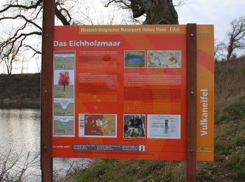
• eichholzmaar, steffeln, duppach, vulkangarten, geo, rundweg, wandern, vulakneifel, natur, geologie, maare, dreese, vu...
20 Angezeigte Touren bei 1306
Kostenlosegpshiking-Anwendung
Aktivitäten
Nahegelegene Regionen
- Donnersbergkreis
- Eifelkreis Bitburg-Prüm
- Gemeinsames deutsch-luxemburgisches Hoheitsgebiet
- Kaiserslautern
- Koblenz
- Landau in der Pfalz
- Landkreis Ahrweiler
- Landkreis Altenkirchen
- Landkreis Alzey-Worms
- Landkreis Bad Dürkheim
- Landkreis Bad Kreuznach
- Landkreis Bernkastel-Wittlich
- Landkreis Birkenfeld
- Landkreis Cochem-Zell
- Landkreis Germersheim
- Landkreis Kaiserslautern
- Landkreis Kusel
- Landkreis Mainz-Bingen
- Landkreis Mayen-Koblenz
- Landkreis Neuwied
- Landkreis Südliche Weinstraße
- Landkreis Trier-Saarburg
- Landkreis Vulkaneifel
- Ludwigshafen am Rhein
- Mainz
- Neustadt an der Weinstraße
- Pirmasens
- Rhein-Hunsrück-Kreis
- Rhein-Lahn-Kreis
- Rhein-Pfalz-Kreis
- Speyer
- Südwestpfalz
- Trier
- Westerwaldkreis
- Worms
- Zweibrücken