![](/images/other/stat-length.png)
- Touren
- Zu Fuß
- Germany
- Rheinland-Pfalz
- Landkreis Neuwied
Landkreis Neuwied, Rheinland-Pfalz, Zu Fuß: Die besten Touren, Trails, Trecks und Wanderungen
Landkreis Neuwied : Entdecken Sie die besten Touren : 62 zu fuß und 1 wandern. Alle diese Touren, Trails, Routen und Outdoor-Aktivitäten sind in unseren SityTrail-Apps für Smartphones und Tablets verfügbar.
Die besten Spuren (63)
![Tour Zu Fuß Puderbach - [B3] Burgweg 3 - Photo](https://media.geolcdn.com/t/350/260/bd3a678d-fa90-49ee-85ba-df82f5331819.jpeg&format=jpg&maxdim=2)
![Zu Fuß Zu Fuß](https://static1.geolcdn.com/sitytour/trail-icons/100.png)
Km
Zu Fuß
![](/images/other/stat-length.png)
![](https://static1.geolcdn.com/siteimages/upload/files/1508320355ic_sort_den_pos_24dp.png)
![](https://static1.geolcdn.com/siteimages/upload/files/1508320355ic_sort_den_neg_24dp.png)
![](https://static1.geolcdn.com/siteimages/upload/files/16400158638029165_repeat_loop_refresh_sync_direction_icon.png)
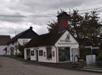
• Trail created by Verbandsgemeinde Puderbach. Symbol: Symbol "Burg" und Text "3" auf weißem Grund Website: https://...
![Tour Zu Fuß Puderbach - [B2] Burgweg 2 - Photo](https://media.geolcdn.com/t/350/260/bd3a678d-fa90-49ee-85ba-df82f5331819.jpeg&format=jpg&maxdim=2)
![Zu Fuß Zu Fuß](https://static1.geolcdn.com/sitytour/trail-icons/100.png)
Km
Zu Fuß
![](/images/other/stat-length.png)
![](https://static1.geolcdn.com/siteimages/upload/files/1508320355ic_sort_den_pos_24dp.png)
![](https://static1.geolcdn.com/siteimages/upload/files/1508320355ic_sort_den_neg_24dp.png)
![](https://static1.geolcdn.com/siteimages/upload/files/16400158638029165_repeat_loop_refresh_sync_direction_icon.png)
• Trail created by Verbandsgemeinde Puderbach. Symbol: Symbol "Burg" und Text "2" auf weißem Grund Website: https://...
![Tour Zu Fuß Puderbach - [B1] Burgweg 1 - Photo](https://media.geolcdn.com/t/350/260/bd3a678d-fa90-49ee-85ba-df82f5331819.jpeg&format=jpg&maxdim=2)
![Zu Fuß Zu Fuß](https://static1.geolcdn.com/sitytour/trail-icons/100.png)
Km
Zu Fuß
![](/images/other/stat-length.png)
![](https://static1.geolcdn.com/siteimages/upload/files/1508320355ic_sort_den_pos_24dp.png)
![](https://static1.geolcdn.com/siteimages/upload/files/1508320355ic_sort_den_neg_24dp.png)
![](https://static1.geolcdn.com/siteimages/upload/files/16400158638029165_repeat_loop_refresh_sync_direction_icon.png)
• Trail created by Verbandsgemeinde Puderbach. Symbol: Symbol "Burg" und Text "1" auf weißem Grund Website: https://...
![Tour Zu Fuß Neuwied - Rheinsteig-Zuweg Engers - Photo](https://media.geolcdn.com/t/350/260/7350b576-8a8a-4526-8ce1-c84a52f2df87.jpeg&format=jpg&maxdim=2)
![Zu Fuß Zu Fuß](https://static1.geolcdn.com/sitytour/trail-icons/100.png)
Km
Zu Fuß
![](/images/other/stat-length.png)
![](https://static1.geolcdn.com/siteimages/upload/files/1508320355ic_sort_den_pos_24dp.png)
![](https://static1.geolcdn.com/siteimages/upload/files/1508320355ic_sort_den_neg_24dp.png)
![](https://static1.geolcdn.com/siteimages/upload/files/16400158638029165_repeat_loop_refresh_sync_direction_icon.png)
• Trail created by Romantischer Rhein Tourismus GmbH. Symbol: Stilisiertes weißes R auf gelbem Grund
![Tour Zu Fuß Melsbach - Rheinsteig-Zuweg Melsbach - Photo](https://media.geolcdn.com/t/350/260/740e6915-a511-487c-b1ab-9d8095187dbd.jpeg&format=jpg&maxdim=2)
![Zu Fuß Zu Fuß](https://static1.geolcdn.com/sitytour/trail-icons/100.png)
Km
Zu Fuß
![](/images/other/stat-length.png)
![](https://static1.geolcdn.com/siteimages/upload/files/1508320355ic_sort_den_pos_24dp.png)
![](https://static1.geolcdn.com/siteimages/upload/files/1508320355ic_sort_den_neg_24dp.png)
![](https://static1.geolcdn.com/siteimages/upload/files/16400158638029165_repeat_loop_refresh_sync_direction_icon.png)
• Trail created by Romantischer Rhein Tourismus GmbH. Symbol: Stilisiertes weißes R auf gelbem Grund
![Tour Zu Fuß Steimel - [RM] Rotmilanwanderweg - Photo](https://media.geolcdn.com/t/350/260/bd3a678d-fa90-49ee-85ba-df82f5331819.jpeg&format=jpg&maxdim=2)
![Zu Fuß Zu Fuß](https://static1.geolcdn.com/sitytour/trail-icons/100.png)
Km
Zu Fuß
![](/images/other/stat-length.png)
![](https://static1.geolcdn.com/siteimages/upload/files/1508320355ic_sort_den_pos_24dp.png)
![](https://static1.geolcdn.com/siteimages/upload/files/1508320355ic_sort_den_neg_24dp.png)
![](https://static1.geolcdn.com/siteimages/upload/files/16400158638029165_repeat_loop_refresh_sync_direction_icon.png)
• Trail created by Verbandsgemeinde Puderbach. Symbol: Symbol "Rotmilan" auf weißem Grund Website: https://puderbach...
![Tour Zu Fuß Bruchhausen - Rotbäckchen Rundwanderweg - Photo](https://media.geolcdn.com/t/350/260/1dd5c4a7-c3a6-459c-9cef-b7e5315b6005.jpeg&format=jpg&maxdim=2)
![Zu Fuß Zu Fuß](https://static1.geolcdn.com/sitytour/trail-icons/100.png)
Km
Zu Fuß
![](/images/other/stat-length.png)
![](https://static1.geolcdn.com/siteimages/upload/files/1508320355ic_sort_den_pos_24dp.png)
![](https://static1.geolcdn.com/siteimages/upload/files/1508320355ic_sort_den_neg_24dp.png)
![](https://static1.geolcdn.com/siteimages/upload/files/16400158638029165_repeat_loop_refresh_sync_direction_icon.png)
• Trail created by Touristik & Gewerbe Unkel e.V.. Ausschilderung spärlich Symbol: Kindergesicht und Illustration "Un...
![Tour Zu Fuß Windhagen - [W2] Windhagener Weg - Photo](https://media.geolcdn.com/t/350/260/adef9696-6d08-4cbb-94cd-bba75114ff6a.jpeg&format=jpg&maxdim=2)
![Zu Fuß Zu Fuß](https://static1.geolcdn.com/sitytour/trail-icons/100.png)
Km
Zu Fuß
![](/images/other/stat-length.png)
![](https://static1.geolcdn.com/siteimages/upload/files/1508320355ic_sort_den_pos_24dp.png)
![](https://static1.geolcdn.com/siteimages/upload/files/1508320355ic_sort_den_neg_24dp.png)
![](https://static1.geolcdn.com/siteimages/upload/files/16400158638029165_repeat_loop_refresh_sync_direction_icon.png)
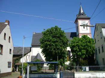
• Trail created by Verbandsgemeinde Asbach. Symbol: Weißer Text W2 auf rotem Grund
![Tour Zu Fuß Asbach - [A4] Mühlenweg - Photo](https://media.geolcdn.com/t/350/260/17f9fb3a-b4a7-45d7-a2b4-ea773ee9f1e5.jpeg&format=jpg&maxdim=2)
![Zu Fuß Zu Fuß](https://static1.geolcdn.com/sitytour/trail-icons/100.png)
Km
Zu Fuß
![](/images/other/stat-length.png)
![](https://static1.geolcdn.com/siteimages/upload/files/1508320355ic_sort_den_pos_24dp.png)
![](https://static1.geolcdn.com/siteimages/upload/files/1508320355ic_sort_den_neg_24dp.png)
![](https://static1.geolcdn.com/siteimages/upload/files/16400158638029165_repeat_loop_refresh_sync_direction_icon.png)
• Trail created by Verbandsgemeinde Asbach. Symbol: Weißer Text A4 auf rotem Grund
![Tour Zu Fuß Asbach - [A3] Kirchspielweg - Photo](https://media.geolcdn.com/t/350/260/17f9fb3a-b4a7-45d7-a2b4-ea773ee9f1e5.jpeg&format=jpg&maxdim=2)
![Zu Fuß Zu Fuß](https://static1.geolcdn.com/sitytour/trail-icons/100.png)
Km
Zu Fuß
![](/images/other/stat-length.png)
![](https://static1.geolcdn.com/siteimages/upload/files/1508320355ic_sort_den_pos_24dp.png)
![](https://static1.geolcdn.com/siteimages/upload/files/1508320355ic_sort_den_neg_24dp.png)
![](https://static1.geolcdn.com/siteimages/upload/files/16400158638029165_repeat_loop_refresh_sync_direction_icon.png)
• Trail created by Verbandsgemeinde Asbach. Symbol: Weißer Text A3 auf rotem Grund
![Tour Zu Fuß Asbach - [A2] Kapellenweg - Photo](https://media.geolcdn.com/t/350/260/cbe88fbf-390b-407f-8f63-05cd1398c451.jpeg&format=jpg&maxdim=2)
![Zu Fuß Zu Fuß](https://static1.geolcdn.com/sitytour/trail-icons/100.png)
Km
Zu Fuß
![](/images/other/stat-length.png)
![](https://static1.geolcdn.com/siteimages/upload/files/1508320355ic_sort_den_pos_24dp.png)
![](https://static1.geolcdn.com/siteimages/upload/files/1508320355ic_sort_den_neg_24dp.png)
![](https://static1.geolcdn.com/siteimages/upload/files/16400158638029165_repeat_loop_refresh_sync_direction_icon.png)
• Trail created by Verbandsgemeinde Asbach. Symbol: Weißer Text A2 auf rotem Grund
![Tour Zu Fuß Asbach - [A1] Basaltweg - Photo](https://media.geolcdn.com/t/350/260/17f9fb3a-b4a7-45d7-a2b4-ea773ee9f1e5.jpeg&format=jpg&maxdim=2)
![Zu Fuß Zu Fuß](https://static1.geolcdn.com/sitytour/trail-icons/100.png)
Km
Zu Fuß
![](/images/other/stat-length.png)
![](https://static1.geolcdn.com/siteimages/upload/files/1508320355ic_sort_den_pos_24dp.png)
![](https://static1.geolcdn.com/siteimages/upload/files/1508320355ic_sort_den_neg_24dp.png)
![](https://static1.geolcdn.com/siteimages/upload/files/16400158638029165_repeat_loop_refresh_sync_direction_icon.png)
• Trail created by Verbandsgemeinde Asbach. Symbol: Weißer Text A1 auf rotem Grund
![Tour Zu Fuß Oberhonnefeld-Gierend - Rundwanderweg Oberhobnnefeld 1 - Photo](https://media.geolcdn.com/t/350/260/2d677b68-54b9-424c-a1b5-5e7f7ae4617d.jpeg&format=jpg&maxdim=2)
![Zu Fuß Zu Fuß](https://static1.geolcdn.com/sitytour/trail-icons/100.png)
Km
Zu Fuß
![](/images/other/stat-length.png)
![](https://static1.geolcdn.com/siteimages/upload/files/1508320355ic_sort_den_pos_24dp.png)
![](https://static1.geolcdn.com/siteimages/upload/files/1508320355ic_sort_den_neg_24dp.png)
![](https://static1.geolcdn.com/siteimages/upload/files/16400158638029165_repeat_loop_refresh_sync_direction_icon.png)
• Symbol: Gelbe "Oh1" auf schwarzen, quadratischem Grund
![Tour Zu Fuß Hümmerich - Butterpfad - Photo](https://media.geolcdn.com/t/350/260/53665152-448a-4296-9aeb-c73b4f68d052.jpeg&format=jpg&maxdim=2)
![Zu Fuß Zu Fuß](https://static1.geolcdn.com/sitytour/trail-icons/100.png)
Km
Zu Fuß
![](/images/other/stat-length.png)
![](https://static1.geolcdn.com/siteimages/upload/files/1508320355ic_sort_den_pos_24dp.png)
![](https://static1.geolcdn.com/siteimages/upload/files/1508320355ic_sort_den_neg_24dp.png)
![](https://static1.geolcdn.com/siteimages/upload/files/16400158638029165_repeat_loop_refresh_sync_direction_icon.png)
• Symbol: Weißer Schriftzug "Butterpfad" auf rotem, recheckigen Grund
![Tour Zu Fuß Melsbach - Rundwanderweg Rengsdorf 4 - Photo](https://media.geolcdn.com/t/350/260/35427193-df66-4c2c-a81e-8a4f9be3dbd3.jpeg&format=jpg&maxdim=2)
![Zu Fuß Zu Fuß](https://static1.geolcdn.com/sitytour/trail-icons/100.png)
Km
Zu Fuß
![](/images/other/stat-length.png)
![](https://static1.geolcdn.com/siteimages/upload/files/1508320355ic_sort_den_pos_24dp.png)
![](https://static1.geolcdn.com/siteimages/upload/files/1508320355ic_sort_den_neg_24dp.png)
![](https://static1.geolcdn.com/siteimages/upload/files/16400158638029165_repeat_loop_refresh_sync_direction_icon.png)
• Trail created by Verbandsgemeinde Rengsdorf. Symbol: Gelbe "R4" auf schwarzem, quadratischem Grund
![Tour Zu Fuß Melsbach - Rundwanderweg Melsbach 1 - Photo](https://media.geolcdn.com/t/350/260/740e6915-a511-487c-b1ab-9d8095187dbd.jpeg&format=jpg&maxdim=2)
![Zu Fuß Zu Fuß](https://static1.geolcdn.com/sitytour/trail-icons/100.png)
Km
Zu Fuß
![](/images/other/stat-length.png)
![](https://static1.geolcdn.com/siteimages/upload/files/1508320355ic_sort_den_pos_24dp.png)
![](https://static1.geolcdn.com/siteimages/upload/files/1508320355ic_sort_den_neg_24dp.png)
![](https://static1.geolcdn.com/siteimages/upload/files/16400158638029165_repeat_loop_refresh_sync_direction_icon.png)
• Trail created by Verbandsgemeinde Rengsdorf. Symbol: Gelbe "Me1" auf schwarzem, quadratischem Grund
![Tour Zu Fuß Oberhonnefeld-Gierend - Rundwanderweg Gierend 1 - Photo](https://media.geolcdn.com/t/350/260/2d677b68-54b9-424c-a1b5-5e7f7ae4617d.jpeg&format=jpg&maxdim=2)
![Zu Fuß Zu Fuß](https://static1.geolcdn.com/sitytour/trail-icons/100.png)
Km
Zu Fuß
![](/images/other/stat-length.png)
![](https://static1.geolcdn.com/siteimages/upload/files/1508320355ic_sort_den_pos_24dp.png)
![](https://static1.geolcdn.com/siteimages/upload/files/1508320355ic_sort_den_neg_24dp.png)
![](https://static1.geolcdn.com/siteimages/upload/files/16400158638029165_repeat_loop_refresh_sync_direction_icon.png)
• Symbol: Gelbes "G1" auf schwarzen, quadratischem Grund
![Tour Zu Fuß Buchholz - [B2] Dreiherrensteinweg - Photo](https://media.geolcdn.com/t/350/260/aecd4644-6921-4b4a-8659-a9cc70680b9b.jpeg&format=jpg&maxdim=2)
![Zu Fuß Zu Fuß](https://static1.geolcdn.com/sitytour/trail-icons/100.png)
Km
Zu Fuß
![](/images/other/stat-length.png)
![](https://static1.geolcdn.com/siteimages/upload/files/1508320355ic_sort_den_pos_24dp.png)
![](https://static1.geolcdn.com/siteimages/upload/files/1508320355ic_sort_den_neg_24dp.png)
![](https://static1.geolcdn.com/siteimages/upload/files/16400158638029165_repeat_loop_refresh_sync_direction_icon.png)
• Trail created by Verbandsgemeinde Asbach. Symbol: weißer Text B2 auf rotem Grund Website: http://www.wanderwegweis...
![Tour Zu Fuß Buchholz - [B3] Silberbergweg - Photo](https://media.geolcdn.com/t/350/260/26598f31-7aa1-441d-a048-772ec0888cec.jpeg&format=jpg&maxdim=2)
![Zu Fuß Zu Fuß](https://static1.geolcdn.com/sitytour/trail-icons/100.png)
Km
Zu Fuß
![](/images/other/stat-length.png)
![](https://static1.geolcdn.com/siteimages/upload/files/1508320355ic_sort_den_pos_24dp.png)
![](https://static1.geolcdn.com/siteimages/upload/files/1508320355ic_sort_den_neg_24dp.png)
![](https://static1.geolcdn.com/siteimages/upload/files/16400158638029165_repeat_loop_refresh_sync_direction_icon.png)
• Buchholz, im schönen Asbacher Land gelegen, ist Ausgangspunkt zu dieser abwechslungsreichen Wanderung. An der Kirche ...
![Tour Zu Fuß Breitscheid - Rundwanderweg Roßbach 1 - Photo](https://media.geolcdn.com/t/350/260/f2c11825-d560-4b0a-bc8e-3db9a2b40c70.jpeg&format=jpg&maxdim=2)
![Zu Fuß Zu Fuß](https://static1.geolcdn.com/sitytour/trail-icons/100.png)
Km
Zu Fuß
![](/images/other/stat-length.png)
![](https://static1.geolcdn.com/siteimages/upload/files/1508320355ic_sort_den_pos_24dp.png)
![](https://static1.geolcdn.com/siteimages/upload/files/1508320355ic_sort_den_neg_24dp.png)
![](https://static1.geolcdn.com/siteimages/upload/files/16400158638029165_repeat_loop_refresh_sync_direction_icon.png)
• Symbol: Markierung schwarzer Hintergrund, gelbe Zahl
20 Angezeigte Touren bei 63
Kostenlosegpshiking-Anwendung
Aktivitäten
Nahegelegene Regionen
- Asbach
- Bad Hönningen
- Breitscheid
- Bruchhausen
- Buchholz
- Dattenberg
- Hümmerich
- Kasbach-Ohlenberg
- Leutesdorf
- Linz am Rhein
- Melsbach
- Neustadt (Wied)
- Neuwied
- Oberhonnefeld-Gierend
- Oberraden
- Ockenfels
- Puderbach
- Rengsdorf
- Rheinbreitbach
- Rheinbrohl
- Roßbach
- Rüscheid
- Sankt Katharinen
- Steimel
- Straßenhaus
- Thalhausen
- Vettelschoß
- Waldbreitbach
- Windhagen