![](/images/other/stat-length.png)
Landkreis Miesbach, Bayern, Zu Fuß: Die besten Touren, Trails, Trecks und Wanderungen
Landkreis Miesbach : Entdecken Sie die besten Touren : 67 zu fuß. Alle diese Touren, Trails, Routen und Outdoor-Aktivitäten sind in unseren SityTrail-Apps für Smartphones und Tablets verfügbar.
Die besten Spuren (67)
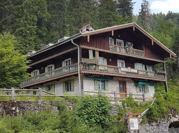
![Tour Zu Fuß Rottach-Egern - Valepp-Schinder - Photo](https://media.geolcdn.com/t/350/260/1e21333e-a75f-43a7-8f43-21fc4f91f731.jpeg&format=jpg&maxdim=2)
![Zu Fuß Zu Fuß](https://static1.geolcdn.com/sitytour/trail-icons/100.png)
Km
Zu Fuß
![](/images/other/stat-length.png)
![](https://static1.geolcdn.com/siteimages/upload/files/1508320355ic_sort_den_pos_24dp.png)
![](https://static1.geolcdn.com/siteimages/upload/files/1508320355ic_sort_den_neg_24dp.png)
![](https://static1.geolcdn.com/siteimages/upload/files/16400158638029165_repeat_loop_refresh_sync_direction_icon.png)
• Trail created by DAV Sektion Bergbund Hausham.
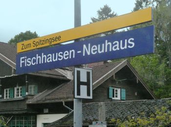
![Tour Zu Fuß Schliersee - Neuhaus - Auracher Köpferl - Aurach - Photo](https://media.geolcdn.com/t/350/260/fb074a8d-a623-442c-b12f-45e61935f30c.jpeg&format=jpg&maxdim=2)
![Zu Fuß Zu Fuß](https://static1.geolcdn.com/sitytour/trail-icons/100.png)
Km
Zu Fuß
![](/images/other/stat-length.png)
![](https://static1.geolcdn.com/siteimages/upload/files/1508320355ic_sort_den_pos_24dp.png)
![](https://static1.geolcdn.com/siteimages/upload/files/1508320355ic_sort_den_neg_24dp.png)
![](https://static1.geolcdn.com/siteimages/upload/files/16400158638029165_repeat_loop_refresh_sync_direction_icon.png)
• Trail created by Markt Schliersee. Symbol: Gelbe Schilder mit schwarzer Schrift
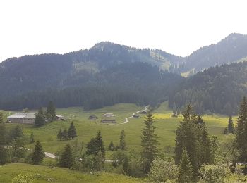
![Tour Zu Fuß Schliersee - Valepper-Almen-Rundweg - Photo](https://media.geolcdn.com/t/350/260/0aedb222-a903-4819-bec5-52a01ca11ec5.jpeg&format=jpg&maxdim=2)
![Zu Fuß Zu Fuß](https://static1.geolcdn.com/sitytour/trail-icons/100.png)
Km
Zu Fuß
![](/images/other/stat-length.png)
![](https://static1.geolcdn.com/siteimages/upload/files/1508320355ic_sort_den_pos_24dp.png)
![](https://static1.geolcdn.com/siteimages/upload/files/1508320355ic_sort_den_neg_24dp.png)
![](https://static1.geolcdn.com/siteimages/upload/files/16400158638029165_repeat_loop_refresh_sync_direction_icon.png)
• Trail created by Markt Schliersee.
![Tour Zu Fuß Valley - Mühltal im Mangfalltal - Photo](https://media.geolcdn.com/t/350/260/00ea52a4-6092-426e-b5fc-94c5eff7c8d2.jpeg&format=jpg&maxdim=2)
![Zu Fuß Zu Fuß](https://static1.geolcdn.com/sitytour/trail-icons/100.png)
Km
Zu Fuß
![](/images/other/stat-length.png)
![](https://static1.geolcdn.com/siteimages/upload/files/1508320355ic_sort_den_pos_24dp.png)
![](https://static1.geolcdn.com/siteimages/upload/files/1508320355ic_sort_den_neg_24dp.png)
![](https://static1.geolcdn.com/siteimages/upload/files/16400158638029165_repeat_loop_refresh_sync_direction_icon.png)
• Trail created by Gemeinde Valley.
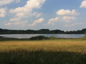
![Tour Zu Fuß Weyarn - Seerundweg - Photo](https://media.geolcdn.com/t/350/260/bdfac741-40a5-4396-9cb0-e3a71327328a.jpeg&format=jpg&maxdim=2)
![Zu Fuß Zu Fuß](https://static1.geolcdn.com/sitytour/trail-icons/100.png)
Km
Zu Fuß
![](/images/other/stat-length.png)
![](https://static1.geolcdn.com/siteimages/upload/files/1508320355ic_sort_den_pos_24dp.png)
![](https://static1.geolcdn.com/siteimages/upload/files/1508320355ic_sort_den_neg_24dp.png)
![](https://static1.geolcdn.com/siteimages/upload/files/16400158638029165_repeat_loop_refresh_sync_direction_icon.png)
• Trail created by Gemeinde Weyarn. Symbol: Gelbe Wegweisschilder mit schwarzer Schrift/Zahl oder blaue Icons mit R-Bu...
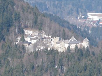
![Tour Zu Fuß Rottach-Egern - Wanderweg 618 - Wallberg - Photo](https://media.geolcdn.com/t/350/260/25da5e27-9c8e-4414-b3a4-f0acaa0c13b1.jpeg&format=jpg&maxdim=2)
![Zu Fuß Zu Fuß](https://static1.geolcdn.com/sitytour/trail-icons/100.png)
Km
Zu Fuß
![](/images/other/stat-length.png)
![](https://static1.geolcdn.com/siteimages/upload/files/1508320355ic_sort_den_pos_24dp.png)
![](https://static1.geolcdn.com/siteimages/upload/files/1508320355ic_sort_den_neg_24dp.png)
![](https://static1.geolcdn.com/siteimages/upload/files/16400158638029165_repeat_loop_refresh_sync_direction_icon.png)
• Trail created by Gemeinde Rottach-Egern.
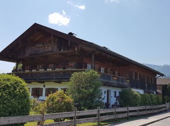
![Tour Zu Fuß Kreuth - Wanderweg 618a - Wallberg - Photo](https://media.geolcdn.com/t/350/260/826cb95e-2173-4c86-866e-54acda3a68b2.jpeg&format=jpg&maxdim=2)
![Zu Fuß Zu Fuß](https://static1.geolcdn.com/sitytour/trail-icons/100.png)
Km
Zu Fuß
![](/images/other/stat-length.png)
![](https://static1.geolcdn.com/siteimages/upload/files/1508320355ic_sort_den_pos_24dp.png)
![](https://static1.geolcdn.com/siteimages/upload/files/1508320355ic_sort_den_neg_24dp.png)
![](https://static1.geolcdn.com/siteimages/upload/files/16400158638029165_repeat_loop_refresh_sync_direction_icon.png)
• Trail created by Gemeinde Rottach-Egern.
![Tour Zu Fuß Schliersee - Wanderweg W24 - Photo](https://media.geolcdn.com/t/350/260/1e21333e-a75f-43a7-8f43-21fc4f91f731.jpeg&format=jpg&maxdim=2)
![Zu Fuß Zu Fuß](https://static1.geolcdn.com/sitytour/trail-icons/100.png)
Km
Zu Fuß
![](/images/other/stat-length.png)
![](https://static1.geolcdn.com/siteimages/upload/files/1508320355ic_sort_den_pos_24dp.png)
![](https://static1.geolcdn.com/siteimages/upload/files/1508320355ic_sort_den_neg_24dp.png)
![](https://static1.geolcdn.com/siteimages/upload/files/16400158638029165_repeat_loop_refresh_sync_direction_icon.png)
• Trail created by Markt Schliersee. Symbol: Gelbe Schilder mit schwarzer Schrift
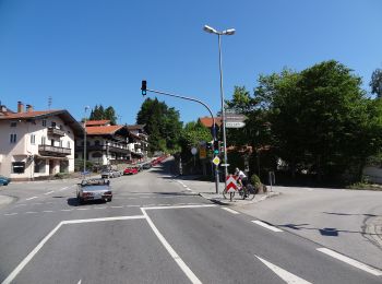
![Tour Zu Fuß Tegernsee - Wanderweg 549a - Gmund am Tegernsee Richtung Miesbach - Photo](https://media.geolcdn.com/t/350/260/d7fc3737-3890-4f3c-bb7f-7e88cb66a8e0.jpeg&format=jpg&maxdim=2)
![Zu Fuß Zu Fuß](https://static1.geolcdn.com/sitytour/trail-icons/100.png)
Km
Zu Fuß
![](/images/other/stat-length.png)
![](https://static1.geolcdn.com/siteimages/upload/files/1508320355ic_sort_den_pos_24dp.png)
![](https://static1.geolcdn.com/siteimages/upload/files/1508320355ic_sort_den_neg_24dp.png)
![](https://static1.geolcdn.com/siteimages/upload/files/16400158638029165_repeat_loop_refresh_sync_direction_icon.png)
• Trail created by Alpenregion Tegernsee Schliersee. Symbol: Gelbe Schilder mit schwarzer Schrift
![Tour Zu Fuß Tegernsee - Wanderweg 549 - Gmund am Tegernsee Richtung Miesbach - Photo](https://media.geolcdn.com/t/350/260/d7fc3737-3890-4f3c-bb7f-7e88cb66a8e0.jpeg&format=jpg&maxdim=2)
![Zu Fuß Zu Fuß](https://static1.geolcdn.com/sitytour/trail-icons/100.png)
Km
Zu Fuß
![](/images/other/stat-length.png)
![](https://static1.geolcdn.com/siteimages/upload/files/1508320355ic_sort_den_pos_24dp.png)
![](https://static1.geolcdn.com/siteimages/upload/files/1508320355ic_sort_den_neg_24dp.png)
![](https://static1.geolcdn.com/siteimages/upload/files/16400158638029165_repeat_loop_refresh_sync_direction_icon.png)
• Trail created by Alpenregion Tegernsee Schliersee. Symbol: Gelbe Schilder mit schwarzer Schrift
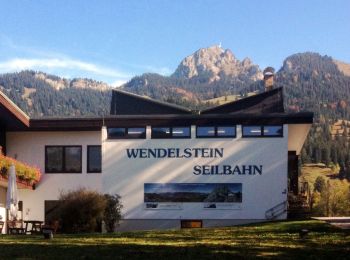
![Tour Zu Fuß Bayrischzell - Sparkasse - Trail - Mieseben-Runde - Photo](https://media.geolcdn.com/t/350/260/bf078132-00f4-4233-9faa-ea3a148c09c2.jpeg&format=jpg&maxdim=2)
![Zu Fuß Zu Fuß](https://static1.geolcdn.com/sitytour/trail-icons/100.png)
Km
Zu Fuß
![](/images/other/stat-length.png)
![](https://static1.geolcdn.com/siteimages/upload/files/1508320355ic_sort_den_pos_24dp.png)
![](https://static1.geolcdn.com/siteimages/upload/files/1508320355ic_sort_den_neg_24dp.png)
![](https://static1.geolcdn.com/siteimages/upload/files/16400158638029165_repeat_loop_refresh_sync_direction_icon.png)
• Trail created by DSV nordic aktiv ZENTRUM. Symbol: Rotes Schild mit weißem Pfeil
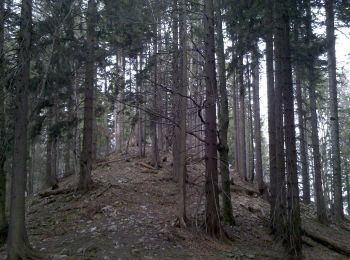
![Tour Zu Fuß Miesbach - Wanderweg 550a - Wasserschloß/Miesbach - Photo](https://media.geolcdn.com/t/350/260/f1db332a-c38f-4f5d-8054-541229ed465c.jpeg&format=jpg&maxdim=2)
![Zu Fuß Zu Fuß](https://static1.geolcdn.com/sitytour/trail-icons/100.png)
Km
Zu Fuß
![](/images/other/stat-length.png)
![](https://static1.geolcdn.com/siteimages/upload/files/1508320355ic_sort_den_pos_24dp.png)
![](https://static1.geolcdn.com/siteimages/upload/files/1508320355ic_sort_den_neg_24dp.png)
![](https://static1.geolcdn.com/siteimages/upload/files/16400158638029165_repeat_loop_refresh_sync_direction_icon.png)
• Trail created by Alpenregion Tegernsee Schliersee. Symbol: Gelbe Schilder mit schwarzer Schrift
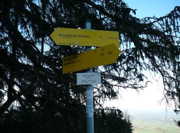
![Tour Zu Fuß Fischbachau - Steingrabner - Alm - Wirtsalm - Bad Feilnbach - Photo](https://media.geolcdn.com/t/350/260/f3ffc65e-38c1-4155-aa30-502888f8fa23.jpeg&format=jpg&maxdim=2)
![Zu Fuß Zu Fuß](https://static1.geolcdn.com/sitytour/trail-icons/100.png)
Km
Zu Fuß
![](/images/other/stat-length.png)
![](https://static1.geolcdn.com/siteimages/upload/files/1508320355ic_sort_den_pos_24dp.png)
![](https://static1.geolcdn.com/siteimages/upload/files/1508320355ic_sort_den_neg_24dp.png)
![](https://static1.geolcdn.com/siteimages/upload/files/16400158638029165_repeat_loop_refresh_sync_direction_icon.png)
• Symbol: Weiße Schilder mit schwarzer Aufschrift
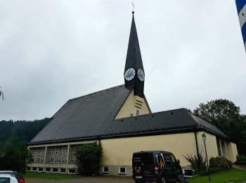
![Tour Zu Fuß Fischbachau - Wanderweg 673b -Wörnsmühl/Schliersee - Photo](https://media.geolcdn.com/t/350/260/a93f29ee-6408-4e8c-a5e4-34d1b0a58ecf.jpeg&format=jpg&maxdim=2)
![Zu Fuß Zu Fuß](https://static1.geolcdn.com/sitytour/trail-icons/100.png)
Km
Zu Fuß
![](/images/other/stat-length.png)
![](https://static1.geolcdn.com/siteimages/upload/files/1508320355ic_sort_den_pos_24dp.png)
![](https://static1.geolcdn.com/siteimages/upload/files/1508320355ic_sort_den_neg_24dp.png)
![](https://static1.geolcdn.com/siteimages/upload/files/16400158638029165_repeat_loop_refresh_sync_direction_icon.png)
• Trail created by Gemeinde Fischbachau;Markt Schliersee. Symbol: Gelbe Schilder mit schwarzer Schrift
![Tour Zu Fuß Hausham - Wanderweg 515 - Hausham/Gmund am Tegernsee - Photo](https://media.geolcdn.com/t/350/260/58e20c21-2cfb-4994-973d-cda5a696c198.jpeg&format=jpg&maxdim=2)
![Zu Fuß Zu Fuß](https://static1.geolcdn.com/sitytour/trail-icons/100.png)
Km
Zu Fuß
![](/images/other/stat-length.png)
![](https://static1.geolcdn.com/siteimages/upload/files/1508320355ic_sort_den_pos_24dp.png)
![](https://static1.geolcdn.com/siteimages/upload/files/1508320355ic_sort_den_neg_24dp.png)
![](https://static1.geolcdn.com/siteimages/upload/files/16400158638029165_repeat_loop_refresh_sync_direction_icon.png)
• Trail created by Gemeinde Hausham. Symbol: Gelbe Schilder mit schwarzer Schrift
![Tour Zu Fuß Miesbach - Wanderweg 570 - Miesbach/Irschenberg - Photo](https://media.geolcdn.com/t/350/260/f1db332a-c38f-4f5d-8054-541229ed465c.jpeg&format=jpg&maxdim=2)
![Zu Fuß Zu Fuß](https://static1.geolcdn.com/sitytour/trail-icons/100.png)
Km
Zu Fuß
![](/images/other/stat-length.png)
![](https://static1.geolcdn.com/siteimages/upload/files/1508320355ic_sort_den_pos_24dp.png)
![](https://static1.geolcdn.com/siteimages/upload/files/1508320355ic_sort_den_neg_24dp.png)
![](https://static1.geolcdn.com/siteimages/upload/files/16400158638029165_repeat_loop_refresh_sync_direction_icon.png)
• Trail created by Stadt Miesbach; Gemeinde Irschenberg. Symbol: Gelbe Schilder mit schwarzer Schrift
![Tour Zu Fuß Schliersee - Wanderweg 670a - Schliersee - Photo](https://media.geolcdn.com/t/350/260/fb074a8d-a623-442c-b12f-45e61935f30c.jpeg&format=jpg&maxdim=2)
![Zu Fuß Zu Fuß](https://static1.geolcdn.com/sitytour/trail-icons/100.png)
Km
Zu Fuß
![](/images/other/stat-length.png)
![](https://static1.geolcdn.com/siteimages/upload/files/1508320355ic_sort_den_pos_24dp.png)
![](https://static1.geolcdn.com/siteimages/upload/files/1508320355ic_sort_den_neg_24dp.png)
![](https://static1.geolcdn.com/siteimages/upload/files/16400158638029165_repeat_loop_refresh_sync_direction_icon.png)
• Trail created by Markt Schliersee. Symbol: Gelbe Schilder mit schwarzer Schrift
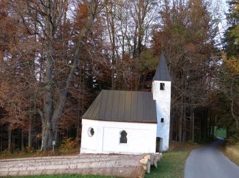
![Tour Zu Fuß Fischbachau - Hofkapellenwanderung - Photo](https://media.geolcdn.com/t/350/260/d2dd5854-a654-4ca8-82d7-b7c453b78928.jpeg&format=jpg&maxdim=2)
![Zu Fuß Zu Fuß](https://static1.geolcdn.com/sitytour/trail-icons/100.png)
Km
Zu Fuß
![](/images/other/stat-length.png)
![](https://static1.geolcdn.com/siteimages/upload/files/1508320355ic_sort_den_pos_24dp.png)
![](https://static1.geolcdn.com/siteimages/upload/files/1508320355ic_sort_den_neg_24dp.png)
![](https://static1.geolcdn.com/siteimages/upload/files/16400158638029165_repeat_loop_refresh_sync_direction_icon.png)
• Trail created by Gemeinde Fischbachau. Symbol: Gelbe Wegweisschilder mit schwarzer Schrift und weiße Informationstaf...
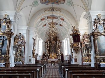
![Tour Zu Fuß Schliersee - Wanderweg 671 - Schliersee/Fischbachau - Photo](https://media.geolcdn.com/t/350/260/89eb604e-9076-4dcf-a568-9b328d8b049b.jpeg&format=jpg&maxdim=2)
![Zu Fuß Zu Fuß](https://static1.geolcdn.com/sitytour/trail-icons/100.png)
Km
Zu Fuß
![](/images/other/stat-length.png)
![](https://static1.geolcdn.com/siteimages/upload/files/1508320355ic_sort_den_pos_24dp.png)
![](https://static1.geolcdn.com/siteimages/upload/files/1508320355ic_sort_den_neg_24dp.png)
![](https://static1.geolcdn.com/siteimages/upload/files/16400158638029165_repeat_loop_refresh_sync_direction_icon.png)
• Trail created by Markt Schliersee. Symbol: Gelbe Schilder mit schwarzer Schrift
![Tour Zu Fuß Miesbach - Wanderweg 550 - Wasserschloß/Miesbach/Hausham/Schliersee - Photo](https://media.geolcdn.com/t/350/260/f1db332a-c38f-4f5d-8054-541229ed465c.jpeg&format=jpg&maxdim=2)
![Zu Fuß Zu Fuß](https://static1.geolcdn.com/sitytour/trail-icons/100.png)
Km
Zu Fuß
![](/images/other/stat-length.png)
![](https://static1.geolcdn.com/siteimages/upload/files/1508320355ic_sort_den_pos_24dp.png)
![](https://static1.geolcdn.com/siteimages/upload/files/1508320355ic_sort_den_neg_24dp.png)
![](https://static1.geolcdn.com/siteimages/upload/files/16400158638029165_repeat_loop_refresh_sync_direction_icon.png)
• Trail created by Alpenregion Tegernsee Schliersee. Symbol: Gelbe Schilder mit schwarzer Schrift
20 Angezeigte Touren bei 67
Kostenlosegpshiking-Anwendung