


3 km | 5,9 km-effort
Fischbachau : Entdecken Sie die besten Touren : 16 zu fuß. Alle diese Touren, Trails, Routen und Outdoor-Aktivitäten sind in unseren SityTrail-Apps für Smartphones und Tablets verfügbar.
Zu Fuß


• Symbol: Weiße Schilder mit schwarzer Aufschrift
Zu Fuß
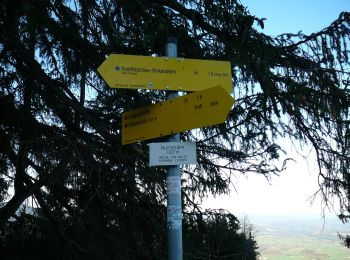
• Trail created by Gemeinde Fischbachau;Markt Schliersee. Symbol: Gelbe Schilder mit schwarzer Schrift
Zu Fuß
• Trail created by Gemeinde Fischbachau. Symbol: Gelbe Wegweisschilder mit schwarzer Schrift und weiße Informationstaf...
Zu Fuß
• Trail created by Gemeinde Fischbachau. Symbol: Gelbe Schilder mit schwarzer Schrift
Zu Fuß
• Trail created by Gemeinde Fischbachau;Markt Schliersee. Symbol: Gelbe Schilder mit schwarzer Schrift
Zu Fuß
• Trail created by Gemeinde Fischbachau. Symbol: Gelbe Schilder mit schwarzer Schrift
Zu Fuß
• Trail created by Gemeinde Fischbachau. Symbol: Gelbe Schilder mit schwarzer Schrift
Zu Fuß
• Trail created by Alpenregion Tegernsee Schliersee. Symbol: Gelbe Schilder mit schwarzer Schrift
Zu Fuß
• Trail created by Gemeinde Bayrischzell; Gemeinde Fischbachau; Markt Schliersee. Symbol: Gelbe Schilder mit schwarzer...
Zu Fuß
• Trail created by Gemeinde Fischbachau. Symbol: Gelbe Schilder mit schwarzer Schrift
Zu Fuß
• Trail created by Gemeinde Fischbachau. Symbol: Gelbe Schilder mit schwarzer Schrift
Zu Fuß
• Trail created by Gemeinde Fischbachau. Symbol: Gelbe Schilder mit schwarzer Schrift
Zu Fuß
• Trail created by Gemeinde Fischbachau. Symbol: Gelbe Schilder mit schwarzer Schrift
Zu Fuß
• Trail created by Gemeinde Fischbachau. Symbol: Gelbe Schilder mit schwarzer Schrift
Zu Fuß
• Trail created by Gemeinde Fischbachau. Symbol: Gelbe Schilder mit schwarzer Schrift

Zu Fuß
• Trail created by Gemeinde Fischbachau. Symbol: Gelbe Schilder mit schwarzer Schrift
16 Angezeigte Touren bei 16
Kostenlosegpshiking-Anwendung
 SityTrail
IGN / Geografische Institute
SityTrail World
Die Welt öffnet sich für Sie