


What are the different buttons on the map screen for?
In the mobile app, the map screen has a number of features. Here are the main ones.
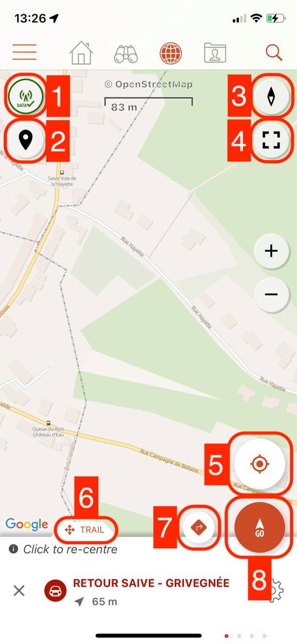
- Restrict to the display of offline mapsThis button is not available on the SityTrail World app.
- Display or not the markers on the map(points of interest and media, photos, etc.) - Visible only if a trail is open or a recording is in progress
- Switch to 2D/3D/view or North View
- Enable/disable full screen mode
- Enable/disable GPS tracking on the map 3 statuses: Tracking off/Tracking on/Compass orientation.
A fourth state unlocks when you start to move. The compass orientation then becomes the orientation in the walking direction - Scrolling lower panelThis panel scrolls from left to right and from bottom to top to display the various screens: Following an open trail, GPS values, Trail recording, Elevation.
- Secondary action(s)Depending on the screen selected in the scrolling bottom panel (see point 6), this button allows you to trigger an action in relation to the chosen screen (e.g. route to the trail, add a photo, etc.)
- Launch the actionDepending on the screen selected in the scrolling bottom panel (see previous point) this button triggers the main action of the chosen screen (e.g. start recording, start tracking, etc.)
Laatste wijziging: 2024-05-10 12:48:01.480284