


25 km | 31 km-effort
Doische : découvrez les meilleures randonnées : 174 pédestres, 21 à vélo ou VTT et 2 parcours équestres. Tous ces circuits, parcours, itinéraires et activités en plein air sont disponibles dans nos applications SityTrail pour smartphones et tablettes.
Marche


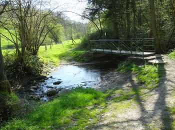
• Soulme – Hermeton-sur-Meuse – Gochenée – Vodelée – Soulme La vallée de l’Hermeton est restée bien longtemps une bell...

Marche
• Soulme – Hermeton-sur-Meuse – Gochenée – Vodelée – Soulme La vallée de l’Hermeton est restée bien longtemps une bell...
Marche
• Details sur TraceGPS.com http://www.tracegps.com/fr/parcours/circuit5096.htm
Marche
• Le village de VODELÉE fut, dans la région, un haut lieu de l'exploitation du marbre en raison de la présence de cinq ...
Marche
• Jolie balade transfrontalière au départ du village de Doische en province de Namur vers le village de Foisches situé ...
Marche
• Jolie balade en Calestienne reliant le village de Vaucelles dans l'entité de Doische en Belgique au village Français ...
Marche
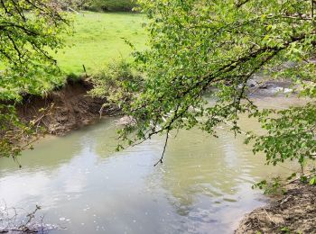
• Très belle balade dans la pittoresque et sauvage vallée de l’Hermeton mais attention cette balade est consseiller aux...
Marche
• 🌳❤️ 🅿️ Départ et Parking: Rue Sainte-Colombes, 5680 Doische, Belgique Coordonnées GPS : 9F265PPP+RW ▶️ Suivre la b...
Marche
• Très jolie marche Adeps dans la pittoresque vallée de l'Hermeton au départ du village de Gochenée dans l'entité de Do...
A pied
• Randonnée créée par Pays des Lacs. Cette promenade vous emmène au cœur du village de Soulme, un des Plus Beaux Vi...
Marche
• Balade proposée par l'office du tourisme de Doische au départ du village de Romerée.

Marche
• Balade proposée par l'office du tourisme de Doiche Cette promenade vous emmène par bois et campagne à la découverte d...
Marche
• Cette promenade vous est proposée par l'office du tourisme de Doische. La balade balisée d'un rectangle rouge vous do...

A pied
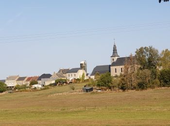
• Doische est un village d'Entre-Sambre-et-Meuse situé en province de Namur. S’étendant à la fois sur les « tiennes » c...

A pied
• Jolie randonnée plongeant dans les bois le long de l'hermeton
Marche
• Pittoresque balade dans la merveilleuse vallée de l'Hermeton au départ du village de Soulme jusqu'au village de Goche...
Marche
• Départ: Eglise de Soulme Attention: Passage avec des cordes au km6.4 et km7.8. Peut être glissant par temps de pluie.
V.T.T.
• Randonnée créée par Pays des Lacs. Site web: https://organismes.tourismewallonie.be/details/LOD-A0-002V-0J9O&type=8/
A pied
• Randonnée créée par Pays des Lacs. Dans un écrin de nature entre rivières, prairies et forêts, cette promenade re...

A pied
• Randonnée créée par Pays des Lacs. Au départ de l’église Sainte-Colombe de Soulme, cette courte promenade travers...
20 randonnées affichées sur 204
Application GPS de randonnée GRATUITE
 SityTrail
IGN / Instituts géographiques
SityTrail World
Le monde est à vous