amiral13

GUIDE Offline

Trails

Trail Walking Cervières - pic de Rochebrune - Photo
Walking
GUIDE
amiral13

Walking

Very difficult
Cervières, Provence-Alpes-Côte d'Azur, Hautes-Alpes, France
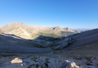
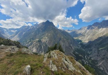
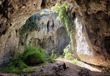
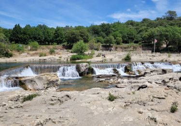
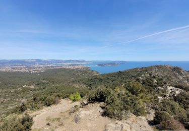
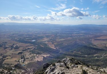
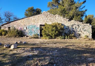
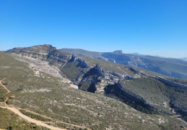
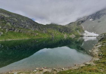
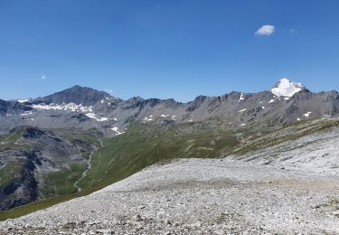
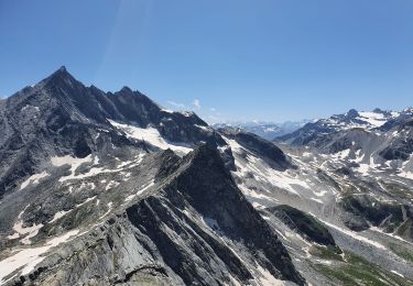
10.8 km | 26 km-effort
8h 10min
Yes
Trail Walking Vallouise-Pelvoux - la blanche et le belvédère des trois refuges - Photo
Walking
GUIDE
amiral13

Walking

Medium
Vallouise-Pelvoux, Provence-Alpes-Côte d'Azur, Hautes-Alpes, France
14.2 km | 33 km-effort
8h 47min
Yes
Trail Walking La Roche-de-Rame - Le Pic du haut Mouriare et le lac de l'Ascension - Photo
Walking
GUIDE
amiral13

Walking

Very difficult
La Roche-de-Rame, Provence-Alpes-Côte d'Azur, Hautes-Alpes, France
17.3 km | 34 km-effort
8h 20min
Yes
Trail Walking Valloire - le grand Galibier par le plan lachat - Photo
Walking
GUIDE
amiral13

Walking

Difficult
Valloire, Auvergne-Rhône-Alpes, Savoy, France
19.1 km | 36 km-effort
5h 50min
Yes
Trail Walking Méjannes-le-Clap - grotte Aven de Peyre haute - Photo
Walking
GUIDE
amiral13

Walking

Very easy
(1)
Méjannes-le-Clap, Occitania, Gard, France
3.6 km | 4.6 km-effort
1h 13min
Yes
Trail Walking La Roque-sur-Cèze - les cascades du Sautadet - Photo
Walking
GUIDE
amiral13

Walking

Easy
La Roque-sur-Cèze, Occitania, Gard, France
8.6 km | 12.3 km-effort
2h 39min
Yes
Trail Walking La Seyne-sur-Mer - Cap Sicié et Notre Dame du mai - Photo
Walking
GUIDE
amiral13

Walking

Difficult
La Seyne-sur-Mer, Provence-Alpes-Côte d'Azur, Var, France
6.6 km | 13.6 km-effort
4h 5min
Yes
Trail Walking Vauvenargues - le pic des mouches et la citadelle - Photo
Walking
GUIDE
amiral13

Walking

Easy
Vauvenargues, Provence-Alpes-Côte d'Azur, Bouches-du-Rhône, France
11.4 km | 18.3 km-effort
3h 53min
Yes
Trail Walking Peynier - le Garri - Photo
Walking
GUIDE
amiral13

Walking

Easy
(1)
Peynier, Provence-Alpes-Côte d'Azur, Bouches-du-Rhône, France
8.4 km | 10.9 km-effort
2h 8min
Yes
Trail Walking Allauch - les trois têtes - Photo
Walking
GUIDE
amiral13

Walking

Medium
Allauch, Provence-Alpes-Côte d'Azur, Bouches-du-Rhône, France
11.8 km | 19.6 km-effort
4h 38min
Yes
Trail Walking Le Rove - de Niolon à l'Erévine - Photo
Walking
GUIDE
amiral13

Walking

Easy
(1)
Le Rove, Provence-Alpes-Côte d'Azur, Bouches-du-Rhône, France
7.3 km | 11.1 km-effort
2h 47min
Yes
Trail Walking Réallon - SityTrail - 2556786 - aiguilles-de-chabriere - Photo
Walking
GUIDE
amiral13

Walking

Difficult
Réallon, Provence-Alpes-Côte d'Azur, Hautes-Alpes, France
11.8 km | 23 km-effort
6h 0min
Yes
Trail Walking Crots - SityTrail - 2251353 - morgon-par-le-grand-clot - Photo
Walking
GUIDE
amiral13

Walking

Medium
Crots, Provence-Alpes-Côte d'Azur, Hautes-Alpes, France
11.8 km | 22 km-effort
5h 30min
Yes
Trail Walking Val-d'Isère - Lac, col et pointe de la Bailletaz - Photo
Walking
GUIDE
amiral13

Walking

Difficult
Val-d'Isère, Auvergne-Rhône-Alpes, Savoy, France
9.6 km | 23 km-effort
4h 35min
Yes
Trail Walking Val-d'Isère - le glacier des sources de l'Isère - Photo
Walking
GUIDE
amiral13

Walking

Very difficult
Val-d'Isère, Auvergne-Rhône-Alpes, Savoy, France
17 km | 32 km-effort
10h 49min
Yes
Trail Walking Tignes - La Grande Sassière - Photo
Walking
GUIDE
amiral13

Walking

Difficult
Tignes, Auvergne-Rhône-Alpes, Savoy, France
12.1 km | 32 km-effort
7h 51min
Yes
Trail Walking Val-d'Isère - pointe de la Sana - Photo
Walking
GUIDE
amiral13

Walking

Very difficult
Val-d'Isère, Auvergne-Rhône-Alpes, Savoy, France
18.4 km | 38 km-effort
7h 3min
Yes
Trail Walking Val-d'Isère - col et pointe des fours au départ du manchet - Photo
Walking
GUIDE
amiral13

Walking

Medium
Val-d'Isère, Auvergne-Rhône-Alpes, Savoy, France
13.5 km | 28 km-effort
3h 43min
Yes
Trail Walking Sainte-Foy-Tarentaise - col de Monseti et lac Noir - Photo
Walking
GUIDE
amiral13

Walking

Medium
Sainte-Foy-Tarentaise, Auvergne-Rhône-Alpes, Savoy, France
12.9 km | 24 km-effort
5h 42min
Yes
Trail Walking Val-d'Isère - rocher du Charvet - Photo
Walking
GUIDE
amiral13

Walking

Difficult
(1)
Val-d'Isère, Auvergne-Rhône-Alpes, Savoy, France
12.6 km | 20 km-effort
5h 10min
No
Trail Walking Pralognan-la-Vanoise - col d'Aussois et pointe de l'Observatoire - Photo
Walking
GUIDE
amiral13

Walking

Difficult
Pralognan-la-Vanoise, Auvergne-Rhône-Alpes, Savoy, France
17 km | 34 km-effort
9h 29min
Yes

Close
My subscriptions