Trail Walking Corenc - Mont Rachais par Corenc - Photo

Mont Rachais par Corenc

 flip38
flip38

User

© OpenStreetMap contributors
Length
Length
13.8 km
Max alt
Max alt
1043 m
Uphill gradient
Uphill gradient
865 m
Km-Effort
Km-Effort  
25 km
Min alt
Min alt
229 m
Downhill gradient
Downhill gradient
867 m
Boucle
Boucle
Yes
Creation date :
2024-03-20 11:15:30.725
Updated on :
2024-04-22 12:15:48.334

(0 Reviews)

Walking
Walking
4h26
Difficulty : Medium

Scan this QR Code to open this trail in the SityTrail application

FREE GPS app for hiking

Logo SityTrail SityTrail

IGN / Geographical institutes

Download SityTrail from the App Store Download SityTrail from Google Play

Logo SityTrail SityTrail World

The world is yours!

Download SityTrail from the App Store Download SityTrail from Google Play Download SityTrail on Huawei AppGallery

About

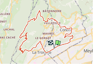
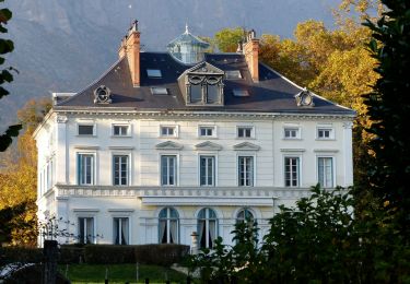
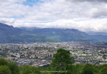
Trail Walking of 13.8 km to be discovered at Auvergne-Rhône-Alpes, Isère, Corenc. This trail is proposed by flip38.

Description

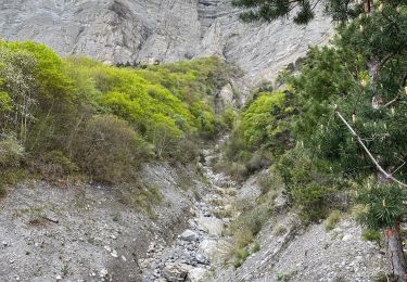
Boucle balisée pour faire ce petit sommet sympathique à coté de Grenoble.
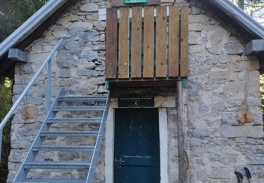
On part ici de la vallée, donc quelques parties bitumées. Le reste est sur de bons sentiers ou chemins.

Elevation profile

Photos

Positioning

Country:
France
Region :
Auvergne-Rhône-Alpes
Department/Province :
Isère
Municipality :
Corenc
Location:
Unknown
Start:(UTM)
716266 ; 5010063 (31T) N.

Trails nearby

Trail Walking Corenc - Mont Saint-Eynard par le Pas Guiguet  - Photo
Walking
cmarit

Walking

Difficult
(2)
Corenc, Auvergne-Rhône-Alpes, Isère, France
10.9 km | 26 km-effort
6h 5min
Yes
Trail Mountain bike Grenoble - Grande Traversée des PréAlpes à VTT : Grenoble - Sisteron - Digne les Bains - Photo
Mountain bike
tracegps

Mountain bike

Very difficult
(2)
Grenoble, Auvergne-Rhône-Alpes, Isère, France
375 km | 539 km-effort
48h 0min
No
Trail On foot Gières - De Gières au col du Gourlu - Photo
On foot
PRO

On foot

Easy
Gières, Auvergne-Rhône-Alpes, Isère, France
6.2 km | 10.5 km-effort
2h 22min
No
Trail On foot La Tronche - Grande Traverse de Meylan - Photo
On foot
PRO

On foot

Easy
La Tronche, Auvergne-Rhône-Alpes, Isère, France
5.6 km | 6.5 km-effort
1h 28min
No
Trail Mountain bike La Tronche - bastille vtt - Photo
Mountain bike
virtumanu

Mountain bike

Medium
(1)
La Tronche, Auvergne-Rhône-Alpes, Isère, France
11.1 km | 19.6 km-effort
24min
Yes
Trail Walking Gières - Boucle Mûrier - Venon depuis Gières - Photo
Walking
flip38

Walking

Medium
Gières, Auvergne-Rhône-Alpes, Isère, France
17.9 km | 29 km-effort
4h 10min
Yes
Trail Walking Fontaine - le tour du brisou par la baraque du veymont  - Photo
Walking
Youcef Atallah

Walking

Very difficult
Fontaine, Auvergne-Rhône-Alpes, Isère, France
125 km | 190 km-effort
8h 23min
Yes
Trail Walking Saint-Égrève - 290423 Tour du Néron - Photo
Walking
mzonzon05

Walking

Very difficult
Saint-Égrève, Auvergne-Rhône-Alpes, Isère, France
12.3 km | 21 km-effort
4h 22min
No
Trail Walking Biviers - Cresancoche - Photo
Walking
NANE51

Walking

Easy
Biviers, Auvergne-Rhône-Alpes, Isère, France
3.3 km | 6.2 km-effort
1h 12min
Yes


Close
My subscriptions