Trail Walking Clamensane - Clamensane - Col de la Croix - Chapelle St-Amand - Photo

Clamensane - Col de la Croix - Chapelle St-Amand

 Marco05
Marco05

User

© OpenStreetMap contributors
Length
Length
12.7 km
Max alt
Max alt
1337 m
Uphill gradient
Uphill gradient
695 m
Km-Effort
Km-Effort  
22 km
Min alt
Min alt
685 m
Downhill gradient
Downhill gradient
696 m
Boucle
Boucle
Yes
Creation date :
2024-03-05 16:15:00.228
Updated on :
2024-04-26 16:02:08.318

(1 Reviews)

Walking
Walking
5h00
Difficulty : Medium

Scan this QR Code to open this trail in the SityTrail application

FREE GPS app for hiking

Logo SityTrail SityTrail

IGN / Geographical institutes

Download SityTrail from the App Store Download SityTrail from Google Play

Logo SityTrail SityTrail World

The world is yours!

Download SityTrail from the App Store Download SityTrail from Google Play Download SityTrail on Huawei AppGallery

About

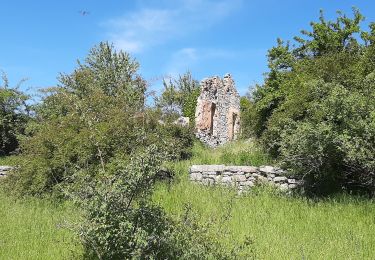
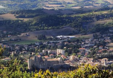
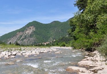
Trail Walking of 12.7 km to be discovered at Provence-Alpes-Côte d'Azur, Alpes-de-Haute-Provence, Clamensane. This trail is proposed by Marco05.

Description

Randonnée de difficulté moyenne pour les habitués de la marche.
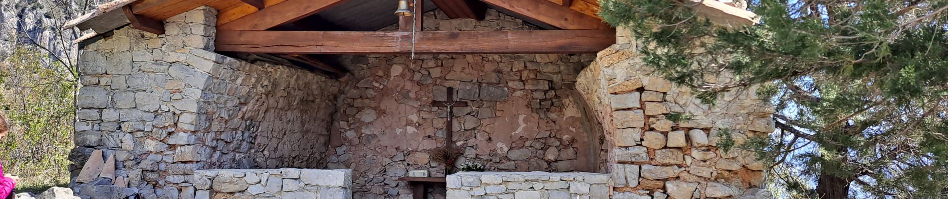
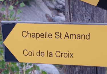
Pas de problème technique, juste deux passages un peu exposés entre le col de la Croix et la chapelle Saint-Amand.
Descente un peu raide par endroit surtout après la chapelle.

Elevation profile

Photos

Positioning

Country:
France
Region :
Provence-Alpes-Côte d'Azur
Department/Province :
Alpes-de-Haute-Provence
Municipality :
Clamensane
Location:
Unknown
Start:(UTM)
266253 ; 4911791 (32T) N.

Comments

Please log in to post a review or rate the element


Trails nearby

Trail Walking Clamensane - CLAMENSANE.  TROU DU DIABLR  . CHAPELLE S AMAND . COL LA CROIX . O L M S. IX  - Photo
Walking
RobinMicheline

Walking

Difficult
Clamensane, Provence-Alpes-Côte d'Azur, Alpes-de-Haute-Provence, France
12.5 km | 21 km-effort
3h 27min
Yes
Trail Walking Clamensane - VALAVOIRE  Pas de Palabiouse , bergerie de Premarche o l s  - Photo
Walking
RobinMicheline

Walking

Difficult
Clamensane, Provence-Alpes-Côte d'Azur, Alpes-de-Haute-Provence, France
11.7 km | 22 km-effort
3h 53min
Yes
Trail Walking Clamensane - VALAVOIRE.  Pas de Palabrouse.  Fontaine de  Pouille o l s - Photo
Walking
RobinMicheline

Walking

Medium
Clamensane, Provence-Alpes-Côte d'Azur, Alpes-de-Haute-Provence, France
11.9 km | 19.8 km-effort
3h 50min
Yes
Trail Walking La Motte-du-Caire - LA MOTTE DU CAIRE .Le tour de la Blachere o - Photo
Walking
RobinMicheline

Walking

Difficult
La Motte-du-Caire, Provence-Alpes-Côte d'Azur, Alpes-de-Haute-Provence, France
37 km | 67 km-effort
4h 0min
No
Trail Walking La Motte-du-Caire - Rome-36-LaMotteDuCaire-Tallard-20170905 - Photo
Walking
patrickdanilo

Walking

Difficult
La Motte-du-Caire, Provence-Alpes-Côte d'Azur, Alpes-de-Haute-Provence, France
22 km | 33 km-effort
6h 41min
No
Trail Walking Clamensane - La chapelle St Amand - Clamensane  - Photo
Walking
tracegps

Walking

Very difficult
Clamensane, Provence-Alpes-Côte d'Azur, Alpes-de-Haute-Provence, France
12.7 km | 22 km-effort
4h 30min
Yes
Trail Walking Nibles - La boucle de Saint Jacques - Nibles  - Photo
Walking
tracegps

Walking

Difficult
Nibles, Provence-Alpes-Côte d'Azur, Alpes-de-Haute-Provence, France
13.1 km | 18.9 km-effort
3h 30min
Yes
Trail Walking Bayons - Le Tour du Puy - Reynier  - Photo
Walking
tracegps

Walking

Difficult
(1)
Bayons, Provence-Alpes-Côte d'Azur, Alpes-de-Haute-Provence, France
9.3 km | 14.5 km-effort
3h 30min
Yes
Trail Walking Clamensane - L'Aqueduc des Sagniéres - Clamensane - Photo
Walking
tracegps

Walking

Medium
(2)
Clamensane, Provence-Alpes-Côte d'Azur, Alpes-de-Haute-Provence, France
5.9 km | 8.7 km-effort
2h 0min
Yes


Close
My subscriptions