Trail Walking Bitche - Randonnée facile autour de Bitche par le col de Schimberg - Photo

Randonnée facile autour de Bitche par le col de Schimberg

 tracegps
tracegps

User

© OpenStreetMap contributors
Length
Length
13.6 km
Max alt
Max alt
411 m
Uphill gradient
Uphill gradient
260 m
Km-Effort
Km-Effort  
17.1 km
Min alt
Min alt
280 m
Downhill gradient
Downhill gradient
261 m
Boucle
Boucle
Yes
Creation date :
2014-12-10 00:00:00.0
Updated on :
2014-12-10 00:00:00.0

(0 Reviews)

Walking
Walking
3h30
Difficulty : Medium

Scan this QR Code to open this trail in the SityTrail application

FREE GPS app for hiking

Logo SityTrail SityTrail

IGN / Geographical institutes

Download SityTrail from the App Store Download SityTrail from Google Play

Logo SityTrail SityTrail World

The world is yours!

Download SityTrail from the App Store Download SityTrail from Google Play Download SityTrail on Huawei AppGallery

About

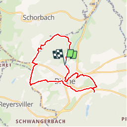
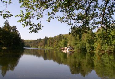
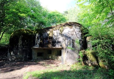
Trail Walking of 13.6 km to be discovered at Grand Est, Moselle, Bitche. This trail is proposed by tracegps.

Description

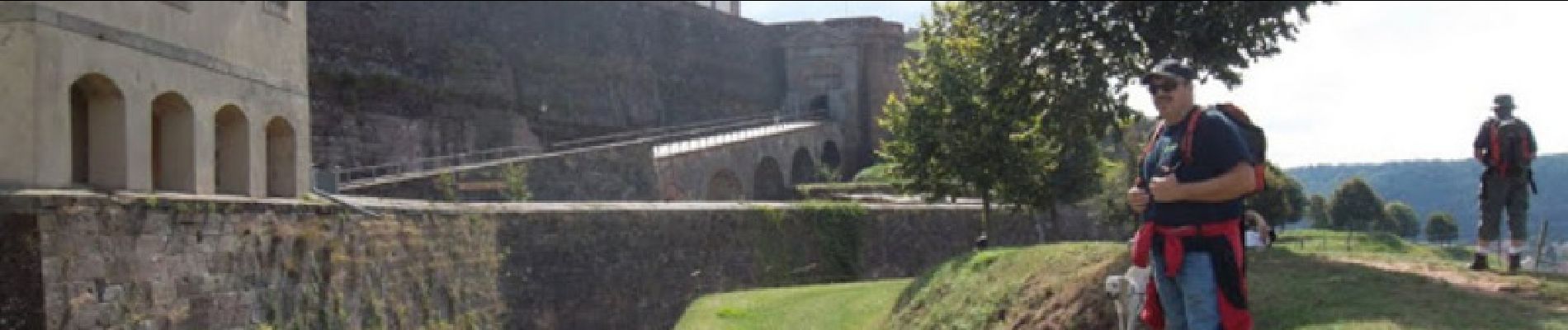
Départ à la chapelle Saint Sébastien, et suite sur circuit panoramique de Bitche. Au col de Schimberg revenir vers Bitche et continuer vers le stand de tir. Retour aux voitures par le golf et la citadelle.

Elevation profile

Photos

Positioning

Country:
France
Region :
Grand Est
Department/Province :
Moselle
Municipality :
Bitche
Location:
Unknown
Start:(UTM)
384981 ; 5435108 (32U) N.

Trails nearby

Trail Walking Bitche - Etang de Hasselfurth et Hochkopf - Bitche - Photo
Walking
tracegps

Walking

Medium
(1)
Bitche, Grand Est, Moselle, France
7.8 km | 10.1 km-effort
2h 0min
Yes
Trail Walking Bitche - Circuit panoramique de Bitche - Photo
Walking
tracegps

Walking

Medium
(2)
Bitche, Grand Est, Moselle, France
12.7 km | 16.7 km-effort
3h 25min
Yes
Trail On foot Hanviller - Chevalet jaune - Photo
On foot
PRO

On foot

Easy
Hanviller, Grand Est, Moselle, France
6.3 km | 7.1 km-effort
1h 37min
No
Trail On foot Schorbach - Anneau bleu - Photo
On foot
PRO

On foot

Easy
Schorbach, Grand Est, Moselle, France
14.6 km | 18.7 km-effort
4h 15min
Yes
Trail On foot Bitche - Yellow triangle - Photo
On foot
PRO

On foot

Easy
Bitche, Grand Est, Moselle, France
8.4 km | 10.7 km-effort
2h 26min
No
Trail On foot Bitche - Blue dot - Photo
On foot
PRO

On foot

Easy
Bitche, Grand Est, Moselle, France
10.7 km | 13.8 km-effort
3h 8min
No
Trail On foot Bitche - Yellow-white-yellow rectangle - Photo
On foot
PRO

On foot

Difficult
Bitche, Grand Est, Moselle, France
26 km | 35 km-effort
7h 58min
No
Trail On foot Bitche - Yellow X - Photo
On foot
PRO

On foot

Easy
Bitche, Grand Est, Moselle, France
12.1 km | 18.2 km-effort
4h 7min
No
Trail On foot Schorbach - Bitche panoramic tour - Photo
On foot
PRO

On foot

Easy
(1)
Schorbach, Grand Est, Moselle, France
13.1 km | 17.2 km-effort
3h 54min
Yes


Close
My subscriptions