Trail Walking Colmars - Tête et col de l'Encombrette-22-09-21 - Photo

Tête et col de l'Encombrette-22-09-21

© OpenStreetMap contributors
Length
Length
22 km
Max alt
Max alt
2546 m
Uphill gradient
Uphill gradient
1399 m
Km-Effort
Km-Effort  
41 km
Min alt
Min alt
1450 m
Downhill gradient
Downhill gradient
1399 m
Boucle
Boucle
Yes
Creation date :
2021-09-22 07:21:01.907
Updated on :
2021-09-24 12:13:35.581

(0 Reviews)

Walking
Walking
6h08
Difficulty : Difficult

Scan this QR Code to open this trail in the SityTrail application

FREE GPS app for hiking

Logo SityTrail SityTrail

IGN / Geographical institutes

Download SityTrail from the App Store Download SityTrail from Google Play

Logo SityTrail SityTrail World

The world is yours!

Download SityTrail from the App Store Download SityTrail from Google Play Download SityTrail on Huawei AppGallery

About

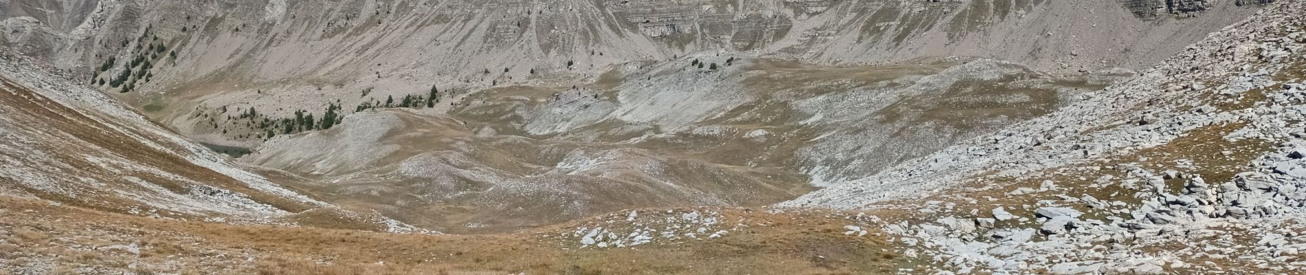
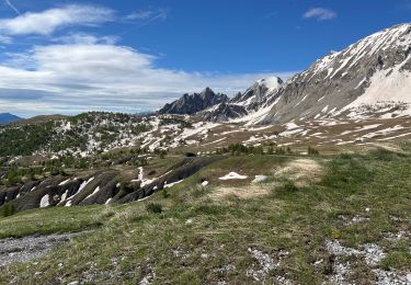
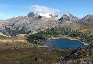
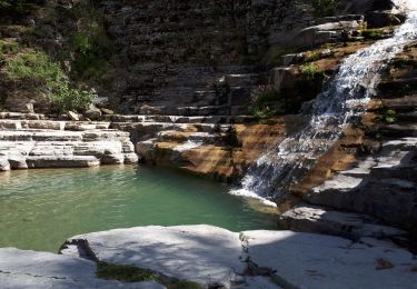
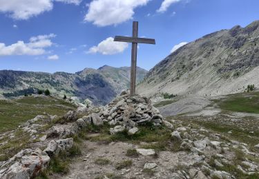
Trail Walking of 22 km to be discovered at Provence-Alpes-Côte d'Azur, Alpes-de-Haute-Provence, Colmars. This trail is proposed by Christiancordin.

Description

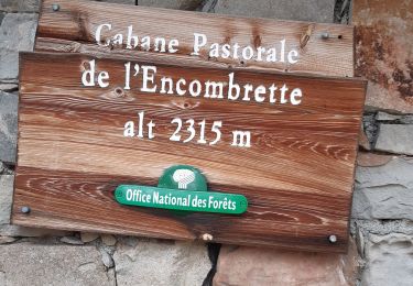
Pk rte de Clignon Haut-Clignon Haut-les Costes-GR de pays du haut Verdon-pas de l'Echelle-cabane de l'Encombrette-lacs de l'Encombrette-tête de l'Encombrette-col de l'Encombrette.

Elevation profile

Photos

Positioning

Country:
France
Region :
Provence-Alpes-Côte d'Azur
Department/Province :
Alpes-de-Haute-Provence
Municipality :
Colmars
Location:
Unknown
Start:(UTM)
311491 ; 4896583 (32T) N.

Trails nearby

Trail Walking Saint-Martin-d'Entraunes - Tête de l’Encombrette - Photo
Walking
bozo1970

Walking

Very difficult
Saint-Martin-d'Entraunes, Provence-Alpes-Côte d'Azur, Maritime Alps, France
9.8 km | 19.7 km-effort
4h 55min
Yes
Trail Walking Colmars - Col de l
Walking
Marchopier

Walking

Very difficult
Colmars, Provence-Alpes-Côte d'Azur, Alpes-de-Haute-Provence, France
17.1 km | 31 km-effort
7h 8min
Yes
Trail Walking Colmars - Colmars les Alpes - Pk de la Serre - ZigZag dans les vasques de la Lance - Photo
Walking
LtZIP

Walking

Difficult
Colmars, Provence-Alpes-Côte d'Azur, Alpes-de-Haute-Provence, France
8.6 km | 14.1 km-effort
2h 28min
Yes
Trail Walking Colmars - col de l'encombrette pas de L'Echellette - Photo
Walking
Joel26400

Walking

Very difficult
Colmars, Provence-Alpes-Côte d'Azur, Alpes-de-Haute-Provence, France
17.5 km | 32 km-effort
6h 11min
Yes
Trail Walking Colmars - l autupie Colmars les Alpes belvédères des gardettes - Photo
Walking
Joel26400

Walking

Very difficult
(1)
Colmars, Provence-Alpes-Côte d'Azur, Alpes-de-Haute-Provence, France
17.8 km | 33 km-effort
6h 0min
No
Trail Walking Colmars - lignin - Photo
Walking
PhilB24

Walking

Medium
Colmars, Provence-Alpes-Côte d'Azur, Alpes-de-Haute-Provence, France
18 km | 28 km-effort
4h 42min
Yes
Trail Walking Villars-Colmars - Chasse - Photo
Walking
GUIDE
harydh

Walking

Easy
Villars-Colmars, Provence-Alpes-Côte d'Azur, Alpes-de-Haute-Provence, France
10.8 km | 19.5 km-effort
4h 33min
Yes
Trail Walking Colmars - Les lacs Lignin - Photo
Walking
donda

Walking

Difficult
Colmars, Provence-Alpes-Côte d'Azur, Alpes-de-Haute-Provence, France
18.8 km | 29 km-effort
5h 33min
Yes
Trail Walking Villars-Colmars - Chalet - Les Espiniers - l'Adroit- Colmars - Photo
Walking
soca

Walking

Difficult
(1)
Villars-Colmars, Provence-Alpes-Côte d'Azur, Alpes-de-Haute-Provence, France
11.1 km | 20 km-effort
4h 7min
Yes


Close
My subscriptions