Trail Walking Jausiers - Costebelle-1 - Photo
 GAPIAN43
GAPIAN43

User

© OpenStreetMap contributors
Length
Length
15.7 km
Max alt
Max alt
2418 m
Uphill gradient
Uphill gradient
1250 m
Km-Effort
Km-Effort  
32 km
Min alt
Min alt
1282 m
Downhill gradient
Downhill gradient
1251 m
Boucle
Boucle
Yes
Creation date :
2019-04-04 09:43:36.764
Updated on :
2019-07-03 11:46:50.2

(0 Reviews)

Walking
Walking
6h24
Difficulty : Difficult

Scan this QR Code to open this trail in the SityTrail application

FREE GPS app for hiking

Logo SityTrail SityTrail

IGN / Geographical institutes

Download SityTrail from the App Store Download SityTrail from Google Play

Logo SityTrail SityTrail World

The world is yours!

Download SityTrail from the App Store Download SityTrail from Google Play Download SityTrail on Huawei AppGallery

About

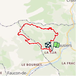
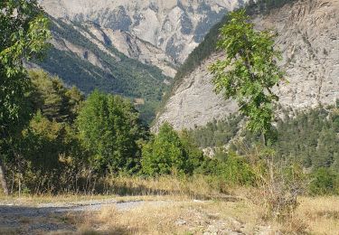
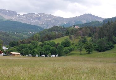
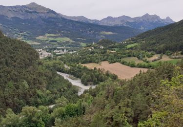
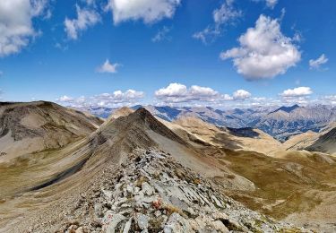
Trail Walking of 15.7 km to be discovered at Provence-Alpes-Côte d'Azur, Alpes-de-Haute-Provence, Jausiers. This trail is proposed by GAPIAN43.

Description

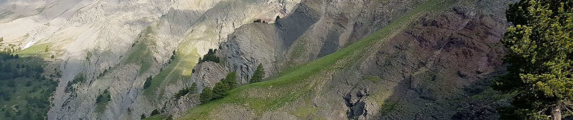
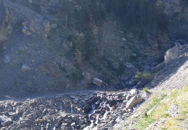
Sentier de Costebelle depuis la Rochette. Suite à un gros éboulement le retour vers Charenc n'est plus possible. Il faut maintenant partir de la Rochette. 200m de déniv en plus et 3km. La traversée du ravin de Frusta (dernière ravine avant de descente sur la MF de Belmont) est assez délicate le sentier a été emporté  et  la ravine est assez délicate à traverser.  Superbe randonnée.

Elevation profile

Photos

Positioning

Country:
France
Region :
Provence-Alpes-Côte d'Azur
Department/Province :
Alpes-de-Haute-Provence
Municipality :
Jausiers
Location:
Unknown
Start:(UTM)
318424 ; 4920441 (32T) N.

Trails nearby

Trail Walking Faucon-de-Barcelonnette - Pre de RATA et St Flavie - Photo
Walking
andre06130

Walking

Difficult
(1)
Faucon-de-Barcelonnette, Provence-Alpes-Côte d'Azur, Alpes-de-Haute-Provence, France
7.8 km | 13.4 km-effort
3h 7min
Yes
Trail Mountain bike Jausiers - Espace VTT FFC Vallée de l'Ubaye - Circuit n° 01 - La Tour des Sagnes - Photo
Mountain bike
tracegps

Mountain bike

Very difficult
(1)
Jausiers, Provence-Alpes-Côte d'Azur, Alpes-de-Haute-Provence, France
31 km | 45 km-effort
4h 0min
Yes
Trail Walking Jausiers - Fontaine de la pissoun 15-08-12 - Photo
Walking
darktotor51

Walking

Medium
(1)
Jausiers, Provence-Alpes-Côte d'Azur, Alpes-de-Haute-Provence, France
9.5 km | 16.5 km-effort
3h 16min
Yes
Trail Walking Jausiers - Pas de Grégoire /Chatelard - Photo
Walking
andre06130

Walking

Medium
Jausiers, Provence-Alpes-Côte d'Azur, Alpes-de-Haute-Provence, France
6.9 km | 11.3 km-effort
2h 1min
Yes
Trail Walking Enchastrayes - PETIT TOUR A BARCELONNETTE - Photo
Walking
walrou63

Walking

Medium
Enchastrayes, Provence-Alpes-Côte d'Azur, Alpes-de-Haute-Provence, France
7.3 km | 8.8 km-effort
2h 20min
Yes
Trail Walking Enchastrayes - Aupillon-cabane basse 04 - Photo
Walking
janussity

Walking

Difficult
Enchastrayes, Provence-Alpes-Côte d'Azur, Alpes-de-Haute-Provence, France
11.1 km | 18 km-effort
3h 24min
Yes
Trail Walking Jausiers - Petite ballade autour du pas de Grégoire  - Photo
Walking
andre06130

Walking

Medium
Jausiers, Provence-Alpes-Côte d'Azur, Alpes-de-Haute-Provence, France
4.7 km | 7.9 km-effort
1h 17min
Yes
Trail Walking Jausiers - Pissoun de Terres plaines - Photo
Walking
LittleAnne

Walking

Medium
Jausiers, Provence-Alpes-Côte d'Azur, Alpes-de-Haute-Provence, France
8.7 km | 14.7 km-effort
2h 57min
Yes
Trail Walking Jausiers - Lac des terres pleines et Arrête Rocher Tête de Clapouse - Photo
Walking
PapouBertrand

Walking

Difficult
Jausiers, Provence-Alpes-Côte d'Azur, Alpes-de-Haute-Provence, France
16.4 km | 28 km-effort
5h 22min
Yes


Close
My subscriptions