Tour Wandern Névache - Vallée  étroite    refuge du Thabor - Photo

Vallée étroite refuge du Thabor

 Sorriaux
Sorriaux

Benutzer

© OpenStreetMap contributors
Länge
Länge
10,2 km
Maximale Höhe
Maximale Höhe
2523 m
Positive Höhendifferenz
798 m
Km-Effort
Km-Effort  
18,4 km
Min. Höhe
Min. Höhe
1760 m
Negative Höhendifferenz
79 m
Boucle
Boucle
Nein
Erstellungsdatum :
2021-07-07 06:29:08.521
Letzte Änderung :
2023-08-04 11:49:12.208

(0 Nachricht)

Wandern
Wandern
3h06
Schwierigkeit : Schwierig

Scannen Sie diesen QR-Code, um die Tour in der SityTrail-Anwendung zu öffnen

Kostenlosegpshiking-Anwendung

Logo SityTrail SityTrail

IGN / Geografische Institute

SityTrail aus dem App Store herunterladen SityTrail von Google Play herunterladen

Logo SityTrail SityTrail World

Die Welt öffnet sich für Sie

SityTrail aus dem App Store herunterladen SityTrail von Google Play herunterladen SityTrail auf Huawei AppGallery herunterladen

Über SityTrail

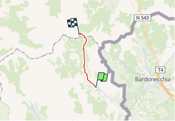
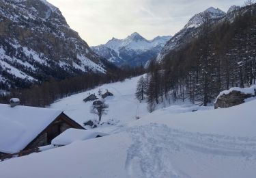
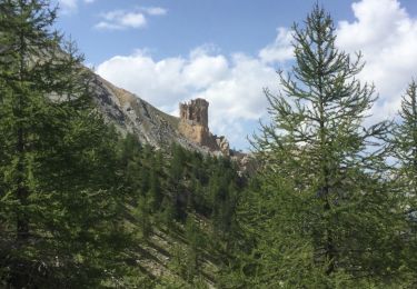
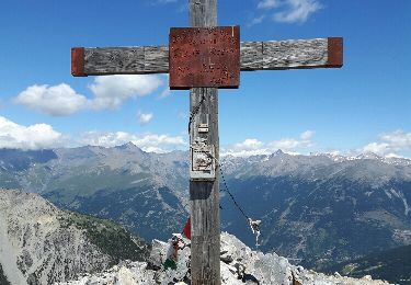
Tour Wandern von 10,2 km verfügbar auf Provence-Alpes-Côte d'Azur, Hochalpen, Névache. Diese Tour wird von Sorriaux vorgeschlagen.

Beschreibung

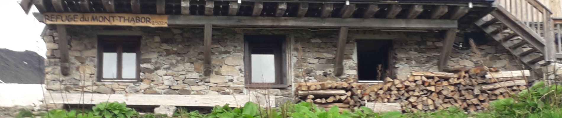
le tour du Thabor 2 jours

Höhenprofil

Foto-Galerie

Ort

Land:
France
Region :
Provence-Alpes-Côte d'Azur
Abteilung/Provinz :
Hochalpen
Kommune :
Névache
Standort:
Unknown
Gehen Sie:(UTM)
312888 ; 4993430 (32T) N.

Touren in der Umgebung

Tour Wandern Névache - Lac Vert.Vallée Etroite.(27-09-17) - Photo
Wandern
Dervalmarc

Wandern

Sehr leicht
(1)
Névache, Provence-Alpes-Côte d'Azur, Hochalpen, France
4,2 km | 5,9 km-effort
1h 19min
Ja
Tour Wandern Névache - les granges de la vallée étroite au refuge du Mont Thabor - Photo
Wandern
reneperrin

Wandern

Einfach
(1)
Névache, Provence-Alpes-Côte d'Azur, Hochalpen, France
8,6 km | 16,2 km-effort
3h 44min
Nein
Tour Mountainbike Névache - Tour des Rois Mages en VTT - Névache - Photo
Mountainbike
tracegps

Mountainbike

Schwierig
(2)
Névache, Provence-Alpes-Côte d'Azur, Hochalpen, France
35 km | 55 km-effort
5h 0min
Ja
Tour Wandern Névache - le Mont Thabor - Photo
Wandern
GUIDE
amiral13

Wandern

Schwierig
Névache, Provence-Alpes-Côte d'Azur, Hochalpen, France
19,9 km | 40 km-effort
8h 44min
Ja
Tour Wandern Névache - J4 2023 - Le Thabor épisode 2 - Photo
Wandern
ETMU5496

Wandern

Sehr schwierig
Névache, Provence-Alpes-Côte d'Azur, Hochalpen, France
24 km | 44 km-effort
7h 13min
Ja
Tour Wandern Névache - Mont Thabor à partir des Granges  - Photo
Wandern
Hugues Michel

Wandern

Sehr schwierig
Névache, Provence-Alpes-Côte d'Azur, Hochalpen, France
18,1 km | 37 km-effort
6h 39min
Nein
Tour Skiwanderen Névache - mont thabor - Photo
Skiwanderen
FREERIDE13006

Skiwanderen

Schwierig
Névache, Provence-Alpes-Côte d'Azur, Hochalpen, France
799 km | 2069 km-effort
6h 18min
Nein
Tour Wandern Névache - les ascles 05 - Photo
Wandern
silvestreclaudine

Wandern

Einfach
Névache, Provence-Alpes-Côte d'Azur, Hochalpen, France
12,8 km | 23 km-effort
6h 1min
Nein
Tour Wandern Névache - l'aiguille rouge - Photo
Wandern
GUIDE
amiral13

Wandern

Einfach
Névache, Provence-Alpes-Côte d'Azur, Hochalpen, France
9,1 km | 19 km-effort
5h 36min
Ja


Schließen
Meine Abonnements