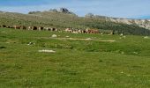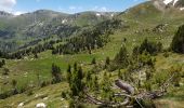

Mantet refuge Da Silva via la Porteille de Rotja Cime de P0marole

MarieFrancoise
Gebruiker

Lengte
10 km

Max. hoogte
2430 m

Positief hoogteverschil
576 m

Km-Effort
17,7 km

Min. hoogte
1905 m

Negatief hoogteverschil
575 m
Boucle
Ja
Datum van aanmaak :
2019-05-27 16:39:58.45
Laatste wijziging :
2019-05-27 16:39:58.649
5h34
Moeilijkheid : Medium

Gratisgps-wandelapplicatie
Over ons
Tocht Stappen van 10 km beschikbaar op Occitanië, Pyrénées-Orientales, Py. Deze tocht wordt voorgesteld door MarieFrancoise.
Beschrijving
départ du refuge Da Silva .la piste est ouverte exceptionnellement le jour de la transhumance des chevaux .
très jolie rando
Plaatsbepaling
Land:
France
Regio :
Occitanië
Departement/Provincie :
Pyrénées-Orientales
Gemeente :
Py
Locatie:
Unknown
Vertrek:(Dec)
Vertrek:(UTM)
447062 ; 4699484 (31T) N.
Opmerkingen
Wandeltochten in de omgeving
Pic de Costabonne par les Conques_T


Stappen
Medium
(1)
Prats-de-Mollo-la-Preste,
Occitanië,
Pyrénées-Orientales,
France

20 km | 36 km-effort
7h 56min
Ja
Roc Colom


Stappen
Moeilijk
(1)
Py,
Occitanië,
Pyrénées-Orientales,
France

19,4 km | 34 km-effort
4h 30min
Neen

Cime de Pomarole


Sneeuwschoenen
Medium
(1)
Mantet,
Occitanië,
Pyrénées-Orientales,
France

8,6 km | 16,2 km-effort
3h 21min
Ja
20220528 Col de Mantet


Stappen
Moeilijk
Py,
Occitanië,
Pyrénées-Orientales,
France

19,5 km | 36 km-effort
6h 40min
Ja

Forquet col del vents pic set homme roche blanche retour forquey


Stappen
Moeilijk
Prats-de-Mollo-la-Preste,
Occitanië,
Pyrénées-Orientales,
France

22 km | 38 km-effort
9h 59min
Ja
Fourquettes Collada del vent Roches banches retour


Stappen
Medium
Prats-de-Mollo-la-Preste,
Occitanië,
Pyrénées-Orientales,
France

13,4 km | 23 km-effort
5h 13min
Ja
Costabone via Siern Esquerdes de roja Rocarodona La Preste


Stappen
Moeilijk
Prats-de-Mollo-la-Preste,
Occitanië,
Pyrénées-Orientales,
France

22 km | 41 km-effort
10h 53min
Ja

Montet à caranza


Stappen
Moeilijk
Mantet,
Occitanië,
Pyrénées-Orientales,
France

12,5 km | 24 km-effort
6h 37min
Neen

24/02/2021 MANTET au Refuge des Allemany


Stappen
Moeilijk
Mantet,
Occitanië,
Pyrénées-Orientales,
France

8,9 km | 16,8 km-effort
3h 27min
Ja


 SityTrail


