


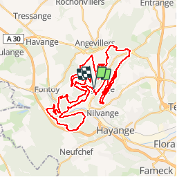

5,4 km | 7,7 km-effort


Gebruiker


Gratisgps-wandelapplicatie
 SityTrail
IGN / Geografische instituten
SityTrail World
De wereld gaat voor u open
Tocht Mountainbike van 49 km beschikbaar op Grand Est, Moselle, Algrange. Deze tocht wordt voorgesteld door Bitzlav.
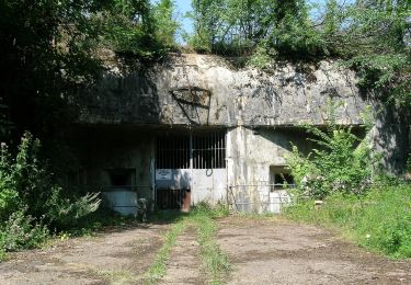
Circuit de 48 km avec possibilité de shunté. Passage au dessus de l'ancienne Mine de Rochonvillers, vu sur Batzenthal puis direction plateau d'Angevillers, vu sur Knutange.

Stappen
Te voet
Te voet
Te voet
Te voet
Te voet
Te voet
Stappen
Te voet