Tocht Stappen Buhy - Buhy/ Le Vaumion - Photo
 cchantal95
cchantal95

Gebruiker

© OpenStreetMap contributors
Lengte
Lengte
11,9 km
Max. hoogte
Max. hoogte
161 m
Positief hoogteverschil
159 m
Km-Effort
Km-Effort  
14 km
Min. hoogte
Min. hoogte
91 m
Negatief hoogteverschil
158 m
Boucle
Boucle
Ja
Datum van aanmaak :
2019-04-24 11:26:39.629
Laatste wijziging :
2019-04-24 11:26:39.751

(0 Bericht)

Stappen
Stappen
2h30
Moeilijkheid : Medium

Scan deze QR-code om de tocht te openen in de SityTrail-applicatie

Gratisgps-wandelapplicatie

Logo SityTrail SityTrail

IGN / Geografische instituten

SityTrail uit de App Store downloaden SityTrail uit Google Play downloaden

Logo SityTrail SityTrail World

De wereld gaat voor u open

SityTrail uit de App Store downloaden SityTrail uit Google Play downloaden SityTrail op Huawei AppGallery downloaden

Over ons

Tocht Stappen van 11,9 km beschikbaar op Île-de-France, Val-d'Oise, Buhy. Deze tocht wordt voorgesteld door cchantal95.

Beschrijving

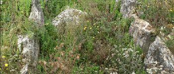
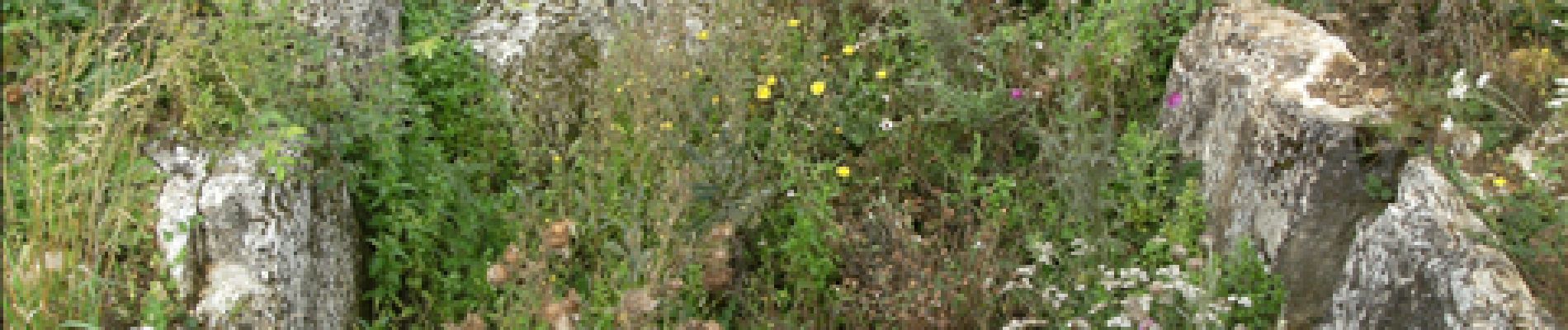
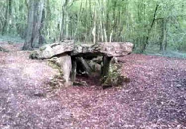
Départ de Buhy, en direction de la Chapelle, le bois Haranger, Le Vaumion, retour par Copierres et son Allée Couverte.

Hoogteprofiel

Foto's

POI's

POI Montreuil-sur-Epte - Allée couverte - Photo
cchantal95
MONTREUIL-SUR-EPTE 
POI Montreuil-sur-Epte - Croix penchée - Photo
cchantal95
MONTREUIL-SUR-EPTE 
POI La Chapelle-en-Vexin - Bois des Bouleaux - Photo
cchantal95
LA CHAPELLE-EN-VEXIN 
POI Buhy - Parking - Photo
cchantal95
BUHY 
POI Ambleville - Champ à l'oignon - Photo
cchantal95
AMBLEVILLE 
POI Buhy - BUHY - Photo
cchantal95
BUHY 

Plaatsbepaling

Land:
France
Regio :
Île-de-France
Departement/Provincie :
Val-d'Oise
Gemeente :
Buhy
Locatie:
Unknown
Vertrek:(Dec)
Vertrek:(UTM)
404739 ; 5449769 (31U) N.

Opmerkingen

Gelieve in te loggen om een commentaar of een beoordeling achter te laten


tres agreable


Wandeltochten in de omgeving

Tocht Stappen Château-sur-Epte - Château sur Epte - Berthenonville - Photo
Stappen
marcel.F

Stappen

Gemakkelijk
(1)
Château-sur-Epte, Normandië, Eure, France
7,8 km | 9,5 km-effort
2h 7min
Ja
Tocht Stappen Château-sur-Epte - Château sur Epte - Rollon Nord - Photo
Stappen
marcel.F

Stappen

Gemakkelijk
(1)
Château-sur-Epte, Normandië, Eure, France
8,4 km | 10,2 km-effort
2h 2min
Ja
Tocht Stappen Vaudancourt - Vaudancourt - Breuil et Boury - Photo
Stappen
marcel.F

Stappen

Gemakkelijk
(1)
Vaudancourt, Hauts-de-France, Oise, France
11,8 km | 14,3 km-effort
3h 5min
Ja
Tocht Stappen Vexin-sur-Epte - Château sur Epte variante par pierre tournante - Photo
Stappen
Fky78

Stappen

Gemakkelijk
(1)
Vexin-sur-Epte, Normandië, Eure, France
9,8 km | 12,1 km-effort
2h 30min
Ja
Tocht Noords wandelen Authevernes - MN 57 Authevernes - Photo
Noords wandelen
marcel.F

Noords wandelen

Gemakkelijk
(1)
Authevernes, Normandië, Eure, France
8,5 km | 10,1 km-effort
1h 30min
Ja
Tocht Stappen La Chapelle-en-Vexin - la chapelle  en vexin - Photo
Stappen
LANDRIEU

Stappen

Medium
(1)
La Chapelle-en-Vexin, Île-de-France, Val-d'Oise, France
13,9 km | 16,9 km-effort
3h 35min
Ja
Tocht Stappen Guerny - Gisancourt - Notre Dame du Chêne - Photo
Stappen
marcel.F

Stappen

Gemakkelijk
(2)
Guerny, Normandië, Eure, France
11,6 km | 13,9 km-effort
3h 2min
Ja
Tocht Stappen Parnes - Parnes - La ferme Chaudry - Photo
Stappen
marcel.F

Stappen

Gemakkelijk
(2)
Parnes, Hauts-de-France, Oise, France
10,4 km | 13 km-effort
2h 49min
Ja
Tocht Stappen Vexin-sur-Epte - Berthenonville Dampsmesni  la côte aux chiens - Photo
Stappen
serge.guerroult

Stappen

Medium
(1)
Vexin-sur-Epte, Normandië, Eure, France
9,5 km | 12,7 km-effort
2h 16min
Ja


Sluiten
Mijn abonnementen