![](/images/other/stat-length.png)
![Tocht Stappen Saint-Gelais - Saint-Gelais 6-12-2011 - Photo](https://media.geolcdn.com/t/1900/400/ext.pjpeg?maxdim=2&url=https%3A%2F%2Fservices.sitytrail.com%2FGeolivesWS%2FDownloadMedia.ashx%3FTrailID%3D96080%26Media%3D20111206160650.jpeg)
Saint-Gelais 6-12-2011
olaze
Gebruiker
![Lengte](/images/other/stat-length.png)
Lengte
8,9 km
![Max. hoogte](https://static1.geolcdn.com/siteimages/upload/files/1508320355ic_sort_altitude_max_24dp.png)
Max. hoogte
64 m
![Positief hoogteverschil](https://static1.geolcdn.com/siteimages/upload/files/1508320355ic_sort_den_pos_24dp.png)
Positief hoogteverschil
114 m
![Km-Effort](/images/other/stat-length.png)
Km-Effort
10,4 km
![Min. hoogte](https://static1.geolcdn.com/siteimages/upload/files/1508320355ic_sort_altitude_min_24dp.png)
Min. hoogte
28 m
![Negatief hoogteverschil](https://static1.geolcdn.com/siteimages/upload/files/1508320355ic_sort_den_neg_24dp.png)
Negatief hoogteverschil
114 m
![Boucle](https://static1.geolcdn.com/siteimages/upload/files/16400158638029165_repeat_loop_refresh_sync_direction_icon.png)
Boucle
Ja
Datum van aanmaak :
2014-12-10 00:00:00.0
Laatste wijziging :
2014-12-10 00:00:00.0
![Stappen](https://static1.geolcdn.com/sitytour/trail-icons/101.png)
2h15
Moeilijkheid : Gemakkelijk
![Scan deze QR-code om de tocht te openen in de SityTrail-applicatie](https://capi.geolives.com/qq0zvz2zws4bq2lad0pu/sitytour/trails/96080/qr.png?size=200)
Gratisgps-wandelapplicatie
Over ons
Tocht Stappen van 8,9 km beschikbaar op Nieuw-Aquitanië, Deux-Sèvres, Saint-Gelais. Deze tocht wordt voorgesteld door olaze.
Beschrijving
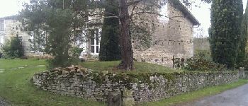
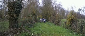
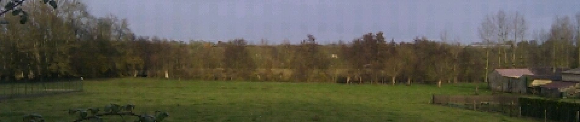
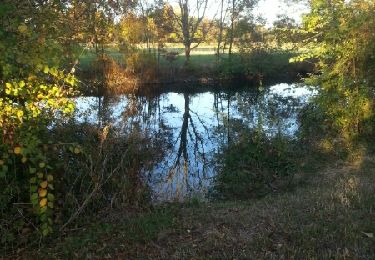
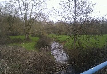
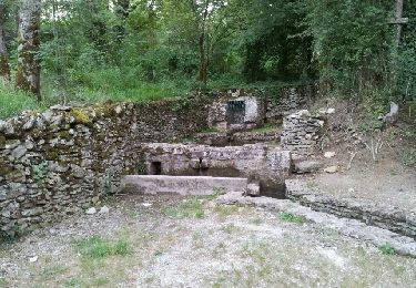
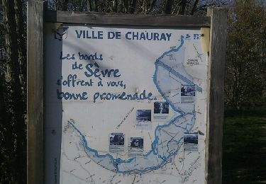
Promenade dans la campagne au départ de St Gelais.Valloné.Sèvres Niortaise.
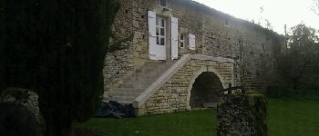
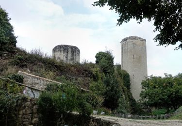
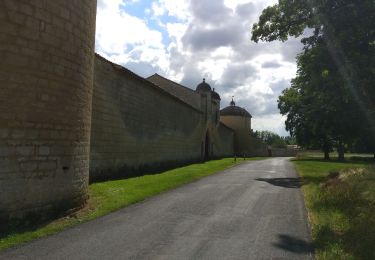
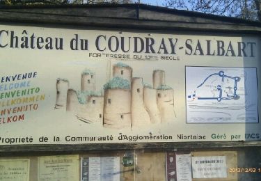
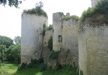
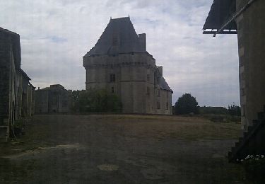
Prieuré d''Availles.
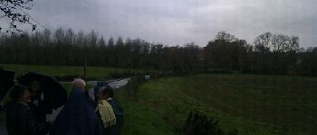
Club rando Bessines.
Plaatsbepaling
Land:
France
Regio :
Nieuw-Aquitanië
Departement/Provincie :
Deux-Sèvres
Gemeente :
Saint-Gelais
Locatie:
Unknown
Vertrek:(Dec)
Vertrek:(UTM)
700613 ; 5139707 (30T) N.
Opmerkingen
Wandeltochten in de omgeving
![Tocht Stappen Échiré - Echiré: balade des 3 châteaux - Photo](https://media.geolcdn.com/t/375/260/7daa007f-2d8f-4318-beb6-46c1636a9277.jpg&format=jpg&maxdim=2)
![Stappen Stappen](https://static1.geolcdn.com/sitytour/trail-icons/101.png)
Echiré: balade des 3 châteaux
Stappen
Medium
Échiré,
Nieuw-Aquitanië,
Deux-Sèvres,
France
![](/images/other/stat-length.png)
6,5 km | 7,2 km-effort
2h 41min
![](https://static1.geolcdn.com/siteimages/upload/files/16400158638029165_repeat_loop_refresh_sync_direction_icon.png)
Ja
![Tocht Mountainbike Chauray - 2019-06-06 VTT vers Echiré - Photo](https://media.geolcdn.com/t/375/260/fc5b97dd-a6d6-46d0-b2d6-f60d07ab0858.jpg&format=jpg&maxdim=2)
![Mountainbike Mountainbike](https://static1.geolcdn.com/sitytour/trail-icons/202.png)
2019-06-06 VTT vers Echiré
Mountainbike
Gemakkelijk
Chauray,
Nieuw-Aquitanië,
Deux-Sèvres,
France
![](/images/other/stat-length.png)
22 km | 25 km-effort
1h 30min
![](https://static1.geolcdn.com/siteimages/upload/files/16400158638029165_repeat_loop_refresh_sync_direction_icon.png)
Ja
![Tocht Stappen Échiré - 2016-10-31 Échiré Ternanteuil Échiré - Photo](https://media.geolcdn.com/t/375/260/ext.jpg?maxdim=2&url=https%3A%2F%2Fservices.sitytrail.com%2FGeolivesWS%2FDownloadMedia.ashx%3FTrailID%3D653957%26Media%3Dfix__20161031164422.jpg)
![Stappen Stappen](https://static1.geolcdn.com/sitytour/trail-icons/101.png)
2016-10-31 Échiré Ternanteuil Échiré
Stappen
Gemakkelijk
Échiré,
Nieuw-Aquitanië,
Deux-Sèvres,
France
![](/images/other/stat-length.png)
11,9 km | 13,4 km-effort
2h 55min
![](https://static1.geolcdn.com/siteimages/upload/files/16400158638029165_repeat_loop_refresh_sync_direction_icon.png)
Ja
![Tocht Stappen Échiré - Coudray-Salbart (6km) - Photo](https://media.geolcdn.com/t/375/260/ext.jpg?maxdim=2&url=https%3A%2F%2Fservices.sitytrail.com%2FGeolivesWS%2FDownloadMedia.ashx%3FTrailID%3D235638%26Media%3Dfix__20131203160628.jpg)
![Stappen Stappen](https://static1.geolcdn.com/sitytour/trail-icons/101.png)
Coudray-Salbart (6km)
Stappen
Medium
Échiré,
Nieuw-Aquitanië,
Deux-Sèvres,
France
![](/images/other/stat-length.png)
5,8 km | 7,2 km-effort
2h 4min
![](https://static1.geolcdn.com/siteimages/upload/files/16400158638029165_repeat_loop_refresh_sync_direction_icon.png)
Ja
![Tocht Stappen Cherveux - Cherveux- 9,1km - Photo](https://media.geolcdn.com/t/375/260/ext.jpg?maxdim=2&url=https%3A%2F%2Fservices.sitytrail.com%2FGeolivesWS%2FDownloadMedia.ashx%3FTrailID%3D180543%26Media%3D20130319153029.jpeg)
![Stappen Stappen](https://static1.geolcdn.com/sitytour/trail-icons/101.png)
Cherveux- 9,1km
Stappen
Medium
Cherveux,
Nieuw-Aquitanië,
Deux-Sèvres,
France
![](/images/other/stat-length.png)
9,1 km | 10,5 km-effort
2h 19min
![](https://static1.geolcdn.com/siteimages/upload/files/16400158638029165_repeat_loop_refresh_sync_direction_icon.png)
Ja
![Tocht Stappen Échiré - Mélusine au bord de la Sèvre - Echiré - Photo](https://media.geolcdn.com/t/375/260/ext.jpg?maxdim=2&url=https%3A%2F%2Fservices.sitytrail.com%2FGeolivesWS%2FDownloadMedia.ashx%3FTrailID%3D173023%26Media%3D14529_3.jpg)
![Stappen Stappen](https://static1.geolcdn.com/sitytour/trail-icons/101.png)
Mélusine au bord de la Sèvre - Echiré
Stappen
Medium
Échiré,
Nieuw-Aquitanië,
Deux-Sèvres,
France
![](/images/other/stat-length.png)
11,6 km | 13,1 km-effort
2h 49min
![](https://static1.geolcdn.com/siteimages/upload/files/16400158638029165_repeat_loop_refresh_sync_direction_icon.png)
Ja
![Tocht Stappen Cherveux - Cherveux . (ATSCAF) 10km - Photo](https://media.geolcdn.com/t/375/260/ext.jpg?maxdim=2&url=https%3A%2F%2Fservices.sitytrail.com%2FGeolivesWS%2FDownloadMedia.ashx%3FTrailID%3D154658%26Media%3D20120921120402.jpeg)
![Stappen Stappen](https://static1.geolcdn.com/sitytour/trail-icons/101.png)
Cherveux . (ATSCAF) 10km
Stappen
Gemakkelijk
Cherveux,
Nieuw-Aquitanië,
Deux-Sèvres,
France
![](/images/other/stat-length.png)
10,1 km | 11,8 km-effort
2h 42min
![](https://static1.geolcdn.com/siteimages/upload/files/16400158638029165_repeat_loop_refresh_sync_direction_icon.png)
Ja
![Tocht Mountainbike Chauray - 2012-08-21 - Photo](https://media.geolcdn.com/t/375/260/ext.jpg?maxdim=2&url=https%3A%2F%2Fservices.sitytrail.com%2FGeolivesWS%2FDownloadMedia.ashx%3FTrailID%3D148740%26Media%3D20120821204135.jpeg)
![Mountainbike Mountainbike](https://static1.geolcdn.com/sitytour/trail-icons/202.png)
2012-08-21
Mountainbike
Medium
Chauray,
Nieuw-Aquitanië,
Deux-Sèvres,
France
![](/images/other/stat-length.png)
32 km | 37 km-effort
2h 14min
![](https://static1.geolcdn.com/siteimages/upload/files/16400158638029165_repeat_loop_refresh_sync_direction_icon.png)
Ja
![Tocht Stappen Chauray - Chauray - Photo](https://media.geolcdn.com/t/375/260/ext.jpg?maxdim=2&url=https%3A%2F%2Fservices.sitytrail.com%2FGeolivesWS%2FDownloadMedia.ashx%3FTrailID%3D116617%26Media%3D20120313160339.jpeg)
![Stappen Stappen](https://static1.geolcdn.com/sitytour/trail-icons/101.png)
Chauray
Stappen
Gemakkelijk
Chauray,
Nieuw-Aquitanië,
Deux-Sèvres,
France
![](/images/other/stat-length.png)
8,7 km | 9,6 km-effort
2h 7min
![](https://static1.geolcdn.com/siteimages/upload/files/16400158638029165_repeat_loop_refresh_sync_direction_icon.png)
Ja