![](/images/other/stat-length.png)
![Tocht Stappen Noirmoutier-en-l'Île - Noirmoutier en l'Ile et l'herbaudière entre marais et la côte - Photo](https://media.geolcdn.com/t/1900/400/ext.pjpeg?maxdim=2&url=https%3A%2F%2Fservices.sitytrail.com%2FGeolivesWS%2FDownloadMedia.ashx%3FTrailID%3D959057%26Media%3Dfix__20180504181600.jpg)
Noirmoutier en l'Ile et l'herbaudière entre marais et la côte
Axelloceane
Gebruiker
![Lengte](/images/other/stat-length.png)
![Max. hoogte](https://static1.geolcdn.com/siteimages/upload/files/1508320355ic_sort_altitude_max_24dp.png)
![Positief hoogteverschil](https://static1.geolcdn.com/siteimages/upload/files/1508320355ic_sort_den_pos_24dp.png)
![Km-Effort](/images/other/stat-length.png)
![Min. hoogte](https://static1.geolcdn.com/siteimages/upload/files/1508320355ic_sort_altitude_min_24dp.png)
![Negatief hoogteverschil](https://static1.geolcdn.com/siteimages/upload/files/1508320355ic_sort_den_neg_24dp.png)
![Boucle](https://static1.geolcdn.com/siteimages/upload/files/16400158638029165_repeat_loop_refresh_sync_direction_icon.png)
![Stappen](https://static1.geolcdn.com/sitytour/trail-icons/101.png)
5h11
Moeilijkheid : Gemakkelijk
![Scan deze QR-code om de tocht te openen in de SityTrail-applicatie](https://capi.geolives.com/qq0zvz2zws4bq2lad0pu/sitytour/trails/959057/qr.png?size=200)
Gratisgps-wandelapplicatie
Over ons
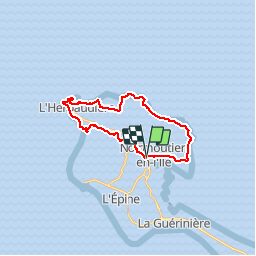
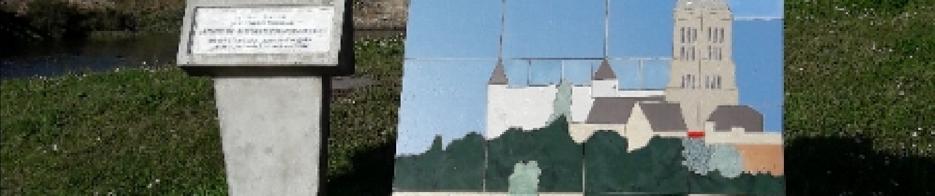
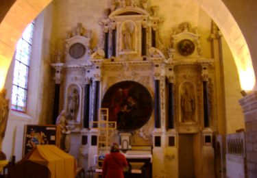
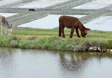
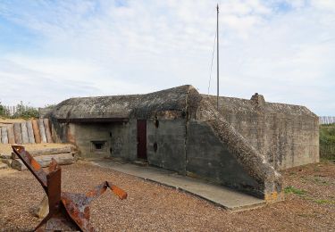
Tocht Stappen van 22 km beschikbaar op Pays de la Loire, Vendée, Noirmoutier-en-l'Île. Deze tocht wordt voorgesteld door Axelloceane.
Beschrijving
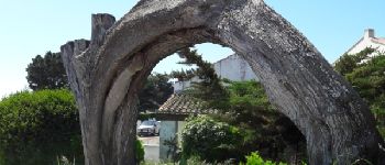
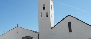
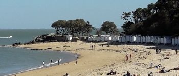
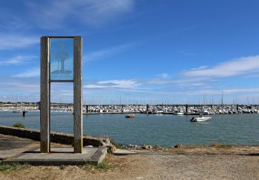
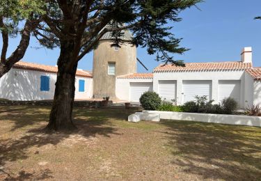
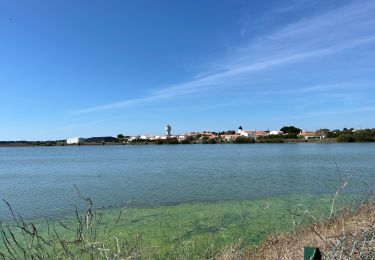
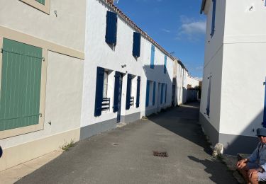
Départ du parking de Noirmoutier en direction de l'Herbaudière par les marais en suivant l'itinéraire rando vélo. Vue du port et à la sortie de la commune suivre de nouveau le balisage rando vélo jusqu'à le Petit Vieil.Puis suivre la côte jusqu'à la plage des Sableaux en passant par le bois de la Chaise et retour à Noirmoutier-en-L'Ile
POI's
Plaatsbepaling
Opmerkingen
Wandeltochten in de omgeving
![Tocht Stappen L'Épine - Les Marais de Luzeronde - Photo](https://media.geolcdn.com/t/375/260/ext.jpg?maxdim=2&url=https%3A%2F%2Fstatic1.geolcdn.com%2Fsiteimages%2Fupload%2Ffiles%2F1553511878bg_sport_marche.png)
![Stappen Stappen](https://static1.geolcdn.com/sitytour/trail-icons/101.png)
Stappen
![](/images/other/stat-length.png)
![](https://static1.geolcdn.com/siteimages/upload/files/16400158638029165_repeat_loop_refresh_sync_direction_icon.png)
![Tocht Te voet Noirmoutier-en-l'Île - Sur les traces des Jacobsen - Photo](https://media.geolcdn.com/t/375/260/6222f97e-2beb-47c2-ac73-1db88481adbd.jpeg&format=jpg&maxdim=2)
![Te voet Te voet](https://static1.geolcdn.com/sitytour/trail-icons/100.png)
Te voet
![](/images/other/stat-length.png)
![](https://static1.geolcdn.com/siteimages/upload/files/16400158638029165_repeat_loop_refresh_sync_direction_icon.png)
![Tocht Te voet Noirmoutier-en-l'Île - Roses trémières - Photo](https://media.geolcdn.com/t/375/260/504a4f09-026b-4f3b-a144-9641852cfb05.jpeg&format=jpg&maxdim=2)
![Te voet Te voet](https://static1.geolcdn.com/sitytour/trail-icons/100.png)
Te voet
![](/images/other/stat-length.png)
![](https://static1.geolcdn.com/siteimages/upload/files/16400158638029165_repeat_loop_refresh_sync_direction_icon.png)
![Tocht Te voet La Guérinière - En Passant par les Moulins - Photo](https://media.geolcdn.com/t/375/260/ccc103f2-0cff-4e2a-b30b-b4e364a262b4.jpeg&format=jpg&maxdim=2)
![Te voet Te voet](https://static1.geolcdn.com/sitytour/trail-icons/100.png)
Te voet
![](/images/other/stat-length.png)
![](https://static1.geolcdn.com/siteimages/upload/files/16400158638029165_repeat_loop_refresh_sync_direction_icon.png)
![Tocht Te voet L'Épine - Chemin de mer et de marais - Photo](https://media.geolcdn.com/t/375/260/ded2016b-df3d-4278-8be0-d3af6896ca41.jpeg&format=jpg&maxdim=2)
![Te voet Te voet](https://static1.geolcdn.com/sitytour/trail-icons/100.png)
Te voet
![](/images/other/stat-length.png)
![](https://static1.geolcdn.com/siteimages/upload/files/16400158638029165_repeat_loop_refresh_sync_direction_icon.png)
![Tocht Hybride fiets L'Épine - B02 - Boucle entre plages et ports - Photo](https://media.geolcdn.com/t/375/260/ext.jpg?maxdim=2&url=https%3A%2F%2Fstatic1.geolcdn.com%2Fsiteimages%2Fupload%2Ffiles%2F1524743154velo.jpg)
![Hybride fiets Hybride fiets](https://static1.geolcdn.com/sitytour/trail-icons/203.png)
Hybride fiets
![](/images/other/stat-length.png)
![](https://static1.geolcdn.com/siteimages/upload/files/16400158638029165_repeat_loop_refresh_sync_direction_icon.png)
![Tocht Stappen L'Épine - Noirmoutier 3 - Photo](https://media.geolcdn.com/t/375/260/640ca307-094e-454b-910c-add2497a7004.jpg&format=jpg&maxdim=2)
![Stappen Stappen](https://static1.geolcdn.com/sitytour/trail-icons/101.png)
Stappen
![](/images/other/stat-length.png)
![](https://static1.geolcdn.com/siteimages/upload/files/16400158638029165_repeat_loop_refresh_sync_direction_icon.png)
![Tocht Stappen Noirmoutier-en-l'Île - Randonnée nord Noirmoutier - Photo](https://media.geolcdn.com/t/375/260/546cf5a8-bd2d-412f-a2bb-12023648116c.jpg&format=jpg&maxdim=2)
![Stappen Stappen](https://static1.geolcdn.com/sitytour/trail-icons/101.png)
Stappen
![](/images/other/stat-length.png)
![](https://static1.geolcdn.com/siteimages/upload/files/16400158638029165_repeat_loop_refresh_sync_direction_icon.png)
![Tocht Stappen Noirmoutier-en-l'Île - Noirmoutier, premier jour, mise en jambe - Photo](https://media.geolcdn.com/t/375/260/44557226-b7a7-4ccf-bccc-db2a3325466d.jpg&format=jpg&maxdim=2)
![Stappen Stappen](https://static1.geolcdn.com/sitytour/trail-icons/101.png)
Stappen
![](/images/other/stat-length.png)
![](https://static1.geolcdn.com/siteimages/upload/files/16400158638029165_repeat_loop_refresh_sync_direction_icon.png)