Tocht Stappen Montesquieu-des-Albères - montesquieu . puig sant cristau . prieuré Santa maria del villard  . montesquieu - Photo

montesquieu . puig sant cristau . prieuré Santa maria del villard . montesquieu

 stef789
stef789

Gebruiker GUIDE

© OpenStreetMap contributors
Lengte
Lengte
15,7 km
Max. hoogte
Max. hoogte
1020 m
Positief hoogteverschil
1155 m
Km-Effort
Km-Effort  
31 km
Min. hoogte
Min. hoogte
155 m
Negatief hoogteverschil
1155 m
Boucle
Boucle
Ja
Datum van aanmaak :
2018-04-18 00:11:49.946
Laatste wijziging :
2018-04-18 00:11:49.946

(0 Bericht)

Stappen
Stappen
7h51
Moeilijkheid : Moeilijk

Scan deze QR-code om de tocht te openen in de SityTrail-applicatie

Gratisgps-wandelapplicatie

Logo SityTrail SityTrail

IGN / Geografische instituten

SityTrail uit de App Store downloaden SityTrail uit Google Play downloaden

Logo SityTrail SityTrail World

De wereld gaat voor u open

SityTrail uit de App Store downloaden SityTrail uit Google Play downloaden SityTrail op Huawei AppGallery downloaden

Over ons

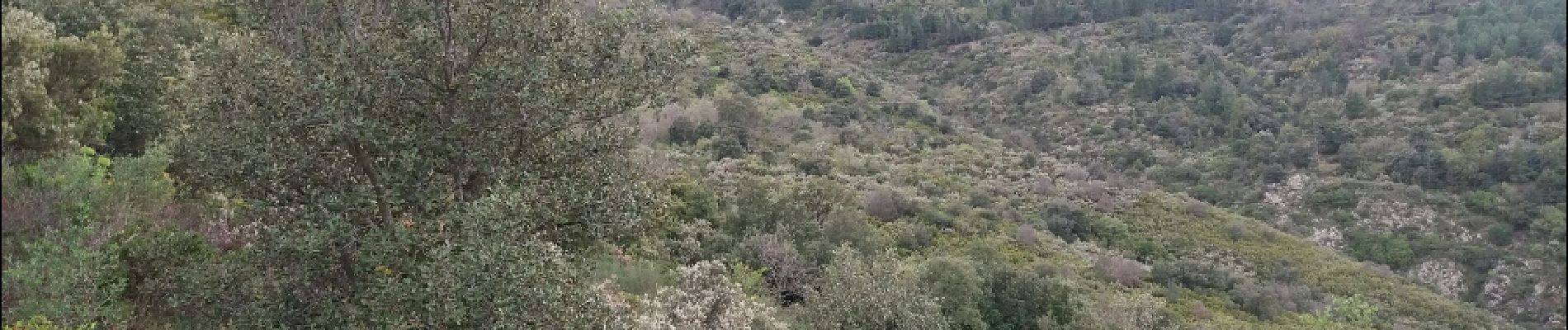
Tocht Stappen van 15,7 km beschikbaar op Occitanië, Pyrénées-Orientales, Montesquieu-des-Albères. Deze tocht wordt voorgesteld door stef789.

Beschrijving

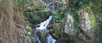
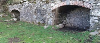
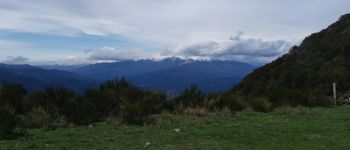
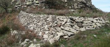
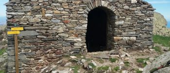
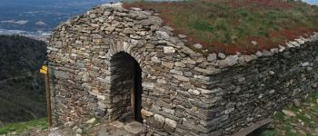
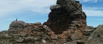
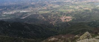
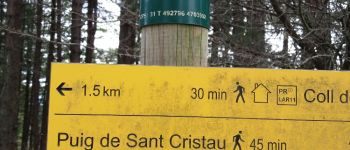
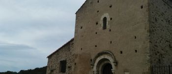
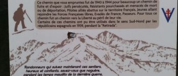
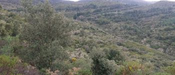
montesquieu . col llinas . col de la branca . puig sant cristau . direction col l ullat . puig d orella a gauche . Roc del grevol a gauche . Après 50 m petit chemin à droite marquage bleu descent fortement et longtemps . a droite vers sors marquage vert fluo . prieuré Santa maria tel villard . chemin de la liberté . montesquieu

Hoogteprofiel

Foto's

POI's

POI Montesquieu-des-Albères - bassin el roure Point 1 - Photo
stef789
MONTESQUIEU-DES-ALBÈRES 
POI Montesquieu-des-Albères - soute a munitions col du llinas Point 2 - Photo
stef789
MONTESQUIEU-DES-ALBÈRES 
POI Montesquieu-des-Albères - canigou depuis col du llinas Point 3 - Photo
stef789
MONTESQUIEU-DES-ALBÈRES 
POI Montesquieu-des-Albères - col de la branca - plateforme de tir - guerre du boulou 1793 Point 4 - Photo
stef789
MONTESQUIEU-DES-ALBÈRES 
POI Montesquieu-des-Albères - puig de sant cristau - ancienne chapelle castrale Point 5 - Photo
stef789
MONTESQUIEU-DES-ALBÈRES 
POI Montesquieu-des-Albères - ancienne chapelle castrale Point 6 - Photo
stef789
MONTESQUIEU-DES-ALBÈRES 
POI Montesquieu-des-Albères - ancienne tour de guet Point 7 - Photo
stef789
MONTESQUIEU-DES-ALBÈRES 
POI Montesquieu-des-Albères - vue de montesquieu Point 8 - Photo
stef789
MONTESQUIEU-DES-ALBÈRES 
POI Laroque-des-Albères - puig d orella Point 9 - Photo
stef789
LAROQUE-DES-ALBÈRES 
POI Villelongue-dels-Monts - prieure santa maria del vilard Point 10 - Photo
stef789
VILLELONGUE-DELS-MONTS 
POI Villelongue-dels-Monts - chemin de la liberte Point 11 - Photo
stef789
VILLELONGUE-DELS-MONTS 
POI Villelongue-dels-Monts - vue du trajet aller Point 12 - Photo
stef789
VILLELONGUE-DELS-MONTS 

Plaatsbepaling

Land:
France
Regio :
Occitanië
Departement/Provincie :
Pyrénées-Orientales
Gemeente :
Montesquieu-des-Albères
Locatie:
Unknown
Vertrek:(Dec)
Vertrek:(UTM)
490134 ; 4707432 (31T) N.

Wandeltochten in de omgeving

Tocht Stappen Les Cluses - LES CLUSES 66 - Photo
Stappen
jeff66

Stappen

Gemakkelijk
(9)
Les Cluses, Occitanië, Pyrénées-Orientales, France
9,4 km | 12,8 km-effort
1h 50min
Ja
Tocht Stappen Laroque-des-Albères - Laroque-des-Albères, petit tour des mas  - Photo
Stappen
GUIDE
stef789

Stappen

Heel gemakkelijk
(1)
Laroque-des-Albères, Occitanië, Pyrénées-Orientales, France
5,4 km | 7,1 km-effort
1h 47min
Ja
Tocht Stappen Laroque-des-Albères - 66 LAROQUE DES ALBERES (maison) SOREDE, par pistes DFCI AL12 et 19, mas del Ca et mas Manere, Itin.16  - Photo
Stappen
jeff66

Stappen

Medium
(1)
Laroque-des-Albères, Occitanië, Pyrénées-Orientales, France
11,2 km | 15,3 km-effort
2h 5min
Ja
Tocht Stappen L'Albère - SAINT-JEAN-D'ALBERE 66 - PUIG  de Sant Christau par le coll de Sant Joan  - Photo
Stappen
jeff66

Stappen

Moeilijk
(1)
L'Albère, Occitanië, Pyrénées-Orientales, France
10,1 km | 17 km-effort
2h 46min
Ja
Tocht Stappen Montesquieu-des-Albères - MONTESQUIEU-DES-ALBERES 66 - Les Agouillous - les chemins de l'eau dans les Albères - Photo
Stappen
jeff66

Stappen

Medium
(1)
Montesquieu-des-Albères, Occitanië, Pyrénées-Orientales, France
12,7 km | 13,9 km-effort
2h 16min
Ja
Tocht Stappen Le Boulou - LES THERMES DU BOULOU - 66 - Albera viva - PUIG de l'Estella - Photo
Stappen
jeff66

Stappen

Medium
(2)
Le Boulou, Occitanië, Pyrénées-Orientales, France
7,3 km | 11,4 km-effort
1h 32min
Ja
Tocht Stappen Laroque-des-Albères - Col-Ullat Pic-aureille_Terrain - Photo
Stappen
force

Stappen

Medium
(1)
Laroque-des-Albères, Occitanië, Pyrénées-Orientales, France
11,2 km | 23 km-effort
4h 47min
Ja
Tocht Stappen Laroque-des-Albères - laroque . four solaire . sorede . laroque - Photo
Stappen
GUIDE
stef789

Stappen

Medium
Laroque-des-Albères, Occitanië, Pyrénées-Orientales, France
7,7 km | 9,2 km-effort
1h 57min
Ja
Tocht Hybride fiets Le Boulou - Autour du Boulou (66) - Photo
Hybride fiets
GUIDE
toutankhcarton

Hybride fiets

Gemakkelijk
Le Boulou, Occitanië, Pyrénées-Orientales, France
17 km | 19,5 km-effort
1h 54min
Neen


Sluiten
Mijn abonnementen