![](/images/other/stat-length.png)
Saisons de la Photo 2021 - Redu/Wellin
La Grande Forêt de Saint-Hubert
Randonnées de la Grande Forêt de Saint-Hubert GUIDE+
![Lengte](/images/other/stat-length.png)
Lengte
38 km
![Max. hoogte](https://static1.geolcdn.com/siteimages/upload/files/1508320355ic_sort_altitude_max_24dp.png)
Max. hoogte
426 m
![Positief hoogteverschil](https://static1.geolcdn.com/siteimages/upload/files/1508320355ic_sort_den_pos_24dp.png)
Positief hoogteverschil
726 m
![Km-Effort](/images/other/stat-length.png)
Km-Effort
47 km
![Min. hoogte](https://static1.geolcdn.com/siteimages/upload/files/1508320355ic_sort_altitude_min_24dp.png)
Min. hoogte
188 m
![Negatief hoogteverschil](https://static1.geolcdn.com/siteimages/upload/files/1508320355ic_sort_den_neg_24dp.png)
Negatief hoogteverschil
719 m
![Boucle](https://static1.geolcdn.com/siteimages/upload/files/16400158638029165_repeat_loop_refresh_sync_direction_icon.png)
Boucle
Ja
Datum van aanmaak :
2018-04-09 12:34:44.979
Laatste wijziging :
2021-03-02 11:16:40.02
![Motor](https://static1.geolcdn.com/sitytour/trail-icons/400.png)
1h10
Moeilijkheid : Onbekend
![Scan deze QR-code om de tocht te openen in de SityTrail-applicatie](https://capi.geolives.com/qq0zvz2zws4bq2lad0pu/sitytour/trails/893950/qr.png?size=200)
Gratisgps-wandelapplicatie
Over ons
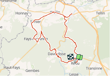
Tocht Motor van 38 km beschikbaar op Wallonië, Luxemburg, Libin. Deze tocht wordt voorgesteld door La Grande Forêt de Saint-Hubert.
Beschrijving
Découvrez grâce à ce circuit, les expositions "Saisons de la Photo en Grande Forêt de Saint-Hubert", passant par les communes de Libin et Wellin. www.lessaisonsdelaphoto.be
POI's
Plaatsbepaling
Land:
Belgium
Regio :
Wallonië
Departement/Provincie :
Luxemburg
Gemeente :
Libin
Locatie:
Redu
Vertrek:(Dec)
Vertrek:(UTM)
654787 ; 5541649 (31U) N.
Opmerkingen
Wandeltochten in de omgeving
![Tocht Stappen Paliseul - RB-Lu-10_Maissin - Photo](https://media.geolcdn.com/t/375/260/ext.jpg?maxdim=2&url=https%3A%2F%2Fservices.sitytrail.com%2FGeolivesWS%2FDownloadMedia.ashx%3FTrailID%3D315513%26Media%3D52f53adc-4763-4371-9efe-70f027b21c91.jpg)
![Stappen Stappen](https://static1.geolcdn.com/sitytour/trail-icons/101.png)
RB-Lu-10_Maissin
Stappen
Moeilijk
(7)
Paliseul,
Wallonië,
Luxemburg,
Belgium
![](/images/other/stat-length.png)
25 km | 32 km-effort
6h 38min
![](https://static1.geolcdn.com/siteimages/upload/files/16400158638029165_repeat_loop_refresh_sync_direction_icon.png)
Ja
![Tocht Stappen Libin - Lesse - Promenade de la Lesse (LI06) - Photo](https://media.geolcdn.com/t/375/260/27528ace-a0b8-4107-8825-6100f3450bfd.jpg&format=jpg&maxdim=2)
![Stappen Stappen](https://static1.geolcdn.com/sitytour/trail-icons/101.png)
Lesse - Promenade de la Lesse (LI06)
Stappen
Medium
(6)
Libin,
Wallonië,
Luxemburg,
Belgium
![](/images/other/stat-length.png)
8,6 km | 11,3 km-effort
2h 26min
![](https://static1.geolcdn.com/siteimages/upload/files/16400158638029165_repeat_loop_refresh_sync_direction_icon.png)
Ja
![Tocht Stappen Libin - Du village de Redu au hameau de Lesse - Photo](https://media.geolcdn.com/t/375/260/ext.jpg?maxdim=2&url=https%3A%2F%2Fservices.sitytrail.com%2FGeolivesWS%2FDownloadMedia.ashx%3FTrailID%3D449318%26Media%3D3daffb28-a541-4d0a-b434-13b6750e6d2d.JPG)
![Stappen Stappen](https://static1.geolcdn.com/sitytour/trail-icons/101.png)
Du village de Redu au hameau de Lesse
Stappen
Gemakkelijk
(3)
Libin,
Wallonië,
Luxemburg,
Belgium
![](/images/other/stat-length.png)
11,3 km | 14,9 km-effort
3h 13min
![](https://static1.geolcdn.com/siteimages/upload/files/16400158638029165_repeat_loop_refresh_sync_direction_icon.png)
Ja
![Tocht Stappen Libin - Lesse - Entre Lesse et Lomme - Photo](https://media.geolcdn.com/t/375/260/29de6fa8-4c44-40a4-a5ee-a6e3f0f650e2.jpg&format=jpg&maxdim=2)
![Stappen Stappen](https://static1.geolcdn.com/sitytour/trail-icons/101.png)
Lesse - Entre Lesse et Lomme
Stappen
Zeer moeilijk
(2)
Libin,
Wallonië,
Luxemburg,
Belgium
![](/images/other/stat-length.png)
79 km | 102 km-effort
23h 15min
![](https://static1.geolcdn.com/siteimages/upload/files/16400158638029165_repeat_loop_refresh_sync_direction_icon.png)
Ja
![Tocht Stappen Libin - Redu - La Virée des Croix - Photo](https://media.geolcdn.com/t/375/260/ext.jpg?maxdim=2&url=https%3A%2F%2Fservices.sitytrail.com%2FGeolivesWS%2FDownloadMedia.ashx%3FTrailID%3D334581%26Media%3D577140e5-7a9b-4e16-8501-3973c972819c.JPG)
![Stappen Stappen](https://static1.geolcdn.com/sitytour/trail-icons/101.png)
Redu - La Virée des Croix
Stappen
Medium
(5)
Libin,
Wallonië,
Luxemburg,
Belgium
![](/images/other/stat-length.png)
6,1 km | 8,2 km-effort
1h 44min
![](https://static1.geolcdn.com/siteimages/upload/files/16400158638029165_repeat_loop_refresh_sync_direction_icon.png)
Ja
![Tocht Stappen Paliseul - RB-LUX-10 - Raccourci 2 - Le long de deux rivières fougueuses : l’Our et la Lesse - Photo](https://media.geolcdn.com/t/375/260/ext.jpg?maxdim=2&url=https%3A%2F%2Fservices.sitytrail.com%2FGeolivesWS%2FDownloadMedia.ashx%3FTrailID%3D216782%26Media%3D52f53adc-4763-4371-9efe-70f027b21c91.jpg)
![Stappen Stappen](https://static1.geolcdn.com/sitytour/trail-icons/101.png)
RB-LUX-10 - Raccourci 2 - Le long de deux rivières fougueuses : l’Our et la L...
Stappen
Gemakkelijk
(2)
Paliseul,
Wallonië,
Luxemburg,
Belgium
![](/images/other/stat-length.png)
22 km | 29 km-effort
4h 6min
![](https://static1.geolcdn.com/siteimages/upload/files/16400158638029165_repeat_loop_refresh_sync_direction_icon.png)
Ja
![Tocht Stappen Paliseul - RB-LUX-10 - Raccourci 1 - Le long de deux rivières fougueuses : l’Our et la Lesse - Photo](https://media.geolcdn.com/t/375/260/ext.jpg?maxdim=2&url=https%3A%2F%2Fservices.sitytrail.com%2FGeolivesWS%2FDownloadMedia.ashx%3FTrailID%3D179615%26Media%3D52f53adc-4763-4371-9efe-70f027b21c91.jpg)
![Stappen Stappen](https://static1.geolcdn.com/sitytour/trail-icons/101.png)
RB-LUX-10 - Raccourci 1 - Le long de deux rivières fougueuses : l’Our et la L...
Stappen
Medium
(2)
Paliseul,
Wallonië,
Luxemburg,
Belgium
![](/images/other/stat-length.png)
14,9 km | 19,4 km-effort
5h 59min
![](https://static1.geolcdn.com/siteimages/upload/files/16400158638029165_repeat_loop_refresh_sync_direction_icon.png)
Ja
![Tocht Stappen Libin - Adeps 5 kms Redu le 25-08-2024 - Photo](https://media.geolcdn.com/t/375/260/28243488-2727-4746-b790-8170a6922936.jpg&format=jpg&maxdim=2)
![Stappen Stappen](https://static1.geolcdn.com/sitytour/trail-icons/101.png)
Adeps 5 kms Redu le 25-08-2024
Stappen
Medium
(1)
Libin,
Wallonië,
Luxemburg,
Belgium
![](/images/other/stat-length.png)
5,4 km | 7 km-effort
1h 35min
![](https://static1.geolcdn.com/siteimages/upload/files/16400158638029165_repeat_loop_refresh_sync_direction_icon.png)
Ja
![Tocht Stappen Libin - Transinne - Les Voies d'Antan (LI12) - Photo](https://media.geolcdn.com/t/375/260/9c2533c3-01b6-4ea6-863f-eedbbedfdc39.jpg&format=jpg&maxdim=2)
![Stappen Stappen](https://static1.geolcdn.com/sitytour/trail-icons/101.png)
Transinne - Les Voies d'Antan (LI12)
Stappen
Medium
(1)
Libin,
Wallonië,
Luxemburg,
Belgium
![](/images/other/stat-length.png)
10 km | 12,5 km-effort
2h 44min
![](https://static1.geolcdn.com/siteimages/upload/files/16400158638029165_repeat_loop_refresh_sync_direction_icon.png)
Ja