![](/images/other/stat-length.png)
![Tocht Andere activiteiten Irouléguy - Menta - Photo](https://media.geolcdn.com/t/1900/400/ext.pjpeg?maxdim=2&url=https%3A%2F%2Fstatic1.geolcdn.com%2Fsiteimages%2Fupload%2Ffiles%2F1545311037marcheuse_200dpi.jpg)
Menta
les randonneurs rionnais
Pignada nous voilà
![Lengte](/images/other/stat-length.png)
Lengte
8 km
![Max. hoogte](https://static1.geolcdn.com/siteimages/upload/files/1508320355ic_sort_altitude_max_24dp.png)
Max. hoogte
328 m
![Positief hoogteverschil](https://static1.geolcdn.com/siteimages/upload/files/1508320355ic_sort_den_pos_24dp.png)
Positief hoogteverschil
268 m
![Km-Effort](/images/other/stat-length.png)
Km-Effort
11,6 km
![Min. hoogte](https://static1.geolcdn.com/siteimages/upload/files/1508320355ic_sort_altitude_min_24dp.png)
Min. hoogte
188 m
![Negatief hoogteverschil](https://static1.geolcdn.com/siteimages/upload/files/1508320355ic_sort_den_neg_24dp.png)
Negatief hoogteverschil
270 m
![Boucle](https://static1.geolcdn.com/siteimages/upload/files/16400158638029165_repeat_loop_refresh_sync_direction_icon.png)
Boucle
Ja
Datum van aanmaak :
2018-04-17 16:55:05.68
Laatste wijziging :
2018-04-17 16:55:05.68
![Andere activiteiten](https://static1.geolcdn.com/sitytour/trail-icons/900.png)
2h00
Moeilijkheid : Onbekend
![Scan deze QR-code om de tocht te openen in de SityTrail-applicatie](https://capi.geolives.com/qq0zvz2zws4bq2lad0pu/sitytour/trails/893224/qr.png?size=200)
Gratisgps-wandelapplicatie
Over ons
Tocht Andere activiteiten van 8 km beschikbaar op Nieuw-Aquitanië, Pyrénées-Atlantiques, Irouléguy. Deze tocht wordt voorgesteld door les randonneurs rionnais.
Beschrijving
Ballade au pays basque au départ d'Irouléguy
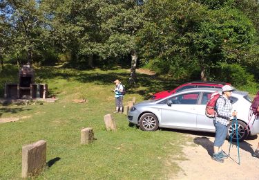
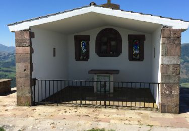
Plaatsbepaling
Land:
France
Regio :
Nieuw-Aquitanië
Departement/Provincie :
Pyrénées-Atlantiques
Gemeente :
Irouléguy
Locatie:
Unknown
Vertrek:(Dec)
Vertrek:(UTM)
638157 ; 4782010 (30T) N.
Opmerkingen
Wandeltochten in de omgeving
![Tocht Stappen Ispoure - arradoy G4Fait - Photo](https://media.geolcdn.com/t/375/260/b1d4f481-6895-478c-81f3-6ef884c4075d.jpg&format=jpg&maxdim=2)
![Stappen Stappen](https://static1.geolcdn.com/sitytour/trail-icons/101.png)
arradoy G4Fait
Stappen
Heel gemakkelijk
Ispoure,
Nieuw-Aquitanië,
Pyrénées-Atlantiques,
France
![](/images/other/stat-length.png)
6 km | 9,7 km-effort
4h 14min
![](https://static1.geolcdn.com/siteimages/upload/files/16400158638029165_repeat_loop_refresh_sync_direction_icon.png)
Ja
![Tocht Stappen Ispoure - Arradoy - Photo](https://media.geolcdn.com/t/375/260/ext.jpg?maxdim=2&url=https%3A%2F%2Fstatic1.geolcdn.com%2Fsiteimages%2Fupload%2Ffiles%2F1553511878bg_sport_marche.png)
![Stappen Stappen](https://static1.geolcdn.com/sitytour/trail-icons/101.png)
Arradoy
Stappen
Gemakkelijk
(2)
Ispoure,
Nieuw-Aquitanië,
Pyrénées-Atlantiques,
France
![](/images/other/stat-length.png)
6 km | 9,6 km-effort
2h 2min
![](https://static1.geolcdn.com/siteimages/upload/files/16400158638029165_repeat_loop_refresh_sync_direction_icon.png)
Ja
![Tocht Stappen Saint-Étienne-de-Baïgorry - iparla - Photo](https://media.geolcdn.com/t/375/260/ext.jpg?maxdim=2&url=https%3A%2F%2Fstatic1.geolcdn.com%2Fsiteimages%2Fupload%2Ffiles%2F1553511878bg_sport_marche.png)
![Stappen Stappen](https://static1.geolcdn.com/sitytour/trail-icons/101.png)
iparla
Stappen
Heel gemakkelijk
(1)
Saint-Étienne-de-Baïgorry,
Nieuw-Aquitanië,
Pyrénées-Atlantiques,
France
![](/images/other/stat-length.png)
13,5 km | 25 km-effort
4h 45min
![](https://static1.geolcdn.com/siteimages/upload/files/16400158638029165_repeat_loop_refresh_sync_direction_icon.png)
Ja
![Tocht Stappen Ispoure - Arradoy - Photo](https://media.geolcdn.com/t/375/260/dad09f6b-17f2-454c-80e0-b56c173ff2a7.jpg&format=jpg&maxdim=2)
![Stappen Stappen](https://static1.geolcdn.com/sitytour/trail-icons/101.png)
Arradoy
Stappen
Gemakkelijk
Ispoure,
Nieuw-Aquitanië,
Pyrénées-Atlantiques,
France
![](/images/other/stat-length.png)
6,1 km | 9,7 km-effort
1h 35min
![](https://static1.geolcdn.com/siteimages/upload/files/16400158638029165_repeat_loop_refresh_sync_direction_icon.png)
Ja
![Tocht Stappen Saint-Jean-Pied-de-Port - Saint-Jean-Pied-de-Port Gr 65 - Photo](https://media.geolcdn.com/t/375/260/be1151ba-0eae-47f2-a1b3-ca8e7b17585f.jpg&format=jpg&maxdim=2)
![Stappen Stappen](https://static1.geolcdn.com/sitytour/trail-icons/101.png)
Saint-Jean-Pied-de-Port Gr 65
Stappen
Gemakkelijk
Saint-Jean-Pied-de-Port,
Nieuw-Aquitanië,
Pyrénées-Atlantiques,
France
![](/images/other/stat-length.png)
4,5 km | 5,8 km-effort
1h 12min
![](https://static1.geolcdn.com/siteimages/upload/files/16400158638029165_repeat_loop_refresh_sync_direction_icon.png)
Ja
![Tocht Stappen Saint-Jean-Pied-de-Port - Saint-Jean-Pied-de-Port, la citadelle - Photo](https://media.geolcdn.com/t/375/260/713cbf20-81b6-4133-bdc9-cae24b6f18c3.jpg&format=jpg&maxdim=2)
![Stappen Stappen](https://static1.geolcdn.com/sitytour/trail-icons/101.png)
Saint-Jean-Pied-de-Port, la citadelle
Stappen
Medium
Saint-Jean-Pied-de-Port,
Nieuw-Aquitanië,
Pyrénées-Atlantiques,
France
![](/images/other/stat-length.png)
7,5 km | 9,6 km-effort
2h 58min
![](https://static1.geolcdn.com/siteimages/upload/files/16400158638029165_repeat_loop_refresh_sync_direction_icon.png)
Ja
![Tocht Stappen Saint-Étienne-de-Baïgorry - GR 10 5ème étape : St Étienne de Baïgorry - St Jean Pied De Port - Photo](https://media.geolcdn.com/t/375/260/f423bfc4-7ba2-4899-9de2-d0d00676b5d2.jpg&format=jpg&maxdim=2)
![Stappen Stappen](https://static1.geolcdn.com/sitytour/trail-icons/101.png)
GR 10 5ème étape : St Étienne de Baïgorry - St Jean Pied De Port
Stappen
Medium
Saint-Étienne-de-Baïgorry,
Nieuw-Aquitanië,
Pyrénées-Atlantiques,
France
![](/images/other/stat-length.png)
22 km | 36 km-effort
4h 31min
![](https://static1.geolcdn.com/siteimages/upload/files/16400158638029165_repeat_loop_refresh_sync_direction_icon.png)
Neen
![Tocht Stappen Saint-Étienne-de-Baïgorry - Chapelle ailandoi depuis st Etienne Baïgorry - Photo](https://media.geolcdn.com/t/375/260/bb12cce8-d7ba-4ea6-9157-caee9a53015d.jpg&format=jpg&maxdim=2)
![Stappen Stappen](https://static1.geolcdn.com/sitytour/trail-icons/101.png)
Chapelle ailandoi depuis st Etienne Baïgorry
Stappen
(2)
Saint-Étienne-de-Baïgorry,
Nieuw-Aquitanië,
Pyrénées-Atlantiques,
France
![](/images/other/stat-length.png)
13,2 km | 24 km-effort
3h 53min
![](https://static1.geolcdn.com/siteimages/upload/files/16400158638029165_repeat_loop_refresh_sync_direction_icon.png)
Ja
![Tocht Stappen Saint-Étienne-de-Baïgorry - Boucle oylarandoy - Photo](https://media.geolcdn.com/t/375/260/1ab54b66-7f67-4257-86b8-a3289cdc40c1.jpg&format=jpg&maxdim=2)
![Stappen Stappen](https://static1.geolcdn.com/sitytour/trail-icons/101.png)
Boucle oylarandoy
Stappen
Medium
Saint-Étienne-de-Baïgorry,
Nieuw-Aquitanië,
Pyrénées-Atlantiques,
France
![](/images/other/stat-length.png)
14,3 km | 25 km-effort
4h 55min
![](https://static1.geolcdn.com/siteimages/upload/files/16400158638029165_repeat_loop_refresh_sync_direction_icon.png)
Ja