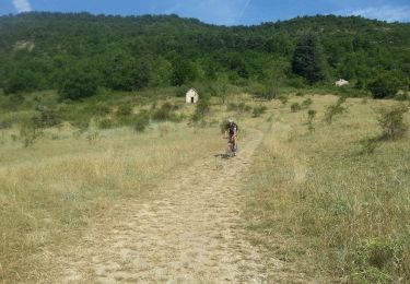
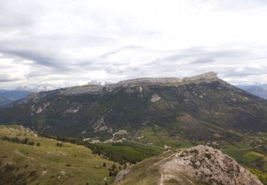
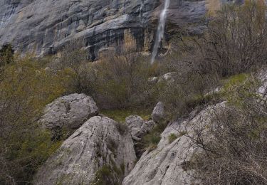
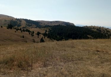
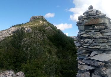
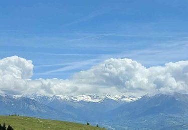
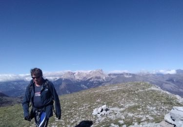
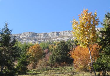
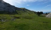
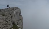
Tocht Stappen Manteyer - R14   Pic de Ceuze - Photo

Les Hautes Alpes à découvrir ! GUIDE+

© OpenStreetMap contributors
Lengte
Lengte
9,6 km
Max. hoogte
Max. hoogte
1863 m
Positief hoogteverschil
454 m
Km-Effort
Km-Effort  
15,6 km
Min. hoogte
Min. hoogte
1524 m
Negatief hoogteverschil
457 m
Boucle
Boucle
Ja
Datum van aanmaak :
2018-03-23 05:41:16.149
Laatste wijziging :
2021-04-20 08:04:04.764

(5 Bericht)

Stappen
Stappen
4h30
Moeilijkheid : Medium

Scan deze QR-code om de tocht te openen in de SityTrail-applicatie

Gratisgps-wandelapplicatie

Logo SityTrail SityTrail
IGN / Geografische instituten

SityTrail uit de App Store downloaden SityTrail uit Google Play downloaden

Logo SityTrail SityTrail World
De wereld gaat voor u open

SityTrail uit de App Store downloaden SityTrail uit Google Play downloaden SityTrail op Huawei AppGallery downloaden

Over ons

Tocht Stappen van 9,6 km beschikbaar op Provence-Alpes-Côte d'Azur, Hautes-Alpes, Manteyer. Deze tocht wordt voorgesteld door Camping Les Rives du Lac.

Beschrijving

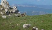
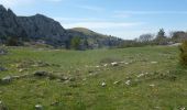
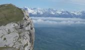
De klif van de Céüse biedt een van de mooiste uitzichten op de Alpen. Start de wandeling richting het westen, zodat de zon je niet verblindt. U kunt de Vercors bewonderen en vervolgens de Mont Ventoux,  de Durance,  de Ubaye, Italië en Queyras, de Ecrins en de Pic de Bure! Deze wandeling is lang maar het is alleen in het begin een beetje steil en daarna is het meeste vrij vlak. Als je eenmaal op het grote plateau bent, kan de route worden ingekort door niet naar Pic de Céüze te gaan. Na de passage naar "La Manche" kom je op een klein plateau waar vaak marmotten zijn.

Hoogteprofiel

Foto's

POI's

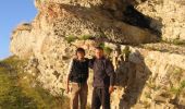
POI Châteauneuf-d'Oze - Ceuse, La Barre - Photo
CampingLesRivesduLac
CHÂTEAUNEUF-D'OZE 
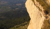
POI Châteauneuf-d'Oze - Céuse, Falaises - Photo
CampingLesRivesduLac
CHÂTEAUNEUF-D'OZE 
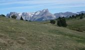
POI Châteauneuf-d'Oze - Ceuse, le plateau - Photo
CampingLesRivesduLac
CHÂTEAUNEUF-D'OZE 
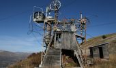
POI Manteyer - Vieux téléski des Marseillais - Photo
CampingLesRivesduLac

Plaatsbepaling

Land:
France
Regio :
Provence-Alpes-Côte d'Azur
Departement/Provincie :
Hautes-Alpes
Gemeente :
Manteyer
Locatie:
Unknown
Vertrek:(UTM)
733391 ; 4933637 (31T) N.

Opmerkingen

Gelieve in te loggen om een commentaar of een beoordeling achter te laten


Rando plus que splendide, des panoramas à couper le souffle


Awesome trail with the most beautiful views you can dream of!


Probably the most beautiful walk I have done in this region so far! Nice changes between lush grassland with wild raspberries and flowers in the high plains and stunning 360 views over Dévoluy, Ecrins and Baronnies from the cliffs. Mostly pretty flat and easy to walk with some steeper climb/descent at the start/end. The starting point is a bit difficult to find: Park your car one turn below the skiing station, enter forest track a little above (briefly ignoring the complaints of your GPS), find the skiing lift track (back on the GPS trail) and follow it almost all the way up. At the end, the GPS trail will lead you cross-country down a long grass slope, a bit steeper and more demanding in some parts. Can probably be avoided by crossing over to the other side of the valley at the top of the ski lift and following the narrow track down to the skiing station. Enjoy!


Wandeltochten in de omgeving

Tocht Mountainbike Manteyer - VTT32   aspremont - Photo
Mountainbike
GUIDE+

Mountainbike

Medium
(2)
Manteyer, Provence-Alpes-Côte d'Azur, Hautes-Alpes, France
21 km | 28 km-effort
2h 8min
Neen
Tocht Mountainbike Châteauneuf-d'Oze - ceuse9 avril 2012 - Photo
Mountainbike
GUIDE
harydh

Mountainbike

Medium
(2)
Châteauneuf-d'Oze, Provence-Alpes-Côte d'Azur, Hautes-Alpes, France
18,1 km | 26 km-effort
Onbekend
Ja
Tocht Trail Châteauneuf-d'Oze - Tour et sommet petite Céüse - Photo
Trail
GUIDE
nadd73

Trail

Medium
Châteauneuf-d'Oze, Provence-Alpes-Côte d'Azur, Hautes-Alpes, France
11,8 km | 22 km-effort
2h 10min
Ja
Tocht Stappen Sigoyer - corniche de Ceüze tour - Photo
Stappen
GUIDE
nadd73

Stappen

Medium
Sigoyer, Provence-Alpes-Côte d'Azur, Hautes-Alpes, France
15,7 km | 28 km-effort
4h 13min
Ja
Tocht Stappen Manteyer - Tour de Ceüze - Photo
Stappen
GUIDE
Marco05

Stappen

Moeilijk
Manteyer, Provence-Alpes-Côte d'Azur, Hautes-Alpes, France
11,2 km | 20 km-effort
4h 34min
Ja
Tocht Stappen Sigoyer - Petite Ceüze - Photo
Stappen
GUIDE
Marco05

Stappen

Medium
Sigoyer, Provence-Alpes-Côte d'Azur, Hautes-Alpes, France
11,6 km | 22 km-effort
4h 54min
Ja
Tocht Mountainbike La Roche-des-Arnauds - La Rivière - Photo
Mountainbike
GUIDE+

Mountainbike

Moeilijk
La Roche-des-Arnauds, Provence-Alpes-Côte d'Azur, Hautes-Alpes, France
38 km | 54 km-effort
2h 31min
Ja
Tocht Stappen Manteyer - Pic de Céüze - Photo
Stappen
GUIDE
nadd73

Stappen

Medium
Manteyer, Provence-Alpes-Côte d'Azur, Hautes-Alpes, France
13,7 km | 25 km-effort
5h 5min
Ja
Tocht Lopen Manteyer - Trail 09 - Céüze par le Pas du Loup - Photo
Lopen
GUIDE+

Lopen

Moeilijk
Manteyer, Provence-Alpes-Côte d'Azur, Hautes-Alpes, France
13,5 km | 28 km-effort
2h 30min
Ja


Sluiten
Mijn abonnementen