![](/images/other/stat-length.png)
![Tocht Stappen Santiago del Teide - Van Santiago del Teide via Cumbre de Masca naar Masca en terug met de bus - Photo](https://media.geolcdn.com/t/1900/400/ext.pjpeg?maxdim=2&url=https%3A%2F%2Fservices.sitytrail.com%2FGeolivesWS%2FDownloadMedia.ashx%3FTrailID%3D870775%26Media%3Dfix__20171130155223.jpg)
Van Santiago del Teide via Cumbre de Masca naar Masca en terug met de bus
karawatsj
Gebruiker
![Lengte](/images/other/stat-length.png)
![Max. hoogte](https://static1.geolcdn.com/siteimages/upload/files/1508320355ic_sort_altitude_max_24dp.png)
![Positief hoogteverschil](https://static1.geolcdn.com/siteimages/upload/files/1508320355ic_sort_den_pos_24dp.png)
![Km-Effort](/images/other/stat-length.png)
![Min. hoogte](https://static1.geolcdn.com/siteimages/upload/files/1508320355ic_sort_altitude_min_24dp.png)
![Negatief hoogteverschil](https://static1.geolcdn.com/siteimages/upload/files/1508320355ic_sort_den_neg_24dp.png)
![Boucle](https://static1.geolcdn.com/siteimages/upload/files/16400158638029165_repeat_loop_refresh_sync_direction_icon.png)
![Stappen](https://static1.geolcdn.com/sitytour/trail-icons/101.png)
3h33
Moeilijkheid : Gemakkelijk
![Scan deze QR-code om de tocht te openen in de SityTrail-applicatie](https://capi.geolives.com/qq0zvz2zws4bq2lad0pu/sitytour/trails/870775/qr.png?size=200)
Gratisgps-wandelapplicatie
Over ons
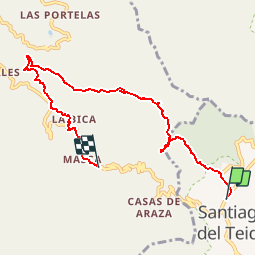
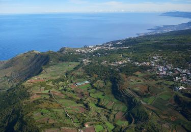
Tocht Stappen van 9,3 km beschikbaar op Canarische Eilanden, Santa Cruz de Tenerife, Santiago del Teide. Deze tocht wordt voorgesteld door karawatsj.
Beschrijving
Wandeling ook in wandelgids Rother nr 28.
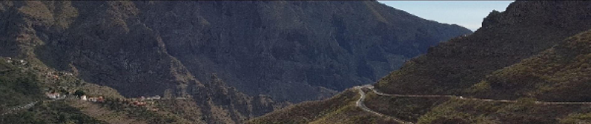
Mooie wandeling.
Niet moeilijk.
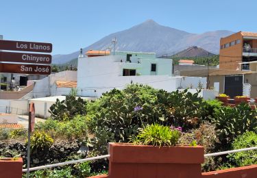
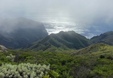
Als het open weer is zéér mooie uitzichten vanop Pico Verde, Cumbre Bolico, Cumbre Masca en Cruz de Hilda.
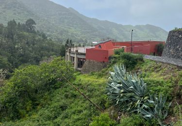
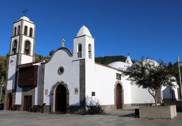
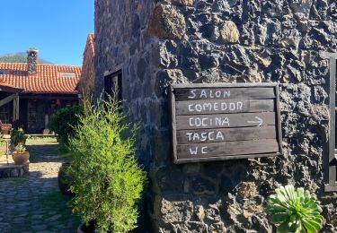
Gezellige bars in Sant. del Teide en in Masca. Prachtig panoramisch terras aan de mirador de la Cruz de Hilda (vrijdag gesloten).
Busverbinding Titsa lijn 355
Plaatsbepaling
Opmerkingen
Wandeltochten in de omgeving
![Tocht Stappen Buenavista del Norte - PR TF59 Mirador Cruz de Hilda -Masca - Photo](https://media.geolcdn.com/t/375/260/d47660bf-8be4-4598-8824-9c1776994929.jpeg&format=jpg&maxdim=2)
![Stappen Stappen](https://static1.geolcdn.com/sitytour/trail-icons/101.png)
Stappen
![](/images/other/stat-length.png)
![](https://static1.geolcdn.com/siteimages/upload/files/16400158638029165_repeat_loop_refresh_sync_direction_icon.png)
![Tocht Stappen El Tanque - San José de Los Lianos Arenas Negra Chinyero - Photo](https://media.geolcdn.com/t/375/260/e96ac2c2-9c83-4b11-a19c-b1c61051064f.jpg&format=jpg&maxdim=2)
![Stappen Stappen](https://static1.geolcdn.com/sitytour/trail-icons/101.png)
Stappen
![](/images/other/stat-length.png)
![](https://static1.geolcdn.com/siteimages/upload/files/16400158638029165_repeat_loop_refresh_sync_direction_icon.png)
![Tocht Te voet El Tanque - SL-TF 151 Ruigómez - Erjos - Ruigómez - Photo](https://media.geolcdn.com/t/375/260/5d6e5983-32b2-4254-9759-cc8cb5c7ec40.jpeg&format=jpg&maxdim=2)
![Te voet Te voet](https://static1.geolcdn.com/sitytour/trail-icons/100.png)
Te voet
![](/images/other/stat-length.png)
![](https://static1.geolcdn.com/siteimages/upload/files/16400158638029165_repeat_loop_refresh_sync_direction_icon.png)
![Tocht Te voet Santiago del Teide - SL-TF 60 Ruta del Almendro en Flor - Photo](https://media.geolcdn.com/t/375/260/318f4fdc-01f0-43b9-8410-6d426dbac95b.jpeg&format=jpg&maxdim=2)
![Te voet Te voet](https://static1.geolcdn.com/sitytour/trail-icons/100.png)
Te voet
![](/images/other/stat-length.png)
![](https://static1.geolcdn.com/siteimages/upload/files/16400158638029165_repeat_loop_refresh_sync_direction_icon.png)
![Tocht Te voet Los Silos - Erjos Monte del Agua Erjos - Photo](https://media.geolcdn.com/t/375/260/ext.jpg?maxdim=2&url=https%3A%2F%2Fstatic1.geolcdn.com%2Fsiteimages%2Fupload%2Ffiles%2F1545311037marcheuse_200dpi.jpg)
![Te voet Te voet](https://static1.geolcdn.com/sitytour/trail-icons/100.png)
Te voet
![](/images/other/stat-length.png)
![](https://static1.geolcdn.com/siteimages/upload/files/16400158638029165_repeat_loop_refresh_sync_direction_icon.png)
![Tocht Stappen El Tanque - Boucle volcan Chinyero à Tenerife - Photo](https://media.geolcdn.com/t/375/260/705e0ea7-430f-4e2e-835e-3fc7c2636c52.jpg&format=jpg&maxdim=2)
![Stappen Stappen](https://static1.geolcdn.com/sitytour/trail-icons/101.png)
Stappen
![](/images/other/stat-length.png)
![](https://static1.geolcdn.com/siteimages/upload/files/16400158638029165_repeat_loop_refresh_sync_direction_icon.png)
![Tocht Stappen Buenavista del Norte - Teno Alto - Photo](https://media.geolcdn.com/t/375/260/2f27afa0-c066-48db-babd-f8d4d2101f2d.jpeg&format=jpg&maxdim=2)
![Stappen Stappen](https://static1.geolcdn.com/sitytour/trail-icons/101.png)
Stappen
![](/images/other/stat-length.png)
![](https://static1.geolcdn.com/siteimages/upload/files/16400158638029165_repeat_loop_refresh_sync_direction_icon.png)
![Tocht Stappen El Tanque - Los partidos - Photo](https://media.geolcdn.com/t/375/260/588a88dc-0d87-49f9-8019-9ae7e35d2d23.jpg&format=jpg&maxdim=2)
![Stappen Stappen](https://static1.geolcdn.com/sitytour/trail-icons/101.png)
Stappen
![](/images/other/stat-length.png)
![](https://static1.geolcdn.com/siteimages/upload/files/16400158638029165_repeat_loop_refresh_sync_direction_icon.png)
![Tocht Stappen Buenavista del Norte - LSG Masca - Photo](https://media.geolcdn.com/t/375/260/ext.jpg?maxdim=2&url=https%3A%2F%2Fservices.sitytrail.com%2FGeolivesWS%2FDownloadMedia.ashx%3FTrailID%3D793391%26Media%3D20170721094344.jpg)
![Stappen Stappen](https://static1.geolcdn.com/sitytour/trail-icons/101.png)
Stappen
![](/images/other/stat-length.png)
![](https://static1.geolcdn.com/siteimages/upload/files/16400158638029165_repeat_loop_refresh_sync_direction_icon.png)